
Monday, August 7, 2023 – BEAUTY STATEWIDE FROM CENTRAL PARK DESIGNS


FROM THE ARCHIVES
MONDAY, AUGUST 7, 2023
ISSUE# 1054
MORE
FREDERICK LAW OLMSTED
&
CALVERT VAUX DESIGNS ADAPTED
BILL ORZELL
NEW YORK ALMANACK
Genesee Valley Park & The Barge Canal: Roman Arches Over Indian Rivers
August 2, 2023 by Bill Orzell
The partnership of Frederick Law Olmsted and Calvert Vaux pioneered American landscape architecture. Their work in Manhattan’s Central Park, Brooklyn’s Prospect Park and Boston’s Franklin Park set new standards for outdoor spaces which some Upstate New York cities such as Buffalo sought to emulate, albeit on a reduced scale.
In 1859 Olmsted married his brother John’s widow, Mary, and adopted their children, which included John C. Olmsted. In 1870 Mary gave birth to Frederick Law Olmsted, Jr. fondly known as Rick, and these siblings followed in their father’s footsteps and formed the landscape architectural firm known as Olmsted Brothers in 1898, which continued many years after their patriarch’s death in 1903.
The Library of Congress is the custodian of Frederick Law Olmsted’s papers, and he is described there as a “farmer, writer, reformer, landscape architect, urban and suburban planner and conservationist.” Certainly he was a man who held a remarkable empathy for all life, and imparted this respect into all his designs.
In Rochester, citizens impressed with the success of Olmsted’s parks in Buffalo desired their own series of parks. In the late 1880s the city selected the Olmsted design which created Seneca Park, Highland Park and South Park, which was later renamed Genesee Valley Park. The city planners must have been delighted when Olmsted declared the farmland recently purchased for Genesee Valley Park was “almost ideal” for the purposed improvement into a city park.
With Governor Theodore Roosevelt in Albany’s Executive Mansion beginning the twentieth century, the citizens of New York State needed to decide the future of their statewide canal network. There was certainly a concern by that Governor about maintaining the preeminence of the Port of New York.
Although the original versions of the Erie Canal built in the previous century were extremely successful, transporting all types of commerce between the Great Lakes and the Atlantic seaboard, while enhancing the state treasury through tolls, it was beginning to wear out and needed enlargement to accommodate larger self-propelled vessels, which would dispense with draft-animals.
An actual ship canal would be an extremely large undertaking, and while this perhaps could have been accomplished at a Federal level to take advantage of the only water-level route through the Appalachian chain of mountains, it did not appear the other states in the union were interested in the proposal. The Barge Canal was an effective plan that New York State could build on its own, and was in fact a compromise between the large scale ship canal and the existing horse-drawn canal.
The New York State Barge Canal was approved as a major public works project by voters in a November 1903 referendum. The State constitution at that time provided for an elected State Engineer, and all design work was performed through that office. The construction phase ran from 1905-1918, and crossings of other transportation elements were some of the greatest obstacles the engineering staff faced.
The new canal would be, like its predecessor versions, the only price control on rail-rates east of the Mississippi River, in the days of a pure laissez faire American economy, before the existence of the Interstate Commerce Commission. The workings of a fair market were a motivating factor in the 1903 election, especially for voters on the terminal ends of the canal in New York City and Buffalo.
The onset of World War before the Barge Canal was completed upset and distorted the original premise and interfered with the designed accomplishments. Certainly railroad management did not look forward to continued competition with canal shippers on an economical waterway, which the railroads tax payments were helping build, and the numerous crossings required by the new construction was a matter of deep contention. In the Rochester area, six major rail routes would interface with the new Barge Canal, adding complications, costs and time required for completion.
Another obstacle faced by canal engineers was opposition from the citizens of Rochester. This upstate New York municipality, originally referred to as the Flour City from the numerous mills the original canal spawned, by the early twentieth century saw themselves as beyond inland navigation. The residents of what by then was the Flower City, resented the idea of prospering via what they foresaw as an unsightly and polluted ditch.
Remarkably, the opposition was spearheaded by the Rochester Chamber of Commerce, under the direction of John M. Ives, who evolved into the leading statewide anti-canal advocate. Rochesterians resolutely sought to keep the canal outside of their city limits. The canal engineers succeeded in doing so, by having the Barge Canal route stay south of the city, and using the Genesee River as a nearly three mile navigable spur into downtown. A movable gate dam was constructed near Court Street, which provided the navigational stage into the heart of the state’s third largest municipality.
This same impounding structure also allowed the main east-west route of the Barge Canal to cross the Genesee River in a slack water pool. Guard locks were built on each side of the crossing, which are only used during water level extremes in the Genesee. The Mount Morris Dam, which has mitigated seasonal periodic flooding of the Genesee River, was not completed until 1952.
This more southerly course was not without objection as well, as this route would bisect Rochester’s sylvan Genesee Valley Park. To allay these concerns, the canal engineers hired at great expense the landscape architectural firm of the late Frederick Law Olmsted, to design elegant footbridges to cross the canal. These three identical arched concrete spans are unique to Genesee Valley Park, and were constructed in order to preserve beauty and harmonize with their surroundings while maintaining the integrity of the walking trails.
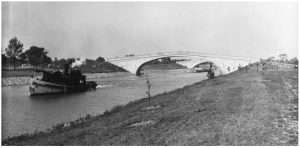
The Christian Science Monitor wrote in 1912: “Genesee Valley Park is essentially pastoral, but it is pronounced a ”thing of joy and beauty” by all who visit it. It is paralleled in many respects by Franklin Park in Boston, but it has the advantage of the long stretch of the Genesee River running through it. It will be bisected by the Erie Barge Canal, which will be spanned by ornamental bridges, I hope patterned after some of those I saw in Boston. Thus the great waterway from the lakes to tidewater will be made to add beauty and interest to the park.”
Calvert Vaux’s previously designed bridges in New York’s Central Park had pleasingly arched chords, however none of them needed to cross a navigational waterway. The Barge Canal engineers were enamored with the recent advent of reinforced concrete, which allowed them to build large modern structures. An advantage which comes by building with reinforced concrete is that only one set of forms for a particular project need be constructed, from which countless identical clone structures could be cast.
The Guard locks on both sides of the Genesee River allowed the canal section through the park to be dry excavated, and the pilings and footings to be set in a convenient and efficient process. The gentle arch of the bridge chord would be surmounted by an attractive row of balusters topped by a balustrade, serving as an open parapet and enhancing the pleasing unique structure group.
The New York State Barge Canal was completed in its entirety in May of 1918, with the area in the vicinity of Genesee Valley Park being the last construction completed on the statewide route. New York State had built the canal solely with the financial support of its own citizens, with no Federal input or assistance, creating a brand new connection linking the Great Lakes to the Atlantic.
| The Empire State patriotically turned over its new transportation network to the national government in order to assist the war effort. Manpower and material shortages, caused by World War I, prevented the Genesee Valley Park pedestrian bridges from being completed until the economic restricting forces of the global conflict eased, with the graceful spans becoming serviceable in the autumn of 1920, and park grading and planting completed the following spring.Legendary canal chronicler Noble E. Whitford in his 1922 epic History of the Barge Canal of New York State wrote: “It was the park, the railroads and the flood conditions that presented the more difficult engineering problems, but none of these was really serious, once the way was cleared for action. By taking scrupulous care the engineers have not allowed the canal to spoil the beauty of the park. Ornamental bridges, both foot and highway, span its waters.”The expansion of the interstate highway system decades later would also bisect Genesee Valley Park, with I-390 spanning the Genesee River and paralleling the Barge Canal. Presently the management and operation of Genesee Valley Park has been divided between the City of Rochester and Monroe County.When the Barge Canal was conceived and built, it had an appeal for recreation possibilities, yet no one was thinking then of trails as activity infrastructure. Yet, in fact what was built is nearly perfect for what has become a statewide network of trails and a system to enjoy, both on the water and along it. The graceful trio of distinctive foot bridges remain an attractive and functional component of Genesee Valley Park, and our canal system and trail network.Herman Melville in Moby Dick wrote: “For three hundred and sixty miles, through the entire breadth of the state of New York; through numerous populous cities and most thriving villages; through long, dismal, uninhabited swamps, and affluent, cultivated fields, unrivalled for fertility; by billiard-room and bar-room; through the holy-of-holies of great forests; on Roman arches over Indian rivers…flows one continual stream… |
| For more information and online shopping check out the website at globaltable.com |
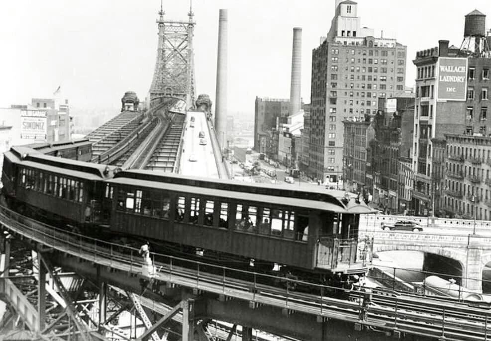
WEEKEND PHOTO
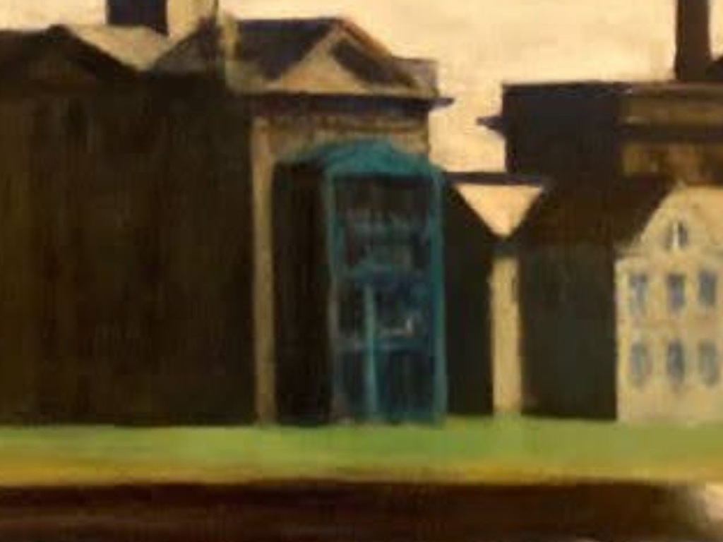
WEST WING OF METROPOLITAN HOSPITAL
FEATURED IN EDWARD HOPPER’S “BLACKWELL’S ISLAND” PAINTING, 1928
MONDAY PHOTO OF THE DAY
SEND YOUR RESPONSE TO:
ROOSEVELTISLANDHISTORY@GMAIL.COM
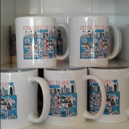
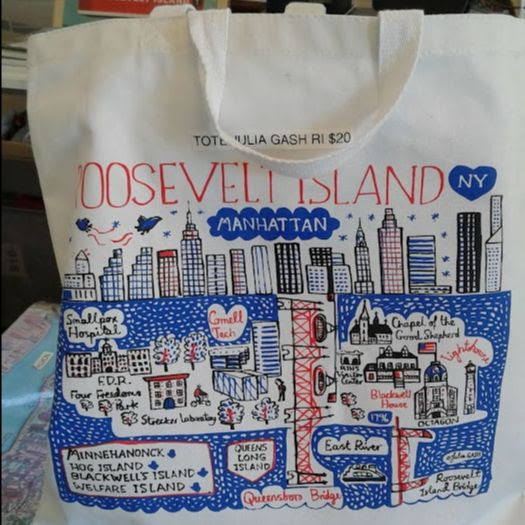
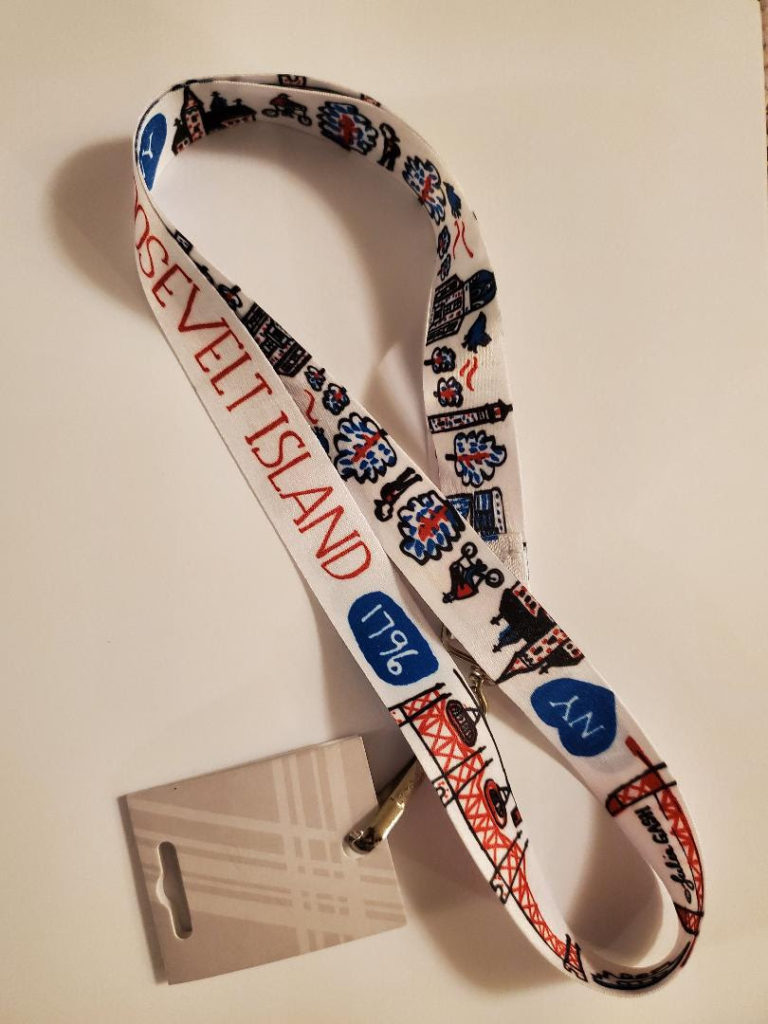
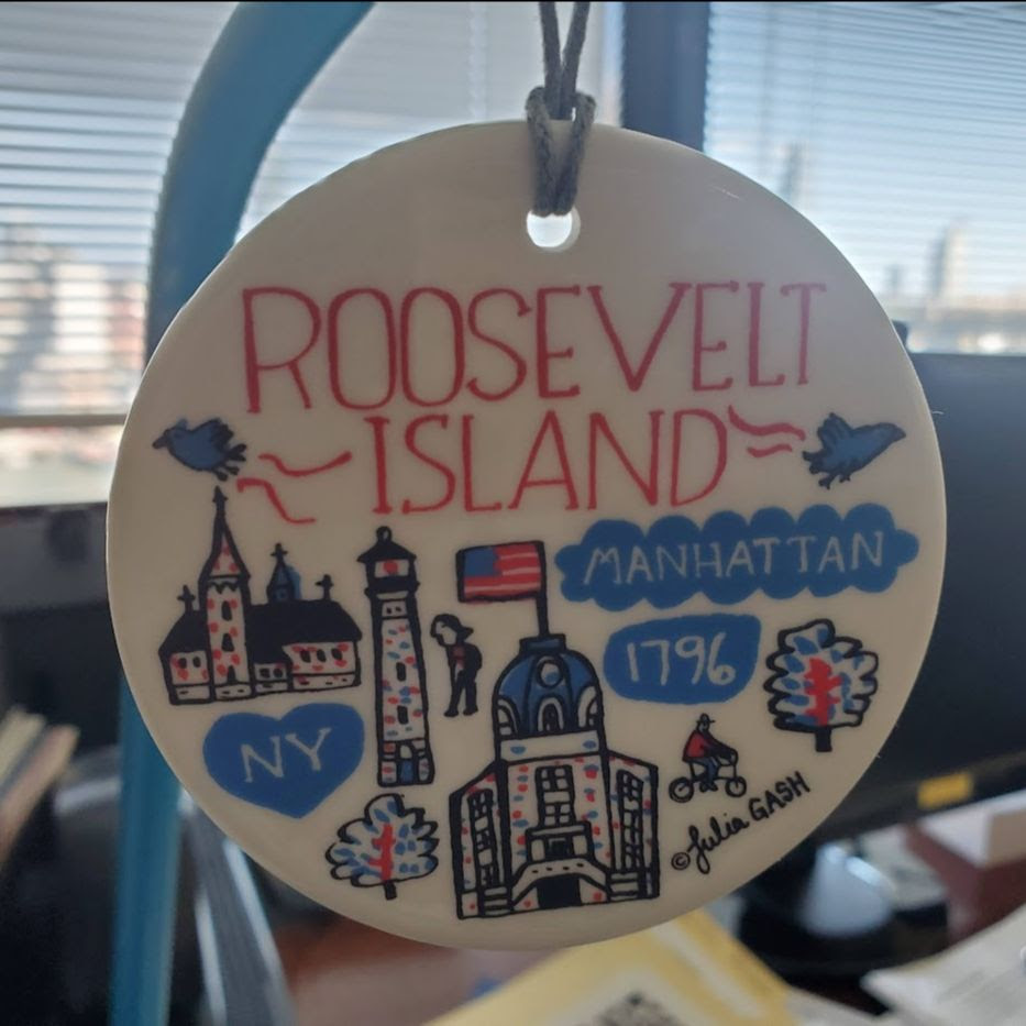
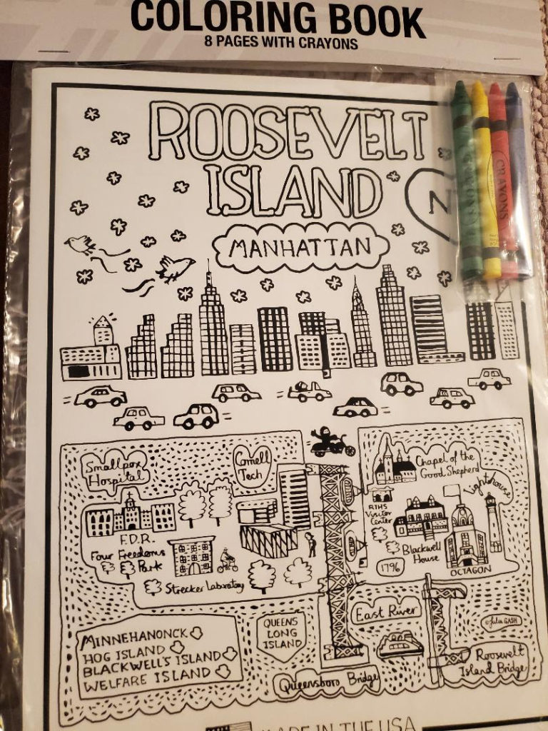
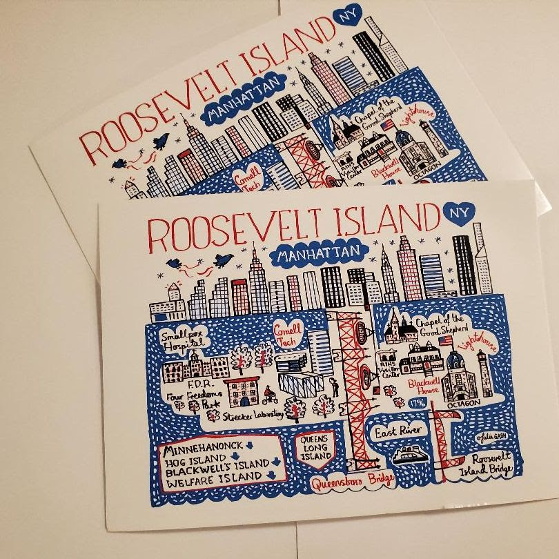
COME SHOP OUR JULIA GASH COLLECTION OF GREAT NEW ITEMS:
MUGS $15-
TOTE $28-
LANYARD $8-
ORNAMENT $20-
COLOR BOOK $8-
POSTCARD $2-
LARGE POSTER $35 (NOT SHOWN)
Text by Judith Berdy
Thanks to Bobbie Slonevsky for her dedication to Blackwell’s Almanac and the RIHS
Thanks to Deborah Dorff for maintaining our website
Edited by Melanie Colter and Deborah Dorff
MAYA LEVANON-PHOTOS TIK TOK & INSTAGRAM
All image are copyrighted (c) Roosevelt Island Historical Society unless otherwise indicated
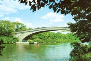
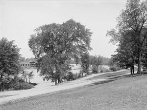
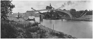
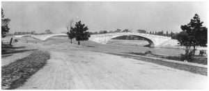
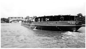
Illustrations, from above: A Real Picture Post Card view of pedestrian bridge spanning the NYS Barge Canal in Genesee Valley Park Rochester, New York; Genesee Valley Park (courtesy Library of Congress); forms and re-bar are in place for the next concrete pour in this westward view of the East Foot Bridge in South Park, Rochester on August 2, 1920 (NYS Dept. of Public Works, courtesy Erie Canal Museum); a view of three foot bridges over the Erie Canal in South Park (Genesee Valley Park) in Rochester on October 15, 1920 (NYS Dept. of Public Works, courtesy Erie Canal Museum); a view of a tugboat pulling a barge under the East foot bridge on the Erie Canal in South Park (Genesee Valley Park), looking West Rochester on August 30, 1921; and a westbound tanker Burlington-SOCONY belonging to the Standard Oil Company of New York passes through Genesee Valley Park circa 1933, with the western most footbridge and Pennsylvania RR (truss) bridge in the distance (Courtesy Auke Visser’s MOBIL Tankers & Tugs website).
www.tiktok.com/@rooseveltislandhsociety
Instagram roosevelt_island_history
THIS PUBLICATION FUNDED BY DISCRETIONARY FUNDS FROM CITY COUNCIL MEMBER JULIE MENIN & ROOSEVELT ISLAND OPERATING CORPORATION PUBLIC PURPOSE FUNDS.

Copyright © 2022 Roosevelt Island Historical Society, All rights reserved.Our mailing address is:
rooseveltislandhistory@gmail.com
Leave a comment