
Weekend, February 8-9, 2025 – Our classic structures of the city are revealed


76 DAYS FROM TODAY IS THE 50th ANNIVERSARY OF THE FIRST RESIDENTIAL TENANT MOVING INTO ISLAND HOUSE, THE FIRST OCCUPIED BUILDING.
HOW WOULD YOU LIKE TO CELEBRATE THE ISLAND’S 50TH ANNIVERSARY?
SEND IN YOUR SUGGESTIONS TO JBIRD134@AOL.COM
Exploring the Geographic Images Collection
Weekend, February 8-9, 2025
ISSUE #1391
New-York Historical Society
Jill Reichenbach
in
From the Stacks
One of the best, if at times maddening parts of any reference librarian or archivist’s job is solving a mystery. What appears at first to be just another query turns into a bona fide challenge. My colleague and I had one such query recently, involving a photo of a clapboard house on East 83rd Street that was incorrectly identified on the back, in pencil, as the Constable House. Eventually we were able to determine that it was in fact a house that belonged to a host of owners, and remained on its plot in the shadow of Fifth Avenue high-rise apartment buildings well into the 1950s.
Thus reveals the magic of the Department of Prints, Photographs and Architectural Collections’ Geographic Images Collection (formerly called the Geographic File). With 160 boxes and 124 flat folder drawers, it is one of the Department’s largest collections, consisting of both prints and photographs of streetscapes and aerial views of cities around the world and across the country, but its strength is New York City prints and photos. It has been culled from myriad sources over the years (including donations from Christopher Gray’s Office for Metropolitan History) and is still being added to; the oldest material dates ca. 1600.
While this is the collection I pull for authors, graduate students and architectural preservationists, it is also the collection I pull when researchers come into the Reading Room hoping to find a photograph of their great-uncle’s bar/bakery/butcher shop. It is not exhaustive, but sometimes we hit pay-dirt. What makes the collection so interesting to me, though, is how random it is, frankly. It is both quaint and impressive. In an effort to prove my point, I pulled twelve images from just a single box–no. 34–of street views between 55th and 72nd Streets.
The first entry here is a print of the Brevoort Estate and its surroundings, including the Youle Shot Tower, which manufactured the “lead shot” used in ammunition, on East 54th Street and First Avenue, ca. 1830. The shot tower was designed by John McComb.
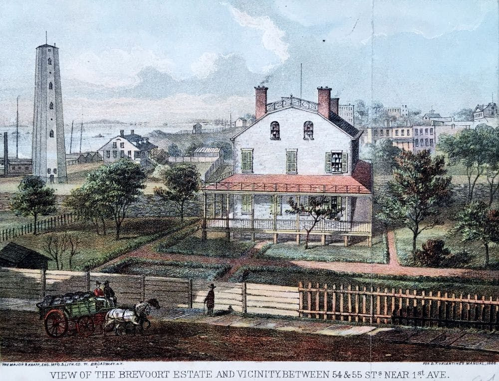
Brevoort Estate and Youle Shot Tower, East 54th Street ca. 1820s; Geographic Images Collection, PR-20, box 34, New-York Historical Society.
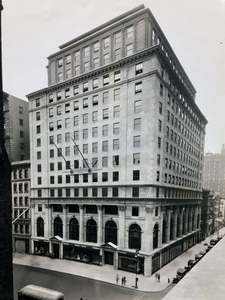
National Broadcasting Company, Fifth Avenue and 55th Street ca. 1930; Geographic Images Collection, PR-20, box 34, New-York Historical Society.
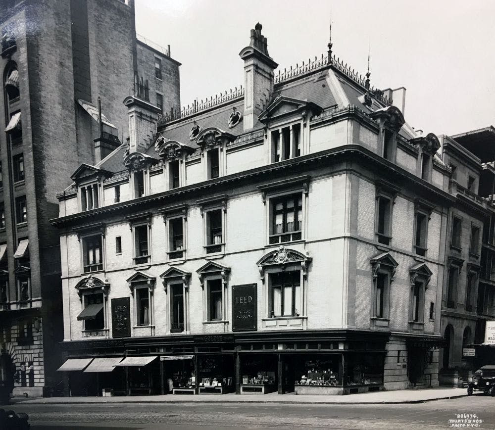
This charming three-story house was at 134 East 56th Street. Looking at this small photo, one can’t help wonder about the former occupants; what kind of life they lived? Who took this photo and why? The site is occupied by a typical 1960s white-brick apartment building now, but on the street level there is a small pizzeria I happened into one night last summer. It’s funny to think of all the history that exists in one tiny spot.
On the other side of Fifth Avenue, at 58-68 West 56th Street we have a photograph of five 5-story buildings that were once homes of prominent New Yorkers. These buildings still stand and many restaurants and shops are in business on the ground floor.
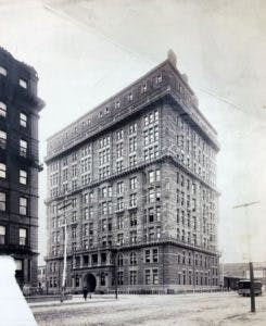
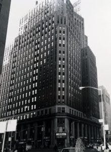
North on 57th Street, now affectionately known as “Billionaire’s Row,” are two photos that I find particularly interesting: one of the Osborne Flats apartment building at 205 West 57th Street ca. 1890, and the other of “Midtown Chevrolet” at the northwest corner of Broadway and 57th Street, in December 1967. I walk by both of these buildings on a daily basis and it’s fascinating to see so many vacant lots surrounding the Osborne Flats, and to think that there was a time one could buy a Chevy on Broadway and 57th. Today the address of the Chevrolet building is “3 Columbus Circle” and the entire facade is sheathed in glass.
Midtown Chevrolet, 3 Columbus Circle, 1967; Geographic Images Collection, PR-20, box 34, New-York Historical Society.
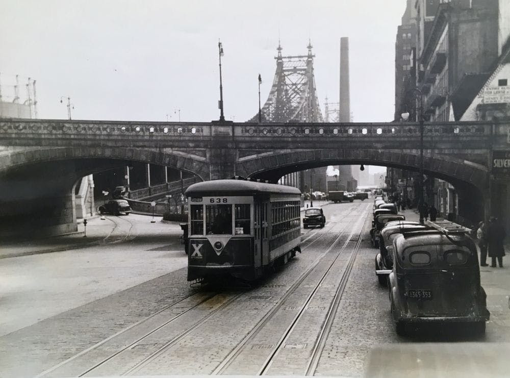
Next up is a photo of car 638 of the Third Avenue Railway System on East 59th Street, just south of the Queensboro Bridge (a.k.a. the “59th Street Bridge,” but, officially, the “Ed Koch Queensboro Bridge”). This picture is dated March 12, 1942; after the line was replaced by buses in 1946, this car, along with 42 others, was sent to Vienna to help rebuild their fleet of trolleys after WWII. Also of note here: the gas tanks on East 61st Street, at left.

Here is a sweet photo of a man shoveling snow off the platform of the 66th Street station on the Eighth Avenue “El,” ca. 1935.West 66th Street, Eighth Avenue El (now Columbus Avenue), ca. 1935; Geographic Images Collection, PR-20, box 34, New-York Historical Society.
At one point, there existed the Clinton & Schermerhorn Chapel on East 67th and Avenue A, as it was known at the time (now York Avenue).
For a time there stood a beautiful mansion on Madison Avenue and 67th Street; it is now yet another white-brick apartment building.

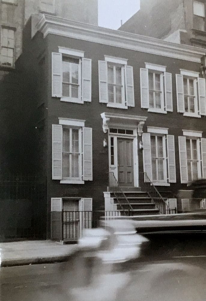
243 West 70th Street, ca. 1970; Geographic Images Collection, PR-20, box 34, New-York Historical Society.
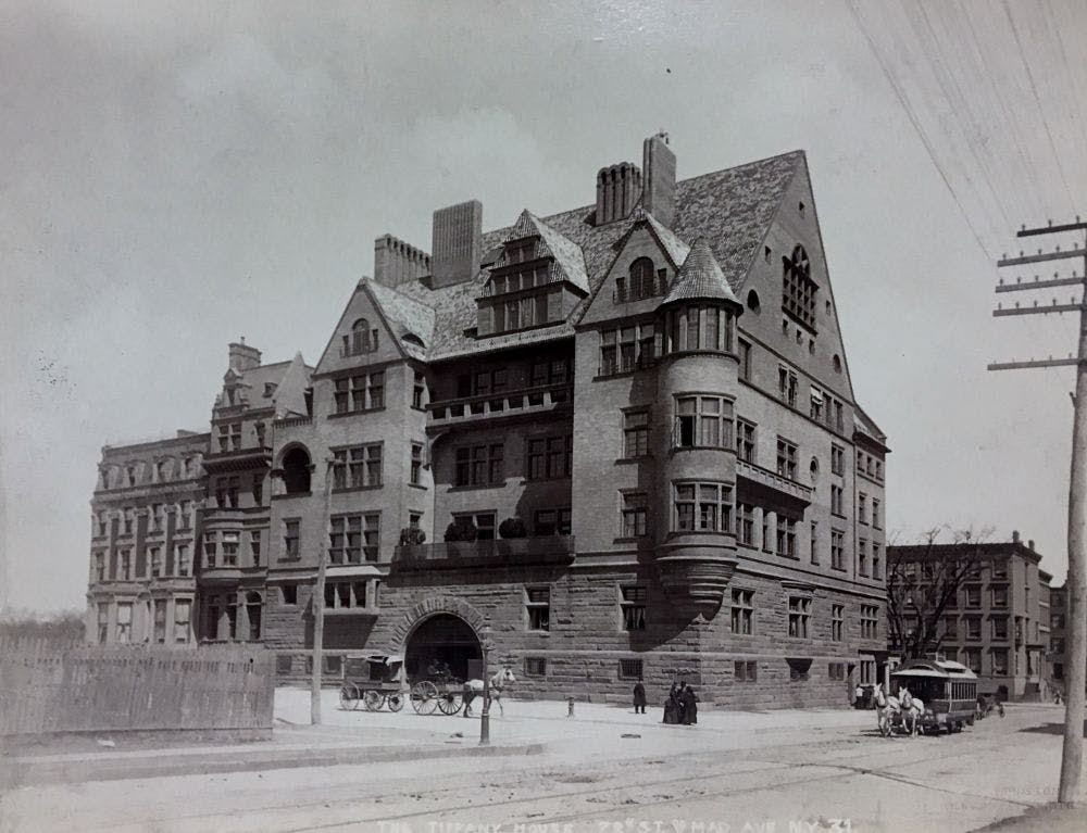
Finally we have a photo of the former Tiffany Mansion, ca. 1887, which stood on the northeast corner of Madison Avenue and 72nd Street for a little over 50 years. The mansion had 57 rooms and was designed by Stanford White, of the architectural firm McKim, Mead & White.
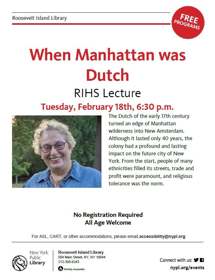
COMING TO THE NYPL BRANCH ON
FEBRUARY 18TH
SAY NO TO THE LOO
At this weeks RIOC Real Estate meeting, they introduced the idea of placing “Portland Loo” public bathrooms near the Firefighter’s Field/Tram area to serve the public.
RIOC staff did not provide and image. I pulled one up on my phone and the reaction was very negative to this metal structure.
Imagine this in the heat of summer or the cold of winter!
(reminds me of Paris Pissoirs of days past).
It is ugly and completely inappropriate to our island.
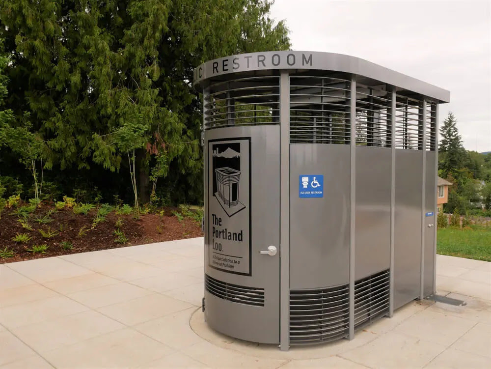
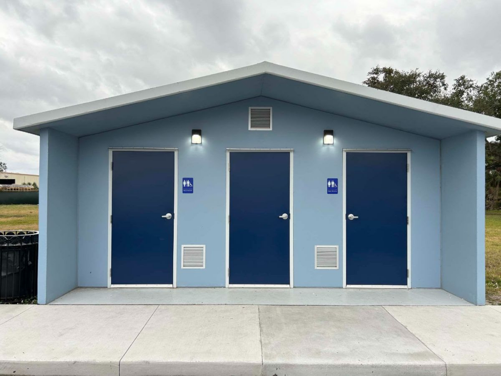
This or some similar design is appropriate similar to the comfort stations at Southpoint Park and Lighthouse Park.
CREDITS
NEW -YORK HISTORICAL SOCIETY
The post is by Jill Reichenbach, Reference Librarian for the Department of Prints, Photographs and Architectural Collections
All image are copyrighted (c) Roosevelt Island Historical Society unless otherwise indicated
THIS PUBLICATION FUNDED BY DISCRETIONARY FUNDS FROM CITY COUNCIL MEMBER JULIE MENIN & ROOSEVELT ISLAND OPERATING CORPORATION PUBLIC PURPOSE FUNDS.


Copyright © 2024 Roosevelt Island Historical Society, All rights reserved.Our mailing address is:
rooseveltislandhistory@gmail.com
Leave a comment