Overshadowed by social realist painters and then the abstract movement early in the 20th century, Colin Campbell Cooper never quite got his due.
by ephemeralnewyork
November 13, 2017
But his evocative takes on New York’s streetscapes and skyline reveal a fascination with the bigness of the city’s architecture contrasted against the smaller personal stories of millions of anonymous New Yorkers.
The bigness you notice first, especially with paintings like the “Mountains of Manhattan” (top) and the “Cliffs of Manhattan” (second), which both depict the city as an awesome and mighty wonder along the lines of the Rockies or the Alps.
When Cooper contrasts the big and the small, as he does here in 1917’s “South Ferry,” he gives us a more humanistic view of Gotham.
We may not be able to read their faces, but every one of those trolley riders and sidewalk vendors has a story.
“Chatham Square,” above, from 1919, is similar. The city’s skyscraper mountains are in the background, while the day-to-day life, its human side, is in the forefront.
Commuters wait for the elevated train to pull in, soldiers march under the tracks, and movie houses attract crowds on the sidewalk. We don’t have to be able to see them up close to know they are us
“New York From Brooklyn” gives us a more detailed and personalized County of Kings. Meanwhile, Manhattan across the river is muted, as if it’s an impenetrable fortress.
Cooper lived in New York from 1904 to 1921. “My pictures are built on these contrasts,” he once said of the juxtaposition in many of his paintings of older, smaller-scale buildings and the modern skyscrapers dominating the skyline. “Columbus Circle” (above), completed in 1923, illustrates this perfectly.
FROM WIKIPEDIA
Colin Campbell Cooper, Jr. (March 8, 1856 – November 6, 1937) was an American Impressionist painter, perhaps most renowned for his architectural paintings, especially of skyscrapers in New York City, Philadelphia, and Chicago. An avid traveler, he was also known for his paintings of European and Asian landmarks, as well as natural landscapes, portraits, florals, and interiors.
In addition to being a painter, he was also a teacher and writer. His first wife, Emma Lampert Cooper, was also a highly regarded painter. Background and education
Colin Campbell Cooper, Jr. was born in Philadelphia, Pennsylvania, on March 8, 1856, into a well-to-do family of English-Irish heritage.[1] He had four older and four younger siblings. His mother, Emily Williams Cooper, whose ancestor emigrated to the U.S. from Weymouth, England,[2] was an amateur painter in watercolors.[3] His father, Dr. Colin Campbell Cooper, whose grandfather came from Derry, Ireland, was a surgeon] and a lawyer with a great appreciation for the arts. Young Colin had been inspired by the art which he discovered when he attended the Philadelphia Exposition of 1876. Both of his parents were highly supportive of his ambitions, encouraging him to become an artist.
In 1879, Cooper enrolled in the Pennsylvania Academy of the Fine Arts in Philadelphia, studying art under famed controversial realist painter Thomas Eakins[5] for three years. In 1886, he embarked on the first of his many travels to foreign lands, visiting the Netherlands, Belgium, and Brittany.[4] Afterwards, his art education resumed at the Académie Julian in Paris from 1886 to 1890,with Henri Lucien Doucet, William-Adolphe Bouguereau, and Jules Joseph Lefebvre.[6] He also studied at Académie Delécluse and Académie Vitti. His work of this period consisted mostly of landscapes painted in a Barbizon manner.[7] He traveled extensively throughout his life, sketching and painting scenes of Europe, Asia, and the United States in watercolors and oils.
Life and work Philadelphia and New York
Back in Philadelphia, Cooper taught watercolor classes and architectural rendering at the Drexel Institute of Art, Science and Industry (now Drexel University) from 1895 to 1898. Many of Cooper’s paintings were destroyed in an 1896 fire at Philadelphia’s Hazeltine Galleries; as a result, relatively little of his early work exists today.
While at Drexel, he spent his summers abroad, primarily in the Dutch artists colony of Laren in North Holland and in Dordrecht in South Holland.Among the other artists in Dordrecht at this time was renowned painter Emma Lampert (1855–1920) from Rochester, New York. She and Cooper met, and were soon married, in Rochester on June 9, 1897.
In 1898, the Coopers returned to Europe for a few years. During this period, as Cooper painted architectural landmarks, he developed the Impressionist style which he used for the rest of his artistic career.
Hudson River Waterfront, N. Y. C., 1913-21
Cooper and his wife exhibited together in several two-person shows, including a May 1902 exhibit at the Philadelphia Art Club and a 1915 show at the Memorial Art Gallery in Rochester.] They moved in 1904 to New York City, where he would remain, other than his many travels, until 1921. Here he continued work, which he had begun about two years earlier in Philadelphia, on his famous skyscraper paintings. Cooper said that he was “greatly interested in the skyscraper buildings in Broad Street. It was intensely interesting to watch the freakishness disappear from those queer towering structures in the glory of the right kind of light”. He said that the painting which first brought him great success was 1902’s Broad Street, New York; in 1903, this painting was honored with the W. T. Evans Award[ of the New York Watercolor Club.[In another interview, he had stated that “one of the points that most strikes me about this view up Broad Street is the dramatic contrast between the old, low type of buildings … and the great skyscrapers. My pictures are built on these contrasts.”[
In 1911, The New York Times, citing Cooper as the artist who best captured modern, towering structures on canvas, declared him to be “the skyscraper artist par excellence of America”. In an article the following year, they stated that he was “one of the most interesting figures in American art”, reiterating that “in his particular field he has no superior”. In addition to New York City, his paintings often depict skyscrapers in Philadelphia and Chicago.
Rescue of the Survivors of the Titanic by the Carpathia, 1912
Cooper’s painting Fifth Avenue, New York was purchased by the French government for the Musée du Luxembourg. Such an honor was quite rare for an American artist. Critics at the time, and up to the present, frequently compared the works of Cooper and Childe Hassam. They have often been credited as being the two most iconic artists whose paintings began a trend of celebrating the wonders of the modern city, especially New York City. Cooper may have intentionally avoided certain subjects in order to differentiate himself from Hassam. Hassam, unlike Cooper, did not concentrate on the tall buildings in his cityscapes.
Cooper was as proficient painting in watercolors as he was in oils. He would often create a small watercolor study before painting a larger work of the same subject in oils. But the smaller watercolors were not mere sketches for his own use; they were finished pieces which he exhibited, sometimes years earlier than the larger corresponding oil paintings that he would ultimately produce. Cooper was elected to a prestigious membership in the National Academy of Design in 1912 (he had previously been elected an Associate, four years earlier).
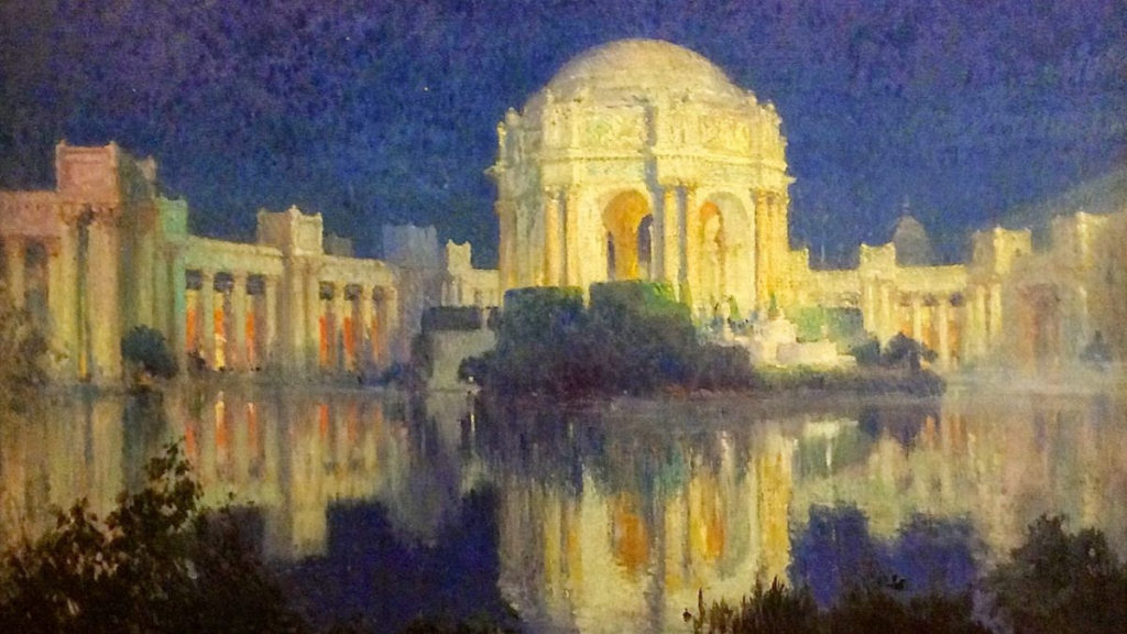
Palace of Fine Arts, San Francisco, c. 1915 He and his wife were aboard the RMS Carpathia during its rescue mission for the survivors from the sunken RMS Titanic on April 15, 1912.[He assisted in the effort, and during the rescue operation, he created several paintings which document the events. The Coopers gave up their ship’s cabin so some of the survivors would have berths to sleep in.
Cooper exhibited in San Francisco’s Panama–Pacific International Exposition of 1915, winning the gold medal for oil and the silver medal for watercolor. While there, he created a series of paintings depicting the exposition’s buildings, including the Palace of Fine Arts. He also participated in the Panama–California Exposition in San Diego in 1916. The Coopers spent the winter of 1915–16 in Los Angeles. This time in southern California was undoubtedly a key factor in Cooper’s later decision to move there permanently. His wife Emma died of tuberculosis on July 30, 1920.
Santa Barbara
After his wife’s death, Cooper moved to Santa Barbara, California in January 1921.Santa Barbara would be his home base for the rest of his life, spending two years in northern Europe and Tunisia. He became Dean of Painting at the Santa Barbara Community School of Arts.
Palace of Fine Arts, San Francisco, c. 1915 Terrace at Samarkand Hotel c. 1923
Cooper said of his new environment: “I find Santa Barbara so conducive to the sort of things a painter most craves – climate, flowers, mountains, seascapes, etc. – with a community interest in all sorts of artistic matters that I am compensated, to a degree, for the isolation from that artistic universe of America.” But he hadn’t abandoned that “artistic universe of America”, New York City, as he continued to maintain a studio there for ten years after his move to California.
Another aspect of his creativity became evident starting in the mid-1920s, as, perhaps influenced by his father’s great love of literature, he began writing plays and books. His plays found their way in the 1920s and 1930 to theater companies in places such as Pasadena, Redlands, and Santa Fe, and were also produced at a theater which he founded in Santa Barbara, called The Strollers. In addition to the plays, he also wrote novels, illustrated books, and an autobiography entitled In These Old Days.
In April 1927, he married his second wife, Marie Henriette Frehsee, in Arizona. Cooper continued to enjoy traveling, and kept painting until prevented from doing so by failing eyesight in his last years. He died in Santa Barbara on November 6, 1937, at the age of 81. In 1938 Santa Barbara’s Faulkner Memorial Art Gallery paid tribute to Cooper’s legacy by presenting a memorial exhibition of his work.
Just several months before his death, however, Cooper initiated the effort to convert the abandoned post office building into an art museum in a letter to the editor of the Santa Barbara News-Press in July 1937. Just four years later that pipedream materialized into the Santa Barbara Museum of Art.
Michal Melamed, Rich Weirach, Howard Polivy, Sharon Bermon, Judy Berdy, Frank Faranace and Ellen Polivy November, 2012 after Hurricane SandyBlackwell Park Cleanup,
Text by Judith Berdy Thanks to Bobbie Slonevsky for her dedication to Blackwell’s Almanac and the RIHS Thanks to Deborah Dorff for maintaining our website Edited by Melanie Colter and Deborah Dorff
EPHEMERAL NEW YORK (thanks for their wonderful postings) NYC MUNICIPAL ARCHIVES WIKIPEDIA
All image are copyrighted (c) Roosevelt Island Historical Society unless otherwise indicated PHOTOS BY JUDITH BERDY / RIHS (C)
FUNDING PROVIDED BY ROOSEVELT ISLAND OPERATING CORPORATION PUBLIC PURPOSE GRANTS CITY COUNCIL REPRESENTATIVE BEN KALLOS DISCRETIONARY FUNDING THRU DYCD
Scandals of the Upper West Side Tuesday, January 12, 7 PM RIHS Lecture The Roosevelt Island Historical Society and the New York Public Library are proud to host Beth Goffe and her presentation “Scandals of the Upper West Side.” Beth Goffe is a licensed New York City tour guide. An Upper West Side resident for over three decades, she is enamored with the city’s history and has amassed quite a few entertaining stories over the years. To register: https://www.nypl.org/events/programs/2020/01/12/scandals-upper-west-side
259th Edition
January 11, 2021
Goldwater Hospital, 1939 RIHS Archives (c)
Roosevelt Island: What Might Have Been Stephen Blank
Our little island, rising bravely from the East River, has inspired quite a few visions of what might be done here. Some were very serious (a site for the City’s penitentiary), some fanciful (a New York version of Copenhagen’s Tivoli Gardens) and some weird (a massive site for 70,000 island inhabitants). I hope you will join me on a brief tour of some of these visions.
The first, of course, was New York City’s vision for the island. In the 1820s, the City bought several small islands where it would build new institutions to house the City’s sick, criminal or indigent. In 1828, our island was purchased from the Blackwell family; a penitentiary would be built here. For the next century, Blackwell’s Island – or, as it became officially known in 1921, Welfare Island – was a major center for some of the City’s most important social institutions.
Blackwell’s Island’s population began to decline at the end of the 19th century and key institutions were closed. In the 1930s, Robert Moses laid out his idea: he would tear down everything that remained and make a great public park here. On June 17, 1934, the New York Times reported that Mayor LaGuardia said that he had instructed Moses, then Commissioner of Parks, to turn at least part of Welfare Island into a public park.
This kicked off an intense debate between Moses and Dr. Sigmund Schultz Goldwater, City Commissioner for Hospitals. Goldwater headed the project to build a new Welfare Island Hospital for Chronic Diseases on the site of the old penitentiary (which would be renamed Goldwater Memorial Hospital in his honor). Goldwater had a very different vision. He wanted to build a suite of seven modern medical facilities in a hospital park on the island. Moses had already opened parks on Randall’s and Wards Islands, and the scale tipped in Goldwater’s favor. The first steps were taken in 1938 with the opening of Goldwater hospital and in 1939 with the Central Nurses Residence. After the war, in 1952, Bird S. Coler Hospital was opened.
Blackwell Mansion, 1969 Historic American Building Survey, Library of Congress
But by the early 1950s, although parts of Welfare Island were still functioning, much of it had been allowed to deteriorate. Soon, only Goldwater and Coler would remain. Most of the island’s buildings were left to ruin. Welfare Island, over the years between the early 1930s and the early 1970s, wrote Judy Berdy in her Images of America volume on Roosevelt Island, “became a haunted, desolate landscape full of wonderful, abandoned buildings…”
These 147 acres, so close to the heart of the City and yet at a distance drew the attention of planners and dreamers. All sorts of ideas were thrown in the air.
Financier Frederick Richmond envisioned creating a new town on Welfare Island with an estimated future population of 70,000. He enlisted Victor Gruen, architect and city planner who in 1961 created a design that would “deck over most of the island with a twenty-two foot high, two-level concrete platform, stashing beneath it schools, shops, pedestrian concourses, a trash and freight system, and an internal transportation system run on conveyor belts.. Above the platform rose a staggered line of fifty-story towers, loosely stitched together by an undulating wall of apartment buildings, ranging in height from eight to thirty stories.” (Rebecca Read Shanor, The City That Never Was, 1988, p. 188). The idea was that this would create a kind of vertical suburb, a haven for families wishing to flee the City’s urban center.
East Island, Victor Gruen Architect (c)
The big problem was transportation. Certainly the island’s bridge to Queens and the elevators down from the 59th St Bridge would be inadequate for a population of 70,000. Then, in 1965, the Transit Authority released a $28 million plan to build a subway under the East River from 63rd Street in Manhattan to Long Island City with a station on Welfare Island. Completion was set for the early 1970s and more possibilities for the island seemed to open.
Landscape architects and site planners Robert Zion and Harold Breen, champions of “vest-pocket” parks in Manhattan, had another take on the island. They saw it as a great park, “with sprawling pleasure ground, modeled after Tivoli Gardens, Copenhagen’s famous in–town amusement and cultural park.” The planners said that it would “not be a garish, noisy reef of honkey-tonk…” Rather it would be “an attractive informal country-like setting” with restaurants and other amenities.
But other ideas were also afoot. In the face of outraged community opposition, Con Ed dropped its plan build the world’s largest nuclear plant at the Ravenswood Facility – across the East River from Welfare Island. It then advanced another idea to build a nuclear reactor on Welfare Island. But the in-town nuclear option failed to gain traction, and the idea died quickly.
Proposed Tivoli Park, Zion and Breen (c)
And Zion and Breen revised their original plan, adding a remarkable new dimension. In 1967, the government of Egypt promised to gift an ancient temple to the United States in thanks for the assistance given in the construction of a new high dam at the southern end of the Nile. A tussle ensured over where it would go: The Smithsonian wanted the temple, but New York’s Metropolitan Museum of Art got it. Not everyone was pleased with the idea of expanding the Met into Central Park to house the temple. Zion and Breen’s new proposal suggested siting it here, at the southern end of the island. Indeed, perhaps the Met’s entire Egyptian collection might be moved here.
The Island Nobody Knows, NYS Urban Development Corporation 1969 (c)
Their proposal was submitted in 1968 to the Welfare Island Planning and Development Committee that had been recently created by Mayor John Lindsey to determine the best possible use for the city-owned island.
An article in NYC Urbanism discusses even more ideas: One far-fetched proposal included digging up bodies in Queens and Brooklyn cemeteries and reburying them on the Island to free up space in the two Boroughs. Other ideas included linking the island to Midtown via landfill and multiple causeways, funneling the East River and shipping traffic through a narrow canal. A university here?
The Welfare Island Planning and Development Committee published a plan which was later incorporated into the General Development Plan produced by Governor Nelson Rockefeller’s New York State Urban Development Corporation (UDC), which he formed in 1969. The UDC issued a 141-page report analyzing the different options for the island. They proceeded to sign a 99-year lease for the land and brought in architects Philip Johnson and John Burgee to design an ambitious masterplan with housing for 20,000 new residents.
The Island Nobody Knows, NYS Urban Development Corporation 1969 (c)
In October 1969, the Johnson-Burgee team revealed its report on “the Island Nobody Knows”. They called for a mixed-income, automobile-free community planned around landscaped plazas and promenades utilizing the picturesque river and skyline views. While the development would have commercial and civic buildings – a public school, daycare facility, parking garage, office space and a hotel – the large majority of space would be used for apartment buildings of varying shapes and sizes. The area was split into two “towns,” Northtown and Southtown, of which there were nine zones, five parks, and four building lots. This was done to preserve the vistas from the island and to avoid long slab-like developments running the length of the island, as seen in the Gruen Plan. The report concentrated on the remarkable buildings – or remains of buildings – found on the island, the island’s “important landmarks”. It laid out impressive ideas for “docks and harbors for water buses and taxis of the sort that have long and efficiently served Venice… and two glass-tower elevators for pedestrian access from the 59th St Bridge.”
The masterplan was approved in October 1969 and the UDC immediately lept into action, hiring architects for the housing, garage, commercial facilities, infrastructure, and parks. In a ceremony in 1973, Governor Rockefeller and Mayor Lindsay were present for the renaming of Welfare Island in honor of President Franklin D. Roosevelt. At the ceremony, architect Louis Kahn revealed his design for the memorial park to be constructed on the island’s Southpoint. And so begins the new phase of our island.
Jose Luis Sert Archives, Harvard University (c)
It might have been fun to wander up north on the island to play in our own Tivoli gardens, or to meander south to visit our Temple of Dendur. Or perhaps to enjoy docks and water taxis like Venice. But I’m glad we didn’t get a nuclear reactor.
Thanks for coming with me.
Stephen Blank RIHS January 9, 2021
WEEKEND PHOTO
The address of Chapel of the Good Shepherd Jay Jacobson, Alexis Villefane and Nina Lublin and Nancy Brown got it right
EDITORIAL After last week, I keep thinking that I hope we can keep it together until next Wednesday at 12 noon. My friend Barbara plans to be at the east river facing the countdown clock in Long Island City. I want a new clock showing days of normalcy. For me it has been 4 years of waking up in trepidation over the news every day. Though my name is Berdy, I do the only tweets I want to hear come from birds.
Judith Berdy
Text by Judith Berdy Thanks to Bobbie Slonevsky for her dedication to Blackwell’s Almanac and the RIHS Thanks to Deborah Dorff for maintaining our website Edited by Deborah Dorff All image are copyrighted (c) ROOSEVELT ISLAND HISTORICAL SOCIETY
Sources: https://www.nycurbanism.com/brutalnyc/2017/2/15/eastwood Rebecca Read Shanor, The City That Never Was, 1988 Greg Goldin, Sam Lubell, Never Built New York, 2016 Judith Berdy, Roosevelt Island; Images of America, 2003
FUNDING PROVIDED BY ROOSEVELT ISLAND OPERATING CORPORATION PUBLIC PURPOSE GRANTS CITY COUNCIL REPRESENTATIVE BEN KALLOS DISCRETIONARY FUNDING THRU DYCD
Scandals of the Upper West Side Tuesday, January 12, 7 PM RIHS Lecture The Roosevelt Island Historical Society and the New York Public Library are proud to host Beth Goffe and her presentation “Scandals of the Upper West Side.” Beth Goffe is a licensed New York City tour guide. An Upper West Side resident for over three decades, she is enamored with the city’s history and has amassed quite a few entertaining stories over the years. To register: https://www.nypl.org/events/programs/2020/01/12/scandals-upper-west-side
NEW YORK HARBOR
Stephen Blank
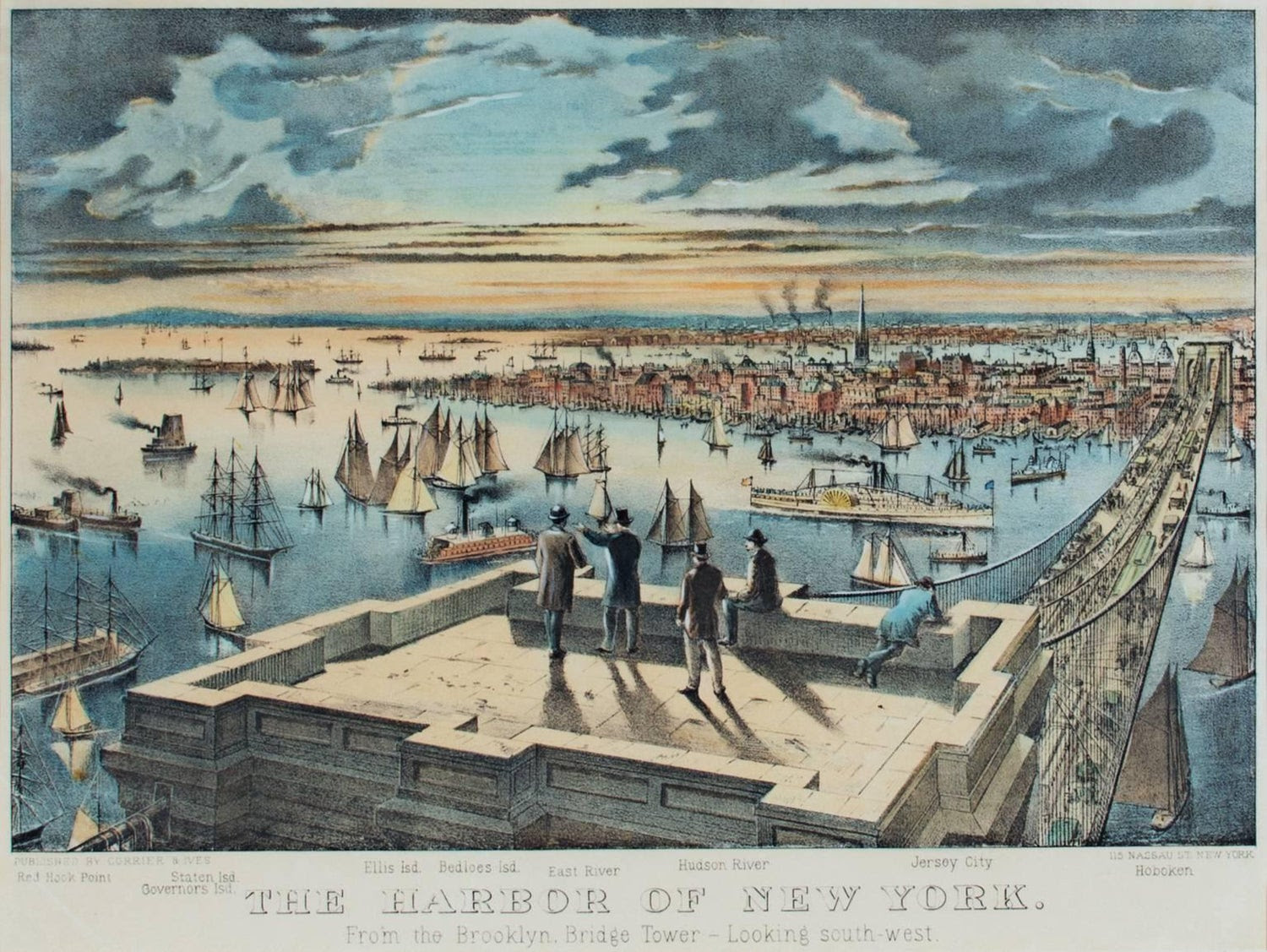
We live on an island, moored by time and tram to another island (and by bridge, to a third, of course). So let’s talk about where all of this water goes, down to New York Harbor and the Port of New York. New York Harbor is one of the largest natural harbors in the world. It’s what caught the eye and imagination of Giovanni da Verrazzano in 1524 and, in 1609, Henry Hudson. The magnificent harbor drew the Dutch here in 1624 for its commercial possibilities – and then the British who took it away in 1644.
The Dutch settlement faced the East River and that’s where the port grew. The first pier was built in 1647 at Pearl and Broad Streets. The Great Dock, at Corlear’s Hook, was working a few decades later and a shipbuilding industry emerged once New York started exporting flour. New Yorkers soon used landfill (excrement, dead animals, ships deliberately sunk in place, ship ballast, muck dredged from the river and more) to transform lower Manhattan’s geography and by 1700, the East River bank had been “wharfed-out” up to around Whitehall Street. By 1815, Water, Front, and South Streets were added to the map and extended well past Manhattan’s original shoreline along Pearl Street.
City’s maritime activity. But it would not be enough to sustain that growth. The key issue in the early 19th century was to access the growing production of the American West (what we now call the Midwest) choked into the endless and expensive voyage down the Mississippi and through the Gulf of Mexico. The opening of the 425-mile Erie Canal in 1825 connected the Great Lakes with the Atlantic Ocean via the Hudson River, and produce and goods from this heartland poured into the harbor. Goods were transported at one-tenth the previous fees in less than half the previous time. The port was booming, and South Street became the “Street of Ships.” China clippers, trans-Atlantic packets, coastal and Caribbean schooners, grain barges, fishing smacks, and Long Island Sound steamboats crowded the teeming wharves. Shipbuilding businesses, auction houses, and residences for seamen could be found in the brick buildings that appeared along John, Fulton, and Beekman streets. In this booming era, the port became the key to American trade. Cotton, for example, was transshipped from southern ports to New York to be exported across the Atlantic (which intensified the South’s sense of victimization). South Street became the busiest port in America to receive goods from across America, Europe, and Asia. The advent of the ocean liner, ships that would cross the Atlantic on fixed schedules created a new business and companies such as the Black Ball Line, Red Star, and Blue Swallowtail began to sail between New York and Liverpool on set days. The Seaport became even busier with the introduction of clipper ships – lighter, faster ships that carried large amounts of cargo became a necessity for the success of import companies. Shipbuilders rushed to build the biggest, fastest clippers to meet the demands of international trade, and New York soon developed a reputation for building beautiful, stalwart ships that could withstand the rough waters of long oceanic voyages. By about 1840, more passengers and a greater tonnage of cargo came through the port of New York than all other major harbors in the country combined and by 1900 it was one of the great international ports.
After the 1860s, the maritime industry shifted from sail to steam, and deep-water piers drew ships across town to the Hudson River. By the mid-twentieth century, New York port’s activity had crossed to the west side, to Brooklyn and New Jersey. Only the Fulton Fish Market and a few lingering cargo lines continued to use South Street’s deteriorating piers. Expanding commercial activity brought more financial activity to the City, as New York institutions grew to meet rising international needs. By the early 20th century, many of America’s new industrial giants – from Singer and Woolworth to Standard Oil – sited their headquarters here and pushed the limits on new skyscraper construction. For many of us, this is the era of the Port that we recall – two images: Great ocean liners stacked up on the Hudson piers (memory – I traveled by the original Queen Mary to Liverpool in February 1959!) and longshore men (think On the Waterfront). (The dirt and noise of the port was why Manhattanites didn’t live close to the water, and why so many of the early public housing projects were built there.)
Not just noise and dirt, but in the mid-20th century, organized crime. The bi-state Waterfront Commission was set up in 1953 (a year before the movie On the Waterfront), to combat labor racketeering. The Gambino crime family was said to control the New York waterfront and the Genovese crime family the New Jersey side. In 1984 the Teamsters local was put under Racketeer Influenced and Corrupt Organizations Act (RICO) trusteeship, and in 2005 a similar suit was brought against the International Longshoremen’s Association local.
Big changes took place in the port in the late 20th century
No longer would we see ocean liners moored up on Hudson. Easy and rapid airplane travel changed patterns of transportation and many of the great liners were removed from service. New York was not a major center for new Cruise Industry although its cruise traffic has grown over the past few years – until that is, the current Covid crisis.
And maritime commercial activity in the old New York City ports declined precipitately. In 1921, the commercial activity of the port of New York City, including the waterfronts of the five boroughs and nearby cities in New Jersey was formalized under a single bi-state Port Authority of New York and New Jersey and the old ports became just one part of a much larger picture. The breakbulk system (cargo on pallets and in bales, hauled in and out of ships by tough guys with hooks and nets) vanished as more cargo traveled in new containers – and soon, the old general purpose steamer was a thing of the past, facing larger and larger ships purpose built to carry more and more containers. Longshoremen were gone, too, replaced by a much smaller number of highly trained specialists who operated larger and larger cranes, onloading and offloading containers. And, given more and more containers and the need to move them quickly by truck or rail, space became a premium – far more than the old New York City ports could provide. And, in any case, New Yorkers discovered the joy of living on the water, in quieter and cleaner former port areas.
Our port contains four container facilities, but, since the 1950s, the New York and Brooklyn commercial port has been almost completely eclipsed by the container ship facility at nearby Port Newark-Elizabeth Marine Terminal in Newark Bay, which is the largest such port on the Eastern Seaboard making New York the second or third largest container port in the nation (after Los Angeles and Long Beach).
Central Nurses Residence Nancy Brown got it right!!
From a Reader
Hi Judy–hank you for your Editorial today. It registered viscerally with me as I had just seen you Wed, afternoon at Coler.
I also went home to see the horrible mobs outside storming & then running amok inside the Capitol Building. I too have been just rolling my eyes at the too little, too late rats jumping ship.
“Where were these people to stop the chaos that started on January 20, 2017?”…….INDEED! All the best
Text by Judith Berdy Thanks to Bobbie Slonevsky for her dedication to Blackwell’s Almanac and the RIHS Thanks to Deborah Dorff for maintaining our website Edited by Deborah Dorff All image are copyrighted (c)
FUNDING PROVIDED BY ROOSEVELT ISLAND OPERATING CORPORATION PUBLIC PURPOSE GRANTS CITY COUNCIL REPRESENTATIVE BEN KALLOS DISCRETIONARY FUNDING THRU DYCD
BLACKWELL’S ISLAND FOUND PHOTOS NEUROLOGICAL INSTITUTE AND OTHER SITES
The Municipal Archives is the treasure trove of photos of all sorts of NYC sites, buildings, parks and much more. To check out the Archives NYC.GOV/RECORDS and go to HISTORICAL RECORDS, COLLECTIONS, DIGITAL COLLECTIONS AND START EXPLORING
Located just south of the Welfare Island Bridge, The Neurological Institute was a part of the City Home. It was a “H” shaped building with a circular area in the center.
The building was facing Queens along the East Road
Occupational Therapy consisted of knitting, embroidery, sewing, making fishing nets, basket weaving, and hand looming.
The Bakery was busy baking for hundreds.
The sewing room seems to be producing clothing for the institution,
JUST DISCOVERED.. A GAZEBO, HOW DELIGHTFUL
A gazebo just south of Holy Sprit Chapel, now The Sanctuary in undated image. In the distance is the pier for the ferry to Manhattan.
The south wing of the Smallpox Hospital
Blackwell House with north wing in place (on the left side)
Lighthouse in Harbor off the coast of Staten Island
EDITORIAL
I walked into my apartment about 2 p.m. yesterday. I had been at Coler, attending to the business of the Hospital Auxiliary, chatted with the food distribution volunteers at the Senior Center, and came home to scene of horror on TV.
After listening to explanations and excuses for an unstable person, the dam burst and our capitol was under siege.
Until 6 p.m. when the police from neighboring states arrived it was a painful site to watch. All we have been taught for respect and law as being overtaken by in-sighted mobs.
Even procedural votes in the House and Senate were a site to see at 1 a.m.
Where were these people to stop the chaos that started on January 20, 2017?
Judith Berdy
Text by Judith Berdy Thanks to Bobbie Slonevsky for her dedication to Blackwell’s Almanac and the RIHS Thanks to Deborah Dorff for maintaining our website Edited by Deborah Dorff Roosevelt Island Historical Society
NYC MUNICIPAL ARCHIVES
FUNDING PROVIDED BY ROOSEVELT ISLAND OPERATING CORPORATION PUBLIC PURPOSE GRANTS
CITY COUNCIL REPRESENTATIVE BEN KALLOS DISCRETIONARY FUNDING THRU DYCD
A DAY OF SHOCK, SHAME AND DISGRACE TO OUR COUNTRY AND OUR ELECTION AND SUCCESSION. AN OFFENSIVE ACTION.
THURSDAY, JANUARY 7, 2021
The
256th Edition From Our Archives
HARBORS OF THE WORLD
BOSTON, BALTIMORE, SAG HARBOR, NEW YORK AND MANY MORE SCENES OF OUR CITY WATERWAYS FROM THE SMITHSONIAN AMERICAN ART MUSEUM
Charles Manger, Boston Harbor, ca. 1860-1869, oil on canvas, Smithsonian American Art Museum, Gift of Mrs. George Viault, 1970.183 In this painting of Boston Harbor in the 1860s, a ship carrying a passenger sits in the center, while an assortment of seafaring vessels dots the hazy horizon. In the foreground, birds fly low among waves that reflect the colors of the sky. Manger’s use of glowing light and smooth brushstrokes was a popular approach among American landscape painters at the time. This work was completed around the time of the American Civil War when Boston Harbor served as a training camp and coastal defense for the Union army.
Don Resnick, Near Sag Harbor, 1984, oil on canvas, Smithsonian American Art Museum, Gift of the artist in memory of Robert and Dorothy Haberstock, 1992.85
William H. Johnson, Harbor, Svolvaer, Lofoten, 1937, oil on burlap, Smithsonian American Art Museum, Gift of the Harmon Foundation, 1967.59.893 In 1937, William H. Johnson and his Danish wife, Holcha, made their way north of the Arctic Circle to the settlement of Svolvaer in Norway’s Lofoten Islands. Thickly applied colors capture strong contrasts of light and shadow and animate the rugged terrain and fishing boats in the harbor. In letters to friends, Holcha called the Lofotens “marvelously beautiful” and wrote that her husband climbed the hills every day to capture the scenery in different light and weather. This canvas shows the twin peaks of the “Svolvaer Goat,” a landmark in the islands that remains famous to this day.
Alice Pike Barney, Bar Harbor, ca. 1892, pastel, Smithsonian American Art Museum, Gift of Laura Dreyfus Barney and Natalie Clifford Barney in memory of their mother, Alice Pike Barney, 1952.13.10
Werner Drewes, Camden Harbor (no. 166), 1954, color woodcut, Smithsonian American Art Museum, Gift of the artist, 1968.9.20
James McNeill Whistler, Valparaiso Harbor, 1866, oil on canvas, Smithsonian American Art Museum, Gift of John Gellatly, 1929.6.159
William H. Johnson, Harbor Scene, Kerteminde, ca. 1930-1932, watercolor and pen and ink on paper, Smithsonian American Art Museum, Gift of the Harmon Foundation, 1967.59.28
Thomas James Delbridge, Lower Manhattan, 1934, oil on canvas, Smithsonian American Art Museum, Transfer from the U.S. Department of Labor, 1964.1.51
Lower Manhattan’s glorious skyscrapers inspired all New Yorkers, including the city’s artists, through the worst hardships of the Great Depression. Looking from the dock of a harbor island, Thomas Delbridge showed the dark mouths of Manhattan’s ferry terminals; above them ever taller buildings climb out of red shadows into gold and white sunshine. The crisply outlined forms evoke such famous structures as the Woolworth Building to the left and the Singer Building to the right without placing the buildings precisely or describing specific details. The skyscraper at the center suggests the mighty Empire State Building as it had stood incomplete before its triumphant opening on May 1, 1931. Even as the stock market foundered and thousands were thrown out of work, New Yorkers had gathered in excited throngs to watch their tallest tower rise. The Manhattan skyscrapers in the painting appear to be pushing back dark clouds, creating an oasis of brilliant blue around the island.
1934: A New Deal for Artists exhibition label
Herman Maril, Sketch of Old Baltimore Waterfront, 1934, oil on fiberboard, Smithsonian American Art Museum, Transfer from the U.S. Department of Labor, 1964.1.187
Herman Maril opened a window onto the history of his native city in this view of Baltimore harbor. Maril was a modernist painter who simplified the forms in the painting to make “the abstract structure . . . dominant,” yet he retained enough details to situate the scene in a past era. A schooner typical of nineteenth-century shipping is tied up in the foreground, its sails furled after a journey that could have brought it from almost anywhere in the world. The domed Merchants and Exchange building visible in the background stood at the corner of Gay and Water streets in Baltimore’s inner harbor from 1815 until it was razed in 1901.
This painting is thus set before Maril’s birth in 1908, in an era cut off from the artist’s life time by the disastrous fire of 1904 that destroyed Baltimore’s inner harbor docks along with much of the city. Maril’s wife recalled that the artist “took pleasure in looking at the architecture and changes in the city over the years,” particularly enjoying “the harbor where he walked with his father.” Baltimore’s vanished past remained key to Maril’s personal conception of the American scene.
1934: A New Deal for Artists exhibition label
Werner Drewes, Southern Harbor, 1964, color woodcut on paper, Smithsonian American Art Museum, Gift of Associated American Artists, 1967.9.1
C. K. Chatterton, Monhegan Harbor, ca. 1920-1948, oil on paperboard, Smithsonian American Art Museum, Bequest of Olin Dows, 1983.90.215
James Floyd Clymer, Untitled (Harbor in Winter), before 1974, oil on canvas mounted on fiberboard, Smithsonian American Art Museum, Transfer from the General Services Administration, 1974.89.6
A seagull perched on the seawall. NOTE THE TRAM TOWER WITH ORANGE COLOR, FROM THE OLD TRAM REPLACED IN 2009.
Text by Judith Berdy Thanks to Bobbie Slonevsky for her dedication to Blackwell’s Almanac and the RIHS Thanks to Deborah Dorff for maintaining our website Edited by Melanie Colter and Deborah Dorff All image are copyrighted (c)
SMITHSONIAN AMERICAN ART MUSEUM (c)
FUNDING PROVIDED BY ROOSEVELT ISLAND OPERATING CORPORATION PUBLIC PURPOSE GRANTS CITY COUNCIL REPRESENTATIVE BEN KALLOS DISCRETIONARY FUNDING THRU DYCD
Scandals of the Upper West Side Tuesday, January 12, 7 PM RIHS Lecture
The Roosevelt Island Historical Society and the New York Public Library are proud to host Beth Goffe and her presentation “Scandals of the Upper West Side.” Beth Goffe is a licensed New York City tour guide. An Upper West Side resident for over three decades, she is enamored with the city’s history and has amassed quite a few entertaining stories over the years.
It was in a part of Manhattan, at the edge of a poor neighborhood of tenements and groggeries, where no one wanted to end up.
But thousands of city residents did found themselves on Misery Lane, as the short stretch of East 26th Street between First Avenue and the East River was known in the turn-of-the-century city.
This block was a dumping ground for the sick, alcoholic, and mentally ill, who sought treatment at Bellevue Hospital, which bordered East 26th Street (above). Some New Yorkers had a sense of humor about it, as this rhyme from a 1917 medical magazine demonstrates:
T.B., aneurysm, and gin-drinker’s liver; Tabetics, paretics, plain drunk, and insane; First Avenue’s one end, the other’s the river; Twenty-sixth Street between they call Misery Lane!
Criminals showed up on Misery Lane as well.
Men and women convicted of a range of crimes were deposited via police wagon on a dock known as Charities Pier at the end of East 26th Street (below).
From there, they were ferried to the workhouse and penitentiary across the East River to Blackwell’s Island to serve their time.
The poor also stood in line at Charities Pier. Unable to afford rent, food, coal, and other necessities, their last resort was the Blackwell’s Island almshouse.
Misery Lane was the site of the Municipal Lodging House, built in 1909 to house mostly homeless, often derelict men (top and second photos), but also women and children.
With the city morgue on 26th Street as well, Misery Lane was the last place New York’s unknown dead went before being interred in the potter’s field on Hart Island.
And when mass tragedy struck the city, Misery Lane was involved as well.
Bodies found after the General Slocum disaster were brought here to be identified—as were the horribly burned corpses of Triangle Fire victims
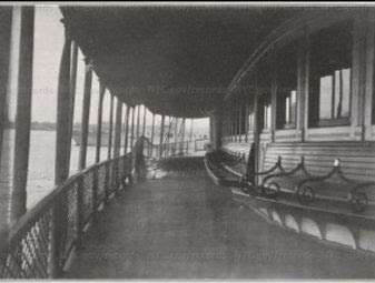
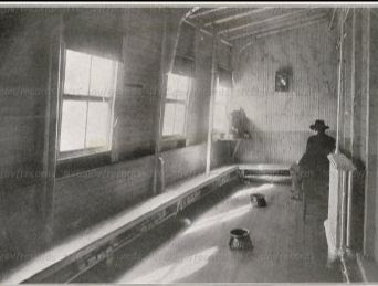
Steamer THOMAS S. BRENNAN DEPARTMENT OF PUBLIC CHARITIES
Steamer Thomas S. Brennan: Male sickroom. Seated man in coat and hat, back to camera. Long planks along walls of room. The Brennan was used for many years to transport a types of persons to Blackwell’s Island.
Museum of the City of New York 93.1.1.4884 Byron Company (New York, N.Y.) Hospital, Bellevue, Blackwell’s Island (Welfare) Old & New Bldgs. DATE:ca. 1896 photograph gelatin silver print printing-out paper
WEDNESDAY PHOTO OF THE DAY
Can you identify this photo and when it was taken?
No one guessed the three ballfields in Queensbridge Park. I must admit that only apartments face east can see the ballfields.
EDITORIAL
East 26th Street still has sites that contribute much to our City history. The Hunter College School of Nursing formerly Bellevue School is located on the far east end of the site with it’s round design overlooking the FDR Drive. Across the street is the new building of the Chief Medical Examiner’s office. It was the site where many remains were stored after 9/11.
It is a street of dreams and sorrows.
Judith Berdy
Text by Judith Berdy Thanks to Bobbie Slonevsky for her dedication to Blackwell’s Almanac and the RIHS Thanks to Deborah Dorff for maintaining our website Edited by Deborah Dorff All image are copyrighted (c) Roosevelt Island Historical Society unless otherwise indicated
EPHEMERAL NEW YORK (C) Museum of the City of New York Municipal Archives of the City of New York
FUNDING PROVIDED BY ROOSEVELT ISLAND OPERATING CORPORATION PUBLIC PURPOSE GRANTS CITY COUNCIL REPRESENTATIVE BEN KALLOS DISCRETIONARY FUNDING THRU DYCD
TIME TO SELECT THE BEST OF 2020 DO YOU HAVE A FAVORITE ARTICLE? SEND US YOUR NOMINATIONS FOR THE BEST FROM THE ARCHIVES ARTICLES FROM 2020. TO SEE ALL THE ARTICLES, GO TO RIHS.US AND SCROLL DOWN TO SEE ALL THE EDITIONS! SEND YOUR SUBMISSION TO: ROOSEVELTISLANDHISTORY@GMAIL.COM
THE LADIES WAITING ROOM AT PENNSYLVANIA STATION & GRAND CENTRAL TERMINAL
by ephemeralnewyork
Old Penn Station’s women-only waiting room by ephemeralnewyork The original Penn Station, opened in November 1910, had many things: a beautiful, spacious building, arcades for high-end stores, 21 tracks for arriving and departing trains…and separate waiting rooms for men and women.
This diagram of the original station shows the upper part of each single-sex waiting room. No word on when these were phased out, if ever, before the old station was torn down in 1963. Interestingly, the city considered something similar around the same time as Penn Station opened: single-sex subway cars, so women didn’t have to be subjected to “brutes,” as this 1909 New York Times article about the possibility of female-only subway cars called them. That idea was ultimately abandoned.
Grand Central Terminal also had a ladies waiting room.
East 53rd Street Pier
We came upon this image of a pier on East 53rd Street from The Department of Public Charities
Another view of the 53 St. Pier
Above The building in the background is the Consumer Brewing Co. Below Remains of pier being demolished for East River Drive
East 70 Street Pier
Pier we assume served the island since the sign is DEPARTMENT OF CHARITIES
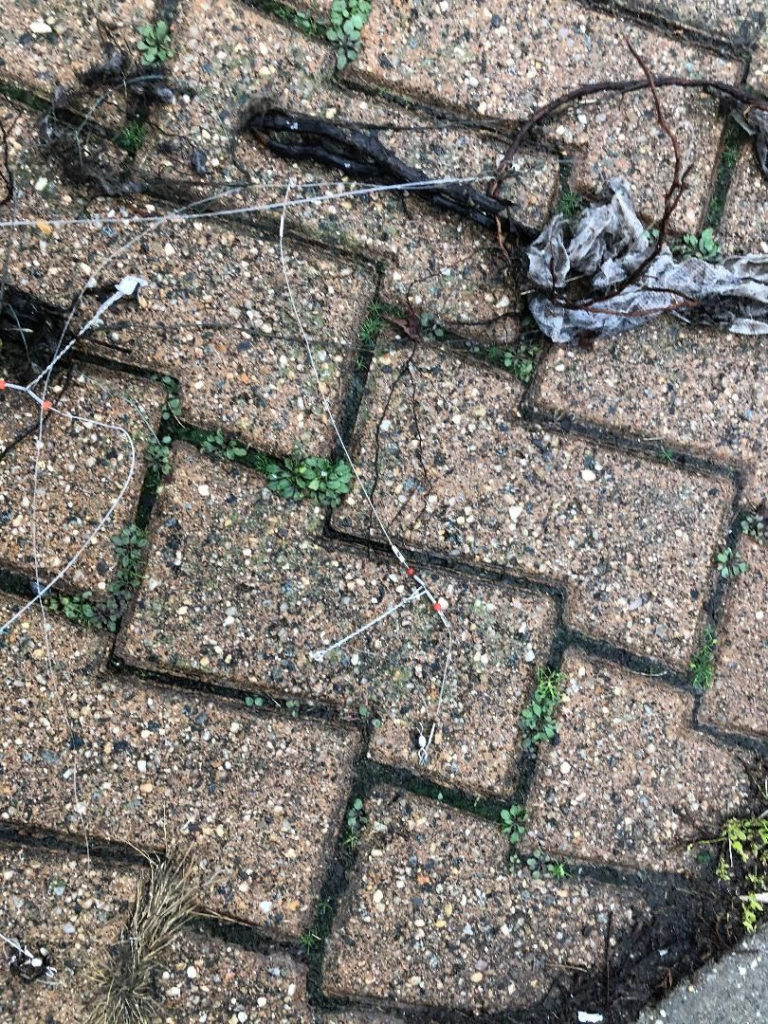
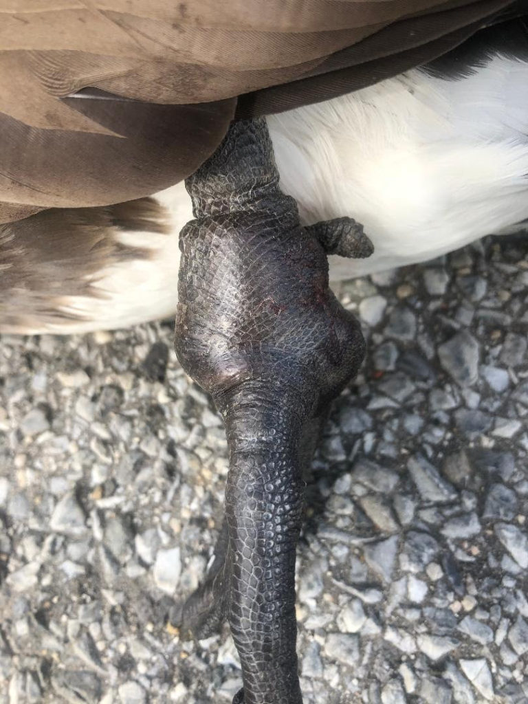
WE LOVE FISH, BUT FISHERMEN ARE CARELESS MANY BIRDS HAVE BEEN INJURED BY FISHING LINE AND HOOKS BEING ABANDONED ON THE WALKWAYS
ABANDONED FISHING LINES ON SIDEWALKS GOOSE LOST HIS FOOT DUE TO BEING ENTANGLED IN FISHING LINES PHOTO WILDLIFE FREEDOM FOUNDATION (C)
Sutton Place Park Janet Spencer King, Clara Bella and Gloria Herman got it right
EDITORIAL We want to hear from you. What were your favorite subjects and articles from 2020? We featured: Island History Smithsonian Art Medical History Current Art Evens People Who Lived and Worked Here Great Architects Tales of Other New York Islands Airports and much more Go to rihs.us and scroll down to see all the 250+ editions of FROM THE ARCHIVES.
WITH BETH GOFFE RIHS LECTURE WITH THE ROOSEVELT ISLAND BRANCH, NEW YORK PUBLIC LIBRARY 7 P.M. ON GOOGLE MEET WATCH FOR RESERVATION INFORMATION
Text by Judith Berdy Thanks to Bobbie Slonevsky for her dedication to Blackwell’s Almanac and the RIHS Thanks to Deborah Dorff for maintaining our website Edited by Melanie Colter and Deborah Dorff
EPHEMERAL NEW YORK (thanks for their wonderful postings) NYC MUNICIPAL ARCHIVES WIKIPEDIA GOOGLE IMAGES ALAMY STOCK PHOTO
All image are copyrighted (c) Roosevelt Island Historical Society unless otherwise indicated SMITHSONIAN AMERICAN ART MUSEUM PHOTOS BY JUDITH BERDY / RIHS (C)
FUNDING PROVIDED BY ROOSEVELT ISLAND OPERATING CORPORATION PUBLIC PURPOSE GRANTS CITY COUNCIL REPRESENTATIVE BEN KALLOS DISCRETIONARY FUNDING THRU DYCD
JUST A STEP AWAY FROM YOUR YACHT TO MANHATTAN RESIDENCE
WITH MATERIAL FROM A EPHEMERAL NEW YORK and CITYSCAPES by CHRISTOPHER GRAY, NYTIMES (C) 2005
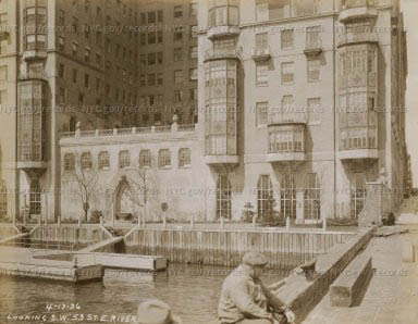
This luxury building had a private dock for yachts
River House, the majestic Art Deco apartment building at the end of East 52nd Street, offers lots of amenities.
Residents of this tony co-op built in 1931 on the site of a former cigar factory enter and exit through a cobblestone courtyard with a private driveway behind a wrought-iron fence.
Multi-room apartments have panoramic views of the East River, and the 26-story building features the River Club, a members-only club with a gym, pool, and dining room.
Too bad one of the original selling points River House dangled in front of its earliest prospective tenants is no longer there: a private dock on the East River where residents could park their yachts.
It’s hard to believe, but this really did exist. Even though the building opened during the Great Depression, that didn’t stop residents from using the dock to sail back and forth to their Long Island mansions, as one Daily News article from 1940 shows.
1936 NYC Municipal Archives Photo
Close-Up of River House Pier 1936 NYC Municipal Archives
The East River Drive sight looking north NYC Municipal Archives
STREETSCAPES
When the Automobile Replaced the Yacht
By Christopher Gray Feb. 27, 2005 Correction Appended
The streamlined, reinforced-concrete Franklin D. Roosevelt Drive remains one of New York’s most elegant public works. But when it was built in the 1930’s (as the East River Drive), it deprived many well-to-do East Side riparians of their river views and access. Among these, perhaps none sacrificed more than the members of the ultra-discreet River Club, built in 1931 between 52nd and 53rd Streets, which lost its romantic stone quay and yacht landing — and received in exchange a six-lane highway.
In the 1920’s, elite residential development washed the shores of the East River along Beekman Place, Sutton Place and East End Avenue. Part of this new shorefront dream was not just a view of the water but access to it. In 1925, the developer Joseph B. Thomas planned a Venetian-style gondola station for his medieval fantasy of an apartment house at 455 East 51st Street. And the 1927 Campanile, facing 52nd Street but backing up onto Thomas’s structure, had a broad open terrace with a riverside restaurant.
But it was the 26-story-high River House, with its waterside River Club, that set the standard. Designed by Bottomley, Wagner & White, River House replaced a cigar factory and a furniture plant. Its two broad wings create a square courtyard facing the river and rise to a broad tower.
Early descriptions do not mention a club and seem to depict a seamless transition between the building and direct water access. But the developers turned the lower floors into the River Club, a private social organization. It is not clear if all River House tenants were automatically accepted, but an advertisement in The New York Times offered apartments “to acceptable persons,” who presumably would have passed muster with the club’s directors. The club leased the space from River House.
In 1930, The Times observed in a headline that “River Club Interests Society” and reported that the new organization had two tennis courts, three squash courts, a gym and a pool. There was also, “for the convenience of members addicted to their yachts and motor boats, a private boat landing.” The Real Estate Record and Guide noted that “it will be possible to step out of a boat and be whisked immediately by fast elevator to the topmost floor of the building.”
The president of the club was Kermit Roosevelt, a writer, steamship executive and son of President Theodore Roosevelt. It is not clear if the younger Roosevelt was particularly interested in boats, but many other River Club organizers were. One, Harold S. Vanderbilt, was a leading yachtsman. In 1930, his boat the Enterprise defeated the English boat Shamrock V in four straight races to win the America’s Cup.
Another, the department-store heir Marshall Field III, made the trip from Port Washington on Long Island to Manhattan in 35 minutes at 50 miles per hour on his commuting yacht, Corisande. This took 50 gallons of gasoline, according to a 1931 article in The Times, which noted that these swift, highly engineered vessels had become “the acme of the ship-building art.”
Another River House resident and River Club member, Representative Ruth Baker Pratt, a New York City congresswoman, commuted from the Pratt family compound at Glen Cove on Long Island on her boat Tuna. But the volume of such commuting, and whether it justified the cost of a private landing, is hard to determine.
The blocklong landing at River Club consisted of a broad quay with steps leading down to a large float in the form of an “H,” with striped railings. Early photographs show yachts tied up at the floats attended by sailors in uniform, hard by the working pier at the foot of 53rd Street, which was stained with coal, cement and sand. This dichotomy formed the backdrop for Sidney Kingsley’s 1935 play “Dead End,” which dealt with the proximity of rich and poor in the neighborhood, where slums and luxury apartment buildings stood almost side by side.
The design of the club itself followed the rest of River House — a mix of robust classicism and Art Deco, but with a tropical twist of bamboo and wicker furniture. Writing in Town and Country magazine in 1932, Augusta Owen Patterson described its ballroom as “a sapphire with many facets set in platinum,” with blue glass, silver leaf and Chinese screens. The swimming pool was just a few feet inside the door to the landing.
In 1932, the River Club’s tennis balcony was full when the tennis star Helen Moody played Manuel Alonso. The Times said that “fashionable New York society filled every seat.” Alonso was leading, 7-5, 6-3, 6-5, when play was called in the third set for reasons unknown.
That River Club members traveled in the same circles could be handy. In early 1933, The Times reported that Kermit Roosevelt would be a guest on Nourmahal, the yacht of Vincent Astor, another club member, along with Roosevelt’s cousin, Franklin D. Roosevelt, who had recently been elected president. The Times described their meeting as an important rapprochement between the two Roosevelt families; they had been estranged for a decade, and Kermit’s mother, Edith, had supported Herbert Hoover in the 1932 election.
From its inception, the River Club was a venue of choice for dinners and debutante parties, as well as a broad variety of other activities. In 1939, a meeting there announced plans to raise $250,000 to erect a pavilion celebrating Germany before the rise of the Nazi Party.
Alfred E. Smith, a former New York governor, spoke to the pavilion’s sponsors, including Field and the theologian and philosopher Paul Tillich, and predicted that “the rank and file some day are going to throw Hitler and all the rest of those fellows with unpronounceable names out the window and give Germany a really decent government.” But the sponsors could not raise the money.
Construction began on the East River Drive in the 1930’s, and the city worked out widely varying compromises with the affected apartment buildings. At the co-op at 1 Sutton Place South, at 57th Street, the city took over most of the co-op’s backyard and, in turn, leased land on a deck over the highway back to the co-op. (The city is planning to take back the deck, now a garden, but the co-op is battling to keep it.)
At the co-op at 10 Gracie Square, at 84th Street, the highway is double-decked, and the co-op’s first three floors were left facing a blank, narrow pit.
At River House, the highway is all at one level, the same level as the original dockside landing. The city built a high wall separating the landing from the highway — leaving plenty of light, if no view — and erected an elevated walkway to a new riverside landing just beyond the highway itself. The new yacht landing apparently saw little use, because the walkway does not appear in aerial photographs of the 1950’s.
The River Club, however, still exists. But on what is now its garden terrace, where the original landing once sat, one cannot hear the water — only the sound of tires.
Streetscapes Correction: March 6, 2005, Sunday A picture caption last Sunday with the Streetscapes column, about the River Club, at the East River between 52nd and 53rd Streets, gave an incorrect date for the photograph and an incorrect credit. The picture was made in 1936, not 1928; it was from the Municipal Archives, not the Museum of the City of New York.
A version of this article appears in print on Feb. 27, 2005
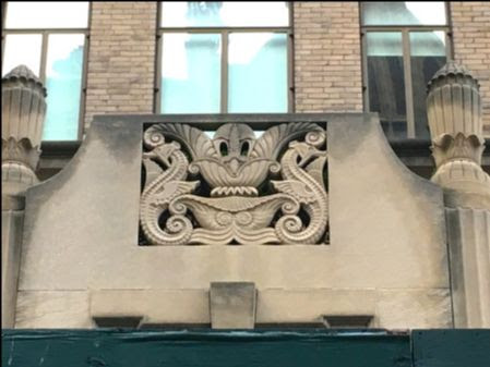
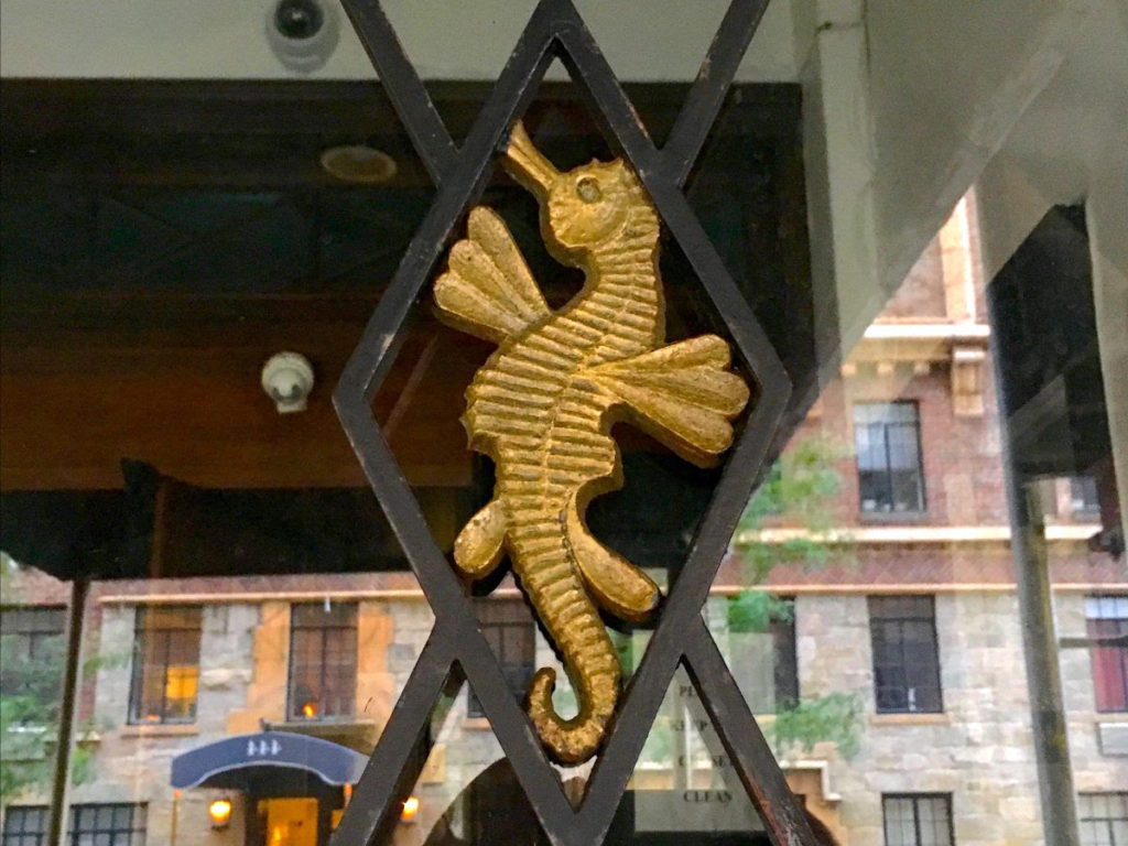
The nautical motifs are evident at the building gate, facade entry to River Club and on street. (EPHERMERAL NEW YORK)
TIME TO SUPPORT THE RIHS WITH A MEMBERSHIP GO TO WWW.RIHS.US JOIN THE SOCIETY ON-LINE CLICK BECOME A MEMBER
EDITORIAL
I had such fun yesterday exploring the new Moynihan Train Hall that today I took a completely different trip. Today we venture down the East River in our yacht to dock at River House at 51st Street. The building opened in 1931, when there were still some millionaires that could come from their estates on Long Island and not mingle with he “rif-raf” on the streets on Manhattan.
Their private glory was short lived with the construction of the FDR Drive.
River House is visible from the FDR Park and parts of it seem to be under constant restoration.
Imagine the life, long gone. Soon we will find Greta Garbo. Stay tuned!
The mail sorting floor at Farley Building now the concourse of Moynihan Train Hall. Correctly identified by Clara Bella, Guy Ludwig, Andy Sparberg and great notes from Ron Crawford
FREE COVID-19
TESTING
HOSPITAL WALK IN COVID-19 TESTING NYC HEALTH + HOSPITAL METROPOLITAN 1901 First Avenue, New York, NY 10029 at 97th Street call (844) 692-4692 9AM-3:30PM Daily Free Diagnostic Testing (Third-party Verified) Screening Required No appointment needed
Text by Judith Berdy Thanks to Bobbie Slonevsky for her dedication to Blackwell’s Almanac Thanks to Deborah Dorff for maintaining our website Edited by Melanie Colter and Deborah Dorff All materials in this publication are copyrighted (c)
EPHEMERAL NEW YORK
CITYSCAPES NYTIMES, CHRISTOPHER GRAY (C) 2005 NYC MUNICIPAL ARCHIVES
FUNDING PROVIDED BY ROOSEVELT ISLAND OPERATING CORPORATION PUBLIC PURPOSE GRANTS CITY COUNCIL REPRESENTATIVE BEN KALLOS DISCRETIONARY FUNDING THRU DYCD
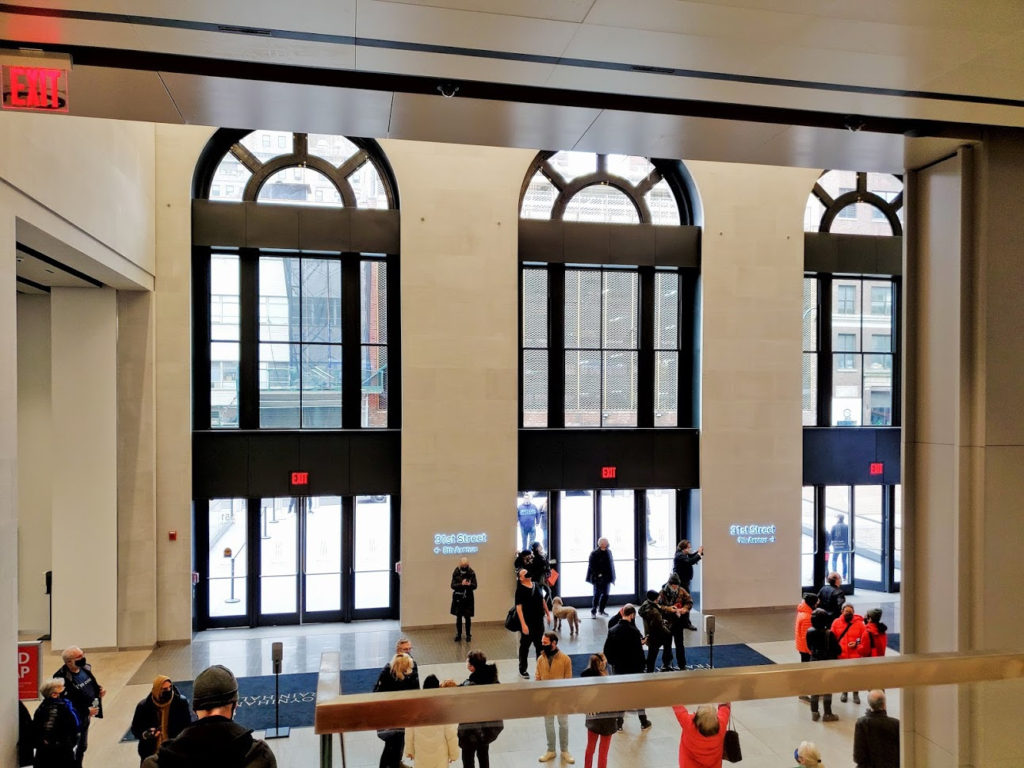
Your first view of the new concourse level as you enter from 8th Avenue.
From the upper level future food and retail area you can watch the comings and goings.
Great graphics hide the yet-to-be opened.
Great images roll across the light and airy concourse. Escalators lead down to tracks, the same way as the original Penn Station.
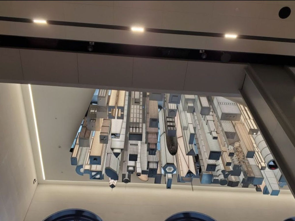
Look above the 31st Street Mid-block entrance for a skyscraper art piece… Remember to look up.
Look above the 33rd Street Mid-block entrance for an interesting “stained glass” artwork.
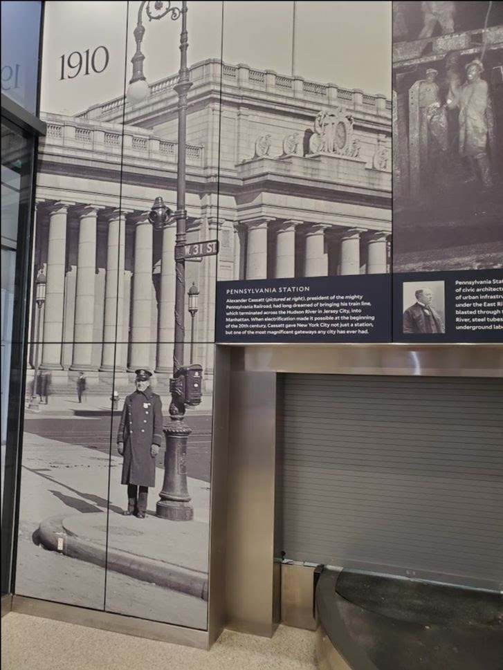
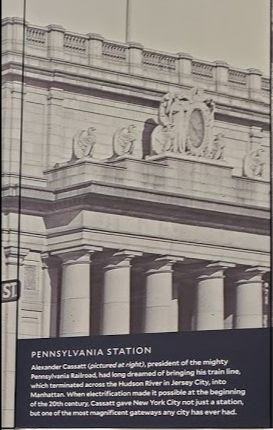
In the new baggage claim room is a history of Pennsylvania Station. This reminded me of the fate of the grand clock and Day and Night Sculpture that ended up in Kansas City, Missouri
Eagle Scout Memorial Fountain, 39th Street at Gillham Road,Kansas City, Missouri, featuring the only remaining assembled example of the four “Day” and “Night” statue pairs by Adolph Weinman that once flanked clocks in New York City’s original Penn Station (1910–1963).
THERE ARE NO TRAINS TO BE SEEN ABOVE THE TRACK LEVEL AT MOYNIHAN HALL. ENJOY THESE FROM THE SMITHSONIAN AMERICAN ART MUSEUM.
Saul Berman, (Study for mural, The Railroads Came to Town), n.d., watercolor, Smithsonian American Art Museum, Transfer from the Internal Revenue Service through the General Services Administration , 1962.8.26
Edward Mitchell Bannister, Train, ca. 1875-1880, oil on canvas, Smithsonian American Art Museum, Gift of Frederick and Joan Slatsky, 1983.95.107
Edward Bannister’s painting shows a train cutting through a rural landscape, where a railroad trestle interrupts the flow of the stream below. These familiar signs of progress in the nineteenth-century landscape highlight a concern shared by many of Bannister’s fellow painters, who worried that industrialization would soon destroy their nation’s natural beauty.
Hugo Robus, Train in Motion, ca. 1920, oil on canvas mounted on fiberglass, Smithsonian American Art Museum, Gift of Mr. and Mrs. Hugo Robus, Jr., 1978.153.2
Hugo Robus created Train in Motion toward the end of his painting career, shortly before he devoted all of his time to sculpture. He was fascinated by the futurist painters, who emphasized the speed and power of modern machinery, but claimed not to be “initiated into their plane of intelligence” when he tried to understand the movement’s principles (Tarbell, Hugo Robus, 1885–1964, 1980). The repeated shapes and blurred colors in this painting express a sense of movement, as if we are watching the landscape sweep past the window of a speeding train. The bright colors and fragmented shapes appear like a kaleidoscope, suggesting that this image is just one of an infinite number of possibilities.
“I [am] interested not in what the eye records but in what our sensitivities feel.” Robus, “Sculptor as Self Critic,” reprinted in Tarbell, Hugo Robus, 1885–1964, 1980
Jack Savitsky, Train in Coal Town, 1968, oil on fiberboard, Smithsonian American Art Museum, Gift of Herbert Waide Hemphill, Jr. and museum purchase made possible by Ralph Cross Johnson, 1986.65.137 Jack Savitsky’s Train in Coal Town depicts a coal-fired passenger train traveling between Pottsville and Silver Creek, two well-known coal towns in Pennsylvania. Behind the smoky plume of the locomotive stand a blue-gray coal breaker and eight mill houses—the very houses that make up the painting’s border. Savitsky conveys the sameness and unending work of the company town through his use of repetitive patterning and decorative elements. However, the lively colors and cheerful rural setting also reflect an energetic spirit within the miner community
Steve Ashby, Train in Landscape, n.d., carved wood with applied wood pieces, Smithsonian American Art Museum, Gift of Herbert Waide Hemphill, Jr., 1998.84.4
Doris Rosenthal, Night Train, n.d., lithograph on paper, Smithsonian American Art Museum, Bequest of the artist, 1976.46.3
Ernest Ralph Norling, Sketch for mural of The Mail Train, n.d., watercolor on paperboard: illustration board, Smithsonian American Art Museum, Transfer from the Internal Revenue Service through the General Services Administration , 1962.8.40
Unidentified, Pennsylvania Railroad Locomotive at Altoona Repair Facility, ca. 1868, albumen silver print, Smithsonian American Art Museum, Museum purchase from the Charles Isaacs Collection made possible in part by the Luisita L. and Franz H. Denghausen Endowment, 1994.91.213
Dox Thrash, Railroad Yard, ca. 1933-1934, aquatint, etching and pencil on paper, Smithsonian American Art Museum, Museum purchase, 1981.11.2
Max Arthur Cohn, Railroad Bridge, opaque watercolor, Smithsonian American Art Museum, Gift of the artist, 1984.63.3
Jack J. Greitzer, Concerning Railroads, n.d., crayon and chalk on paper, Smithsonian American Art Museum, Transfer from the U.S. Department of the Interior, National Park Service, 1965.18.21
NO ONE GUESSED THE INTERIOR OF THE CLOSED BLACKWELL’S ISLAND PENITENTIARY
EDITORIAL What a treat today. I had visited the closed area at the Farley Post Office years ago with an engineer. It was empty, bleak and depressing. Little could I imagine that today it is a sparkling re-birth of this building.
The use is complicated for Moynihan Hall. All Amtrak trains load from this station. When an Amtrak train arrives you can depart from 7th Avenue or Moynihan Hall.
New Jersey Transit still uses Track 1-4 in the 7th Avenue Building, so that has not changed.
LIRR uses tracks 17-21 which are only in the 7th Avenue Building. Other tracks for LIRR trains can be accessed through Moynihan Hall.
There is a Starbucks open already. There are areas for ticketed passengers with restrooms. I spotted restrooms by the 31St. Midblock exit.
IF YOU WANT TO SEE WHAT THIS BUILDING LOOKED LIKE 4 YEARS AGO, CHECK OUT UNTAPPED CITIES:
Text by Judith Berdy Thanks to Bobbie Slonevsky for her dedication to Blackwell’s Almanac and the RIHS Thanks to Deborah Dorff for maintaining our website Edited by Deborah Dorff All image are copyrighted (c)
SMITHSONIAN AMERICAN ART MUSEUM ROOSEVELT ISLAND HISTORICAL SOCIETY JUDITH BERDY
FUNDING PROVIDED BY ROOSEVELT ISLAND OPERATING CORPORATION PUBLIC PURPOSE GRANTS CITY COUNCIL REPRESENTATIVE BEN KALLOS DISCRETIONARY FUNDING THRU DYCD
Return with us now to those thrilling days of yesteryear, when from out of the past come the thundering hoofbeats of…a Wooly Mammoth??
By popular demand, we bring the New York City/Roosevelt Island story up to date, or at least to when the Dutch took over. When we left, around 10,000 years ago, after the retreat of the last great ice sheets, the Paleo-Indians living in the New York region were, perhaps, chasing down megafauna like mammoths, mastodons, giant beavers and giant short-faced bears.
University of New Mexico Archeological Discoveries
Before we move on, who were these folks?
The current view is that all Native Americans – before Europeans and Africans arrived – were cast from the same original stock, from humans who crossed from Siberia to Alaska over what was then land (in glacial periods, seas were much lower) perhaps 40,000 years ago. They – the “founders” – the theory goes, represent a culture that was isolated for thousands of years up in the cold north of our continent, incubating a population that would eventually seed everywhere else in the hemisphere.
An earlier theory, based on projectile points resembling spearheads and other hunting paraphernalia found in an archaeological site near Clovis, New Mexico put the arrivals in North America at around 13,000 years ago. The new theory pushes that date back much further. Eventually, probably because of climate change and population increase, the founders moved out and over many years (12,000?) populated the entire hemisphere. Over time, genetic variation occurred among the various founder subgroups, but au fond all indigenous Americans share the same core genetic heritage.
So, long story short, it took a while, but these people finally found their way to the New York region – our own Paleo-Indians – arriving between 13,000 and 10,000 years ago. Some paleoanthropologists characterize them as nomadic bands of big game hunters, following the herds of mammoths and other ice age animals across the continent. Some feel that the Paleo-Indians – together with a warming climate – were responsible for killing off these local plus-sized mammals.
With the gradual melting of the glaciers, a number of climatic changes began occurring between 10,000 and 5,000 years ago throughout the Northeast. The larger animals migrated north and our intrepid hunters followed. Here, the warming climate encouraged the northward growth of deciduous trees bearing a variety of protein-rich black walnuts, butternuts, and chestnuts. A rich supply of fruits, seeds, and nutritious roots expanded the food base. In thicker forests, smaller animals predominated.
During this period, a more sedentary culture developed. Known as the Archaic Period, people made advances that allowed them to exploit the new conditions. Not simply hunting, they developed the technology needed to harvest the fish and shellfish found in New York Harbor as well as acorns and other new plant species.
Approximately 2,000 years ago, things changed again, this time, however, pushed by changes in human technology. During the Eastern Woodland Period, major advances such as pottery, bow and arrows, and agriculture were developed. These allowed for even greater utilization of the land and resources leading to the growth of larger settlements such as villages. We know more about these people. The remains of approximately 8,000 early encampments together with more advanced hunting implements have been found throughout the city. Since then, the New York region has probably remained continually inhabited.
The next several millennia seem pretty foggy. It seems that the first Native Americans (no longer Paleo-Indians) to occupy the New York area spoke the Algonquian language with the last wave of Algonquians arriving just before the year 1000. They were part of a union of tribes known as the Algonquian nation that stretched from what is now Virginia, through New Jersey, and into Canada. The peoples who came here seem to have had no relation to the sophisticated Native American civilizations that built the grand mounds of Ohio and Mississippi River Valleys and across the Southeast. No mounds here.
The Algonquian star would fade: By the time the first Europeans arrived in New York during the late 1500s and early 1600s, the Algonquian power had declined and had shifted to the powerful tribes of the Iroquois.
But the people Europeans met here weren’t Iroquois. They were Lenape. Their language was Algonquian.
The name Lenape has several interpretations, among which are “ordinary people” and “original people.” The settlers eventually renamed these people “Delaware Indians” after the English nobleman Lord De la Warr (Del-a-ware, get it?) for which Delaware and the Delaware River were named.
Lenape territory extended along both sides of the Delaware River from what is now northern Delaware, eastern Pennsylvania, and throughout New Jersey. We’re told that the Lenape were highly regarded by the other eastern woodland tribes of the Algonquian nation. They were respectfully known as the “Grandfathers”—elders of the eastern woodland tribes. Their noble status eventually declined after they were displaced from their homeland. When they became a tribe in exile, their “Iroquois” neighbors ultimately slandered their good name by calling their warriors “women.”
Scholars have estimated that at the time of European settlement, there may have been about 15,000 Lenape in approximately 80 settlement sites around much of the New York City area, alone. In 1524, Lenape in canoes met Giovanni da Verrazzano, the first European explorer to enter New York Harbor, who called the area New Angoulême to honor his patron, King Francis I, Count of Angoulême, of France. These are the people who famously signed the Treaty of Shackamaxon with William Penn in 1682, in which both sides agreed that their people would live in a state of perpetual peace
When the Dutch arrived in what’s now New York City, their encounters with Lenape seem to have been amicable. They shared the land and traded guns, beads and wool for beaver furs. We’ve long been told that the Dutch even “purchased” Manahatta island from the Lenape in 1626.
But the story does not end well. This transaction, enforced by the building of walls around New Amsterdam, marked the beginning of the Lenape’s forced mass migration out of their homeland. The wall, which started showing up on maps in the 1660s, was built to keep out Native Americans and British. Facing growing European population pressure and continuing struggles with Iroquois, the Lenape agreed to give up lands they had been promised in treaties. They began a long migration to Pennsylvania, and then settled in Ohio, then Indiana, then St. Louis, and then elsewhere in Missouri before purchasing a reservation in Kansas in 1830 using funds from previous treaties. After the Civil War, the U.S. government forced the Lenape in Kansas to sell their land so railroad companies could build tracks on it. The Lenape then purchased a reservation from the Cherokee in Oklahoma, where they reside today, in Bartlesville and Anadarko. Kin also reside in Ontario, in the Delaware Nation at Moraviantown and the Munsee Delaware Nation. Smaller bands of Lenape still live in New England and the mid-Atlantic, but most are self-recognized, one exception being the Ramapough Lenape Nation, recognized by the state of New Jersey but not the U.S. government. At the end of the day, we actually know little about the Lenape who preceded – and, apparently welcomed – us to New York.
Let me conclude by recommending a wonderful book – Mannhatta, A Natural History of New York City, by Eric W. Sanderson that takes off from this point. Sanderson was able, using the most modern techniques of computational geography and visualization and remarkable old maps, to reconstruct what Manhattan looked like in the hours before Henry Hudson sailed up his river. Lenape figure here as among the earliest of peoples who have transformed the ecosystem of our City.
SWIMMING IN THE EAST RIVER GLORIA HERMAN AND ALEXIS VILLEFANE GOT IT
REMINDER: JANUARY 1st IS THE ANNUAL SWIM BY THE POLAR BAY CLUB IN THE ATLANTIC OCEAN IN CONEY ISLAND!!!
Text by Judith Berdy Thanks to Bobbie Slonevsky for her dedication to Blackwell’s Almanac and the RIHS Thanks to Deborah Dorff for maintaining our website Edited by Deborah Dorff Roosevelt Island Historical Society
FUNDING PROVIDED BY ROOSEVELT ISLAND OPERATING CORPORATION PUBLIC PURPOSE GRANTS
CITY COUNCIL REPRESENTATIVE BEN KALLOS DISCRETIONARY FUNDING THRU DYCD
FUNDING PROVIDED BY ROOSEVELT ISLAND OPERATING CORPORATION PUBLIC PURPOSE GRANTS CITY COUNCIL REPRESENTATIVE BEN KALLOS DISCRETIONARY FUNDING THRU DYCD