LAST MINUTE UPDATE WE WERE UNABLE TO LOCATE PHOTOS OF THE TRAM’S 40TH ANNIVERSARY FOR THE SPECIAL WEEKEND ENJOY THEM.
MONDAY
MAY 18, 2020
RIHS’s 54th Issue of
Included in this Issue:
ISAMU NOGUCHI MUSEUM
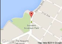
SOCRATES SCULPTURE PARK
Isamu Noguchi (1904–1988) was one of the twentieth century’s most important and critically acclaimed sculptors. Through a lifetime of artistic experimentation, he created sculptures, gardens, furniture and lighting designs, ceramics, architecture, and set designs. His work, at once subtle and bold, traditional and modern, set a new standard for the reintegration of the arts. Noguchi, an internationalist, traveled extensively throughout his life. (In his later years he maintained studios both in Japan and New York.)
He discovered the impact of large-scale public works in Mexico, earthy ceramics and tranquil gardens in Japan, subtle ink-brush techniques in China, and the purity of marble in Italy. He incorporated all of these impressions into his work, which utilized a wide range of materials, including stainless steel, marble, cast iron, balsa wood, bronze, sheet aluminum, basalt, granite, and water.
Born in Los Angeles, California, to an American mother and a Japanese father, Noguchi lived in Japan until the age of thirteen, when he moved to Indiana. While studying pre-medicine at Columbia University, he took evening sculpture classes on New York’s Lower East Side, mentoring with the sculptor Onorio Ruotolo. He soon left the university to become an academic sculptor. In 1926, Noguchi saw an exhibition in New York of the work of Constantin Brancusi that profoundly changed his artistic direction. With a John Simon Guggenheim Fellowship, Noguchi went to Paris, and in 1927 worked in Brancusi’s studio. Inspired by the older artist’s forms and philosophy, Noguchi turned to modernism and abstraction, infusing his highly finished pieces with a lyrical and emotional expressiveness, and with an aura of mystery.
Returning to New York City as well as traveling extensively in Asia, Mexico, and Europe in the late 1920s through the 1930s, Noguchi survived on portrait sculpture and design commissions, proposed landscape works and playgrounds, and intersected and engaged in collaborations with a wide range of luminaries. Noguchi’s work was not well-known in the United States until 1940, when he completed a large-scale sculpture symbolizing the freedom of the press, which was commissioned in 1938 for the Associated Press Building in Rockefeller Center, New York City. This was the first of what would eventually become numerous celebrated public works worldwide, ranging from playgrounds to plazas, gardens to fountains, all reflecting his belief in the social significance of sculpture.
The Japanese attack on Pearl Harbor and the backlash against Japanese Americans in the United States had a dramatic personal effect on Noguchi, motivating him to become a political activist. In 1942, he started Nisei Writers and Artists Mobilization for Democracy, a group dedicated to raising awareness of the patriotism of Japanese Americans; and voluntarily entered an internment camp in Arizona where he remained for seven months. Following his release, Noguchi set up a studio at 33 MacDougal Alley in Greenwich Village, New York City, where he returned to stone sculpture as well as prolific explorations of new materials and methods. His ideas and feelings are reflected in his works of that period, particularly the delicate slab sculptures included in the 1946 exhibition Fourteen Americans at The Museum of Modern Art, New York.
Noguchi did not belong to any particular movement, but collaborated with artists working in a range of disciplines and schools. He created stage sets as early as 1935 for Martha Graham, beginning a lifelong collaboration; as well as for Merce Cunningham, Erick Hawkins, and George Balanchine and composer John Cage. In the 1960s, Noguchi began working with stone carver Masatoshi Izumi on the island of Shikoku, Japan; a collaboration that would also continue for the rest of his life. From 1961 to 1966, he worked on a playground design with the architect Louis Kahn.
Whenever given the opportunity to venture into the mass-production of his designs, Noguchi seized it. In 1937, he designed a Bakelite intercom for the Zenith Radio Corporation, and in 1947, his glass-topped table was produced by Herman Miller. This design—along with others such as his designs for Akari light sculptures which were initially developed in 1951 using traditional Japanese materials—are still being produced today.
In 1985, Noguchi opened The Isamu Noguchi Garden Museum (now known as The Noguchi Museum), in Long Island City, New York. The Museum, established and designed by the artist, marked the culmination of his commitment to public spaces. Located in a 1920s industrial building across the street from where the artist had established a studio in 1960, it has a serene outdoor sculpture garden, and many galleries that display Noguchi’s work, along with photographs and models from his career. Noguchi’s first retrospective in the United States was in 1968, at the Whitney Museum of American Art in New York City. In 1986, he represented the United States at the Venice Biennale. Noguchi received the Edward MacDowell Medal for Outstanding Lifetime Contribution to the Arts in 1982; the Kyoto Prize in Arts in 1986; the National Medal of Arts in 1987; and the Order of the Sacred Treasure from the Japanese government in 1988. He died in New York City in 1988.
(c) RIHS
Garden design by Isamu Noguchi and Louis Kahn
Associated Press Building in Rockefeller Center
Lobby of 666 Fifth Avenue by Noguchi. Now threatened of being demolished.
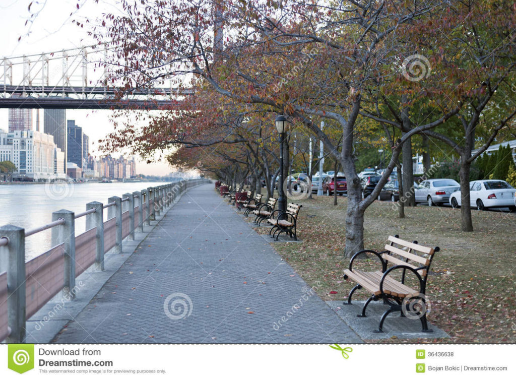
The story of this unique park demonstrates how a community can organize to reclaim and create a positive public space. Situated at the confluence of the Harlem and East Rivers, the site has a picturesque view of “Hell Gate,” or “Hellegat” as originally named by the Dutch colonists. Throughout the 17th and 18th centuries, this narrow strait between Astoria and Wards Island was infamous for treacherous navigational conditions caused by powerful tides and dangerous rock outcroppings. The 1780 shipwreck of the British ship Hussar and numerous other marine tragedies which occurred in this channel necessitated an 1876 effort by the Army Corps of Engineers to blast away much of the dangerous ledge.
Unfortunately, in the years preceding 1985, the long-abandoned Marine Terminal had become desecrated with illegal dumping and graffiti, its panoramic vista inaccessible to citizens of Astoria and Long Island City. In 1985 a coalition of artists led by local sculptor Mark di Suvero came here with a vision for an outdoor sculpture laboratory dedicated to up-and-coming artists. That year, they began the arduous process of restoring the site, and named it Socrates Sculpture Park – both in honor of Socrates (469-399 B.C.), the great Greek philosopher, and also as a tribute to the people of Astoria, New York’s largest Greek community.
By 1990, when Socrates Sculpture Inc. was formed to raise funds, oversee the arts programming, and manage the daily operations of the park, di Suvero and others had restored this beautiful park and begun to develop its international reputation as a cultural institution. Socrates Sculpture Park offers tours to school groups and tourists, internships and apprenticeships to high school and college students, and employment to a number of area residents. Since 1993, the park has been under the jurisdiction of Parks. With assistance from Mayor Giuliani, Borough President Claire Shulman, and Council Member Walter L. McCaffrey, Socrates Sculpture Park has made many improvements. The enhanced facility provides numerous amenities to the community and expands opportunities for arts and recreation.
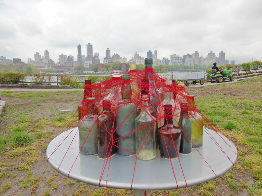
Socrates Sculpture Park has been unique since its inception: it serves multiple purposes, as a major arts destination, a catalyst for economic development in the neighborhood, and open space access to the waterfront. Begun as one person’s vision to transform a vacant lot, the park is home to a collaborative enterprise involving a diverse array of local residents, artists, and government agencies to create a valuable community resource as well as a vital cultural institution. Socrates Sculpture Park was officially assigned as Parkland on December 14, 1998.
NYC Parks (c)
Socrates Sculpture Park was founded in 1986 by visionary sculptor Mark di Suvero as a community engaged, accessible arts space dedicated to supporting artists in the production and presentation of public artworks.
Socrates is now a designated New York City public park and cultural anchor in Queens exhibiting topical contemporary public art that intimately engages our five-acre waterfront landscape and diverse audiences. The Park’s visual arts programming presents emerging, mid-career, and internationally renowned artists by offering an open platform for public art and encouraging unfettered ambition in scale and subject matter. Since the Park’s inception, the vast majority of artworks exhibited at the Park have been commissioned and built on-site in our outdoor artist studio space.
This gives our visitors the unique opportunity to witness the creative and often labor-intensive art-making process. The Park also remains open to the public during exhibition installation and de-installation. Socrates does not have a permanent collection and all artworks are temporarily on view. A searchable archive of every Socrates exhibition is available HERE and our archive of over 1,000 participating artists is available HERE. Additionally, you can browse our digital library of exhibition catalogs and publications HERE.
In recent years, the Park has presented four major visual arts initiatives annually: The Spring/Summer Exhibition; ‘The Socrates Annual’ fellowship & exhibition; The Folly/Function Design Competition in Partnership with The Architectural League of New York; & The Broadway Billboard Series. Admission to the Park and all of our exhibitions is always FREE.
Note: The park is open and the scheduling has changed due to circumstances.
MONDAY PHOTO OF THE DAY
WHAT AND WHERE WAS THIS? SEND YOUR ANSWER TO JBIRD134@AOL.COM WIN A TRINKET FROM THE RIHS VISITOR CENTER KIOSK
YESTERDAY’S MYSTERY PHOTO OF THE DAY
These are columns that held the beams supporting the floors in the City Hospital, that was located on this site at what is now the northern end of Southpoint Park..
EDITORIAL
Ever since I have been visiting the Noguchi Museum I have loved the garden with its water table fountain flowing down the sides of the stone. I remember when you could smell the ink of the graphics plant that was located in the red brick building facing Vernon Blvd. The garden is the site of a gas station.
It reminds me of the lost history of Vernon Blvd including the last blacksmith in Queens.
On a personal note today: For the last few weekends some friends and I have had wonderful afternoons at the Cornell Tech campus. We were at Cornell Tech campus where we saw parents not minding their children. There was one child picking flowers and three kids climbing the trees. This is not the behavior we expect as guests on the Cornell campus.
Text by Judith Berdy Thanks to Bobbie Slonevsky for her dedication to Blackwell’s Almanac Thanks to Deborah Dorff for maintaining our website Edited by Melanie Colter and Deborah Dorff All materials in this publication are copyrighted (c)
FUNDING BY ROOSEVELT ISLAND OPERATING CORPORATION PUBLIC PURPOSE FUNDING
DISCRETIONARY FUNDING BY COUNCIL MEMBER BEN KALLOS THRU NYC DYCD
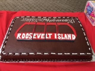
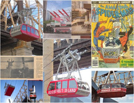
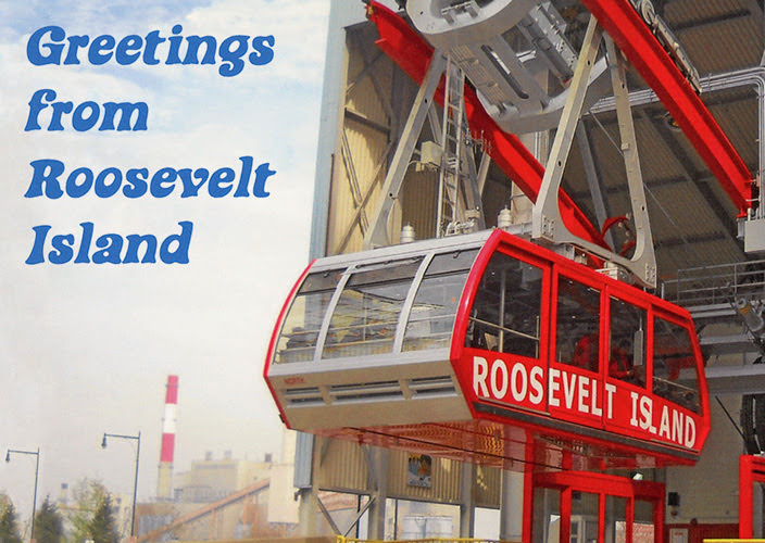
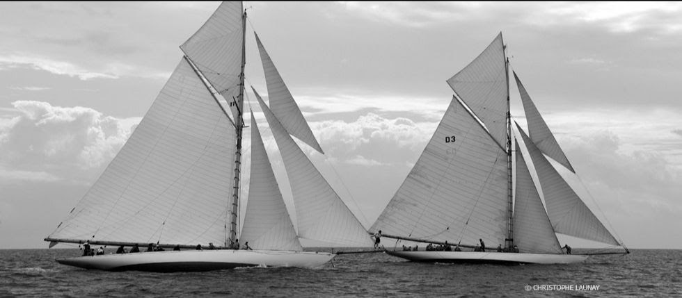
MAY 17, 1976 WAS THE OPENING DAY OF THE TRAM HAPPY 44TH BIRTHDAY!
Remember the long staircase?
At 6 a.m. on a Sunday twice a year the tram staff would gather for the mandatory evacuation drill. You could leave the cabin in a bucket thru a hatch in the floor. With a pulley and manual power everyone was lowered to the lawn.
The other way was more challenging was to hitch a rescue cage up on the cable and hoist it to the cabin. The window and window guards were removed and the passengers climbed into the cage. This was only used once in 2006 when the tram was stuck over the river for 11 hours. The second cabin was over First Avenue and the rescue was easier.
THE ORIGINAL TRAM FROM DOPPELMEYER, VON ROLL, SWITZERLAND 1976-2010
The rescue cage held only 4 persons.
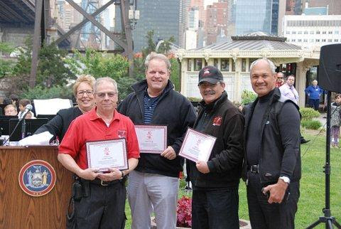
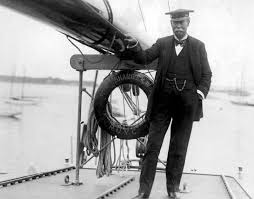
Greg started at the Tram a year before it opened!
Minnie who has handled the staff and finances for the Tram for decades. For year she had to account for tokens and the MTA daily and handled all special requests.
In 2009 RIOC decided to replace the 35 year old system with a new French one from Leitner Poma of Grenoble, France. The tram was closed for 9 months. At the same time the RIHS visitor center was being restored and we spent a hot summer watching these two construction projects. The kiosk and the tram both reopened on the same date November 30th.
The old cabins have been dumped and abandoned unceremoniously by the Motorgate.
Down with the old tram and up with the new tram in less than one year.
Like a giant jigsaw puzzle, all the pieces fit and come together
Armando Cordova has been the Tram Master for decades!!!
To celebrate the Tram’s anniversary the RIHS held a tram model contest. The submissions were on display in the Rivercross storefront
You are invited to come to see the cherry blossoms next year!!! All will be welcome. Save the dates April 20 to May 1!
At the same time the tram was being rebuilt, the Visitor Center Kiosk got a complete historical restoration.
MYSTERY PHOTO OF THE DAY
Can you identify this?| Send e-mail to jbird134@aol.com Winner will get gift from RIHS Visitor Center
Yesterday’s Photo of the Day OCTAGON VIEW FROM THE LOBBY TO THE DOME
EDITORIAL
So many fond memories came back while writing today’s tram and kiosk stories. It seems like only yesterday when a new cabin was installed bringing us better service and much less swinging in the breeze rides.
Most of the tram staff is still here, though on furlough due to the pandemic, Will be glad to have every back soon.
The Tram is Roosevelt Island. I took my first ride the evening it opened on May 17,1976. I lived a few blocks away and took the 35 cent ride to the island and back. It has been a love affair ever since.
Funding Provided by: Roosevelt Island Operating Corporation Public Purpose Funds Council Member Ben Kallos City Council Discretionary Funds thru DYCD Text by Judith Berdy Thanks to Bobbie Slonevsky for her dedication to Blackwell’s Almanac and the RIHS Thanks to Deborah Dorff for maintaining our website Edited by Melanie Colter and Deborah Dorff
Astoria Park Rainey Park Queensbridge Park Gantry Plaza State Park Hunters Point South Park
An example of Fredrick W. Beers’ map of the Long Island City, published in 1873
As NYC Parks and Recreation notes, the site of Astoria Park was once home to wealthy, “fashionable families” like the Barclays, Potters, Woolseys, and Hoyts, who established their country houses along the shore. For instance, the Barclay family, whose roots can be traced back to traders along the Baltic and Scandinavian coast, owned a mansion near Hell Gate, which was later torn down to make room for the construction of the bridge. NYC PARKS (C)
Image courtesy NYC Parks and Recreation Astoria Park is equipped with one of the most popular swimming facilities in the country, which also happens to be the largest swimming pool in New York City park’s pools. Planned by Parks Commissioner Robert Moses, the outdoor pool is 54,450-square-feet and measures 330 feet in length. Harry Hopkins, the administrator of the Works Progress Administration (WPA), which provided the labor to construct the pool, described it as “The finest in the world.” According to NYC Parks, it has been said that it was intended to be the “grandest” of the eleven pools Moses intended to install throughout the city in the summer of 1936 — possibly because it provided the best view of the Triborough Bridge, which was completed in the same year. NYC PARKS (C)
RAINEY PARK
Thomas Rainey (1824-1910), a resident of Ravenswood, Queens, spent 25 years of his life and most of his fortune advancing the construction of a bridge across the East River between Manhattan and Long Island City. The area that now accommodates Rainey Park was to be the Queens anchor for the “Blackwell Island Bridge,” a project backed by leading citizens of Long Island City after the American Civil War. In 1871, they incorporated the “New York and Queens County Bridge Company.” The bridge, planned with one ramp south to Brooklyn and another out to Long Island, was promoted as a catalyst for developing growth in Queens and as a railroad link to Long Island. To the community’s disadvantage, the effort fell apart during the financial Panic of 1873.
NYC PARKS (C)
QUEENSBRIDGE PARK
This park is named for the nearby Queensboro Bridge, which is also known as the Ed Koch Queensboro Bridge or 59th Street Bridge. The 1960s band Simon and Garfunkel made the bridge famous in their song “Feelin’ Groovy,” also called “The 59th Street Bridge Song.”
Dr. Thomas Rainey (1824-1910), a resident of Ravenswood, Queens, spent twenty-five years of his life and most of his fortune promoting the construction of a bridge across the East River connecting Manhattan and Long Island City. The area now occupied by Rainey Park (just to the north) was to be the Queens anchor for this structure, which was to be called Blackwell Island Bridge. The bridge, planned with one ramp south to Brooklyn and another out to Long Island, was promoted as a catalyst for developing growth in Queens and as a railroad link to Long Island. However, the effort fell apart during the financial Panic of 1873; most interest in the region was for another bridge between Brooklyn and Manhattan, and the sparse population in Queens at the time raised further concerns of need and profitability.
On July 19, 1901, construction on the Queensboro Bridge officially began, but it was years before any notable progress was made. Renowned bridge engineer and City Bridge Commissioner Gustav Lindenthal (1850-1935) collaborated with architects Leffert L. Buck (1837-1909) and other designers and builders of the Williamsburg Bridge, to create the Queensboro Bridge. Significant construction did not get underway until 1906, after several delays, including a lengthy steel strike. The final link in the superstructure of the Queensboro Bridge was completed in March 1908. One year later, the bridge opened to traffic, at the cost of $20 million.
The original 1909 configuration of the bridge accommodated six lanes for motor vehicles, four pairs of trolley tracks, two elevated subway lines, and lanes for pedestrians and bicyclists. By the 1930s, this connection with Manhattan transformed Queens from a rural outpost into a borough with over two million by the 1950s. In 1957, the last trolley trains crossed the Queensboro Bridge, and the bridge was reconfigured to allow for ten lanes of vehicular traffic.
The City of New York acquired the land that is now Queensbridge Park in two sections in 1939. The nearby Queensbridge Houses gave jurisdiction of the land to the New York City Housing Authority, but it was understood that NYC Parks would maintain it. In 1975, some of the property was transformed into parking lots under the supervision of the Bureau of Property Management. The park is characterized by a variety of facilities, including baseball fields, a soccer-football combination field, basketball, volleyball and handball courts, a playground with see-saws, swings and jungle gyms, a comfort station, picnic areas, sitting areas, walkways, greenery, and trees.
In 2014, the seawall was reconstructed using rip-rap, or large rocks, which protect the shoreline by absorbing and deflecting waves while lessening the effects of erosion. The project also created a 6-foot wide waterfront promenade with benches, plantings, and a small wharf at its northern end. The promenade was named after long-time park advocate Elizabeth McQueen. NYC Parks announced in 2018 that the park’s old field house, which was built in 1941, will be demolished in order to build a new 1,500 square foot field house and comfort station. The new LEED-certified field house will include a community room, an office area for Parks staff, a public restroom, and storage space for the park’s maintenance equipment. It will be surrounded by an outdoor plaza area complete with seating, bicycle racks, and drinking fountains.
NYC PARKS (C)
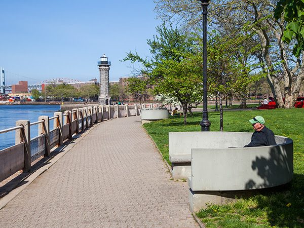
GANTRY PLAZA STATE PARK
Gantry Plaza State Park is a 12-acre riverside oasis that boasts spectacular views of the midtown Manhattan skyline, including the Empire State Building and the United Nations. Enjoy a relaxing stroll along the park’s four piers or through the park’s manicured gardens and unique mist fountain. Along the way take a moment to admire the rugged beauty of the park’s centerpieces – restored gantries. These industrial monuments were once used to load and unload rail car floats and barges; today they are striking reminders of our waterfront’s past. With the city skyline as a backdrop and the gantries as a stage, the park’s plaza is a wonderful place to enjoy a spring or summer concert. Recreational facilities include basketball courts, playgrounds, handball courts, and a fishing pier with its own cleaning table. NYSPARKS (C)
HUNTERS POINT SOUTH PARK
This waterfront park was until recently an abandoned post-industrial area in Long Island City. Transformed into a space that offers fun and relaxation for everyone in the area, the new park includes a central green, playgrounds, adult fitness equipment adog run, a bikeway, a waterside promenade, picnic terraces a basketball court, a 30-foot-tall cantilevered platform for viewing the skyline and waterfront, and a 13,000 square foot pavilion that contains comfort stations, concessions, and an elevated cafe plaza. NYC PARKS (C)
IMAGE OF THE DAY
CAN YOU IDENTIFY THIS AND LOCATION? SEND TO JBIRD134@AOL.COM WINNER GETS AN ITEM FROM RIHS VISITOR CENTER KIOSK RIHS (C)
Thursday Mystery Photo No one identified the terra cotta panel on the side of the RIHS Visitor Center Kiosk.
EDITORIAL
The other day Bobbie Slonevsky and I were discussing the water fowl who nest and live around the island. She has written a great reference guide to our waterborne neighbors. We look at five parks in Queens that have blossomed in the last decade. Astoria Park, by the Triboro Bridge offers the largest municipal pool in the City. In the summer and especially around July 4th, there are free concerts and events in the park.
Just across from Octagon is Rainey Park. It is on a hillside overlooking the East River and has lovely blooms in the spring. It is just south of Costco.
Queensbridge Park has had many improvements in the last few years and now sports a new seawall and facilities building. Probably one of the most popular places for movie and television shoots.
Gantry Plaza State Park (designed by Weintraub and Di Domenico who designed Octagon Park) salutes the gantries where train cars were loaded onto barges to Manhattan, before train tunnels were completed. This is a NYS park that was the first park to be developed on the Brooklyn Queens waterfront.
The spectacular NYC Parks Department Hunters Point South Park runs south of Gantry Plaza to the Newtown Creek. Opened a few years ago, it is multi-leveled and a naturally occurring distancing spaced promenades.
You can easily walk from one park to another, though you have to venture onto Vernon Blvd at times. As you walk, you can look out on that long skinny island in the East River.
Roosevelt Island, a two-mile sliver of land in the East River nestled between the Upper East Side and Astoria, is home to a population of 12,000 on 147 acres of land. But the island’s small size belies its importance to the history of the city. In its different lives — the land was known as Welfare Island from 1921–1973, and Blackwell’s Island, Hog Island, and Minnehanonck before that — the island has been an influential site of innovations in architecture, medicine, infrastructure, and social service delivery. One such notable institution is the Goldwater Memorial Hospital, known as The Welfare Hospital for Chronic Disease when it first opened in 1939 (its sister hospital, the Bird S. Coler Hospital, opened on the north end of the island in 1952). The immense facility was designed to be a new model of medical care for those with chronic illness. The architect, Isadore Rosenfield, was as concerned with the careful design of a patient’s bedside lamp as he was with the circulation patterns of the thousands of people who would use the facility each day. Rosenfield wrote of the project for Modern Hospital in 1937 that his design was “the first tangible result of agitation, research and educational work over a period of years by…the committee on chronic illness of the Welfare Council in New York City,” and was best understood through an explanation of “the principles in accordance with which it was developed.”
Goldwater closed its doors on December 31, 2013, transferring its patients to other facilities around the city. Today, the buildings are in the midst of being torn down to make way for what the City hopes will be the next chapter in Roosevelt Island’s legacy of innovation: the forthcoming campus of Cornell NYC Tech. A two-million-square-foot applied sciences and engineering campus is planned for 12 acres on the southern half of the island, as part of an initiative launched by Mayor Bloomberg to make New York City a “global leader in technological innovation.”
Photographer and architect Charles Giraudet has been furiously documenting Goldwater Hospital in its last days, compiling an extraordinary 15,000 images so far during the brief window between its de-commissioning and its imminent demolition. Below, Giraudet shares a selection of his photographs (click on any of the photographs below to launch a slideshow with more images) and describes how this archival project has expanded to become, in his own words, “a study of the architect’s intention, of the life and activities in the building, and of light.”
The first stone of Welfare Hospital, subsequently renamed Coler-Goldwater, was laid on Roosevelt Island in 1937. Fiorello La Guardia was then mayor of New York and Dr. Sigismund Schultz Goldwater was Commissioner of the Department of Hospitals. Together they planned the development of Roosevelt Island as a haven for medical care and research with the creation of several major pieces of infrastructure, the flagship of which would be Welfare Hospital, dedicated to chronic diseases.
Dr. Goldwater hired a young architect to head the design team. Having emigrated from Russia as a young child and worked as a butcher’s assistant before he went to Harvard to get a degree in architecture, Isadore Rosenfield was to become the Chief Architect of the Department of Public Works. After the war, he would be in charge of New York City’s $100 million hospital program. He wrote several books and articles about hospital design. In a 1937 piece titled “The Fruit of Research“,[1] he describes the scientific process that informed the design decisions at Welfare Hospital. All major programming decisions — from the number of beds to the general layout of the buildings, the angled wings of the wards and the relative heights — were related to an unwavering patient-centric design approach. Going further, the bed itself, with its lighting and relationship to the other beds in the ward, were designed from the ground up to serve two purposes, seen as one: the well-being of the patient and the ability for the doctor to care for him or her.
Roosevelt Island provided Rosenfield with a perfect site. The old penitentiary at the south of the 59th Street Bridge would be demolished so the hospital could take its place. In this low-density setting, patients would benefit from the sun and air necessary to their recovery, while remaining close to their families, an aspect of care that Rosenfield deemed essential.
Away from the constraints of an urban setting, the hospital’s master plan could also yield to its program and develop organically. Four chevron-shaped ward buildings running east-west, connected by a three-story gallery running the length of the site; between the wards’ buildings, two pavilion buildings to receive the families; at the north end, a smaller building housing research laboratories; finally, a central building for admissions, administration, surgery, dorms for visiting doctors and nurses, therapies, and food preparation. All support and technical services were placed in the basement of the various buildings, and a tunnel — running the length of the island — would bring hot water and steam to the facility from a centralized plant that still functions today. Encompassing the width of the island edge to edge, the hospital resembles the superstructure of a ship, the bedrock of Roosevelt Island its hull.
I discovered Goldwater by accident a couple of decades ago, as a young architect from France interested in the nooks and crannies of New York. I was immediately drawn to its angled wings and running balconies reminiscent of the ocean liner architecture of early modernists. There aren’t so many buildings of that era in the country. I grew up near Paris, in a town where, in the 1930s, architects Lods and Beaudoin, associated with Jean Prouvé, built the Ecole du Plein-Air where kids with tuberculosis or other respiratory ailments could be schooled, and I was familiar with Alvar Aalto’s Paimio sanatorium. Goldwater seemed to echo these buildings. They spoke of an age where architecture could ambitiously address social needs for the public good.
Before penicillin, sunlight was part of the cure as much as any medication, so an almost obsessive attention was paid by Rosenfield to the path of light through his buildings. The buildings were placed so that they wouldn’t cast shadows on one another. The chevron shape yielded more hours of exposure and views of the river. Wards were designed to encourage the use of the outdoor space with every bedroom opening onto a wide balcony or terrace. Even the roofs of the main gallery were meant to be used as circulation and terraces by the patients during the sunny months. In fact, almost every single space in the facility receives natural daylight. Corridors set deep in the building are lined by glass partitions or doors with transoms. The dumbwaiter lobby in the laboratory building gets its light from a window set high above the sink of a bathroom that has its own six-foot-high window to the outside. There are countless examples and variations.
I entered the building during a very special and short phase of its life, between the day when patients and staff had been relocated and rooms had been emptied out of all things not attached to the walls or ceilings and the day the demolition crews would start to tear it down. For the first two weeks, I walked alone in the deserted hallways and basements with my cameras, pushing open doors to rooms that would invariably surprise me. The photo project evolved from a documentation of the “significant spaces” to an encyclopedic project, now totaling 15,000 images. This was due in part to the evolving time parameters of the project and in part to the impossibility of finding any space insignificant in a building so carefully tailored to its use. Ultimately, my photographs became a study of the architect’s intention, of the life and activities in the building, and of light.
Every time period has its light. It is the blank page onto which architect and designers write their projects. Yet, because we view it as part of nature, we have developed little vocabulary to discuss it. Its intensity, temperature, its use in architecture are measured or discussed, but we should consider it a part of culture that is reflected in all its aspects. When it comes to architecture, light is the very substance of space, a cultural trait par excellence. Anyone who walks around or lives in a building of a different era has the experience of a difference in the light’s quality. Movie directors use this to move us through time and space, as it speaks to us through our bodies before our consciousness can awaken to the trick. In a marvelous little book called In Praise of Shadows, Jun’ichiro Tanizaki talks about the influence of western aesthetics on a Japanese man. The western taste for light, brightness, clarity, brilliance, total transparency, and sheen is compared with the soothing, soul-feeding qualities of the deep shade, the murkiness of texture, the patina of time.
What Tanizaki describes is the tactility of light, what our bodies are able to register of the texture of a surface without touching it, how a surface changes depending on how it’s lit — hard to soft, superficial to deep, slick to rutted — how our bodies would feel if immersed in that surface, and how that surface is merely a threshold to the surrounding space. Through our senses, light and touch are connected and always entertain a relationship, of affinity or dissonance, whether or not we’re aware of it. We touch what we see before we touch it and it may even be that some of us can’t see what we can’t touch[2]. In the darkness one can better feel the density of space, often experienced as claustrophobia in our day and age where luminosity is brought everywhere. We have lost the ability to move in darkness comfortably like we have lost the taste for feeding from silence.
Moving through the deserted hospital, enveloped in darkness, or basking in the sunlight drenching the day rooms in the evenings, I came to realize that a different sensibility and aesthetics from ours had informed the design, coming from a time of less disregard for the body’s comfort and functions. Goldwater is superbly built and entirely lined with green and honey-glazed bricks that deepen in tone with incandescent lighting. Its 2700 windows are made of bronze and work like they did on day one even after years of being screwed shut. Until renovations introduced a measure of vinyl and plastic, your hand would touch only wooden handrails and doors, brass knobs, marble windowsills. We have so distanced ourselves from the aesthetics of the ‘30s and the values that informed them that we often associate natural materials and their aging with grime. The gentleness with which light touches these surfaces and the sensation that remains can be so unsettling to the modern hand — the hand that expects the antiseptic and inorganic qualities of whiteness — that it’s easy to forget that the facility merely required a good cleaning on the outside, an operation that fell low on the priority list due to a chronic lack of funding for maintenance (the building is spotless inside).
Goldwater first served as a chronic diseases research facility. During World War II conscientious objectors volunteered to be used as guinea pigs for secret experiments on malaria and extreme cold. Tylenol was partially developed there. Eventually, the south side became a nursing home while the north side evolved into a respiratory care, hospital and rehab facility. In 1970 a new building opened at the south end, designed by William Lescaze, housing chapels for four religions, a library, a radio station, a gym, and a large sports arena and auditorium with a full sound and light stage. Research was abandoned and the laboratory building was used for nurses’ training and administration. Meals were no longer prepared from fresh ingredients and the operating rooms became doctors’ offices. Over the years, the facility had to adapt to changing safety requirements that condemned the balconies and limited the window openings to six inches,
along with other, often nonsensical, alterations. The forest was lost for the trees. These mandated changes forced hundreds of air conditioners onto the facades like so many pimples, closed access to the galleries’ roofs, choked the circulation. Parking lots replaced the landscaping on the east side. But because Goldwater was home to people living and working there around the clock who cared for it, it remained a vibrant place and retained its humanity and dignity even when it was stripped of its purpose and its occupants. There is much to be learned from the study of Goldwater. A number of its qualities are precisely what we are trying to re-instill in many contemporary buildings, including in our tech-centric – as opposed to patient-centric — hospitals where almost anyone will become dazed and confused after a short stay. Air, sunlight, natural materials, attention to circadian rhythms, access to the outdoors, generous space that adapts to a body’s movement rather than requiring that adaptation from the user can’t be considered replaceable by technological prosthetics without consequences for the people and activities for which the building is designed in the first place. Architecture should be about sheltering human activities, not processing them.
There is also something to be learned about the relationship between urban design and architecture: Rosenfield thought he was building a facility, but Goldwater was a de facto small city. At the core of his design were urban principles setting relationships between the buildings themselves and the site, expressing the relationship between the new community and New York as a whole. The hospital was part of a much larger project to build not just the infrastructure of New York, but also its community. The urban realm manifests a culture’s identity and values; it reflects its soul. Only too often nowadays does architecture try to manage what urbanism should, resulting in hyper-expressive buildings reflecting the fascination with the formal exploration unleashed by new CAD tools rather than an interest for the satisfaction of social needs. But Goldwater is also a lesson in what we can expect of an enlightened city administration whose vision is focused on the welfare of its constituents, and of architecture when it seeks modestly but ambitiously to embody these values. As the hospital enters its final hours, we can ponder the loss of yet another public health facility at a time of intense privatization of the sector and decreasing access to quality healthcare and eldercare for so many. We can use the example of Goldwater to reflect on the way healthcare is currently being delivered to New Yorkers and what has been lost since 1938, when Rosenfield conceived of the architectural experience as a path to well-being for all New Yorkers.
The author would like to acknowledge Judy Berdy, President of the Roosevelt Island Historical Society, who provided most of the historical background used in this article and generously shared her deep knowledge of Goldwater, its history and the people who lived and worked there; Andrew Mongiardo, Goldwater’s former Facility Director, who spent 37 years maintaining the building and came time and again to the hospital after work hours to graciously answer all my questions; and Andrew Winters, Director of Capital Projects and Planning for Cornell Tech, for granting me access to Goldwater.
[1]Isadore Rosenfield, The Fruit of Research [Welfare Hospital on Welfare Island, New York City], Modern Hospital, 1937 Mar., v. 48, p. 58-64.
[2]Oliver Sacks, To See and Not See in An Anthropologist on Mars (Alfred A. Knopf, 1995)..
To learn about Charles GIraudet’s other projects see charlesgiraudet.com. Please contact him if you have recollections of Goldwater.
IMAGE OF THE DAY
CAN YOU IDENTIFY THIS AND ITS LOCATION? E-MAIL YOU ANSWER TO JBIRD134@AOL.COM WIN A BOOK FROM THE RIHS VISITOR KIOSK
YESTERDAY’S PHOTO IS THE TOP OF THE SMALLPOX WITH A VIEW WEST TO THE RIVER
Text by Judith Berdy Thanks to Bobbie Slonevsky for her dedication to Blackwell’s Almanac and the RIHS Thanks to Deborah Dorff for maintaining our website Edited by Melanie Colter and Dottie Jeffries
Thanks to artist Ron Crawford for our 50th Edition Art (c)
WEDNESDAY
MAY 13, 2020
RIHS’s 50th Issue of
In honor or our 50th issue we have asked the members of our Board to contribute their thoughts to this issue.
We have a great Board of Directors at the RIHS. We asked them to contribute to this issue..
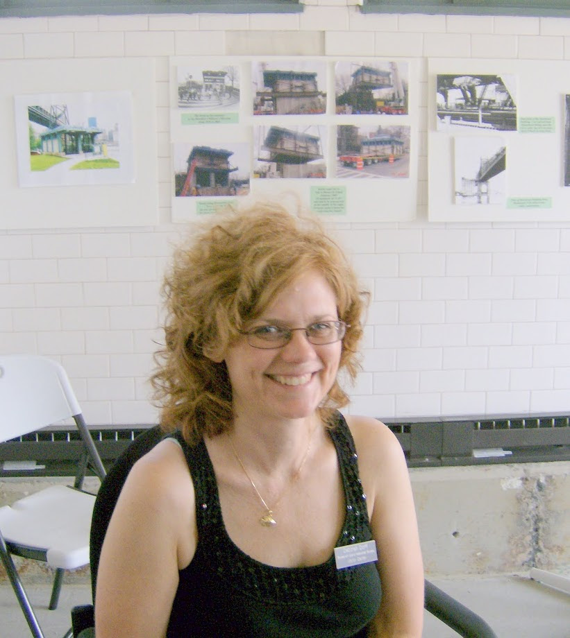
Arlene Bessenoff a long time member is the person who has been our secretary and grant writer extraordinaire.
Stephen Blank is a retired professor and with his late wife Lenore love the island and our history.As you can tell Stephen is a great movie fan.
Melanie Colter came to us as a Historic Preservation intern from Cornell (in Ithaca) and she has stayed on to write for us and give preservation perspectives into our projects.
Tanya Morrisett is here with her husband and family from Ithaca. Tanya has become an instant active member in our island and Cornell Tech community,
Thom Heyer has used his artistic talents on many projects on the island and is always ready to volunteer for a new project.
Matt Altwicker is an architect and we met when he developed an Affordable Housing exhibit at NYIT School of Architecture. When not scouting hidden sites on the island he practices at his studio in the Brooklyn Navy Yard.
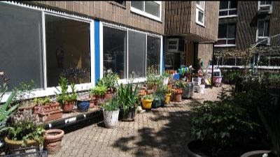
Lisa Fernandez is the Director of the Carter Burden Senior Center here. When not running a very busy center, she is in the garden outside the center tending to the flowers and plants.
Lynne Shinozaki is the master caterer and coordinator of our Mae West fund raiser, we cannot wait to see what she is up to next.
Judy Connorton uses her organizational skills to help us research and gather information for our programs
Pat Schwartzberg, though not a Board Member, she keeps us on track financially.
Deborah Dorff arrived on the island the day the tram got stuck for many hours. She was not on the tram so she and her husband stayed for years. Now in Austin, Texas Deborah gets our website and all of these articles on line every day, and she is still talking to me!
ARLENE BESSENOFF
PANDEMIC WALK COLLAGE
Stephen Blank
Confined to home these days, our thoughts turn to films. And what could be more fascinating than movies about our Island? So I dug into my archives and found several pieces on Roosevelt Island in the Movies that were published in the Almanac a while ago. So, here from the Blank archives.
A lot of filming has taken place on Roosevelt Island. But few of the films shot here were actually about our island. The one film that is really about the island wasn’t filmed here. “Blackwell’s Island,” released by Warner Brothers in 1939, was filmed at their Burbank Studios. Aside from a few stock clips early in the production, no sign of any local work shows up. Indeed, the last scenes – a boat chase on the river – are shot against a totally wrong background. But the film, a quick (71 minute) B movie and a vehicle for a young John Garfield is well worth the time. It’s based roughly on the real-life raid by the New York police on the corrupt Blackwell’s Island penitentiary. The 1934 raid took the City’s notorious penitentiary back from mob bosses who had ruled the roost, exploiting their fellow prisoners with the tacit permission or active cooperation of its warden and deputy warden. The movie focuses on a crusading reporter, Garfield, who contrives to get himself convicted by slugging a D.A. He’s sent to the island and witnesses firsthand the corruption of one Bull Bransom, a protection racketeer who rules the New York City waterfront. Bransom is “taking a leave” on the island and soon sees the possibility of using his organizational skills there.
The film includes corrupt old cops and an honest young one – whose sister Garfield falls for – and the bang-up mid-night assault on the island. Blackwell’s Island was known mainly for its prison, and while the island wasn’t mentioned by name, everyone knew what was going on.
“No Man of Her Own” is a 1932 romantic comedy starring Clark Gable and Carol Lombard. Lombard had been in films longer than the slightly older Gable and she was better known, but neither had hit the big time yet. The plot is straight forward enough. Gable plays “Babe” Stewart, a card shark who hides out to avoid the cops. He meets a lonely but slightly wild librarian named Connie Randall. There follows a certain amount of pre-code, much enjoyable grappling. They marry on the flip of a coin and the grappling, now legit, continues. Problem: how does Babe keep new bride Connie from learning that he is still in the racket? He can’t. Connie discovers Babe hasn’t reformed and demands that he lay off the cards. Gable says he can’t, and tells Lombard he’s taking off for South America. But love makes men do strange things. In fact, Babe has turned himself in and copped a plea. He agrees to spend 90 days “across the river.” This is New York City and “across the river” is nothing other than our own island jail (as opposed to “up the river” which means Sing Sing).
What’s cool is that Lombard is wise to the action and gazes out of her hotel window at Blackwell’s Island Penitentiary. Granted, there’s never been a hotel with that view, but it’s still cool. This excellent Paramount film was directed by Wesley Ruggles and it launched him into several fairly well regarded comedies, including Mae West’s 1933 “I’m No Angel.” (Another Blackwell link: In 1927, Mae West served eight days in our prison on an obscenity charge for her play Sex.)
In two really important (my view) films, Roosevelt Island plays no leading role, but is the background for important action. Critics see “My Man Godfrey” as the definitive “screwball comedy.” In this 1936 film, a depression-downed “forgotten man,” William Powell, tangles with (his real-life ex-wife) Carol Lombard and a grand supporting cast in a story with very strong class overtones. Bill Powell is not a “bum,” but educated, sophisticated and down on his heels. Lombard’s wealthy family is— a typical plot line in these films—rich, crass and dumb. Lombard drags Powell in as a butler, but he has entrepreneurial ideas of his own. This is great fun and really good cinema: “My Man Godfrey” got Oscar nominations for writing, directing and all four acting awards (though not for Best Picture). Blackwell’s Island? Well, it’s there even if you don’t see it. In the opening credits, the background is the Queensboro Bridge and Blackwell’s Island. Why? Because the story line develops around Powell’s plan to open a night club on the shore of the East River, basically where Sutton Place is now.
The background to all of the scenes that deal with his plan is Blackwell’s Island. The film was shot in Universal Studios in California, so none of this is live. The scenes are filmed against a rear projection of the island. Look carefully and you will see that, in one scene, there’s a slip-up and the image is reversed, so that the old elevator (“upside-down”) building is suddenly on the south side of the bridge. Never named. But we know what we’re seeing.
And even more, of course, the romantic scene in Woody Allen’s “Manhattan” (1979) when he and Diane Keaton sit on a bench in Sutton Place, looking at a softly focused Queensboro Bridge. The moment is framed by the background music of Gershwin’s “Someone to Watch Over Me”. We Islanders knew the film was an ode to New York City, but knew, too, our island was never so dreamy. The Queensboro Bridge itself played a major role several times on the big screen.
When the tram was held hostage in “Nighthawks” (1981) with Sylvester Stallone, we worried that this might give some idiot an idea. We were tickled when we saw that Billy Crystal’s character Mitch Robbins in “City Slickers” (1991) lived on the island and commuted to work on the tram like the rest of us. And who could forget when, in the 2002 “Spider-Man,” the Green Goblin threw Mary Jane Watson from the bridge, and Spider-Man had to decide between saving her or passengers on the Roosevelt Island tram. Always a good night at the Roosevelt Island flicks.
Stephen Blank May 11, 2020
MELANIE COLTER
Researching the Chapel of the Holy Spirit which has become a destination event space called The Sanctuary. I always wish I had more time to do RIHS work.
TANYA MORRISETT
Roosevelt Island from a newcomers perspective
Tanya Morrisett
Almost every single day, people ask me the following question, “So, I bet you’re upset that you moved to New York City from Ithaca last summer with all this virus business?” Almost every single day, I shake my head and give the same, short answer. “No.” Yes, I’m now living in the heart of the pandemic – one that has forever changed our world.
Sadly, it has claimed the lives of tens of thousands of New Yorkers. It would be safer to be living in Ithaca. And like so many, I spend almost all my time in a small apartment trying to find some type of normalcy. But, I would move here again if given the choice. I adore this city and I love Roosevelt Island. I’m not happy until I see the sunrise over LaGuardia in the morning and look down on the powerful steel bridge with its never-ending stream of cars going between Manhattan and Queens.
I love to watch the tram glide over the water carrying people back and forth across the East River. The ruins of the Smallpox Hospital are enchanting and the Chapel is peaceful. Most of all, I love the people. New Yorkers are incredibly friendly and the people who live on Roosevelt Island are even more lovely. It is a wonderful community of people. So, tomorrow, when I’m asked again, I’m going to give the same, short answer, “No,” and I’m going to smile. This beautiful, little island has welcomed me. I’m going to ride out this pandemic here in my new city on my little island. We’ll all get through this together.
THOM HEYER
I started an artistic endeavor on the subject of the singer Alberta Hunter & the entertainer Mae West a year ago. It was for FIGMENT when that Arts celebration came to the island last June. Both women were contemporaries in the entertainment industry & both had ties to Roosevelt Island, but never met. My premise was what if they HAD met. What might that moment have been like? Because of the current COVID-19 shut-down, FIGMENT is one of the many events that have had to be cancelled. Though I’m still working on the Alberta/Mae Project, I am happy to share this unfinished set of portraits–each is 8.5″ X 11″.
Thom’s version of Edward Hopper’s NIGHTHAWKS
MATT ALTWICKER
Secret Places
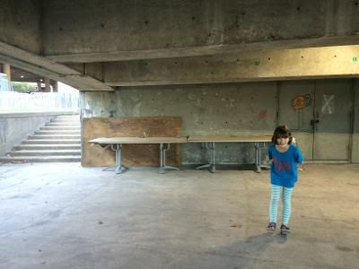
I have learned a lot about the Island in the last 49 days of Judy’s daily reports. We moved here in 2006 and my daughter Zechine was born here in 2008. Like all kids and parents, we think we have probably covered every inch of the island in that time.
Over the almost 12 years since Zechine’s birth there have been two places that we have always called our secret places. They have been called that because we have never seen anyone else there. I was reminded of the space and stairs under the Helix reading about the recent death of the architect of Motorgate and the adjacent helix, Michael McKinnell. It is a strange place where RIOC and DOT store various items as they wish, but where they always seem to leave a walking path free for us to leave the Promenade and go up to the intersection without meeting anyone, along the way finding all the mundane items of the everyday island – the lampposts, the Z bricks, the barriers, etc. In this photo an impromptu desk was set up. (Under the Helix, 2016)
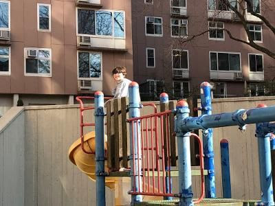
The discussion of the Island’s landscape architects reminded me of the Island House playground. It is a playground design from another era, although it is itself not an original. Maybe it is the rusty metal, the fading paint, or the non-compliance with current playground safety, but over all the years, we have never encountered another child on the playground.
That has made it all the more attractive to visit in the late afternoon sun coming from the west. (Empty Playground, 2020) It is hard to believe that in places so public and so central to the island, one can find this kind of solitude, but maybe this is one of those mysterious qualities of the Island that one cannot fully grasp but one can simply enjoy.
LISA FERNANDEZ
LYNNE SHINOZAKI
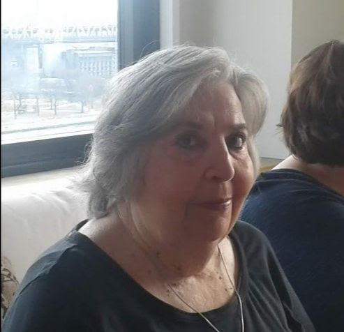
JUDY CONNORTON PAT SCHWARTZBERG DEBORAH DORFF
Deborah our wonderful staff member
EDITORIAL
Neighbors, friends and strangers have been asking me why I have been publishing FROM THE ARCHIVE. Why not? I have little else to do and I will do anything not to do filing. Our kiosk is closed, the staff cannot work, there are no visitors. I can go to our office in the Octagon, but there are no persons on our floor and what fun is it to sit alone all day looking out at unused sports equipment. I could unload 30 boxes of RIHS records stored in the Octagon, but there is no one to assist.
I could complain, kvetch, decry the government, though I do express opinions to certain politicians. At this time of year I train election workers, work the primary election and early voting. This year I taught 3 classes and then all was canceled.
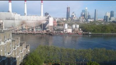
I have mastered the art of watching oil deliveries to the power plant. The tugs gently nudge the barges parallel to the pier where they will stay about 2 weeks, getting lighter every day. They will be replaced and the cycle start again. Queensbridge Park has a lovely new promenade and seawall. It is hardly used, even on lovely spring days. At night the 4 baseball diamonds are lit, though empty. See views from my window below.
The construction at Queens Plaza has stopped midstream. The 70+ story building sits there with orange construction tape on what will be the next 20 floors to be closed in. Citicorp, the monument and first building is now half obscured from my window. The cars speed over the Queensboro Bridge, no traffic jams now. Silvercup shines red every night.
I continue my work at Coler Community Advisory Board and Coler Auxiliary. We will be raising funds for our nursing home residents as soon as we can be allowed into the building again. The support of Coler has been excellent and we will continue with your assistance.
Judith Berdy212 688 4836
PHOTO OF THE DAY
IDENTIFY AND LOCATE THE PHOTO OF THE DAY E-MAIL YOUR SUBMISSION TO JBIRD134@AOL.COM FIRST CORRECT ANSWER GETS A BOOK FROM RIHS VISITOR KIOSK,
Regina Avner is the winner of yesterday’s photo contest. It is the old Breyer’s Ice Cream Plant on Queens Blvd. The logo leaf design sign is still on the roof.
Text by Judith Berdy Thanks to Bobbie Slonevsky for her dedication to Blackwell’s Almanac and the RIHS Thanks to Deborah Dorff for maintaining our website Edited by Melanie Colter and Dottie Jeffries
Included in this Issue: MANHATTAN’S OTHER ISLAND A PROGRESS REPORT SUMMER 1974
(c) RIHS
This brochure was published in 1974 to promote the new community on Roosevelt Island. What do you recognize?
EDITORIAL
I received an e-mail this morning and was asked if we had any pictures of the island under construction. This brochure shows the apartment houses about 75% complete.
Speaking of complete, the safety shed outside 480 Main Street is coming down since 460 Main Street is almost complete. The lottery is open for the the “affordable” apartments in the new building.
WHAT WAS THE ORIGINAL PURPOSE OF THIS BUILDING? E-MAIL JBIRD134@AOL.COM First correct reply gets a book from the Visitor Center
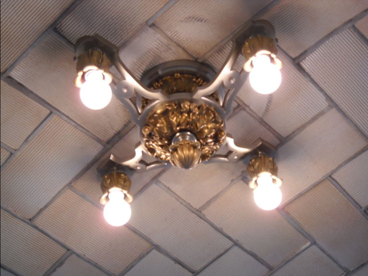
Monday’s photos is from the ceiling of the RIHS visitor center kiosk. Same light fixture as in Grand Central Terminal.
Text by Judith Berdy Thanks to Bobbie Slonevsky for her dedication to Blackwell’s Almanac and the RIHS Thanks to Deborah Dorff for maintaining our website Edited by Melanie Colter and Dottie Jeffries
DAN KILEY NICOLAS QUINNELL/QUINNELL ROTHSCHILD ZION BREEN
(c) RIHS
Called Blackwell Island beginning in the 18th century, this 147-acre, two-mile-long island in the East River was sold to the City of New York in 1828. It became home for the city’s poor, housed within quarantined hospitals, alms houses, a lunatic asylum and a penitentiary, warranting the name Welfare Island in 1921. By 1961 the island was desolate, and Victor Gruen proposed an urban renewal scheme to transform the neglected island into a residential enclave.
In 1969 the city established a 99-year lease with the New York State Urban Development Corporation (UDC), who adopted a master plan devised by Philip Johnson and John Burgee. The plan envisioned a new town model of two medium-density residential clusters – Northtown and Southtown – interspersed with public spaces, and also addressed infrastructure, transportation, retail areas, civic institutions, schools, and hospitals.
The Office of Dan Kiley and Zion & Breen were hired to study roads and open space in the pedestrian-focused scheme. The plan was completed within eight years, and included mid- and high-rise apartment and commercial blocks designed by well-known architects.
Parks were integral to the overall plan, with Blackwell Park designed by Kiley, the Promenades designed by Zion & Breen, and Lighthouse Park designed by Nicholas Quennell Associates. Several nineteenth-century landmarks were also restored and preserved. In 1973 the island was renamed for Franklin D. Roosevelt, during which time Louis Kahn was commissioned to design a memorial park honoring Roosevelt’s four freedoms speech, which was not completed until 2012. Today, the island is home to more than 14,000 residents.
ROCKEFELLER UNIVERSITY CAMPUS LANDSCAPING BY DAN KILEY
DAN KILEY BLACKWELL PARK RIVERCROSS LAWN
While in Europe, he visited Chateau de Villandry as well as the work of André Le Nôtre at Sceaux, Chantilly, Versailles, and Vaux-le-Vicomte, whose formality and geometric layout shaped his future Classical Modernist style. Following the war, Kiley found himself one of the only modern landscape architects in the postwar building boom. In California, his friend Garrett Eckbo, Thomas Church and others were developing and practicing the modernist style. Kiley re-established his practice in Franconia, New Hampshire, and later moved it to Charlotte, Vermont.
In 1947, in collaboration with Saarinen, Kiley entered and won the competition to design for the Gateway Arch National Park (then known as the Jefferson National Expansion Memorial), a high-profile job that launched his career as a landscape architect. Kiley’s first essentially modern landscape design was the Miller Garden in 1955, which is now owned by the Indianapolis Museum of Art and known as the Miller House and Garden. Among his other masterworks are the Fountain Place in Dallas, Texas; the NationsBank Plaza in Tampa, Florida; the United States Air Force Academy; the Oakland Museum; Independence Mall in Philadelphia; and the Dallas Museum of Art.
He completed more than 900 projects, which received countless awards. In 1997, he was presented with the National Medal of Arts. In his office, he hired and inspired designers such as Richard Haag, Peter Hornbeck, Peter Ker Walker, Peter Schaudt and Ian Tyndal. The unique geometric layout of allees, bosques, water, paths, orchards, and lawns characterize Dan Kiley’s design. To Kiley, regular geometry lay at the heart of his design. Like his predecessors, Le Corbusier and Le Nôtre,
Kiley believed that geometry was an inherent part of man. It was the structure man could use to gain comprehension and create stabilization of his surroundings. He also firmly believed that man was a part of nature, rather than being separate from it. Rather than copying and trying to imitate the curvilinear forms of nature he asserted mathematical order to the landscape. Kiley’s landscapes overstepped their boundaries rather than ending elements neatly on a suggested edge. He called this approach, slippage, or an extension beyond the implied boundary, creating ambiguous relationships in the landscape.
Dan Kiley was a landscape architect made famous by his hundreds of distinguished works of landscape design, and inspires many students and professionals in the field of landscape architecture.
PLAY AREA OUTSIDE FORMER PS 217
BLACKWELL PARK FACING QUEENS
SEATING AREA BETWEEN BASKETBALL COURTS
MEDITATION STEPS OVERLOOKING THE RIVER AND MANHATTAN
As I walked around Blackwell Park recently with a RIOC staff member, we looked at the deteriorated state of the park in back of Blackwell house. After over 45 years of use, abuse, neglect and patching up the park is in sorry shape. The steps leading down the hill thru an arcade of ginkgo trees is paved with bricks that are falling out of the ground. Not a good place to step down.
The red covered shade area between the basket ball courts are rotted out and the pergola makes a great place to climb.
As you approach the sidewalk outside of the north of Blackwell House, be careful the pavers are lifting and hazardous.
On the west side of Main Street the Rivecross lawn is full of dips and bumps. The entire lawn needs to be rebuilt.
The good news is the Meditation Steps are in great shape. After years of rebuilding them with junk pine, they were rebuilt about 5 years ago with Brazilian wood that does not rot. The steps are great, but the brick walls next to them are deteriorating as are the railings.
Maybe in the near future the Blackwell Parks will have a thoughtful rebuild and not another Band-Aid patch.
Re-imagining Dan Kiley’s work will be a challenge for whomever will take on the chore. Read the adjoining article and see how many of Kiley’s landmark design ideas you can find in out parks.
Mid-century design constantly gets lambasted. Go across the river to Rockefeller University campus and see how wonderful the mid-century Dan Kiley landscape looks!
QUINNELL ROTHSCHILD
LIGHTHOUSE PARK NORTHTOWN PARK/CAPOBIANCO FIELD
NICHOLAS QUINNELL
Born in London in 1935, Quennell earned his diploma in architecture from the Architectural Association in London in 1956 and then worked for architect Leonard Manasseh and for the housing division of the London County Council.
In 1961 Quennell arrived in New York City, but soon settled in Cambridge, Massachusetts, where he worked for Josep Lluís Sert (of Sert, Jackson & Gourley). One year later Quennell joined the San Francisco firm of Lawrence Halprin & Associates and was assigned to work on Ghirardelli Square almost immediately. While at the firm, he flirted with the idea of being an artist and returned to New York City in 1967,
living in the storied Chelsea Hotel. To support his artistic ambitions, Quennell took a job with Vollmer Associates and then earned his M.L.A. from Harvard’s Graduate School of Design in 1969. He then established his own landscape architecture practice before teaming with Peter Rothschild to found Quennell Rothschild Associates in 1979 (renamed Quennell Rothschild & Partners in 1998).
LIGHTHOUSE PARK PRIOR TO RESTORATION IN 1977
AERIAL VIEW OF LIGHTHOUSE PARK
CAPOBIANCO FIELD
ZION BREEN PROMENADES
As classmates at Harvard University, Robert Zion and Harold Breen were introduced to modern design by Lester Collins, Walter Gropius, Joseph Hudnut and Norman Newton. In 1957, the pair formed a partnership in New York. Their firm, which would relocate to Imlaystown, New Jersey in 1973, would endure for over forty years, first as Zion and Breen Associates, then as Zion Breen Richardson Associates (since 2001) with the addition of Donald Richardson, who first joined the firm in 1962, as a principal.
The firm designed projects for museums, universities, corporations, cities, towns, developers and individual clients, but is most well known for its public parks which have become landmarks of civic design. In 1967, Zion’s commission for the first “vest-pocket” park, Paley Park in New York earned the firm early recognition. They collaborated with top architects of the time working with Philip Johnson on the design for New York’s Museum of Modern Art sculpture garden. The firm would continue their work for MoMA, directing the garden’s renovation for the museum’s 50th anniversary celebration in 1989, and in 2005 working on a major expansion of the property.
From 1967 to 1982, the firm also served as landscape architects to Yale University and from 1976 to 1983 as campus landscape architects to Princeton University, while completing numerous master plans for other universities throughout the country. The firm’s significant commissions included the Philip Morris Corporate Offices and Tech Center in Richmond, Virginia, as well as the company’s 2,000-acre manufacturing plant in Concord, North Carolina; a master plan for Liberty State Park in New Jersey; the grounds of the Statue of Liberty in New York; the Bamboo Garden in the IBM World Headquarters atrium; and the Cincinnati Riverfront Park.
The firm has been honored with over 50 national and regional awards for design excellence. Zion and Richardson were inducted into the National Academy of Arts in New York in 1972 and 2006 respectively and all three partners, Zion, Breen and Richardson were made Fellows of the American Society of Landscape Architects.
Mystery Photo of the Day for Monday
Can you identify this and the location. E-Mail Jbird134@aol.com Winner will receive a book from the kiosk.
WEEKEND MYSTERY PHOTO
Did you guess this location? It is the entrance to the Queensbridge apartment houses. Just across Vernon Blvd. With over 3000 units, built in 1939 it has been called the largest public housing development in the U.S.
EDITORIAL
Maybe many of us will appreciate our green spaces,more than ever this year since we are all spending lot of time walking the island.
Today I visited the kiosk for it’s weekly check. Outside I found life in full bloom and about to burst forth.
Text by Judith Berdy Thanks to Bobbie Slonevsky for her dedication to Blackwell’s Almanac and the RIHS Thanks to Deborah Dorff for maintaining our website Edited by Melanie Colter and Dottie Jeffries
SHIP BUILDERS AMERICA’S CUP HIGH ISLAND HART ISLAND HIGH ISLAND STEPPING STONES LIGHT CHIMNEY SWEEPS ISLANDS
City Island is a neighborhood in the northeastern Bronx in New York City, located on an island of the same name approximately 1.5 miles (2.4 km) long by 0.5 miles (0.80 km) wide.
City Island is located at the extreme western end of Long Island Sound, south of Pelham Bay and east of Eastchester Bay. At one time the island was incorporated within the boundaries of Pelham, Westchester County, New York, but the island is now part of New York City.
City Island is part of the Pelham Islands, a group of islands that once belonged to Thomas Pell. The body of water between City Island and the even smaller, uninhabited Hart Island to the east is known as City Island Harbor. The small island adjacent to the northeast is High Island.
The Stepping Stones Light, marking the main shipping channel into New York, is off the southern tip of City Island, near the Long Island shore.
Originally inhabited by the Siwanoy band of Lenape Indians, City Island later was settled by Europeans as part of property and estate bought by English nobleman Thomas Pell in 1654.[5] Prior to that, English settlers led by Anne Hutchinson (seeking religious freedom) settled in an area nearby on the river (now known as the Hutchinson River) in 1642.
After changing hands several times, in 1761 the island (at that time known as Minefer’s Island), was bought by Benjamin Palmer of New York. Up to this point the island had been inhabited by only a few homes and farms. It had a population of about 1000 people, who tended farms and livestock.
Palmer had the vision of developing the island into a port, which could rival that of New York. He knew that ships heading north and south passed City Island using Long Island Sound as a safe inshore waterway. He envisioned shipyards, and stores that could cater to the ships. He went as far as to have the island mapped out in different plots designated as shipyards, docks, business, farms, homes, schools, and houses of worship, along with streets, paths, and access routes.
Benjamin Palmer appealed to the British Crown and received letters patent that covered the ownership of waterfront properties 400 feet out from the high tide mark under water and around the perimeter of the Island. This patent, known as the “Palmer Grant” is unique to City Island; it has been contested in courts since, but has always been upheld Palmer also is responsible for changing the name from Minefer’s Island to City Island in anticipation of things to come. Palmer’s vision never fully materialized, however, as the timing just before the American Revolution halted all progress, and the war depleted the capital of Palmer and his investors
It would be another sixty years before the island again started to be developed when oystermen, pilots of Hell Gate, a set of nearby narrows, and eventually shipbuilders arrived and introduced these industries.
In 1819, City Island was annexed to the town of Pelham, Westchester County.It narrowly voted to become a part of New York City in 1895, in exchange for a new bridge to the mainland, and was consolidated as part of the Bronx in 1898.
The island continued to host harbor defenses through the early 20th century. In the mid-20th century, City Island developed as a shipbuilding community, before becoming a daytrippers’ destination.
City Island has generally remained sparsely developed with a suburban feel. A 43-unit condo complex called On the Sound, built in 2015, was the first major residential project on the island since around 2000.
According to local tradition, anyone actually born on the island is known as a “clamdigger”. A City Island resident not born on the island is known as a “musselsucker.”
1910 Image of Belden’s Point MCNY (c)
SHIP BUILDERS
In 1891 The Rudder magazine published in its “On Long Island Sound” column a remarkable preview of yachting history:
There is, perhaps, no place in this country better situated, or in possession of more advantages and facilities for yacht building, hauling out for repairs, and storing for the winter, than City Island. It is virtually the yachting center of New York. No yachtsman in this vicinity will dispute the fact that the Sound has superior advantages over any other place in New York City for yachting, which alone proves that someday City Island will be the great building place of these waters. Already three or four more or less prominent builders have located there, and the boats built by them are familiar to all interested yachtsmen. . . . When the march of improvements reaches City Island, look out for wonderful developments.
AMERICA’S CUP
City Island and the America’s Cup
The America’s Cup is the oldest international sporting trophy. In 1851, the yacht America beat the best of the British fleet during the World’s Fair and won a sterling silver trophy that would become known as the America’s Cup (named after the yacht, not the country).
The first official challenge took place in 1870 in New York Harbor and was won by the American yacht Magic (the aging America finished fourth). Originally built in 1857 in Philadelphia, Magic had been completely rebuilt by David Carll in 1869 (lengthened and widened with increased draft) and converted to a centerboard schooner before winning the first defense of the America’s Cup.
And thus began the longest winning streak in the history of sport, a 132-year stretch of domination that saw boats representing the United States successfully defend the trophy 23 more times through 1980—until 1983, when Australia II became the first successful challenger to lift the trophy. americas-cup.jpg
During the 1890s, many of the America’s Cup defenders, contenders, and challengers, including Vigilant, Defender, and Columbia, plus Shamrocks I and II, were serviced and stored at City Island by both the Hawkins and Piepgras yards. During the first half of the 1900s, the America’s Cup defender Reliance was serviced, stored, and ultimately broken up at the Robert Jacob Shipyard. Defiance and Vanitie were serviced at City Island yards, and the challengers Shamrock III and IV were also serviced and stored at the Jacob yard.
From 1903 to 1958, every America’s Cup defender carried an inventory of Ratsey & Lapthorn sails, including Reliance (1903), Resolute (1920), Enterprise (1930), Rainbow (1934), Ranger (1937), and Columbia (1958). In addition, between the 1890s and 1980, alterations, rigging work, and new spars were provided for the contenders by many City Island concerns, including Hawkins, Piepgras, B. F. Wood, Robert Jacob, Ratsey & Lapthorn, Henry B. Nevins, Charles Ulmer, and Kretzer Boat Works.
Between the years 1935 and 1980, twenty 12-meter yachts were built in America, twelve of them at City Island. Eight were contenders for America’s Cup defense (Vim 12 US/15, Columbia 12 US/16, Constellation 12 US/20, Intrepid 12 US/22, Courageous 12 US/26, Enterprise 12 US/27, Independence 12 US/28, and Freedom 12 US/30). Of these, five were defenders in seven America’s Cup campaigns, Columbia in 1958, Constellation in 1964, Intrepid in 1967 and again in 1970, Courageous in 1974 and again in 1977, and Freedom in 1980.
The 110-year string of 24 successful campaigns to defend the Cup began with Magic, completely rebuilt on City Island in 1870, and ended with Freedom, built on City Island in 1980. Ironically, in 1983, when City Island had no connection with the defender, America suffered her first loss.
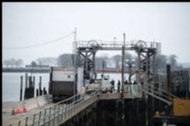
HART ISLAND
Down the street from the City Island Historical Society Museum is the ferry dock for Hart Island. The island, until recently was operated by the Department of Corrections. It is now under the auspices of the Parks Department.. Now, Hart Island will be the repository of those perishing from Covet-19 victims. Hopefully, it will be a memorial park in the lovely and tranquil Long Island Sound.
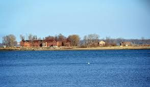
HIGH ISLAND
HIGH iSLAND IS JUST NORTH OF CITY ISLAND, IT IS CONNECTED TO CITY ISLAND AND IS PRIVATELY OWNED. CBS (c)
STEPPING STONES LIGHT
Stepping Stones Light
Stepping Stones Light
is a Victorian-style lighthouse in Long Island Sound, in Nassau County, New York. The lighthouse is square-shaped and made of red brick, standing one-and-a-half stories high. The Hudson-Athens Lighthouse is a virtual twin of this structure.
The light is in current use, under the management of the United States Coast Guard. It is not open to the public. The reef upon which it sits was given its name by Siwanoy (Minnefords) Native American legends. According to the legend, the tribe used warriors, medicine, and magic to chase the devil out of present-day Westchester County,New York onto City Island (formerly Greater Minneford Island), surrounding him at Belden Point. The devil then picked up huge boulders lying there and tossed them into Long Island Sound, using them as stepping stones to make his escape. The natives named the rocks, “The Devil’s Stepping Stones”.
It was added to the National Register of Historic Places as Stepping Stones Light Station on September 15, 2005, reference number 05001026. The light station has been declared surplus, and the application for transfer under the National Historic Lighthouse Preservation Act of 2000 is under review.[5] In 2008, the light station was transferred to the Town of North Hempstead.
In 2014, the Town of North Hempstead entered into a partnership with the Great Neck Historical Society and the Great Neck Park District to raise funds to rehabilitate the Lighthouse
CHIMNEY SWEEPS ISLANDS
The Chimney Sweeps Islands are a pair of small islands located within New York City in the northern part of City Island Harbor in the borough of The Bronx. The islands, along with High Island, New York, divide City Island Harbor from Pelham Bay.
The islands are entirely made out of bedrock. The islands are uninhabited, but are home to many birds, such as gulls, skuas, and great blue herons. The islands are owned by the New York City Department of Parks and Recreation, which acquired them in 1939 from the Chimney Sweeps Islands Corporation, a private group that used the islands for recreation, and are now a part of Pelham Bay Park.
There are two local legends about the origin of the islands’ name. One is that from a distance the two islands look like Chimney Sweeps, which were brooms or tools used to clean and sweep out chimneys. The other was that a person that became rich sweeping chimneys bought the islands. A former owner of the islands, Mr. Russell Smith, suggested that the name originated in the now archaic usage of the term “chimney” to describe the flow of water between two rocks. In the early 1900s, a family lived on the islands and operated a tavern on them as well.
EDITORIAL
I started out writing about one island City Island and something happened. I had known about Hart Island. I had never heard about High Island and Stepping Stones Light. I have to thank the folks at Wikipedia and the City Island Historical Society for much of the information published today.
Every issue has brought me and hopefully the readers knowledge of parts of our region that was a discovery.
Where to next? We do not seem to be running out of islands. Stay tuned. Send me your suggestions.
Celebrating National Nurses Day and salute by FDNY, EMS, NYPD,PSD and USPS in front of Coler today.
Text by Judith Berdy Thanks to Bobbie Slonevsky for her dedication to Blackwell’s Almanac and the RIHS Thanks to Deborah Dorff for maintaining our website Edited by Melanie Colter and Deborah Dorff
SPECIAL REPORT FROM MOMO, THE HEALING HOUND AT COLER
East View of Hell Gate in the Province of New York NYPL (c)
In 1851, the U.S. Army Corps of Engineers led by General John Newton began to clear obstacles from Hell Gate, a strait in New York City’s East River, with explosives.
The operation would last 70 years. On September 24, 1876, the Corps used 50,000 pounds (23,000 kg) of explosives to blast the rocks, which was followed by further blasting.
The process was started by excavating under Hallets reef from Astoria. Cornish miners assisted by steam drills dug galleries under the reef, which were then interconnected. They later drilled holes for explosives. A patent was issued for the detonating device. After the explosion the rock debris was dredged and dropped in a deep part of the river, this was not repeated at the later Flood rock explosion.
Tunnels were built under the river in preparation for the explosion.
Hell Gate Explosion On October 10, 1885
A major impediment to navigation on the East River, a huge rock island called Flood Rock, was blown up. This rock island was located between Astoria (Queens) and Wards Island (Manhattan) in a dangerous narrow section of the East River called Hell Gate.
The explosion was watched by thousands of spectators and felt throughout the city. Hell Gate is a narrow tidal strait in the East River which connects the Upper Bay of New York Harbor and Long Island Sound, a place of rocks and dangerously converging tide-driven currents. It is located between Wards Island (part of Manhattan) and Astoria (Queens).
This choke point on the East River was, and still is, a challenge to navigation.During the 19th century, the U.S. Army Corps of Engineers undertook a decades-long project to clear major obstacles from Hell Gate. In the 1880s the massive (9 acre) stone island called Flood Rock was its target.
Tides hitting the rock created turbulent currents and whirlpools in the busy narrow channel, impeding navigation. The Corp’s plan was to employ explosives, a huge amount of explosives, to widen and deepen the Hell Gate channel and to lessen the swirls and eddies. During the nine years leading up to 1885, a mine shaft was dug deep into Flood Rock with tunnels branched out at various levels. Holes drilled into the ceilings were filled with 283,000 pounds of explosives.
When the day came to set off the explosion, the mine shaft was flooded with water to help deaden the sound and mitigate the shock in surrounding areas, and on October 10, 1885 the largest single explosion recorded to date broke up the base of the rock.
Flood Rock, now full of cracks, settled lower in the water. Surface blasting addressed some remaining above-surface areas. General Newton, in charge of the project, declared the result a complete success. Removal of the broken rock would take place over time and be done by dredges. The shock of the deep explosion was felt all over the city.
An estimated 200,000 spectators lined the Astoria Long Island shore, the river front of Manhattan, Wards and other islands in the East River, and crowded on many commercial and private vessels. Note: Wards Island (south) is now conjoined with Randalls Island (north). Before being filled in, the passage between them was called “Little Hell Gate”. They are part of the borough of Manhattan.
A D FISK 1880 MCNY (C)
THE HELL GATE
BRIDGE
The Hell Gate Bridge, originally the New York Connecting Railroad Bridge or the East River Arch Bridge, is a 1,017-foot (310 m)[a] steel through arch railroad bridge in New York City.
The bridge carries two tracks of Amtrak’s Northeast Corridor and one freight track across the Hell Gate, a strait of the East River, between Astoria in Queens, and Randalls and Wards Islands in Manhattan. The arch across the Hell Gate is the largest of three bridges that form the Hell Gate railroad viaduct.
An inverted bowstring truss bridge with four 300-foot (91.4 m) spans crosses the Little Hell Gate, a former strait that is now filled in, and a 350-foot (106.7 m) fixed truss bridge crosses the Bronx Kill, a strait now narrowed by fill. Together with approaches, the bridges are more than 17,000 feet (3.2 mi; 5.2 km) long.
The designs of the Tyne Bridge in Newcastle, England and the Sydney Harbour Bridge in New South Wales, Australia were derived from the Hell Gate Bridge.
Scientific American Magazine
Plans from Scientific American Magazine (c)
Gustav Lindenthal also designed the Queensboro Bridge
Bridge under construction while boat sails under it.
Pool was built for Olympic Trials for Berlin Olympics 1936
Astoria Park Pool 1937 MCNY Wurts Bros.(c)
The bridge was conceived in the early 1900s to link New York and the Pennsylvania Railroad (PRR) with New England and the New York, New Haven, and Hartford Railroad (NH) In June 1906, the NH applied for and received a franchise to operate trains from the northeastern suburbs of New York City to Pennsylvania Station in Midtown Manhattan, built by the PRR. The New Haven would be able to accomplish this by constructing a spur from the four-track New Haven Railroad and New York Central Railroad main line in the Bronx (these railroads are now respectively the modern-day New Haven Line and Harlem Line of the Metro-North Railroad).
The spur, now the Port Morris Branch, would split north of Melrose station in the South Bronx, then merge with the Harlem River and Port Chester Railroad (HR&PC; now part of the Northeast Corridor) just north of the Harlem River. The HR&PC would pass from the Bronx to Queens via the Hell Gate Bridge, then continue south through Queens, eventually connecting to the East River Tunnels and Penn Station
As part of the plan, the Hell Gate Bridge would carry four tracks, which would connect to the NH’s four-track lines on either side of the Hell Gate.[8] Construction was overseen by Gustav Lindenthal, whose original design left a gap of 15 feet (4.6 m) between the steel arch and the masonry towers. Fearing that the public assumed that the towers were structurally integral to the bridge, Lindenthal added aesthetic girders between the upper chord of the arch and the towers to make the structure appear more robust. The original plans for the piers on the long approach ramps called for a steel lattice structure.
The design was changed to smooth concrete to soothe concerns that asylum inmates on Wards and Randall’s islands would climb the piers to escape. The engineering was so precise that when the last section of the main span was lifted into place, the final adjustment needed to join everything together was just 5⁄16 inch (7.9 mm). Construction of the Hell Gate Bridge began on March 1, 1912 and ended on September 30, 1916.
The bridge was dedicated and opened to rail traffic on March 9, 1917, with Washington–Boston through trains first running on April 1.] It was the world’s longest steel arch bridge until the Bayonne Bridge opened in 1931.
During World War II, its economic value made it a target of the Nazi sabotage plan known as Operation Pastorius. In the 1990s, the bridge was repainted for the first time since it opened. It was painted a deep red called “Hell Gate Red”. Due to a flaw in the paint, the red color began to fade before the work was completed, leading to the bridge’s currently faded, splotchy appearance.
EDITORIAL
A few years ago a friend and I took Amtrak from Penn Station to Vermont. We took the train from Manhattan thru the Sunnyside Yards on the tracks parallel to Northern Blvd and thru Astoria and going over the Hell Gate Bridge to the wonderlands of the Bronx. The rest of the 13 hour experience, I will save for a day with a large Margarita in my hand.
Looking out of rail cars, elevated subway cars, tram cabins, airplane windows are my favorite pass times. I am the one who raises the window shade to look down on America.
Since we are so limited now, I can suggest the F train over the bridges and to Smith and 9th streets in Brooklyn for the view. It is the highest station in the MTA system.
At some point if you crave aerial adventures, take some of the Transit Museum vintage train tours. One to take in the summer is going from downtown Brooklyn to Coney Island on an old 1950’s car. Get off at Stillwell Avenue and take the nice new cool F train home.
Judith Berdy 212 688 4836
REPORT FROM MOMO,
THE COLER HEALING HOUND
Our Healing Hound MOMO, who lives and works at Coler was on hand Monday to receive a supply of Keurig Coffee makers for the nursing home units. in order to make life better, having a coffee maker on the unit will raise spirits and give the residents the opportunity for an easy beverage at any time.
The coffee makers were donated the the Coler Auxiliary.
In order to support the Auxiliary, please see our letter below.
Text by Judith Berdy Thanks to Bobbie Slonevsky for her dedication to Blackwell’s Almanac and the RIHS Thanks to Deborah Dorff for maintaining our website Edited by Melanie Colter and Deborah Dorff
All image are copyrighted (c) PHOTOS MCNY (C) Text Wikipedia (c) Images Scientific American (c)
My Family A Small Community Yachting at the Turn of the Century
The Berdy’s of Seagate
For many years my father had a Berdy cousin, Irwin Berdy (not to be confused with my father Irving Berdy) and his wife Ruth Berdy (not to be confused with my mother Ruth Berdy) who lived in Seagate. They had two sons Michael and Andy. Irwin was a retired Army veteran who instilled the Army life into his sons.
Both attended West Point. Michael, class of ’65 was a football star at the Point and was killed in Vietnam, in 1967. His younger brother Andy went onto a long Army career and has two sons, both now senior officers in the Army. (I mean real senior officers, with lots of stripes and responsibilities.
I remember visiting the Berdys in Seagate and then going to Nathans or somewhere a little fancier for dinner. Families did that, meet and eat on weekends hearing the family tales over and over, sitting on the porch overlooking the neighborhood. In the house was the flag from Michael’ funeral at West Point, a father that never was the same after that loss of a child.
The local public school P.S. 188 and the street outside Lincoln High school are named for Michael E. Berdy.
Going to Seagate was entering a different world with quiet streets and the hub-bub of Coney Island a million miles away. The street had an aura as on our island where everyone knew the kids, the families and the stories of a community.
SEAGATE
Sea Gate is a private gated community at the far western end of Coney Island at the southwestern tip of the New York City borough of Brooklyn. Located on the portion of the Coney Island peninsula west of West 37th Street, it contains mostly single-family homes, some directly on Gravesend Bay.
History
The area that is now Sea Gate was once known as Norton’s Point. “Norton” was the name of the owner of a casino, which was situated where the Coney Island Light now stands. The neighborhood held a reputation for gambling before it was developed into a residential neighborhood.
Sea Gate was developed into a full neighborhood in 1892 by developer Alrick Man. By 1899, Sea Gate property owners included the Morgan, Dodge, and Vanderbilt families. Governor Al Smith and others frequented the Atlantic Yacht Club, whose clubhouse was designed by Stanford White.
Sea Gate is surrounded on three sides by water with private beaches. In 1995, the Army Corps of Engineers completed its work of replenishing Coney beaches and building new jetties, including a long jetty at the border of Sea Gate and Coney Island
Residents refer to Sea Gate as “the gate” and venturing into adjoining Coney Island as going “out the gate”. There are no stores in the neighborhood. There are express buses to Manhattan, which take an average of 80 minutes.
As of 2010 Sea Gate is made up of 832 single-family houses in a variety of architectural styles, including Queen Anne Style and Mediterranean. Residents pay for private security as well as sewer, beach, lifeguards, street lights, and street cleaning.
There are two points of interest in Sea Gate. Located on Beach 47th Street in Sea Gate is the 75-foot-tall Coney Island Light, is a lighthouse built in 1890, before the area was populated. The lighthouse is the former home of Frank Schubert, the United States’ last civilian lighthouse keeper, who died in 2003.
The chapel in Sea Gate, once used for services and built in 1901, is a historical building now used for social events, yoga classes, and is a polling site at election times. The Chapel with its stained-glass windows is the first structure seen when entering the main (police protected) gate.
A sandy/grassy patch of land with views of Lower New York Harbor and the Verrazano-Narrows Bridge. It is nicknamed “Lindy Park”, commemorating Charles Lindbergh.
(c) tug 44
Atlantic Yacht Club
Atlantic Yacht Club
The Atlantic Yacht Club is a family-oriented yacht club located on the shores of Gravesend Bay in south Brooklyn. A storied member of the New York sailing community, the club is perhaps best known for its contributions to New York sailing in the late 19th and early 20th centuries, when it featured prominently as one of the leading yacht clubs of its day.
The Atlantic Yacht Club’s facilities have moved several times over its history: the first facility was located at the foot of Court Street on Gowanus Bay in Gowanus, Brooklyn; it subsequently moved to a site at the foot of 55th Street in the neighborhood that subsequently became known as Sunset Park, Brooklyn.
In 1898 it moved to perhaps its most famous club-house, located in Seagate. Seagate is located on the western end of Coney Island, and the club facilities were located on the northern, inland, side of Coney Island facing Gravesend Bay.
For many years, the Atlantic Yacht Club was one of the largest and most prestigious yacht clubs in New York City. History Clubhouse of the Atlantic Yacht Club at Seagate, as it appeared in the 1890s.
The Atlantic Yacht Club was organized in 1866 by a breakaway group from the earlier Brooklyn Yacht Club. Within five years its membership rolls eclipsed those of the Brooklyn Yacht Club, and the club developed a reputation as an active corinthian sailing organization that attracted many of Long Island’s most prominent citizens and soon drew in members from throughout the region, as well as prominent sailors who frequented the active New York sailing season.
The Atlantic Yacht Club rapidly developed into one of the most active yacht clubs in New York, hosting regular regattas and competing against the leading yacht clubs in the region. The club’s annual Atlantic Race Week and Lipton Cup regatta regularly drew sailors from around the world, competing in multiple classes. The club was also a driving force behind the formation of the United States Power Squadrons in 1914.
The club’s original clubhouse was a barge that was moored at the foot of Court Street at the end of Gowanus Creek, facing Gowanus Bay. Gowanus Creek, and the Erie Basin in Red Hook, Brooklyn served for several decades as a center of the New York sailing and yachting community, and several important boat yards were located in the area. As time passed, however, increasing industrialization in the area led many to relocate to other sites around New York Harbor and, indeed, locations in Long Island Sound. In the early 1880s, the club acquired a waterfront farm property on 55th Street in Yellow Hook, Brooklyn.
The neighborhood subsequently assumed the name of Bay Ridge, a name suggested by club-member, former Commodore and leading Brooklyn florist, James Weir. The converted clubhouse was soon replaced by a larger facility constructed at the end of the club’s new pier at the end of 55th Street. A marina and anchorage were established at the same site at that time. Clubhouse of the Atlantic Yacht Club at 55th Street in Bay Ridge, Brooklyn, as it appeared in the early 1890s. Photo by John S. Johnston.
A new clubhouse at Seagate was designed by Frank Tallman Cornell and built in 1898 on Poplar Avenue overlooking Gravesend Bay (the site of the old clubhouse becoming the main yard of the Morse Dry Dock and Repair Company). The move to the new clubhouse was driven in large part by Commodore George Jay Gould I, the prominent financier and a son of Jay Gould. The club attracted New York socialites and aristocrats, including prominent members of the Auchincloss, Dodge, Elsworth, Fish, Gould, Hoagland, Iselin, Vermilye and Voorhees families, among many others. Sir Thomas Lipton, J.P. Morgan and the Earl of Dunraven (the British challenger for the America’s Cup, with his yacht Valkyrie) were among the club’s prominent members.
Known for corinthian sailing, for many years the club sponsored one of the most active racing programs in New York Harbor, holding races almost weekly through the summer season. Sir Thomas Lipton, a five-time unsuccessful British challenger for the America’s Cup, typically stayed at the club during his America’s Cup campaigns. His yacht Shamrock docked at the Atlantic Yacht Club during the Cup campaigns. The Atlantic Yacht Club played a major role with respect to the famous Kaiser’s Cup transatlantic race of 1905. The race was initially proposed on September 18, 1903 at the Sea Gate club-house during a dinner to commemorate the retirement as club Commodore of Robert E Tod.
Initially intended as a snub directed at the New York Yacht Club’s largely steam-powered yachting fleet, at Lipton’s recommendation the regatta was encharged to the New York Yacht Club. In due course, the regatta was won by the yacht Atlantic, sponsored by the New York Yacht Club, and skippered by Charlie Barr. Barr, a three-time winner of the America’s Cup, was one of the leading sailors of his day.
The Atlantic sailed to victory in record time, establishing trans-Atlantic mono-hull records that stood for 100 years. The AYC’s entry, the yacht Thistle, a schooner built in 1901 by New York’s Townsend & Dourney, and owned and skippered by Robert E Tod, finished 10th. Tod, a New York investment banker, was the only owner-skipper in the regatta.
The Atlantic Yacht Club’s Seagate clubhouse burned down in 1933. The club soldiered on for a number of years thereafter, becoming inactive in the 1950s. The club was revived several decades later, in the early 21st century. Today, the AYC operates as a sailing club based off Bay Parkway, directly across Gravesend Bay from its earlier Sea Gate location, with a social facility in Brooklyn Heights.
EDITORIAL
This is a personal story. I have to thank my neighbor Ross Wollen for keeping me informed on his West Point class mate, my late cousin Micheal Berdy, thru the alumni network.
Family history is not all cut and dry like I read in the records as I have been using for this series. My father had 18 first cousins and I had 4 aunts, his sisters. We had the family “show up” at our houses on Sundays. I always laugh that they would all call parent telling them they were taking a ride from Brooklyn to suburbia on the spur of the moment. There was always food and fun. This is something we don’t do now .
A grumpy 5 year old and her 8 year old brother in suburbia,
Text by Judith Berdy Thanks to Bobbie Slonevsky for her dedication to Blackwell’s Almanac and the RIHS Thanks to Deborah Dorff for maintaining our website Edited by Melanie Colter and Dottie Jeffries