
WEDNESDAY, AUGUST 26 2020 – Take the A train to a different world


Wednesday, August 26, 2020
OUR 140th ISSUE
OF
FROM THE ARCHIVES
BROAD CHANNEL
A
FLOATING COMMUNITY

LOCATION
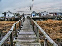
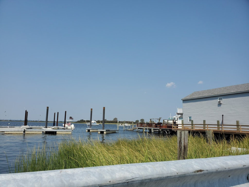
East of Cross Bay Boulevard between East 10th and 14th Roads there are houses built on stilts over an inlet of Jamaica Bay (also known as Broad Channel). Above: East 12th Road Broad Channel is the province of seagulls, roaring jets taking off from Kennedy Airport, The Jamaica Bay Wildlife Refuge, and a proud, insular neighborhood.
Unlike many NYC mainland neighborhoods (such as Glendale, Laurelton, Marine Park or Throgs Neck, it features a subway stop. Cross Bay Boulevard is the main artery and carries traffic between Broad Channel and the mainland, as well as the Rockaway peninsula. Many Broad Channel families have been there for two or three generations, since the island began to become populated in the 1880s. The island remains the only populated island in Jamaica Bay.

Broad Channel is a neighborhood in the southern portion of the New York City borough of Queens. It occupies the southern portion of Rulers Bar Hassock (known colloquially as “Broad Channel Island”), the only inhabited island in Jamaica Bay. The neighborhood stands on Big Egg Marsh, an area of fill approximately 20 blocks long and 4 blocks wide at the south end of Rulers Bar Hassock.
The community is an inholding within the Jamaica Bay Wildlife Refuge, managed by the U.S. National Park Service as part of the Gateway National Recreation Area. The area comprises several artificial canals separating dead-end residential blocks. It is connected to the rest of Queens by road and subway bridges.
EARLY SETTLEMENT
Prior to European settlement, the Jameco and Canarsie bands of Lenape Native Americans frequented this area. During the 17th century, Dutch settlers established a community on the island and began harvesting oysters, clams, shrimp, and fish.The name “Broad Channel” itself originally referred to a channel in Jamaica Bay, within which the island is located.
Until the American Civil War, most of Jamaica Bay’s islands east of Bergen Island and Barren Island were not inhabited, including Broad Channel. The boundary line between the towns of Flatlands, Brooklyn, and Jamaica, Queens, ran through Jamaica Bay, cutting through Broad Channel, though the island was mostly part of Jamaica.
After 1865, fisheries were developed in the bay, and by the late 1870s, the town of Jamaica indicated that structures had been built in the bay without the town’s permission. The Long Island Rail Road built its Rockaway Beach Branch across the bay in 1880, cutting through Broad Channel The presence of the railroad led to the development of fishing villages with shacks, summer homes, boathouses, and stores. As part of the project, some other islands in Jamaica Bay were removed or connected to others.
Broad Channel remained a parcel within the town of Jamaica until the City of Greater New York was created in 1898. The northern (and larger) portion of the island is part of Gateway National Recreation Area and is managed as part of the Jamaica Bay Wildlife Refuge, the only wildlife refuge in the National Park System. The waters and marsh islands of the refuge entirely surround the community.
20th CENTURY
Seen in 1915 In 1915, the city leased Broad Channel Island, Goose Creek Island, and Raunt Island to Pierre Noel, who subleased it to the Broad Channel Corporation.[The 30-year lease specified payments of $16.57 per acre for the first three years and a maximum of $33.73 per acre for the last five years of the thirty-year term. The Broad Channel Corporation in turn made 10-year subleases to private individuals for the development of summer bungalows and houses.
There was public criticism of the lease after the public learned about the deal, which Pierre Noel, president of the Broad Channel Corporation, countered by pointing to $180,000 of improvements it had made, including digging a well to supply drinking water, building a power plant, adding landfill to reduce the need for houses on piles, and laying out streets on the island Residents disputed the quality of these improvements, however, saying that the tap water was brown and not potable, that their houses had no electricity, and that there were no sewers on the island.
The Broad Channel Corporation responded by saying the water was of the same quality as was available in the Rockaways and that it planned to install a filtration device to remove the iron from the tap water. It said that the streets had electric lights, and it said installing sewers was not possible on the island. For years, the only way to reach the island was by ferry or railroad but in 1925, the North Channel Bridge opened, connecting the island to Howard Beach. The Cross Bay Parkway Bridge opened in 1939, connecting to the Rockaways
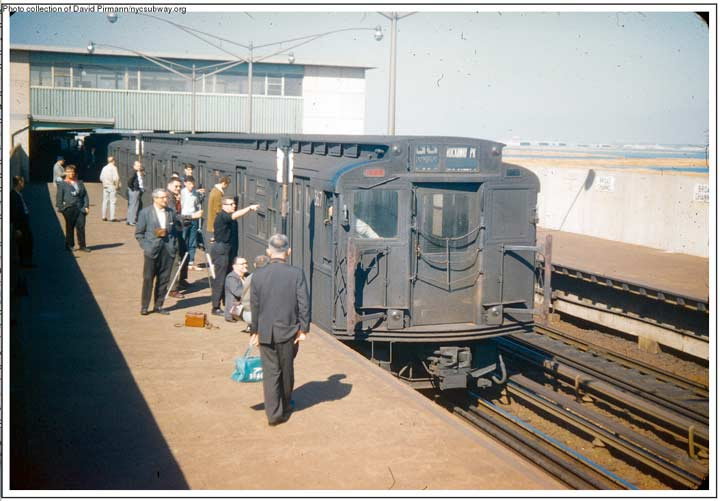
The railroad trestle across Jamaica Bay experienced around 30 fires between 1942 and 1950. One such fire, between The Raunt and Broad Channel stations on May 7, 1950, cut service on the middle section of the railroad line.[19] The LIRR, then bankrupt, could not afford to repair the trestle, and the city of New York purchased the line in 1952,[19][20] and it reopened as the New York City Subway’s IND Rockaway Line in 1956.
Parks Commissioner Robert Moses announced his intention to build a park on the island in 1938; he planned recreation on the shore with a wildlife sanctuary on the north end of the island.[25] The next year, the Broad Channel Corporation declared bankruptcy, and the city acquired the island’s property titles. In May 1944, Broad Channel’s 4,000 residents, collectively living in 1,260 homes, secured an injunction that would prevent the city from evicting them by April 30, 1948. Later in 1944, the New York City Board of Estimate indicated that it would give residents the right to purchase the land under their houses.
However, this right was denied for many years; the city made many attempts to alter the island’s purpose, but the local community resisted them all. Proposed changes included the construction of a commercial port and the extension of John F. Kennedy International Airport
Rumors of high hepatitis rates spread in 1967 because of the island’s bad sewage system. At the time, several homes still dumped sewage into the bay, causing activities like clamming, wading, and swimming to be banned. The health hazards prompted the city to again attempt eviction proceedings against Broad Channel’s residents, which prompted them to protest, and the Board of Estimate ordered the residents’ leases to be renewed the following year, despite the real estate commissioner’s protests\ The government of New York City finally granted Broad Channel residents the right to purchase their property in 1982.The Joseph P. Addabbo Memorial Bridge replaced the dilapidated North Channel Bridge during the late 1980s.[33]
THE VOLSTEAD ACT
PROHIBITION
RUM RUNNERS

From The Rockaway Museum
Dedicated To The Memory Of Leon S. Locke
Historical Views of the Rockaways
Prohibition and Rum-Running in Rockaway
In 1919, while a great number of American men and boys were still in uniform, and still in Europe, the so-called “drys” won out and caused the Volstead Act to be passed and become the law of the land. The passage of this act ushered in the era of prohibition (1919-1933) when the manufacture and sale of alcoholic beverages was forbidden in the United States. This irked all the veterans of the Great War, who felt that they were wronged while they were overseas.
They came home to soft drinks, tap water and fruit juice! The liquid libations that they had developed a taste for were denied to them by law and this caused the rise of the law-breaking bootlegger or smuggler who illegally brought booze and beer into dry America. Some built secret liquor stills and beer brewery – but most employed trucks, boats and airplanes to slake the thirst of dry Americans – to cure their dehydration. It has been said that Broad Channel (and the two other bay colonies of the Raunt and Goose Creek) was the Mecca of local bootleggers who met and closed their deals at certain hotels at these places, which were only accessible by boat or train.
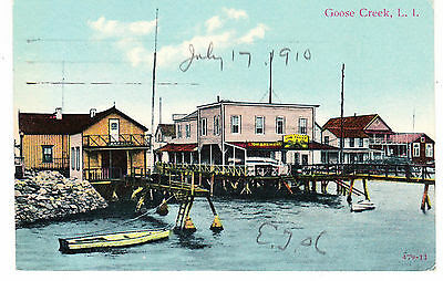
All of these meeting places were built on wooden piling, driven into the marshes and waterways and were reached by catwalks from the Bay Railroad trestle stations and each other. In case of a raid by the police, a quick get-away was easily facilitated by prepared law-breakers. One such hotel is shown today in Historical Views, and was described as the “bootlegging capitol or our Jamaica Bay.” It was aptly called the Hotel Enterprise, which was located off the northeast end of the Broad Channel Station.
The complex shown began as Parson’s Hotel and Fishing Station in 1881. In 1892 it was known as Dorman’s Atlantic Hotel and Fishing Station. Another name later ascribed for the place was Lindstrom’s. The first names found associated with proprietorship of the enterprise were Mess’rs, August Vogel, and Edward Bollerman, in 1893.
During prohibition, Broad Channel was known as Little Cuba. In today’s photo, the LIRR trestle is shown heading to the Raunt, where some buildings are readily seen. Goose Creek is above the Raunt and cannot be seen. The Broad Channel station is to the left and not shown in this photo. The wooden walks to the enterprise complex all come from the station platform. The marsh shown circles Goose Pond on the north end of Broad Channel. Unfortunately, the booze smugglers kept no records of their dealing for their lucrative business…and newspapers told of booze raids locally – as well as U.S. Coast Guard interceptions of some booze boats.
The Enterprise was raided once, and some illegal beer was confiscated by the authorities along with 1500 bottles of liquor. I’ve been told that most raids were set-ups to show that something was being done by local police, and that local police protected or guarded local landings by rum boats, with a few cases going to the local precincts.
That’s how unpopular prohibition was to all imbibers of alcohol. I once got a grand tour of a sleek boat that was used as a rum-runner during the prohibition years. It looked as if it could go 100 knots an hour to outrun a Coast Guard cutter. And, as expected, no ship’s log was available to tell of the rum-running adventure. Are there any old-timers in Wave-land to enlighten us? The Wave reported that a railroad freight car full of beer was found on a siding by the Broad Channel railroad station, and that pilots stationed at Fort Tilden and the Rockaway Naval Air Station were accused of smuggling booze in their planes. Rockaway Point and Arverne were the favored landing places for large rum-running operations which were done at night.
Other reports of smuggling entailed darkened vessels of all types coming up to the long docks along the bayside or the Rockaways. These docks were full of fishing and yacht clubs that had trap-doors in their floors for special deliveries. One such boat was seized at Beach 97 Street, on the bay, with 400 cases of Scotch Whiskey. I wonder how much was turned in as evidence? At the same time a carload of beer was seized on Beach 102 Street. The Coast Guard intercepted a few slow rum-runners in “rum row”, a name given to the waters around Long Island…and fired on the faster booze boats. Only one was reported to have been hit by gunfire.
One boat company out on Long Island built fast boats for the Coast Guard and even faster ones for bootleggers. The Coast Guard boats could do 26 knots at top speed, while the rum-runners made 30 knots loaded. In 1932, bootlegger radios were seized by local police. It seems as though the smugglers of hootch were really doing a modern communications thing, to stay a step or two ahead of the authorities.
Despite all the law enforcement by federal, state, city and local lawmen, the Volstead Act, which ushered in prohibition, lasting from 1920 to 1933, did little to stop bootlegging and small distillery operations here. Bathtub gin was brewed in private homes, and winemaking in homes was well above the limits on how much could be made. Speakeasy’s were all over the Rockaways during prohibition years. This was the name for private drinking clubs which sprang up, and were often raided by police to keep the “drys” happy. Prohibition was repealed in early 1933 due to a bill sponsored by local congressman William F. Brunner Sr. of Rockaway Beach.
In a short time the Rockaway’s places got “wetter” than they were during the Volstead Act years. World War One veterans were happy now. Most felt that the “drys” got the no alcohol law passed because they were not there to vote on it. The Boats used for rum-running now became sleek pleasure boats. There were often well-built power boats about 50 feet in length and valued at about $1800 in the 1930’s. I wonder if any are still around? All the structures shown in today’s Historical Views are long gone…the victims of fire, storm and bay railroad improvements. Only the memories of the past recall the Hotel Enterprise and the prohibition era. Can anyone out there in Wave-land supply us with a run down of a booze run in the old days, or perhaps a photo or two of a bootleggers rum-running boat?
WEDNESDAY PHOTO OF THE DAY
IDENTIFY THIS
SEND SUBMISSION TO ROOSEVELTISLANDHISTORY@GMAIL.COM
WINNER GETS A KIOSK TRINKET

CLARIFICATION
WE ARE HAPPY TO GIVE WINNERS OF OUR DAILY PHOTO IDENTIFICATION A TRINKET FROM THE VISITOR CENTER.
ONLY THE PERSON IDENTIFYING THE PHOTO FIRST WILL GET A PRIZE.
WE HAVE A SPECIAL GROUP OF ITEMS TO CHOOSE FROM. WE CANNOT GIVE AWAY ALL OUR ITEMS,.
PLEASE UNDERSTAND THAT IN THESE DIFFICULT TIMES, WE MUST LIMIT GIVE-AWAYS. THANK YOU
TUESDAY’S PHOTO OF THE DAY
GOLDWATER HOSPITAL UNDER CONSTRUCTION
CORRECT ANSWER #1 ALEXIS VILLEFANE

EDITORIAL
If you think our island has a convoluted history, check out Broad Channel. It remains an insular community in the Jamaica Bay with a small population. Its history of fighting for survival shows the fortitude of the residents.
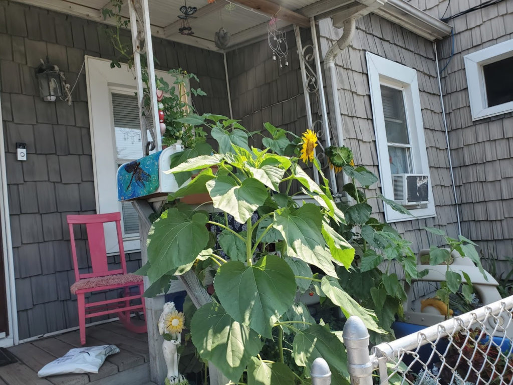
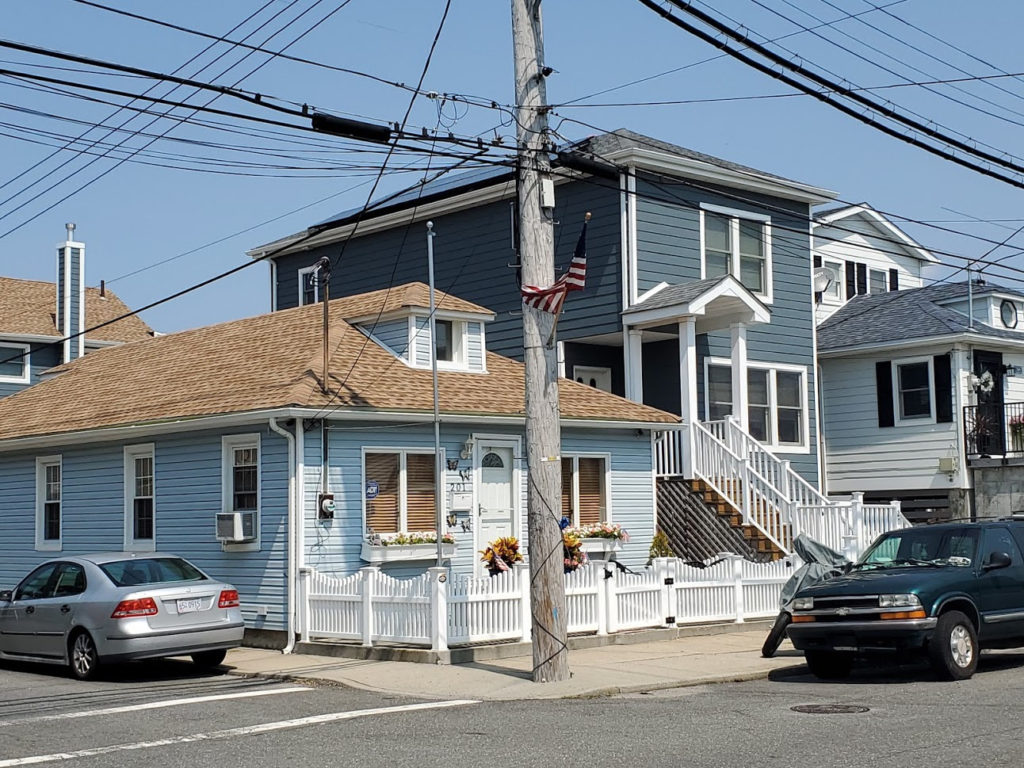
The part that the community played in Prohibition is noteworthy. I have not found evidence of massive rum-running on Blackwell’s or Welfare Island. Who knows what was on the boats coming to the island, perhaps transporting libation for the populace. I decided to take a trip and check out Broad Channel for myself. It is a lovely summer day. At West 4th Street, I changed for the A train. The A train takes you directly to Broad Channel. The subway station is a few blocks from the Cross Bay Blvd., the main street.
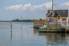
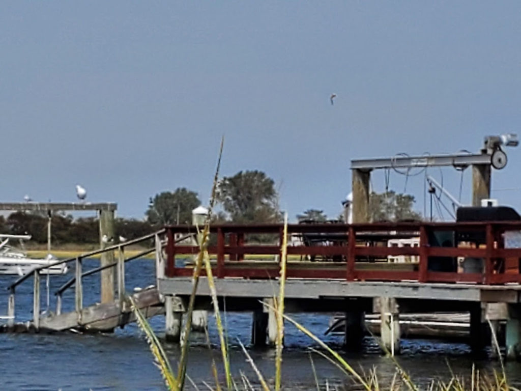
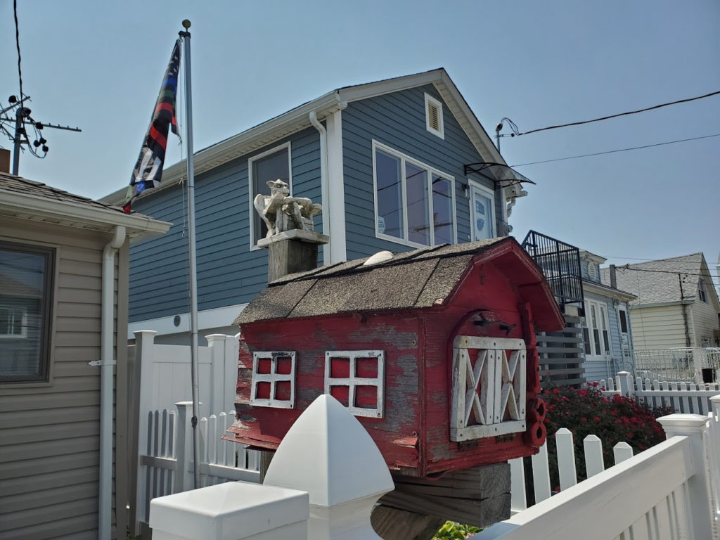
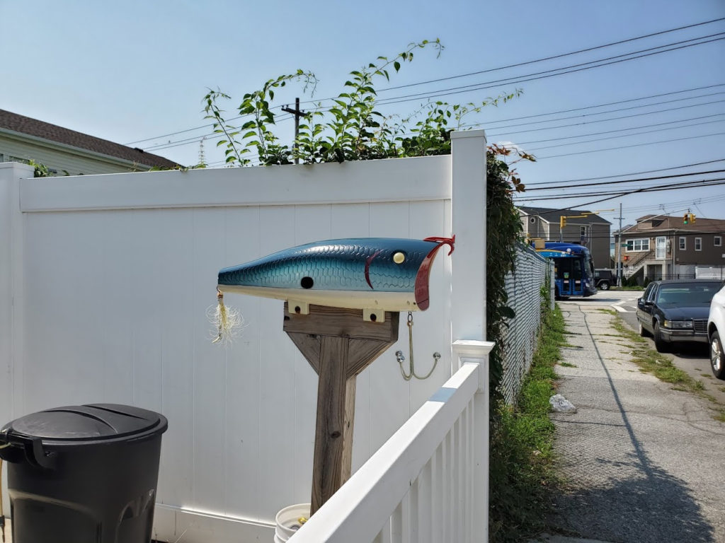
The streets are narrow and almost every home has an American flag fluttering in the breeze. I wandered around the neighborhood. Many of the homes were destroyed in Hurricane Sandy and have been re-built with a garage on ground level and the rest of the house is raised for flood prevention.
Some old homes partially built on stilts remains adding a quaint feel to the community.
Here are some photos and my suggestion is to take a ride to Broad Channel. The Jamaica Bay Wildlife Refuge is just north of the island, so you can drive to both easily.
JUDITH BERDY
NEW FEATURE
FROM OUR KIOSK
GREAT STUFF FOR ALL OCCASIONS

IN HONOR OF THE RUM-RUNNERS
BOOTLEGGERS
&
SPEAKEASYS OF THE ROCKAWAY PENINSULA
SHOT GLASSES $8-
AVAILABLE AT THE KIOSK
OPEN WEEKENDS 12 NOON TO 5 P.M.
ORDER ON-LINE BY CHARGE CARD
ROOSEVELTISLANDHISTORY@GMAIL.COM
Text by Judith Berdy
Thanks to Bobbie Slonevsky for her dedication to Blackwell’s Almanac and the RIHS
Thanks to Deborah Dorff for maintaining our website
Edited by Deborah Dorff
All image are copyrighted (c)
Roosevelt Island Historical Society
unless otherwise indicated
THE WAVE ROCKAWAY NEWS
WIKIPEDIA
GOOGLE IMAGES
FUNDING PROVIDED BY ROOSEVELT ISLAND OPERATING CORPORATION PUBLIC PURPOSE GRANTS
CITY COUNCIL REPRESENTATIVE BEN KALLOS DISCRETIONARY FUNDING THRU DYCD


Copyright © 2020 Roosevelt Island Historical Society, All rights reserved.Our mailing address is:
rooseveltislandhistory@gmail.com
Leave a comment