
Thursday, September 9, 2021 – JUST A MINUTE AWAY, AN OASIS THAT HAS PERSEVERED FOR GENERATIONS


THURSDAY, SEPTEMBER 9, 2021
THE 464th EDITION
THE MAKING OF
QUEENSBRIDGE
PARK
FROM :
NEW YORK MUNICIPAL ARCHIVES
Queensbridge Park, named for the nearby Queensboro Bridge, is a 20.34-acre (8.23 ha) city park along the East River in Long Island City, Queens, New York City. The park is a primary place of recreation for residents of Queensbridge Houses and has a riverfront promenade, baseball diamonds, running paths, lawns and areas for picnicking.
History
The New York City government acquired the land on which Queensbridge Park lies in 1939, the same year the Queensbridge Houses across Vernon Boulevard opened. While New York City Housing Authority had jurisdiction over the land, it was operated by the New York City Department of Parks and Recreation.[1]
From the 1950s to 1970s, the park was known as “River Park”, a reference to the East River that runs next to it.
During construction for the 63rd Street Tunnel which completed in 1989, a 60 by 90 feet (18 by 27 m) combined ventilation structure and emergency exit was constructed in the park.[2]
In 2014, a large seawall was constructed against the East River to protect against erosion. The project also created a 6-ft wide promenade which was named for longtime park advocate Elizabeth McQueen.[1]

The west side of Vernon Blvd. before the park was built.

The circular design is still in use inside the park,

The park continued from Vernon Blvd to 21 Street, with tennis courts and a tree lined promenade.

The New York Architectural Terra Company building along the river just south of the Queensboro Bridge.

The recreation center, recently demolished and replaced.

An aerial view of the housing and park.

Welfare Island in the background showing the Steam Plant , Goldwater Hospital and Elevator Storehouse Building. The Queensboro Bridge had flagpoles on the towers, which were later removed.

The newly completed park.

These four ballfields are still in use and lit up nightly.
TO REALLY APPRECIATE THESE PHOTOS, FOLLOW THESE STEPS:
GO TO NYC.GOV/RECORDS
GO TO QUICK LINKS
GO TO COLLECTIONS
GO TO DIGITAL COLLECTIONS
IN THE SEARCH BOX ENTER “QUEENSBRIDGE PARK”
I have overlooked Queensbridge Park for 16 years. It is never boring. The seasons come and go, I watched the seawall erode in Hurricane Sandy and being rebuilt in2014. There are many occasions there from rock concerts to parties along the water’ edge,. Yesterday a Synagogue set-up a tent and held Rosh Hashanah services there. The park is virtually empty during the week and the ball fields are full every evening. It is a green oasis between the Queensbridge House and the high rises just east.
THURSDAY PHOTO OF THE DAY
Can you identify this photo from today’s edition?
Send you submission to
ROOSEVELTISLANDHISTORY@GMAIL.COM

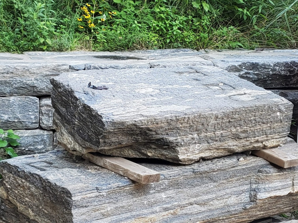
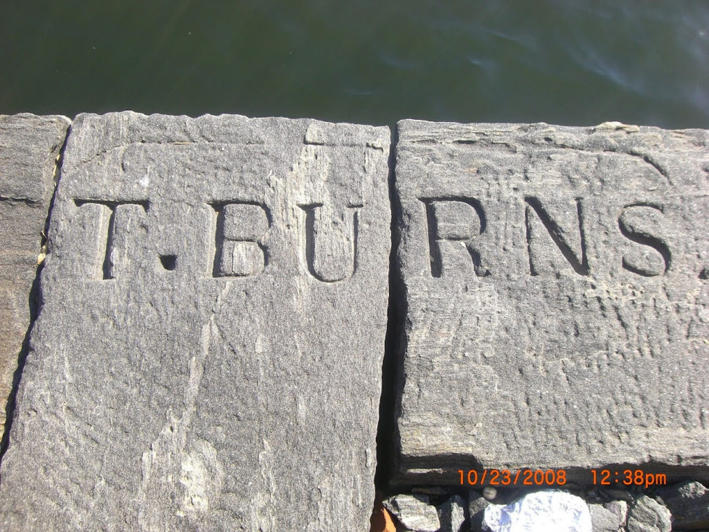
WEDNESDAY PHOTO OF THE DAY
These two engraved stones were found on the east shore in Southpoint Park. They have been saved by the contractors working on the park. The stones will soon be in a place of honor outside the RIHS Visitor Center kiosk. Who T Burns, was we do not know, but will honor him (or her) at the RIHS.
Text by Judith Berdy
Thanks to Bobbie Slonevsky for her dedication to Blackwell’s Almanac and the RIHS
Thanks to Deborah Dorff for maintaining our website
Edited by Melanie Colter and Deborah Dorff
All image are copyrighted (c) Roosevelt Island Historical Society unless otherwise indicated
MUNICIPAL ARCHIVES OF THE CITY OF NEW YORK
FUNDING PROVIDED BY ROOSEVELT ISLAND OPERATING CORPORATION PUBLIC PURPOSE GRANTS CITY COUNCIL REPRESENTATIVE BEN KALLOS DISCRETIONARY FUNDING THRU DYCD


Copyright © 2021 Roosevelt Island Historical Society, All rights reserved.Our mailing address is:
rooseveltislandhistory@gmail.com
Leave a comment