
Monday, October 10, 2022 – SOMETIMES I GET CURIOUS BY A STREET SIGN


FROM THE ARCHIVES
MONDAY, OCTOBER 10, 2022
THE 803rd EDITION
ODD-NAMED STREETS
BOOKS & ISLAND ARTISTS
UNTAPPED CITIES
When I visit NYU physicians office on East 41st Street, there is an odd street on the corner. Not Second Avenue or Third Avenue, it is Tunnel Exit Street.
Had to find out more about this street from 34th to 41st Streets

| When the Queens Midtown Tunnel was built in 1940, connecting Hunters Point, Queens, to Murray Hill, Manhattan, two streets were constructed with it. Tunnel Entrance Street (formerly Tunnel Approach) and Tunnel Exit Street are exactly what they sound like. The former leads to the tunnel’s entrance, and the latter allows exiting cars to diffuse into Second or Third Ave gradually over eight blocks. What’s interesting is that, despite the surrounding neighborhood having blossomed over the past seven decades, Tunnel Entrance and Tunnel Exit Streets have no street addresses. Perhaps this is because of the area’s unpopularity: one online reviewer called a nearby park “the saddest park in New York.” She goes on to cite noise and traffic as the vicinity’s biggest nuisances. |
 This Brooklyn road (or series of connected roads) is adjacent to the Floyd Bennett Field, which once was New York’s first municipal airport. Opened in 1931, it went on to be the most active US airport during World War II. The field is currently part of the Gateway National Recreation Center and commemorates aviation history. Recently, the field held the Brooklyn Tomato Battle. In addition, the aptly named Aviation Road is the only remaining entrance to the field, since the airport and WWII Navy entrances are now closed to the public. |
 No, there weren’t any famous New Yorkers named “Extra.” The street got its name because it was simply unclaimed, extra land. When Philip Minthorne, who owned this land as part of an 110-acre farm, passed way in the early nineteenth century, his children split up the land but left out a small piece for whatever reason. For a while, this 3-feet wide, 120-feet long piece was home to seedy establishments, like low-end speakeasies and metalworking garages. After a brief stint as the back door of punk venue CBGB, the place declined into shabbiness once more. Now, the small street is revitalized again, with restaurants, shops, and artsy events. |
 Queens has a Conduit Avenue, Brooklyn has Conduit Boulevard. It’s really the same road that crosses both boroughs and was named after a water conduit (aqueduct) run by the now-defunct Brooklyn Water Works that was replaced by this road. The entire length of the road stretches from Atlantic Avenue in Brooklyn to the Queens/Nassau County border. |
 Force Tube Avenue was also built onto the same water conduit as Conduit Avenue/Boulevard. It warranted a separate listing just because it’s name is so awesome. It’s currently separated from Conduit Boulevard by an empty grassy lot but on a map you can easily see that it’s the same right of way, cutting against the regular Queens street grid. |
 Division Street in Chinatown gets its name from a colonial border between two landowners, James deLancey and Henry Rutgers who, according to Forgotten NY, “between them owned most of the Lower East Side in the 18th Century.” The Second Avenue Elevated train once ran down Division Street, demonstrating just how long borders can linger, long after the people who create them are gone. |
 Meanwhile, Division Avenue in Brooklyn marked a former municipal boundary between Brooklyn and Bushwick (which included Williamsburg at the time).It should be noted that Queens is particularly full of functionally named streets, like Junction Boulevard, Railroad Avenue (next to Cavalry Cemetery), North Loop Lane (near Fort Totten), Traffic Avenue (in Ridgewood), and Trotting Course Lane. There’s also a “Zoo Bridge” which is just next to the World’s Fair Pavilion ruins in Flushing Meadows Corona Park |
RIHS KID’S BOOK GIVEAWAY ON SATURDAY AT RIVERCROSS LAWN


FALL FOR ARTS COORDINATED BY RIVAA
FOR RIOC
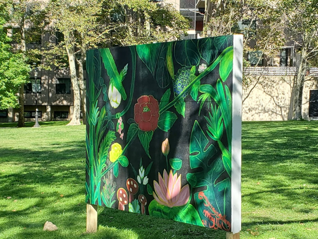
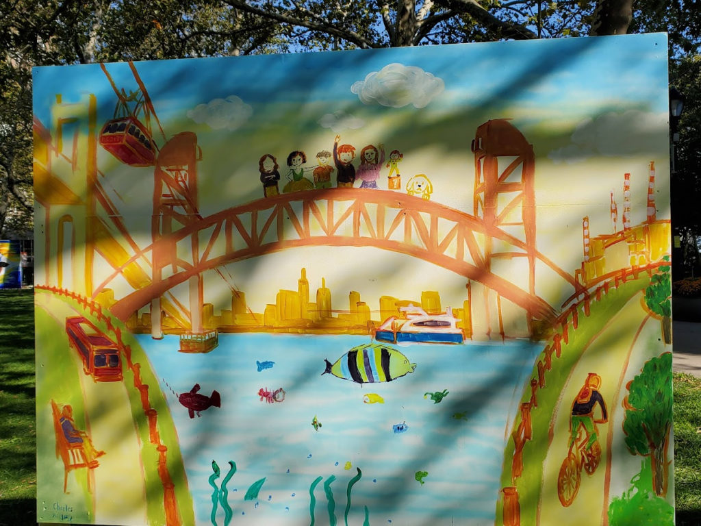
GREAT ART NOW ON VIEW ON RIVERCROSS LAWN

4 NYU BIOLOGISTS ARE SOLVING ALL KINDS OF PUZZLES

THE DARK CITY IS SURROUNDED BY OUR ISLAND GREENERY

THE BEAUTY OF MANY CULTURES

THE SUPER PAINTING TEAM FROM OUR YOUTH CENTER
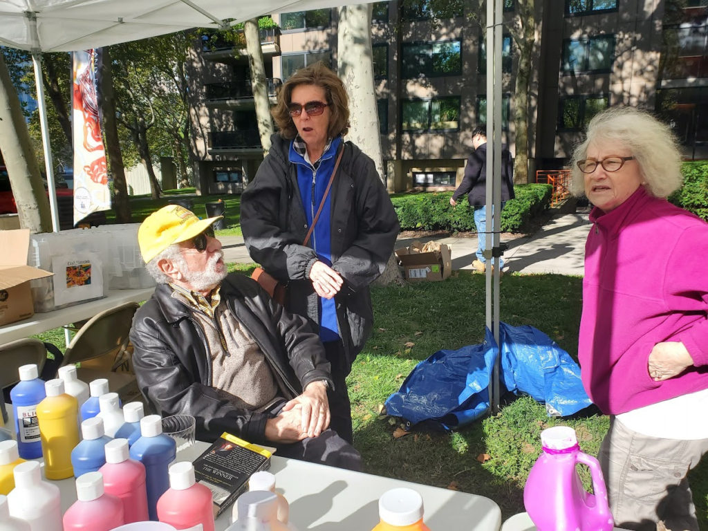
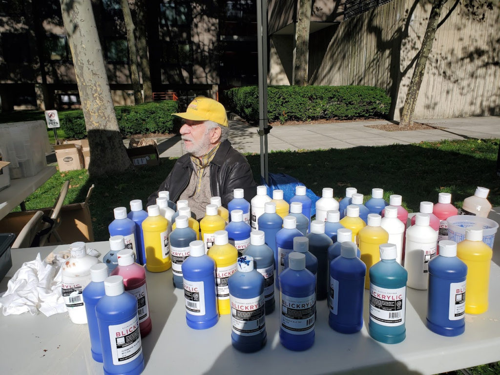
MARGIE SMITH, MATT KATZ AND SHERRIE HELSTEIN, LONG TIME ISLANDERS STAFFED THE PAIN DISTRIBUTION TABLE.

https://www.nypl.org/events/programs/2022/10/18/rihs-lecture-queer-history-womens-house-detention
MONDAY PHOTO OF THE DAY
Send your response to:
rooseveltislandhistory@gmail.com

WEEKEND PHOTO
FROM: ED LITCHER
A bank draft dated July 28, 1828 from the City of New York to James Blackwell for $13,900.00, which completed the Blackwell Island transfer of ownership from the family to the City of New York.
The next big transfer of ownership for our island will happen on 12/24/2068 when the current City/State 99-year lease will expire and the island will be returned to full City control.
ALEXIS VILLAFANE ALSO GOT IT RIGHT

Text by Judith Berdy
Thanks to Bobbie Slonevsky for her dedication to Blackwell’s Almanac and the RIHS
Thanks to Deborah Dorff for maintaining our website
Edited by Deborah Dorff
All image are copyrighted (c)
UNTAPPED NEW YORK
JUDITH BERDY
JAY TARTEL
CITY COUNCIL REPRESENTATIVE JULE MENIN DISCRETIONARY FUNDING THRU DYCD

Copyright © 2022 Roosevelt Island Historical Society, All rights reserved.Our mailing address is:
rooseveltislandhistory@gmail.com
Leave a comment