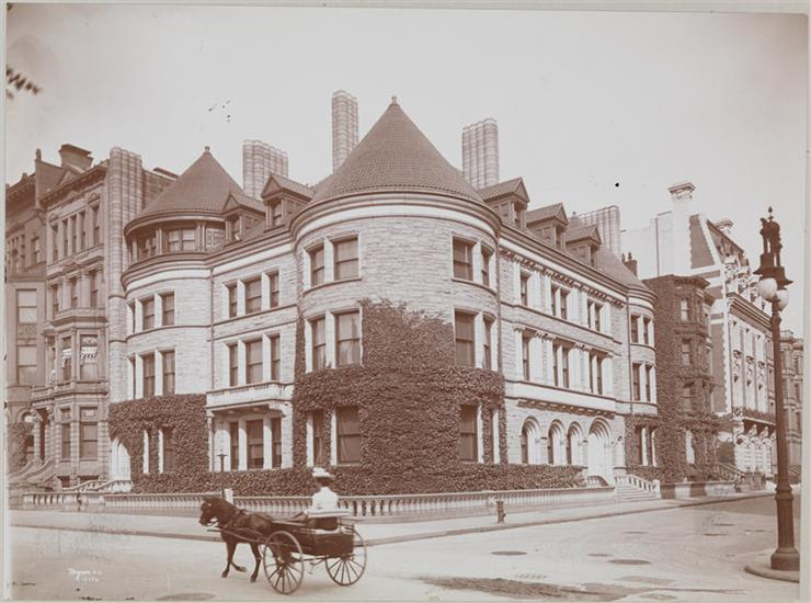
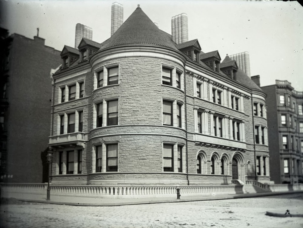
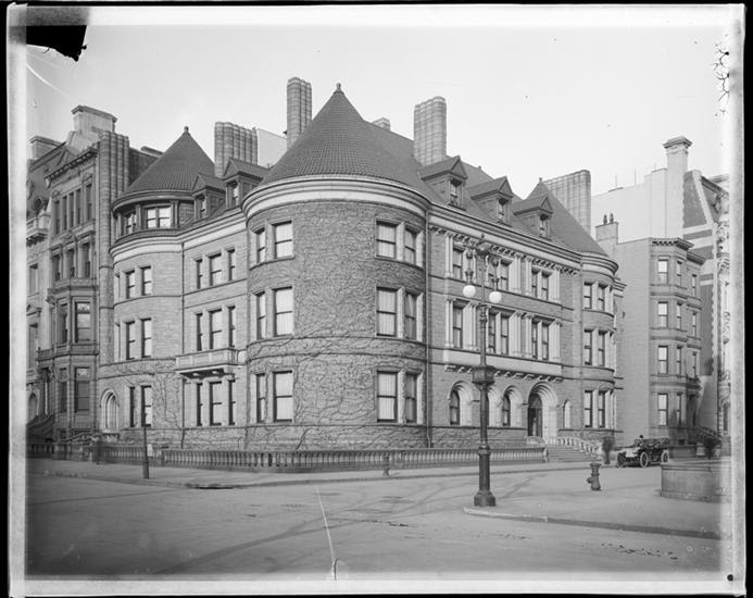
The house itself, a Romanesque Revival mansion completed in 1893 that spread across the northeast corner of 66th Street and Fifth Avenue like an open book, was sober and restrained.
Compared to Caroline and John Jacob Astor IV’s fantastical French Renaissance chateau one block south, as well as the many other gaudy showpieces lining the Gilded Age’s millionaire mile, it had an air of unobtrusive understatement.
But the rough-stone facade and turreted bays belied an interior so extraordinary, it made the house not just a family mansion but also a landmark of decoration filled with masterfully placed art and antiquities from all over the world.
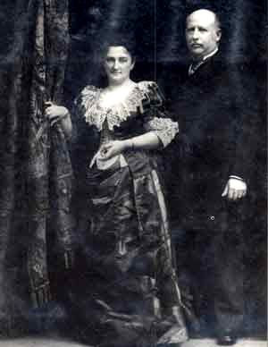
The husband and wife who built this “house of fantasy,” as one newspaper retrospective called it, were not only fabulously wealthy but also well-known in business, political, and social circles of the 19th and early 20th centuries: Henry O. and Louisine Havemeyer.
Henry Havemeyer—known as Harry—was the heir to a family sugar dynasty that operated a refinery along the East River in South Williamsburg. Hence Williamsburg’s Havemeyer Street, which may have been named for the sugary refinery or possibly for William Frederick Havemeyer, a relative who served three stints as New York’s mayor in the 19th century.
Starting as a teenage apprentice in the 1850s, Harry learned all about the business, from the secrets of sugar boiling to finance. Eventually he became one of the leaders of what was then called Havemeyer & Elder.
His work ethic and competitive nature helped Havemeyer & Elder corner the extremely competitive post–Civil War sugar market and make the East River waterfront the top sugar refining location in the nation. The company built a state-of-the-art refinery on the same spot in the 1880s, ran afoul of anti-trust laws, and in 1901 introduced a new name, Domino—which maintained a presence in Williamsburg until 2004.
While Harry was a fierce businessman, he also enjoyed what seemed to be a fulfilling home life. Louisine, his second wife (above, with daughter Electra in an 1895 portrait by Mary Cassatt), was the daughter of his former business partner George W. Elder.
Later in life, Louisine would become known as a feminist and suffrage supporter who was arrested outside the White House during a 1919 march. But as a 19-year-old student on an extended trip to Paris with her family, she was introduced to painter Mary Cassatt—who became a pivotal figure.
“When we first met in Paris, [Cassatt] was very kind to me, showing me the splendid things in the great city, making them still more splendid by opening my eyes to see their beauty through her own knowledge and appreciation,” recalled Louisiane in her autobiography, via the Shelburne Museum website.
“With Cassatt’s tasteful eye and tap on the pulse of the Parisian art world, she guided Mrs. Havemeyer during their initial meetings to purchase modern art—works by Edgar Degas (1834-1917), Edouard Manet (1832-1883), and Cassatt herself—which would inform her, and later, her husband’s collecting interests,” states the Shelburne museum.
Harry and Louisine married in 1883, had three children, and spent the rest of their lives collaborating as art collectors. Harry had already purchased items on his own, such as carved ivory figures, Japanese lacquered boxes, and sword guards. Louisine continued her interest in scooping up the work of French Impressionists.
Eventually their collection included “nearly 2,000 Egyptian, Greek and Roman, Asian, Islamic and European paintings, sculptures, drawings, prints, and decorative objects,” wrote Michael Kimmelman in the New York Times in 1993.
As their collection grew, they needed a mansion with the proper light and grandeur to display their holdings. The commission to design the house went to architect Charles Coolidge Haight. For the interiors, they turned to the design firm run by Louis Comfort Tiffany and Samuel Colman.
“While Colman supervised the decorative schemas, Tiffany saw to the fabrication of opulent decorative elements that resembled giant pieces of jewelry,” states the University of Michigan Art Museum website.
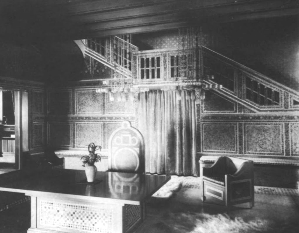
Perhaps the most imaginative feature in the house could be found in the second-floor picture gallery: a “flying” staircase. “The spectacular staircase was suspended, like a necklace, from one side of the balcony to the other,” wrote art and architectural critic Aline Saarinen, as quoted in Splendid Legacy.
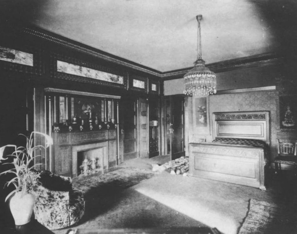
Also inventive in Louisine’s second-floor bedroom (below) overlooking Fifth Avenue was Tiffany’s use of “what seem to be two long printing blocks, possibly Indian and perhaps for textiles, adorn the headboard and footboard for the bed,” wrote Frelinghuysen.
“Every component of the eclectic interior décor pushed the limits of decorative design by merging principles of jewelry design, mosaic art, sculpture, metalwork, and textile and furniture design,” the Michigan museum continued. “Not one square inch was neglected; no surface was left untouched.”
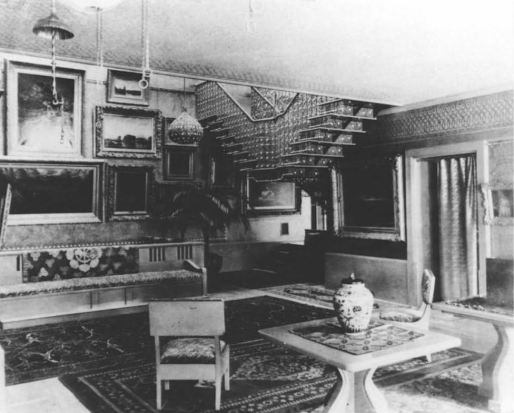
What Tiffany and Colman created was a sumptuous work of art in itself. Visitors would go through the metal and opalescent front doors and find themselves in the main entrance hall (fifth image), with a glass mosaic-faced staircase and a frieze of “individual mosaic panels that repeated a motif of Islamic character,” states Alice Cooney Frelinghuysen in Splendid Legacy: the Havemeyer Collection.
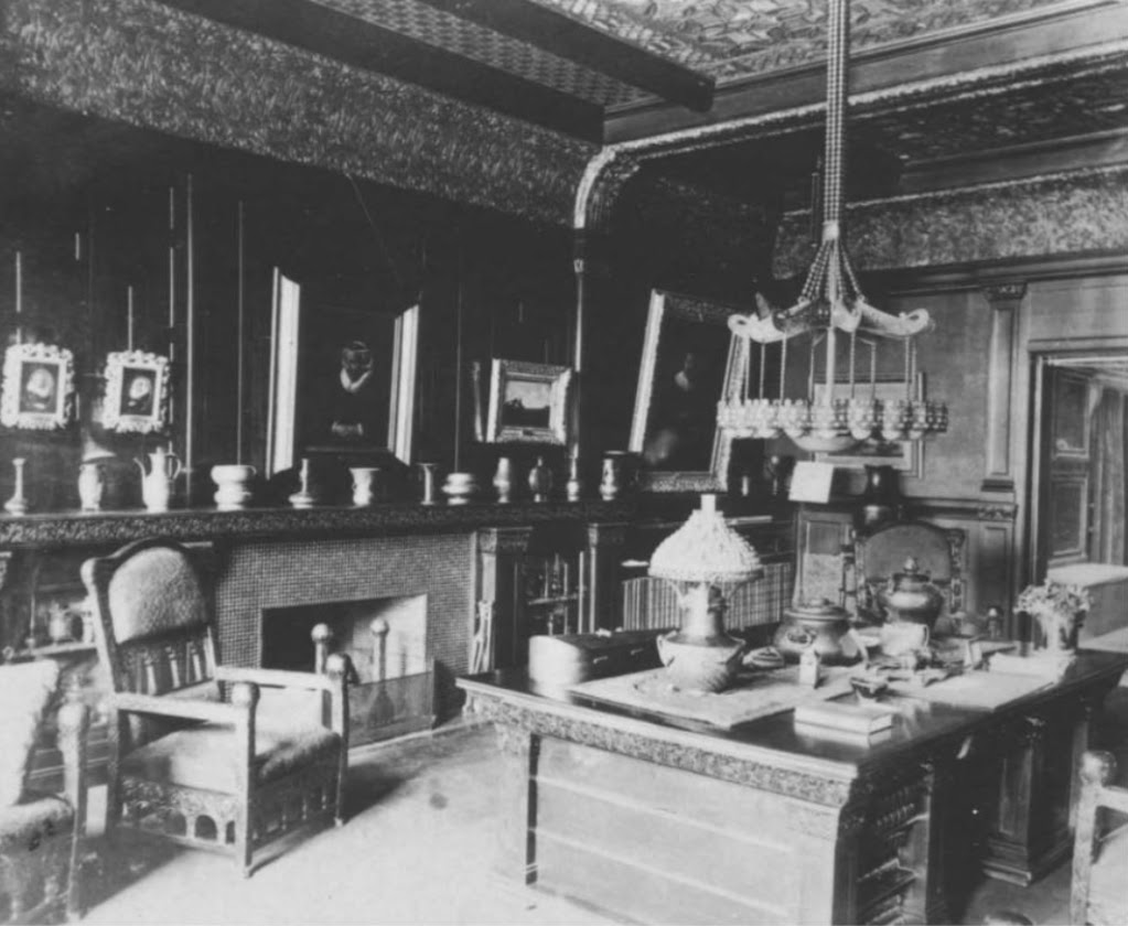
The library was known as the Rembrandt room (above), as it held the couple’s collection of Dutch pictures. Colman designed the furniture; the lighting fixture above the desk may be the first extant Tiffany chandelier, suggests Frelinghuysen, who was a family descendant by marriage.
It would not have been unusual for wealthy mansion dwellers to have art galleries in their homes. But because of their extensive collection and vision for how to display it, in partnership with Tiffany and Colman, the Havemeyers created a harmonious, enchanting, and spectacular space that received international attention.
Even after Harry passed away in 1907, Louisine continued collecting. Following her death in 1929, much of the couple’s holdings were bequeathed to the Metropolitan Museum of Art. Some went to the Shelburne Museum in Vermont, which was co-founded in 1947 by youngest daughter and art collector in her own right Electra Havemeyer Webb.
And the mansion itself? This fortress of art and antiquities went to the three children, who had the magnificent interiors broken up, sold off (some artifacts went to the University of Michigan Museum of Art), and the house demolished. Its replacement is an 18-story co-op completed in 1949.
A final relic of the Havemeyer fortune still stands in Williamsburg. The Domino sugar refinery is part of a complex rebranded Domino Park that includes the facade of the old brick refinery—an eerie ghost of one of the many riverfront industries that powered the fortunes made during the Gilded Age.
All image are copyrighted (c) Roosevelt Island Historical Society unless otherwise indicated THIS PUBLICATION FUNDED BY DISCRETIONARY FUNDS FROM CITY COUNCIL MEMBER JULIE MENIN & ROOSEVELT ISLAND OPERATING CORPORATION PUBLIC PURPOSE FUNDS.
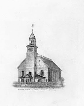
As New York City rapidly grew so did its postal needs. In 1845 the post office was working out of the defunct Middle Dutch Church – a bleak structure already 200 years old at the time.
By the time of the Civil War, the old church building could no longer handle the increased mass of mail and the need for a new facility was obvious. A congressional investigation reported that “the present post office building was totally unfitted for an inadequate to the present wants of the postal business.”
The Middle Dutch Church building on Nassau Street was home to the post office in the early 19th Century — NYPL Collection
In 1857 the President of the United States authorized Congress to purchase a site for a new post office in New York “at a cost not to exceed $500,000.”
The wheels of government turned slowly and eleven years later, on May 16, 1866 Congress resolved to appoint a commission to select a proper site for a multi-purpose structure. In the time between the President’s authorization and the formation of the congressional committee the average amount of mail processed in the old church had grown from 10 to 100 tons per day.
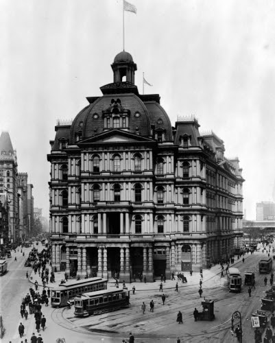
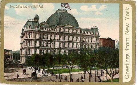
Congress envisioned a structure that would house the postal business of New York City as well as the United States Courts and would require “a space of land equal to from twenty-five to thirty city lots.” The spot selected was the tip of City Hall Park, directly in front of the elegant Federal-style City Hall.
The price tag place on the plot by the city was $500,000; perhaps not coincidentally exactly the maximum amount allowable. The New York Times offered its opinion, “We believe that, as the Government has got the ground so cheap, it will be inclined to act liberally as regards the structure.”
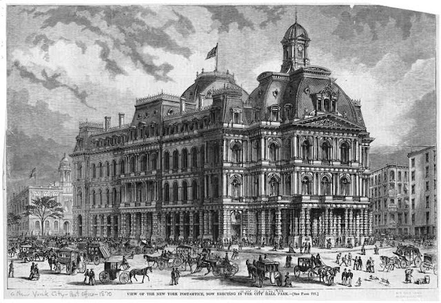
A contest among architects was held for a winning design. Sadly, there was no winner. So a committee of architectural firms was appointed to review all the plans and perfect a design from among them. Included in the committee were some of the most influential architects of the time including Richard Hunt and James Renwick, Jr. The result was a monumental French Second Empire pile that The Times called “pure French Renaissance style, and represents a chaste and harmonious combination and grouping of parts.”
Architect Alfred B. Mullett, who had submitted his own design in the competition, didn’t think so.
After he aggressively lobbied against the extravagant expense of the group design, he was handed the project to complete.
By early 1869 still little seemed to have been accomplished, other than plans for a “grand plaza” in the remainder of the park between City Hall and the proposed post office building. The editor of The Times recommended that the plaza “should be made as nearly like the Place de la Concorde in Paris as possible.”
Finally in August of that year ground was broken – while squabbling still continued over the intended site by groups opposed to the location. As excavation progressed, five human skeletons were discovered, remnants of a potter’s field, as well as several gold coins. The laborer who found the coins did not report back to work the following day.
As the Post Office rose, it was praised by the press. Readers were told it would be “renaissance, of the French school,” according to The Times in January 1870 and “The exterior will be treated in the Doric style, each story embracing an order which will be increased in richness from the ground to the cornice.”
Four stories of granite rose like a grey stone wedding cake to a bulbous mansard roof. The colossal edifice cost a staggering $8.5 million — $5 million over the proposed cost and approximately $156 million in 2011 dollars.
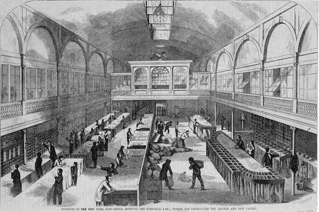
The state-of-the-art sorting room — NYPL collection
Up-to-the-minute innovations, like a system of pneumatic tubes that whisked mail to sub-stations and distribution points, improved delivery. The Federal Government rented the upper offices for judges and lawyers as well as for hearing rooms and court rooms. And it immediately became a must-see spot for tourists.
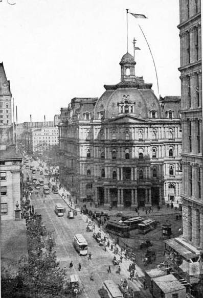
Looking back with a 21st Century viewpoint, we see Mullett’s grand edifice as a wonderful and splashy example of Victoriana at its best – a lush pile of ornament and shapes. The AIA Guide to New York City says it was “a rich building inspired by Napoleon III’s Paris.”
The rarely-photographed rear facade facing City Hall Park — author’s collection
Contemporary opinion was not so kind. By the time the eleven-year construction project was completed the style was already out of date. Almost immediately it was dubbed Mullett’s Monstrosity” and, in comparison to the tall buildings rising around it, was likened to a portly dowager squatting in the park. The Century Magazine called it “a showy granite building.”
Horse-drawn drays line up at the loading docks (far left) in 1909 — photograph from author’s collection
The New York Sun derided Mullett as “the most arrogant, pretentious, and preposterous little humbug in the United States.” In 1890 the architect ended his life in Washington DC.
By 1912 there were calls for the demolition of the giant building. The Times wrote “The Mullett Post Office has always been an architectural eyesore, and has, from the first, been unsatisfactory to the Postal Service and the Federal Courts beneath its roof.”
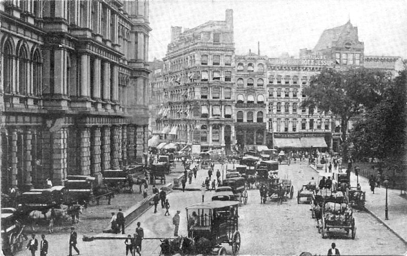
Trolley cars snarl in front of the post office building in 1905 — NYPL Collection
Dissatisfaction grew and in 1921, only four decades after its opening, the reviled post office was deemed obsolete. Postmaster Edward M. Morgan stated that the facility was “totally inadequate” and noted that the Government spent about $900,000 in rent in the building; while Postmaster General Will H. Hays admitted “almost universal sentiment on the part of the people of this city is to have their old park restored to its original colonial form and beauty.”
The New York Times added its own brutal criticism. “The city spoiled the park for a mess of pottage,” it said, “Except for cheapness there is no merit in the present building.” Calling the Post Office “an architectural abomination,” the editorial quoted Postmasters Willcox, Patten and Morgan as deeming it “inconvenient, inadequate, unhealthful.”
That year, in what now seems the pinnacle of irony, the New York Historical Society and the Sons of the Revolution garnered the assistance of “many persons and associations active in the conservation of historical landmarks and beauties of the city” to attack the problem of “ridding the park of what everybody regards as a nuisance.”
Although the dispute between the Federal government and the city over ownership of the land provided a temporary stay of execution for the post office; New York’s attempts to beautify the city for the upcoming 1939 World’s Fair hastened the end. In 1938 Mullett’s elaborate granite masterpiece with its columns and porches, mansards and iron cresting, was bulldozed to rubble.
Today the old City Hall Post Office is remembered as one of the best examples of monumental French Second Empire architecture in the United States – along with Mullett’s Old Executive Office Building in Washington DC. However there are few who remember it at all. Posted by Tom Miller
NON-PROFIT DISCUSS THEIR GROUPS HOWARD AXEL OF THE FDR FOUR FREEDOMS STATE PARK, JUDITH BERDY, MODERATOR, CHRISTINA DELFICO OF Idig2Learn, BOBBIE SLONEVSKY-EDITOR OF BLACKWELL’S ALMANAC AT THE RIHS EVENT ON MONDAY
Credits
DAYTONIAN IN MANHATTAN
All image are copyrighted (c) Roosevelt Island Historical Society unless otherwise indicated THIS PUBLICATION FUNDED BY DISCRETIONARY FUNDS FROM CITY COUNCIL MEMBER JULIE MENIN & ROOSEVELT ISLAND OPERATING CORPORATION PUBLIC PURPOSE FUNDS.
NYPL RI Branch Monday, October 20th 6:30 P.M. THE ROOSEVELT ISLAND HISTORICAL SOCIETY & THE NEW YORK PUBLIC LIBRARY
“ROOSEVELT ISLAND AT 50”
Our next program in our 50th anniversary series presents: Non-Profit Island Discussion with Howard Axel and Christina Delfico.
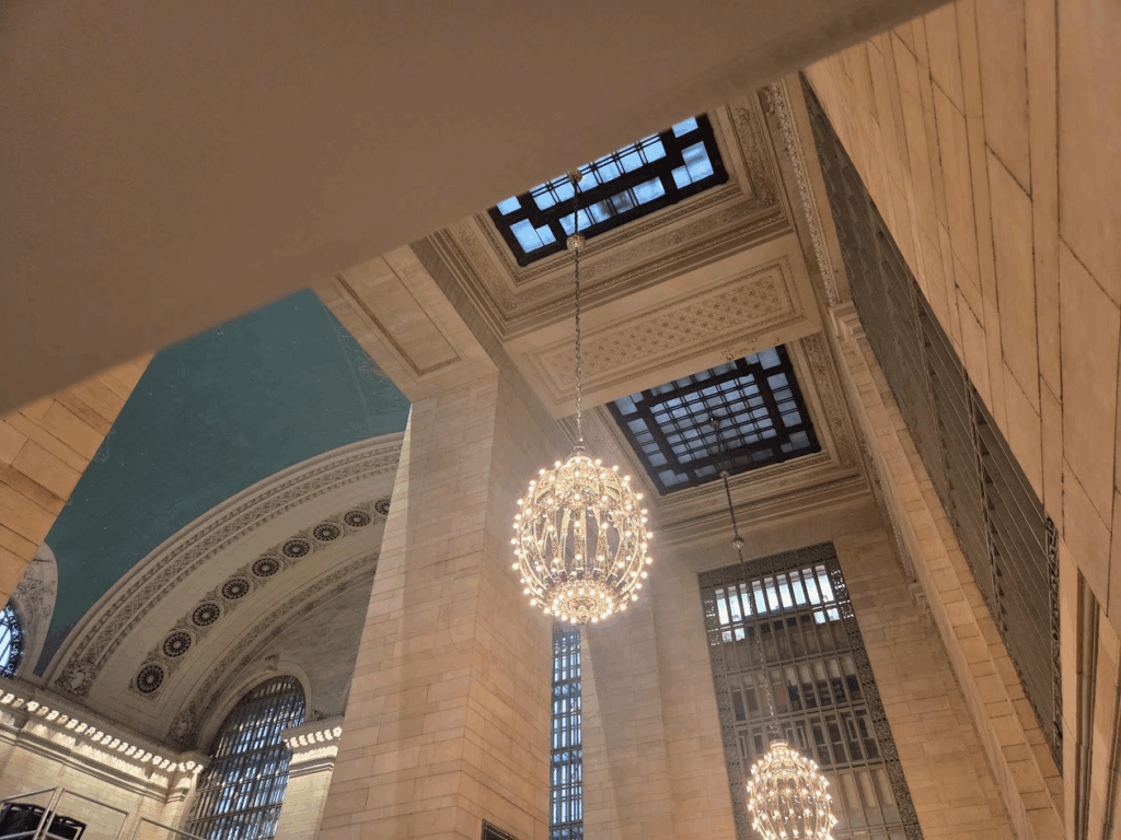
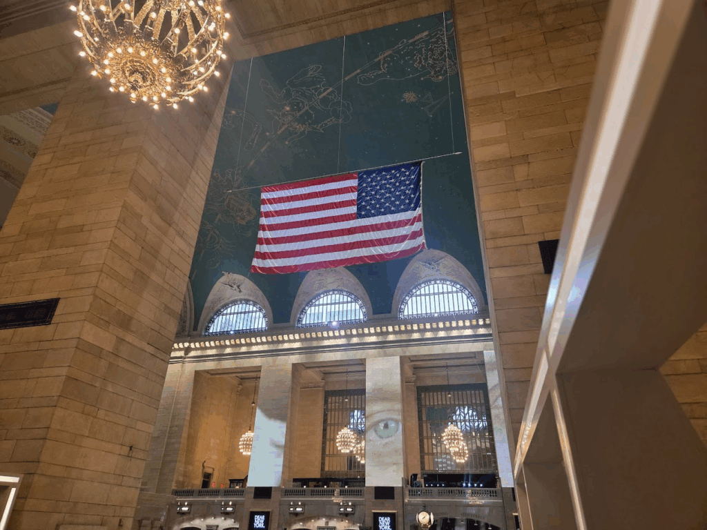
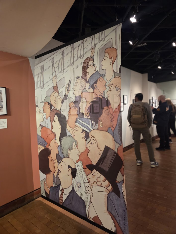
Yesterday, two friends and I ventured to Grand Central Terminal to see the photo exbibit “Dear New York .”
The terminal was mobbed with commuters, tourists, demonstators from the No Kings demonstration and I made a quick exit to The Transit Museum Gallery located in a quiet corner of the terminal.
The skylight above the escalators bring more light into the terminal
Nothing makes me happier than being in the grand main terminal
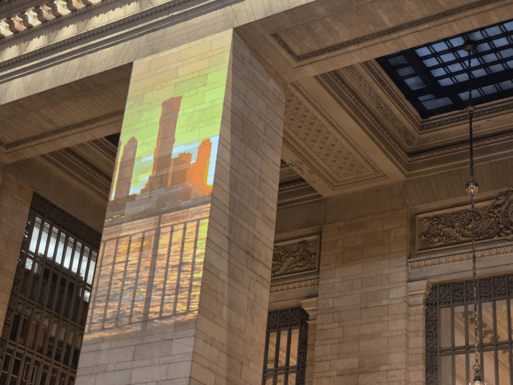
The pillars had new views
Outside the Transit Museum Gallery, a demonstator taking his politics to the terminal
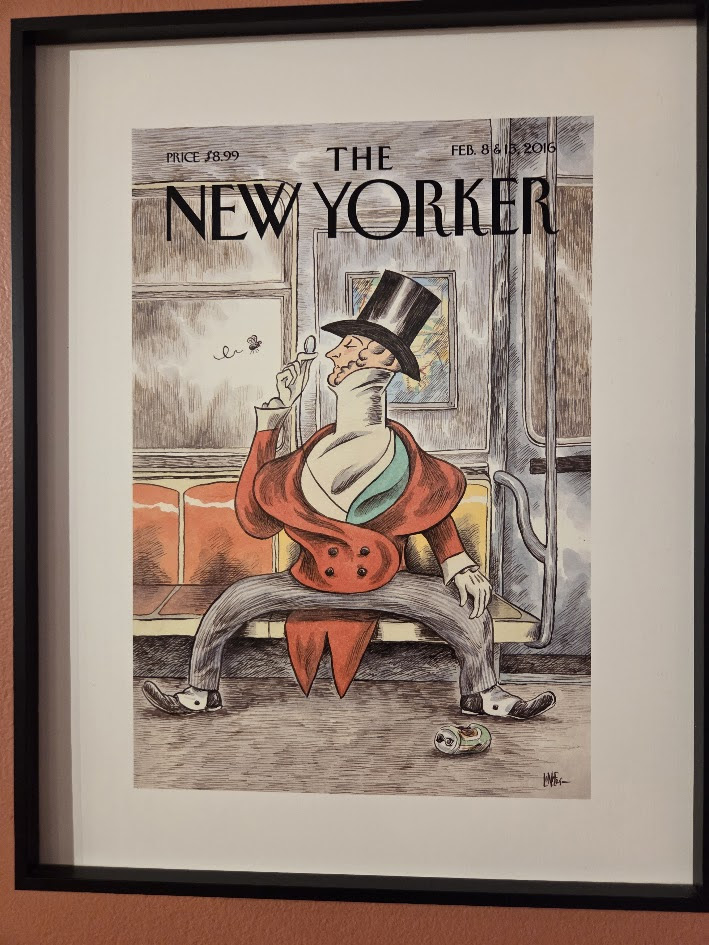
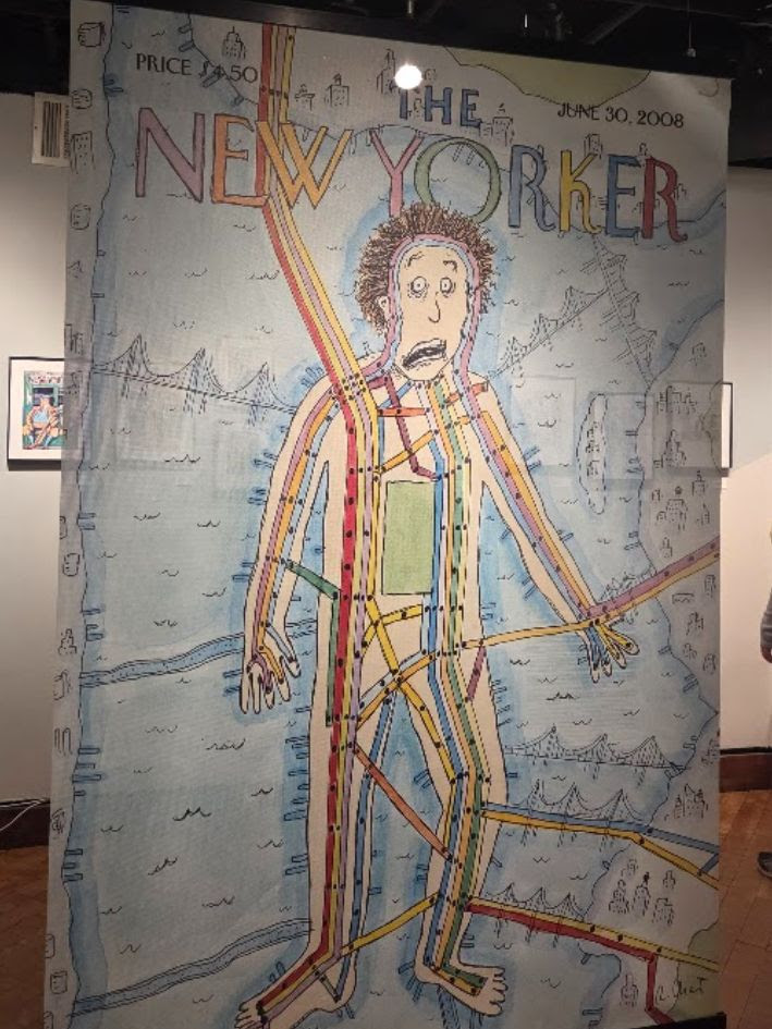
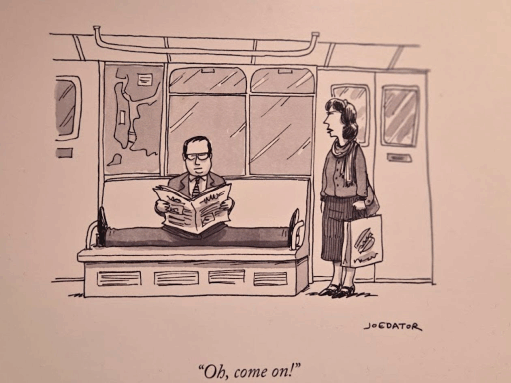
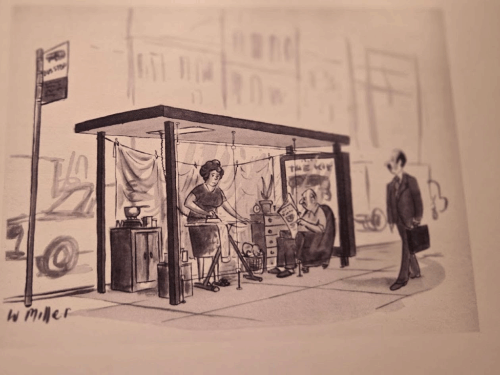
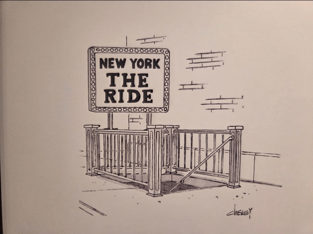
A Century of The New Yorker’s Transportation Cartoons
Commentary on the Commute
Many of the cartoons are over a century old.
Great transit map!
HALLOWEEN EXTRAVAGANZA IN THE OCTAGON LOBBY
Credits
Commute: A Century of The New Yorker’s Transportation Cartoons. Showcasing work from 57 artists, the exhibit includes a selection of cartoons and covers from The New Yorker whose subjects should be familiar to anyone who has ever taken public transportation: the uniqueness of New Yorkers, the challenges of the commute, the daily sea of humanity (and critters) that move through the region, and the grittiness and the grandeur that is New York. On view now through October.
Judith Berdy
All image are copyrighted (c) Roosevelt Island Historical Society unless otherwise indicated THIS PUBLICATION FUNDED BY DISCRETIONARY FUNDS FROM CITY COUNCIL MEMBER JULIE MENIN & ROOSEVELT ISLAND OPERATING CORPORATION PUBLIC PURPOSE FUNDS.
NYPL RI Branch Monday, October 20th 6:30 P.M. THE ROOSEVELT ISLAND HISTORICAL SOCIETY & THE NEW YORK PUBLIC LIBRARY
“ROOSEVELT ISLAND AT 50”
Our next program in our 50th anniversary series presents: Non-Profit Island Discussion with Howard Axel and Christina Delfico.
Howard Axel, the CEO of Four Freedoms Park Conservancy responsible for maintaining and operating FDR Four Freedoms Park on Roosevelt Island, NY. Axel is a nonprofit executive committed to bringing the best of business practices to sustainable social impact efforts in the United States. Axel has 13+ years of experience in fundraising, creating and stewarding strategic partnerships, executing marketing and social media-driven crowdsourcing opportunities for non-profits and entertainment brands.
In 2012, Christina Delfico founded iDig2Learn because she recognized the need for a local organization that would connect city children and their families with nature. Leveraging her expertise as an Emmy-nominated children’s media producer, she saw the chance to disconnect children from their screens and get them outside. Developing and facilitating enriching opportunities soon expanded to include spotlighting smart waste reduction practices to support a healthy environment. Today, iDig2Learn creates experiences for all ages and abilities.
From Public Hanging to Electric Chair: Kemmler, Edison & Tesla
(also: Executions on Blackwell’s Island)
Weekend, October 18-19, 2025
Issue #1557
New York Almanack
Jaap Harskamp
From Public Hanging to Electric Chair: Kemmler, Edison & Tesla
Italian jurist and criminologist Cesare Beccaria was a leading figure in Milan’s Enlightenment circles. In 1764 he published his treatise Dei delitti e delle pene which made an instant impact. Translated in many languages, an English version appeared in 1767 as On Crimes and Punishments.
Advocating proportionality of punishment, Beccaria was one of the first thinkers to make a case against the death penalty by claiming that it is “better to prevent crimes than to punish them.”
Insisting that there is no justification for the taking of life by the state, his exposition made a strong impact in Europe and America. Both George Washington and Thomas Jefferson acquired a copy of the book in 1769. The latter scribbled more than two dozen passages from Beccaria’s study into his “commonplace book” (a diary of his reading).
When asked by a reporter what would be the greatest challenge to any political career, British Prime Minister Harold Macmillan reputedly replied: “Events, dear boy, events.” Incidents happen and tend to knock governments off course or instigate change.
Against the background of Enlightenment thinking, unpredicted events made an impact on the way in which society dealt with crime and punishment, both in London and New York – and there were many similarities.
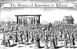
Tyburn Theater
In early nineteenth-century England there were more than two hundred offenses carrying the death penalty, from stealing sheep to treason, arson or murder. Until 1783, Tyburn (a village close to the current location of Marble Arch) served as London’s primary place of execution.
Public display of hangings was a vital part of a legal system that relied upon deterring people from committing crime. Executions were spectacles that followed a regulated protocol. For the occasion to set a fearful example, the “performance” had to be a dramatic one.
A public execution was set for three days after trial, allowing time for repentance and reconciliation. The event itself was both ritual and spectacle.
Large numbers of onlookers, men, women and children, enjoyed the atmosphere. It was a family affair and a profitable day for vendors, pickpockets and prostitutes. Printed broadsides were offered for sale telling stories of murderers, pirates, traitors and other felons. Such tales enhanced the excitement.
On hanging day, the condemned person was transported from Newgate Prison to the execution site in a two-mile procession through central London. The journey took place on an open cart and drinks were consumed on the way. The “parade” could last for several hours. A rowdy mob followed the cart, pelting the convicted criminal with rotten vegetables and stones.
The prison chaplain accompanied the criminal (not all, but mostly males) during the procession and on to the scaffold, praying for him. An addition to the process was the “gallows speech.” The spiritual state of those facing death was believed to possess a special truth.
Convention dictated that a felon confessed his sins. In doing so, he accepted the fairness of his sentence and the legitimacy of the justice system.
But convicts did not always adhere to expectations in their final address. Some claimed innocence; others complained of injustices in their conviction. Increasingly, spectators demanded “firework” from the platform.
An outrageous speech electrified onlookers who became vocally involved in this carnival of death. Then the hangman appeared, the noose was adjusted and a bag drawn over the criminal’s head. The horse would be lashed to move the cart and leave the criminal hanging in the air.
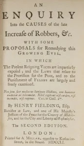
Procession and execution would serve, according to Henry Fielding in An Enquiry into the Causes of the Late Increase of Robbers (1751), to “add the Punishment of Shame to that of Death; in order to make the Example an Object of greater Terror.”
The regularity of hangings however led to execution-fatigue amongst the public and a hardening of moral senses. Around the mid-eighteenth century critics began demanding a stop to public executions.
By 1861 the number of capital offenses was reduced to five (murder, piracy, arson, espionage and high treason). Seven years later, the Capital Punishment Amendment Act was passed, requiring that hangings must be conducted in private.
The last public execution took place on May 26, 1868, when Irish activist Michael Barrett was hanged for his part in the Clerkenwell bomb explosion of December 1867 in which twelve bystanders died.
Hanging John Johnson
When European peoples emigrated to settle in what is now the United States, they brought with them the laws and customs of their homelands. England introduced the death penalty into the American colonies.
The first recorded instance took place in 1608 when Captain George Kendall was executed in Jamestown, Virginia, for plotting to betray the English to the Spanish. He was executed in front of a firing squad.
New York’s history of capital punishment also goes back to colonial times. During various periods from the 1600s onward, its legal provisions prescribed the death penalty for crimes such as sodomy, rape, adultery, counterfeiting or perjury. Most executions were carried out by hanging.
By 1796, the legislature authorized construction of the State’s first penitentiary and reduced the number of capital crimes from thirteen to two (murder and treason, to which arson was added in 1808).
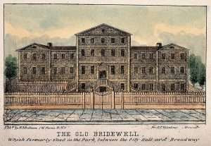
John Johnson was a family man who kept his wife and children at an upstate farm whilst he ran a seedy boarding house for mariners at 65 Front Street, Lower Manhattan, close to the buzzing port.
One day in 1823, the body of a Boston sailor named James Murray was discovered in a nearby alley. His head had been split open with a hatchet.
Murray had rented a room at Johnson’s lodge. When police officers found bloody sheets in the cellar of the property, the latter was accused of robbery and murder. Under interrogation Johnson made conflicting statements, admitting to the crime, then retracting his statement, blaming another guest for the attack.
The case attracted wide publicity. Whether Johnson was fairly treated is unclear, but public interest in the story reached fever pitch as details were splashed across newspapers. Decrying his innocence to the end of the trial, he was sentenced to hang on April 2, 1824.
Seated on a coffin in an open wagon, Johnson was transported from Bridewell Prison through Broadway to a field at the junction of Second Avenue and 13th Street (once part of Peter Stuyvesant’s “Bouwerie”). He was accompanied to the gallows by a minister and escorted by infantrymen who had to hold back an over-excited pack of onlookers.
His hanging was witnessed by a huge crowd. Estimates vary between thirty and fifty thousand spectators which, at the time, was almost a third of New York City’s entire population.
His body was then taken to the College of Physicians and Surgeons at Barclay Street, Manhattan, where it was subjected to a number of medical “experiments.”
Public Executions
Wherever they took place, public executions were unruly affairs, achieving the opposite of their intended effect. Instead of deterring people from crime, these events were an orgy of drunkenness debauchery and pick-pocketing. There were many observers who called for a stop to public hangings on moral grounds.
The city authorities seemed to agree – but for an entirely different reason. The execution of John Johnson had caused gridlock conditions in Manhattan. His macabre death marked a change in decision making.
Future executions were to be moved to nearby Blackwell’s Island (now Roosevelt Island) where crowds would not be able to reach proceedings. The outcome proved even worse. Nothing could deter the mob from entertainment.
On May 7, 1829, the double execution of convicted murderers Richard Johnson (a white man) and Catharine Cashier (a Black woman), was to take place on the island.
That day The Evening Post reported that large crowds had gathered outside Bridewell Prison at an early hour. Broadway was “blocked up with spectators, so much so as to make it difficult for carriages to pass; and for a short time before the procession moved, every avenue leading to the prison was completely closed.”
The prisoners were supposed to have been moved quickly to the port where a chartered steamer awaited them, but several delays allowed a huge crowd to build up. There was worse to come.
When the ship left dock, thousands of spectators had piled into small vessels and ringed the island. Many made their way ashore. This time gridlock prevailed on the East River.
Regular water traffic was brought to a halt, whilst steamboats packed with spectators jostled for the best vantage point. At least three small vessels overturned and a number of people drowned.
It turned out to be one of the last public executions staged in the city of New York. The council ordered that all future hangings would take place in prison behind closed-doors. Only a select number of people were allowed to attend proceedings.
Final Event
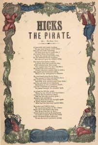
The final public execution in the City took place on July 13, 1860. Sailor and lifelong petty criminal Albert Hicks had joined a three men crew of the E.A. Johnson, a sloop docked on the Hudson River which he knew to be carrying cash for buying oysters in Virginia.
When the vessel approached Staten Island, he grasped an axe, killed his colleagues, stole all money and valuables, and reached the shore in a small rowing boat. When coast guards entered the abandoned and blood-bathed sloop, they just found mutilated body parts.
After a huge manhunt, Hicks was arrested at a boarding house in Providence, Rhode Island, where detectives recovered some of the stolen goods. He was returned to Manhattan and tried for piracy in a Federal Court.
The case created a sensation. Public executions were proscribed by New York State by then, but the federal government had no such ban. New Yorkers wanted Hicks to hang. He was taken to Bedloe’s Island to be executed.
Having undergone a religious conversion in prison, Hicks stepped calmly towards the gallows as if resigned to his fate. He was smartly dressed, wearing his favorite wide-brimmed Kossuth hat down low of one eye. An estimated 12,000 rowdy spectators had turned up to view the display from boats anchored in New York Bay.
Hicks made no gallows speech. Kneeling down for a brief prayer, he spoke his last words. “Hang me quick – make haste.”
The hangman slipped a hood over his head, placed a rope around his neck and pulled the lever. When the weights dropped, Hicks was thrown six meters into the air, his neck snapping at the third vertebra.
The crowd cheered. A quarter of a century later, Bedloe’s Island (renamed Liberty Island in 1956) became home of the Statue of Liberty.
The public spectacle of official physical punishment disappeared from legal proceedings in the aftermath. The word “punish” itself became suspect. The renaming of institutions was evidence thereof.
The slammer became a penal institution; prison was turned into a house of correction. The new name was a euphemism in order to expel memories of a brutal past. Metaphorically at least, it suggested a more humane regime.
Humane Methods
Physician Joseph-Ignace Guillotin was one of ten Parisian deputies in the French Assembly and an advocate of prison reform. In October 1789 he proposed that capital punishment should take place by means of a “painless” mechanism as a first step towards the abolition of the death penalty altogether.
While he did not invent the guillotine, the politician’s name became an eponym for it. He also vowed to make punishment a more private process, but the public was not convinced. A “hidden” execution was considered suspicious.
The first time that the guillotine was applied, the Chronique de Paris reported widespread protests and calls for “Give us back our gallows.”
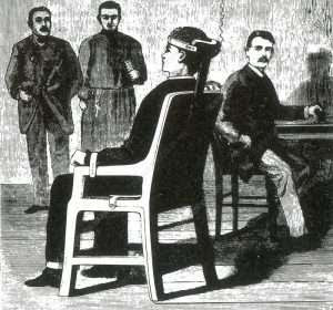
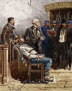
Nearly a century later (1886), New York State established a committee to determine a less cruel system to replace hanging. Dentist Alfred Southwick came up with the idea of putting electric currents through a chair.
A prototype was built by employees of Thomas Alva Edison’s works at West Orange, New Jersey. Edison suggested that the system of alternating current (AC) system, developed by his arch-rival, Serbian-born engineer Nikola Tesla, be applied to for its superior lethal power.
The first person to be executed in this manner was William Kemmler at New York Auburn Prison on August 6, 1890. He descended from a dysfunctional family of German immigrants; William himself was notorious for drinking binges in his Buffalo neighborhood. He murdered his wife Tillie Ziegler with a hatchet.
On the morning of his execution, Kemmler was presented to seventeen witnesses in attendance. The first passage of current through his body lasted seventeen seconds. It caused unconsciousness, but failed to stop his heart.
The generator was re-charged and in a second attempt William was shocked with 2,000 volts. Blood vessels ruptured and his body caught fire. The stench in the death chamber “was unbearable,” according to a report in The New York Times.
The entire process took eight minutes. Those present described the execution as a grotesque and shocking spectacle, one far worse than hanging.
The botched nature of the act in addition to the disputed legal proceedings leading up to Kemmler’s execution caused widespread concern and would contribute to the rise of movements that pleaded for the abolition of capital punishment altogether.
After examining Kemmler’s body, Tesla declared that death by electrocution was “cruel torture” and that the chair should never be used again.
HALLOWEEN EXTRAVAGANZA IN THE OCTAGON LOBBY
Credits
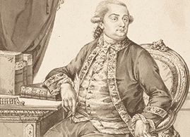
New York Almanack Illustrations from above: Detail of portrait of Cesare Beccaria by Jean-Baptiste-François Bosio, nd (Metropolitan Museum of Art); Contemporary image of a Hanging Day at Tyburn, London; An Enquiry Into the Causes of the Late Increase of Robbers; H. R. Robinson, “Old Bridewell, Manhattan”; A Correct Copy of the Trial and Conviction of Richard Johnson (New York); “Hicks the Pirate,” a murder ballad by H. S. Backus (sung to “The Rose Tree”); Prototype of the first electric chair, 1890; and a contemporary illustration of Kemmler’s execution.
Judith Berdy
All image are copyrighted (c) Roosevelt Island Historical Society unless otherwise indicated THIS PUBLICATION FUNDED BY DISCRETIONARY FUNDS FROM CITY COUNCIL MEMBER JULIE MENIN & ROOSEVELT ISLAND OPERATING CORPORATION PUBLIC PURPOSE FUNDS.
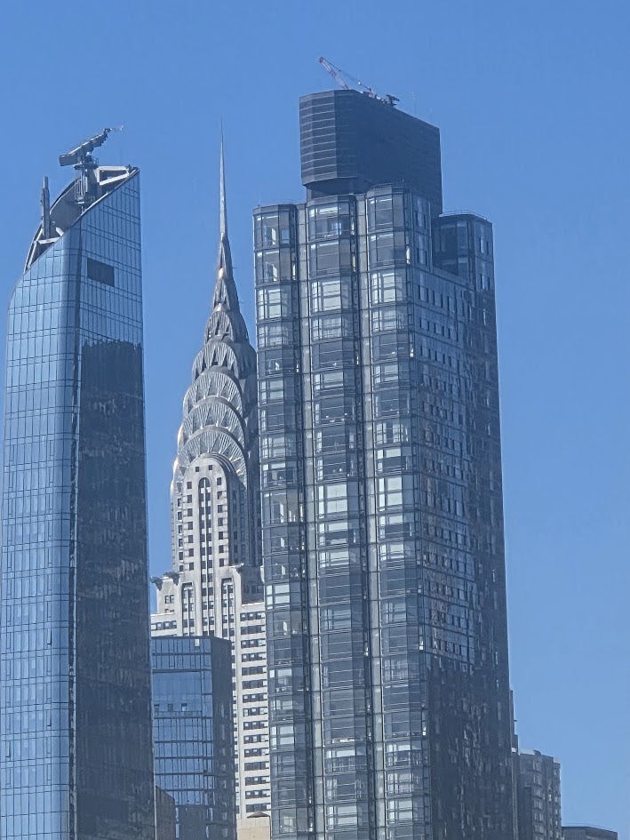
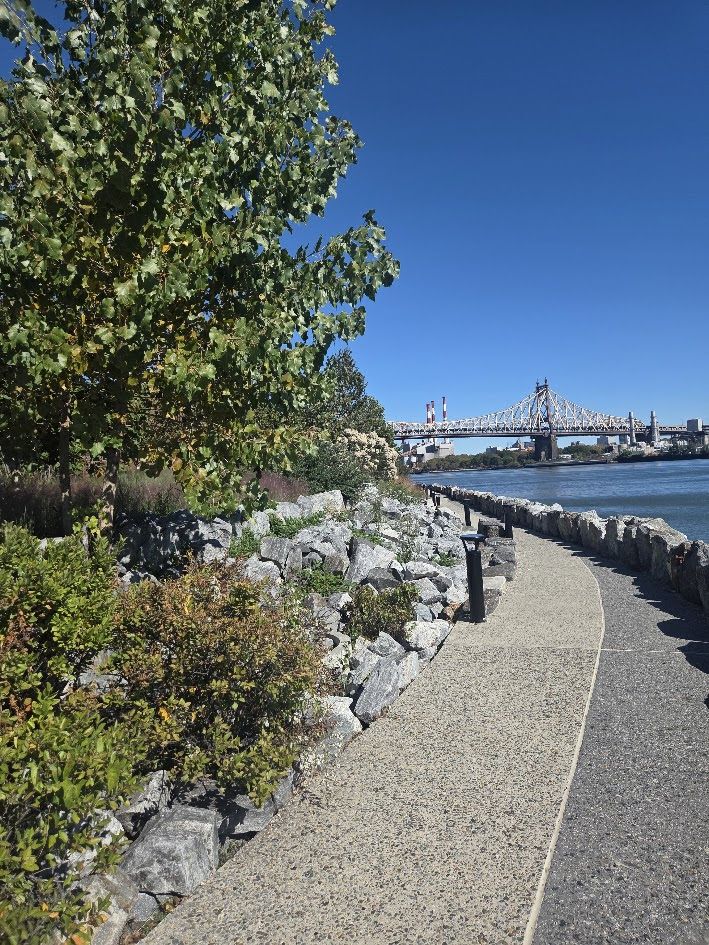
For the second time this month I guided a group of 10 visitors from the Tram to Southpoint Park and the FDR Park.
As with last week’s tour the weather was clear and crisp. I could not resist the image of the grand Chrysler Building surrounded by contemporary towers.
Our visit started out with one of our feline friends who was patrolling the FDR Park.
The entrance to the east walkway is accross from the WFF Cat Sanctuary,
Two tidbits about the path: You notice the dark pavement on the right side. Why? The park was under construction during the pandemic and suddenly RIOC discovered the ADA path was too narrow. Therefore, rocks had to be reomoved and the path widened.
I always have fears that some daring teen will walk the rocks and fall into the river.
Th path is below grade and you are not visible from the east roadway. Also, two exits were planned from the path to the road. They were never installed. This means the only north exit is at the park north exit.
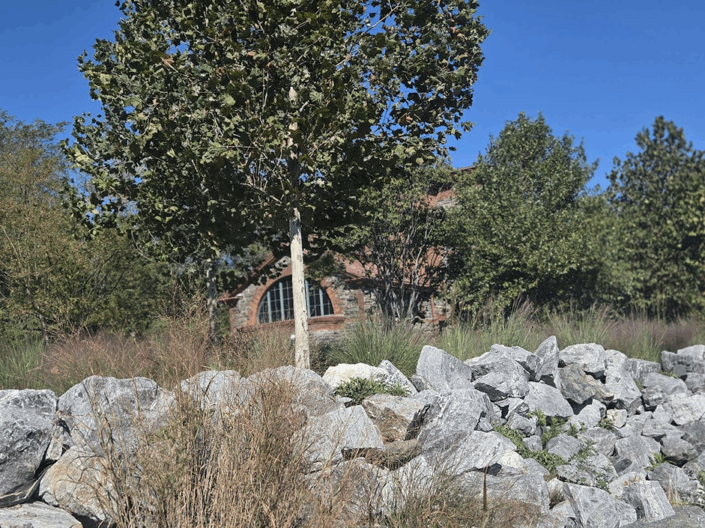
Strecker Laboratory peeking out thru the plantings.
The structure south of Strecker was built to provide emergeny suppor in case of the potential of subway tunnel flooding.
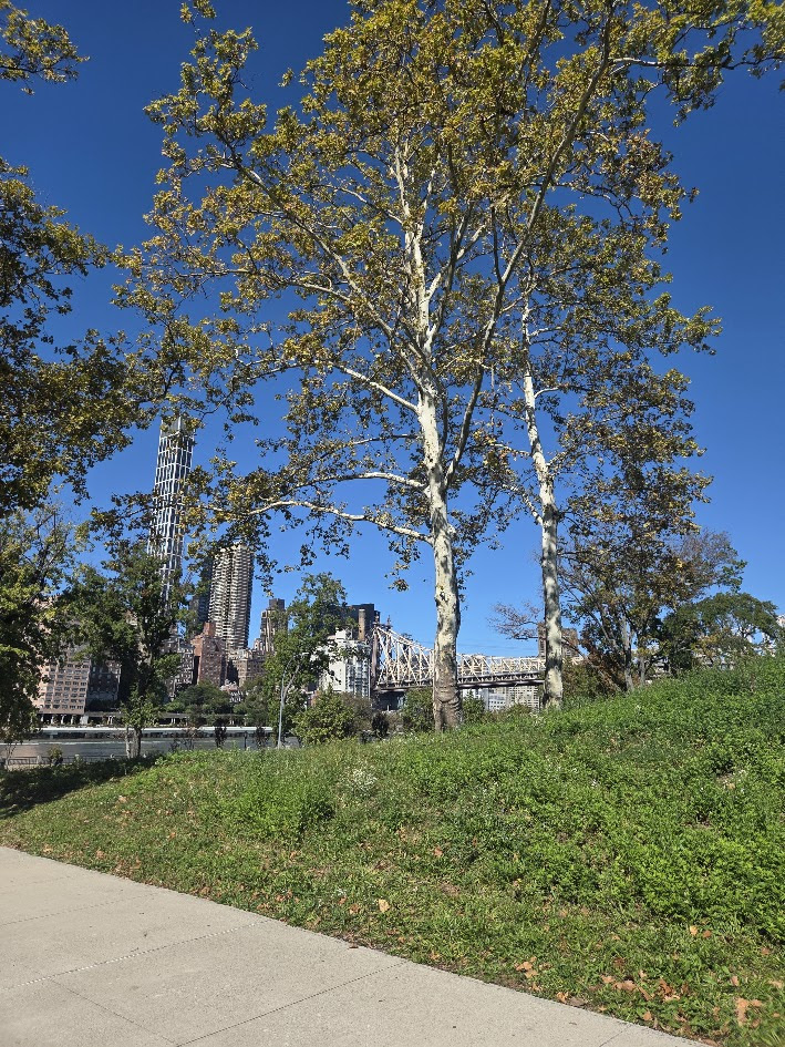
Just the beginning of fall foliage here
Wonderful views are plentiful all along the path. Next time “go east, off the beaten path.”
RIHS/NYPL ROOSEVELT ISLAND AT 50 PROGRAM
NYPL RI Branch Monday, October 20th 6:30 P.M. THE ROOSEVELT ISLAND HISTORICAL SOCIETY & THE NEW YORK PUBLIC LIBRARY
“ROOSEVELT ISLAND AT 50”
Our next program in our 50th anniversary series presents: Non-Profit Island Discussion with Howard Axel and Christina Delfico.
Howard Axel, the CEO of Four Freedoms Park Conservancy responsible for maintaining and operating FDR Four Freedoms Park on Roosevelt Island, NY. Axel is a nonprofit executive committed to bringing the best of business practices to sustainable social impact efforts in the United States. Axel has 13+ years of experience in fundraising, creating and stewarding strategic partnerships, executing marketing and social media-driven crowdsourcing opportunities for non-profits and entertainment brands.
In 2012, Christina Delfico founded iDig2Learn because she recognized the need for a local organization that would connect city children and their families with nature. Leveraging her expertise as an Emmy-nominated children’s media producer, she saw the chance to disconnect children from their screens and get them outside. Developing and facilitating enriching opportunities soon expanded to include spotlighting smart waste reduction practices to support a healthy environment. Today, iDig2Learn creates experiences for all ages and abilities.
HALLOWEEN EXTRAVAGANZA IN THE OCTAGON LOBBY
Credits
Judith Berdy
All image are copyrighted (c) Roosevelt Island Historical Society unless otherwise indicated THIS PUBLICATION FUNDED BY DISCRETIONARY FUNDS FROM CITY COUNCIL MEMBER JULIE MENIN & ROOSEVELT ISLAND OPERATING CORPORATION PUBLIC PURPOSE FUNDS.
In celebration of the 50th anniversary of residents moving to the island, RIOC has partnered with the Roosevelt Island Historical Society to create “RI 50,” a special history panel exhibit at the Tram Plaza. The exhibit consists of two large maps—one of the island in 2025 and one from its original land survey in 1969—and two info graphic panels that detail how the island has developed over the past 5+ decades. The panels tell the story of the island’s rich history, walking visitors back in time to understand how the one-time “Welfare Island” became a serene home to more than 12,000 New Yorkers today.
DYLAN BROWN, BJ JONES AND JUDITH BERDY AT THE CEREMONY REVEALING THE MAPS AND PHOTO PANELS. THANKS TO WONDERFUL COOPERATION WITH RIOC,THIS PROJECT CAME OUT BETTER THAN EVER ANTICIPATED. THIS IS A TRIBUITE TO MUTUAL COOPERATION. THANKS TO ALL WHO WORKED TO MAKE THIS A RED LETTER DAY!
The two panels show photos of Welfare Island in 1969 and Roosevelt Island in 2025.
RIHS/NYPL ROOSEVELT ISLAND AT 50 PROGRAM
NYPL RI Branch Monday, October 20th 6:30 P.M. THE ROOSEVELT ISLAND HISTORICAL SOCIETY & THE NEW YORK PUBLIC LIBRARY
“ROOSEVELT ISLAND AT 50”
Our next program in our 50th anniversary series presents: Non-Profit Island Discussion with Howard Axel and Christina Delfico.
Howard Axel, the CEO of Four Freedoms Park Conservancy responsible for maintaining and operating FDR Four Freedoms Park on Roosevelt Island, NY. Axel is a nonprofit executive committed to bringing the best of business practices to sustainable social impact efforts in the United States. Axel has 13+ years of experience in fundraising, creating and stewarding strategic partnerships, executing marketing and social media-driven crowdsourcing opportunities for non-profits and entertainment brands.
In 2012, Christina Delfico founded iDig2Learn because she recognized the need for a local organization that would connect city children and their families with nature. Leveraging her expertise as an Emmy-nominated children’s media producer, she saw the chance to disconnect children from their screens and get them outside. Developing and facilitating enriching opportunities soon expanded to include spotlighting smart waste reduction practices to support a healthy environment. Today, iDig2Learn creates experiences for all ages and abilities.
Our limited edition holiday card is available at a special early shopper price of 2 cards for $5- While supplies last!
PHOTO OF THE DAY
(NISI IS BACK WITH A CUSTOMER FRIENDLY MENU) SALT SHAKERS HAVE RETURNED
Credits
RIHS
All image are copyrighted (c) Roosevelt Island Historical Society unless otherwise indicated THIS PUBLICATION FUNDED BY DISCRETIONARY FUNDS FROM CITY COUNCIL MEMBER JULIE MENIN & ROOSEVELT ISLAND OPERATING CORPORATION PUBLIC PURPOSE FUNDS.
Join RIOC and RIHS for a Special “RI 50” Exhibit Unveiling Ceremony at Tram Plaza on Wednesday, October 15th at 1PM
In celebration of the 50th anniversary of residents moving to the island, RIOC has partnered with the Roosevelt Island Historical Society to create “RI 50,” a special history panel exhibit at the Tram Plaza. The exhibit consists of two large maps—one of the island in 2025 and one from its original land survey in 1969—and two info graphic panels that detail how the island has developed over the past 5+ decades. The panels tell the story of the island’s rich history, walking visitors back in time to understand how the one-time “Welfare Island” became a serene home to more than 12,000 New Yorkers today.
Join us for the unveiling next to the Visitor Center TOMORROW, Wednesday, October 15th, at 1 PM — we’d love to see you there!
Back at the Tram Lawn the Map Project panels were installed and awaiting the reveal on Wednesday, October 15th at 1 p.m.
Come for the event and learn 50+ years of island history
Our limited edition holiday card is available at a special early shopper price of 2 cards for $5- While supplies last!
Save the Date Wednesday, October 15th 1 p.m. at the Tram Lawn for the Revealing of the “Roosevelt Island 1969-2025 Maps and Images”
Credits
JUDITH BERDY
All image are copyrighted (c) Roosevelt Island Historical Society unless otherwise indicated THIS PUBLICATION FUNDED BY DISCRETIONARY FUNDS FROM CITY COUNCIL MEMBER JULIE MENIN & ROOSEVELT ISLAND OPERATING CORPORATION PUBLIC PURPOSE FUNDS.
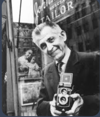
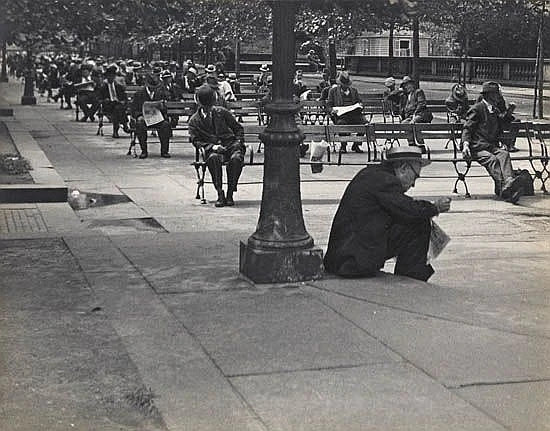
John Albok saw much loss early in his life. Born in Hungary in 1894, he was drafted into war, then returned home to learn that two of his sisters died of starvation and his father had committed suicide
He may have been able to get through these tragedies by focusing on his passion: photography.
As a 12-year-old, he acquired his first camera, a Kodak Brownie. He took photos during his army years, documenting scenes from prisons and hospitals, according to New York University’s digital library. But his family had no funds to spend on art school. Instead he was apprenticed to a tailor.
In 1921 he immigrated to New York City, opening a tailor shop at 1392 Madison Avenue, between 96th and 97th Streets. Now married, Albok, his wife, and his daughter lived in an upstairs tenement apartment for the next six decades, witnessing waves of demographic change on the border of the Upper East Side and East Harlem.
From his shop, he began taking pictures—turning a compassionate, sensitive eye toward the sidewalks and streets in all seasons outside his front window.
“For 60 years, using a 5 x 7 view camera and then a twin lens reflect camera, Albok took as his subject people and passersby outside his shop, and New York City life during the Depression, and World War II,” per NYU. “Central Park, children, street scenes, and people at leisure were also among his preferred subjects.”
He described his Depression-era photos as a way to combat the degradation of poverty. “I photographed many poor souls, trying my best to leave them their most precious heritage—their dignity,” he said. “There is nothing else left.”
His work as a tailor occupied his days. “At night, he used the small shop as a darkroom to develop his pictures, many of them taken through the shop’s window,” wrote the New York Times.
Albok didn’t only capture images on Madison Avenue. He roamed the city for subjects, sometimes not returning home until early the next morning, much to the consternation of his wife. Labor protests and antiwar activism sparked his interest, as did day-to-day life among the Hungarian immigrant community then concentrated around East 79th Street.
Critical acclaim for his images came in the late 1930s. A curator at the Museum of the City of New York (MCNY) mounted a solo exhibit titled “Faces of the City.”
Through the next decades he had occasional exhibits, published photos in art journals, and was the subject of two documentaries.
Framed photos he had taken also hung from the walls of his shop, “peeking out from behind the garments hanging from the ceiling,” reported the New York Daily News in 1968.
This gentle tailor (at right, in the 1970s) found himself and his work rediscovered in the early 1980s, per NYU.
Another MCNY show, “Tailored Images,” was put together. One day before this retrospective exhibit was to open in 1982, Albok died at age 87.
Albok was still residing in the tenement apartment above the shop that provided a window to the wonder and pathos of New York City life—glimpsed in these and thousands of other poetic images.
In a 1966 Daily News piece, he explained what might sum up his drive to chronicle the humanity in the city: “Wherever there is people there is pictures because there is life.”
Back at the Tram Lawn the Map Project panels were installed and awaiting the reveal on Wednesday, October 15th at 1 p.m.
Come for the event and learn 50+ years of island history
Our limited edition holiday card is available at a special early shopper price of 2 cards for $5- While supplies last!
Save the Date Wednesday, October 15th 1 p.m. at the Tram Lawn for the Revealing of the “Roosevelt Island 1969-2025 Maps and Images”
CREDIT TO
Ephemeral New York
All image are copyrighted (c) Roosevelt Island Historical Society unless otherwise indicated THIS PUBLICATION FUNDED BY DISCRETIONARY FUNDS FROM CITY COUNCIL MEMBER JULIE MENIN & ROOSEVELT ISLAND OPERATING CORPORATION PUBLIC PURPOSE FUNDS.
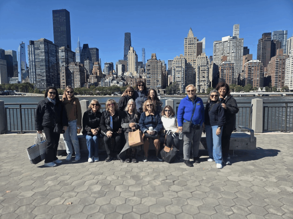
Thursday was a perfect day for a tour of the south end of the island. With a group of 11 women,leisurely walked from the kiosk to the FDR Park.
It is always fun to read the engraved stones at the Hope Memorial. A good lesson in lsland History a few feet at a time.
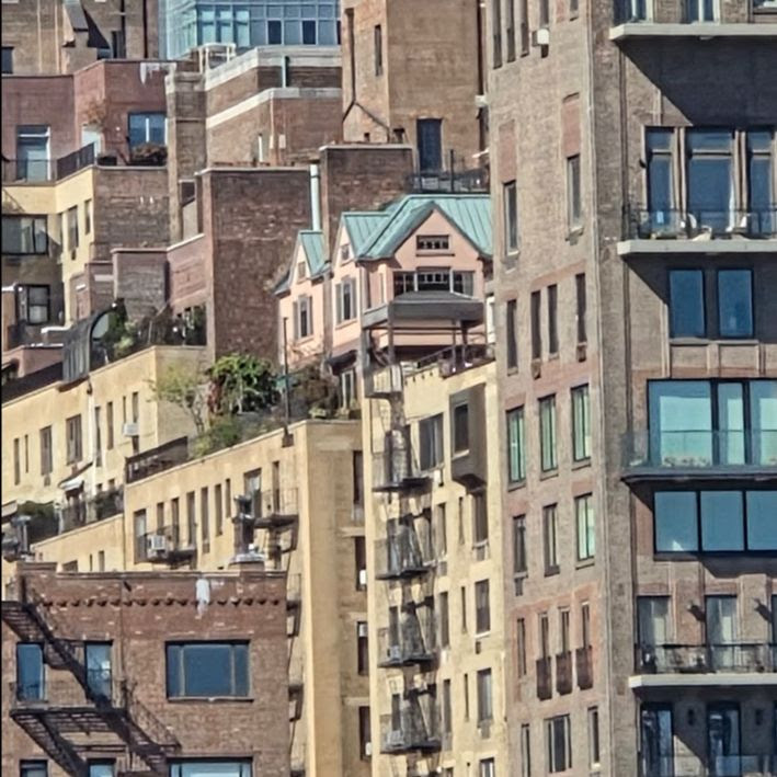
Find the pink house? My favorite thing to do. Usually people spot it.
Here it is. On top of an apartment building. Rumor is that it was once the home of John Lennon.
The new (2023?)_ lookout is perfect for a group photo
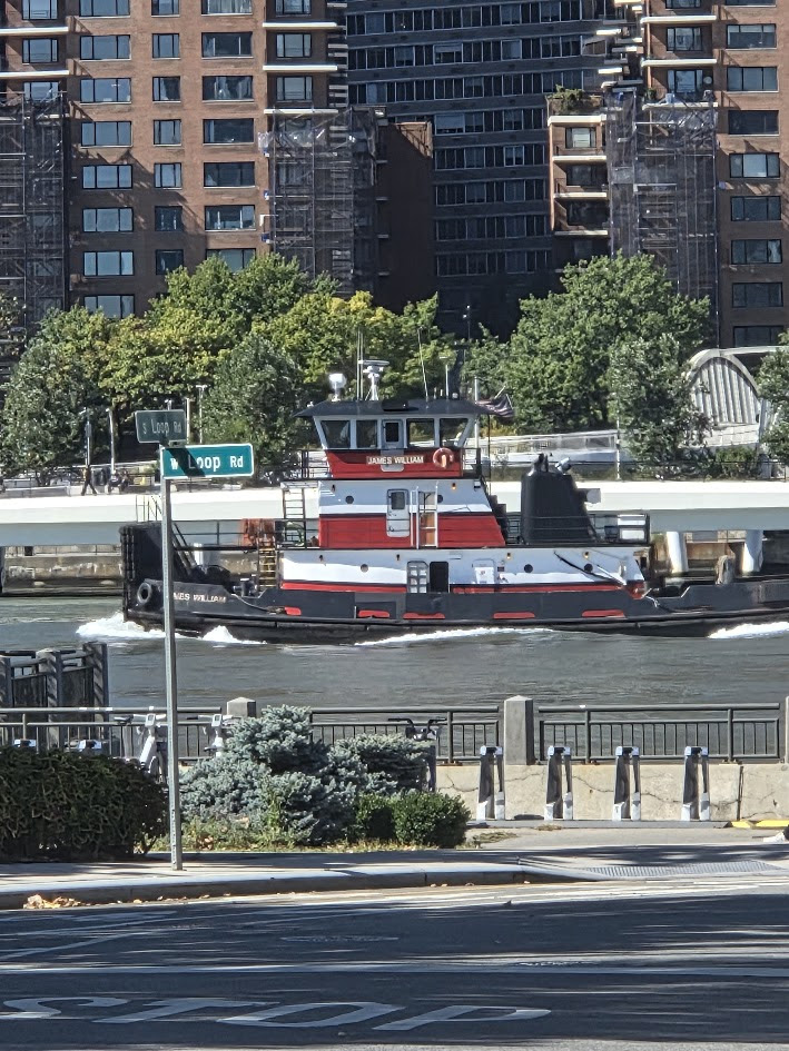
Never tired of seeing tugs in the river.
Walking home, really waiting for the RED BUS, was a perfect view west.
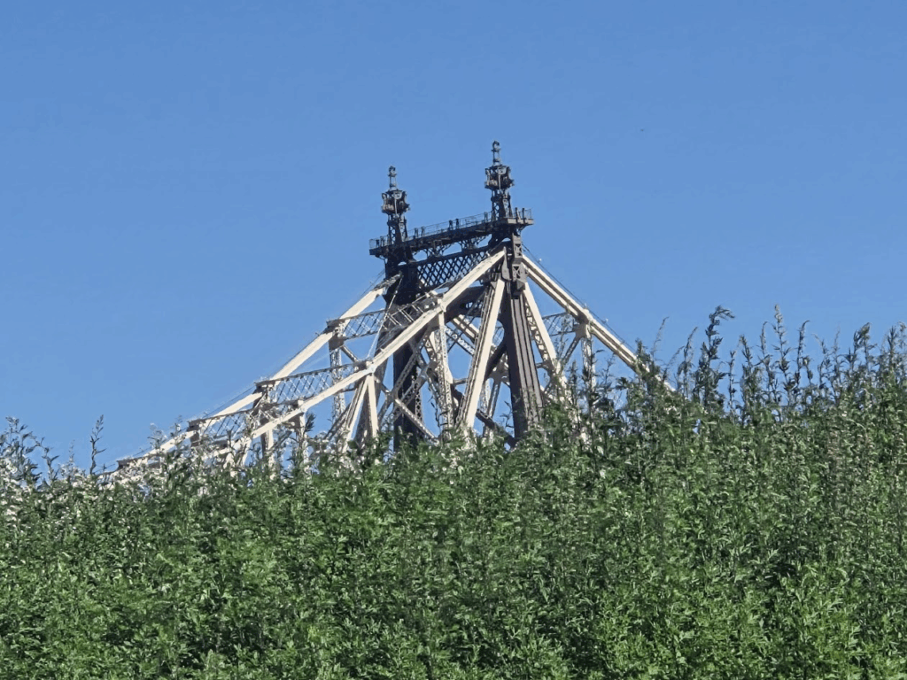
There seems to be no way to take a bad photo of the Bridge.
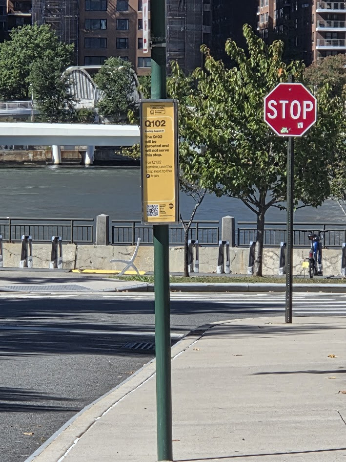
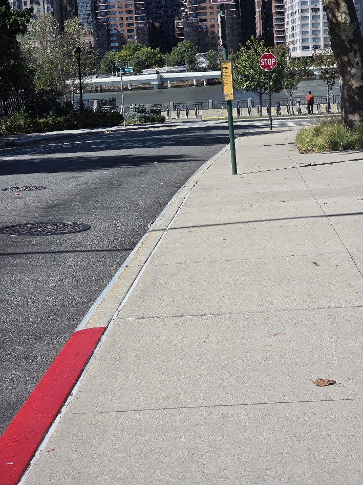
Though the Q102 no longer stops at Southpoint the RED BUS still does.
RIOC…How about a bench at this bus stop. My feet were aching and many visitors would welcome a bench while waiting.
Back at the Tram Lawn the Map Project panels were installed and awaiting the reveal on Wednesday, October 15th at 1 p.m.
Come for the event and learn 50+ years of island history
Our limited edition holiday card is available at a special early shopper price of 2 cards for $5- While supplies last!
Save the Date Wednesday, October 15th 1 p.m. at the Tram Lawn for the Revealing of the “Roosevelt Island 1969-2025 Maps and Images”
Credits
Judith Berdy
All image are copyrighted (c) Roosevelt Island Historical Society unless otherwise indicated THIS PUBLICATION FUNDED BY DISCRETIONARY FUNDS FROM CITY COUNCIL MEMBER JULIE MENIN & ROOSEVELT ISLAND OPERATING CORPORATION PUBLIC PURPOSE FUNDS.
By T.M. Brown Published Sept. 30, 2025 Updated Oct. 1, 2025
ISSUE #1551
We first reported on this colorful house in our September 17th issue. Here is the update from the NY Times.
Times Insider explains who we are and what we do and delivers behind-the-scenes insights into how our journalism comes together.
“An acid trip in house form.”
That was how my editor on the Real Estate desk, Matthew Oshinsky, described the “ridiculous” house in Astoria, Queens, that he was proposing I cover a few months ago.
The exterior of the home, I found out, was painted a painfully mismatched butter yellow and fire-engine red. A surrounding wrought-iron gate was emblazoned with metal flowers in the same mustard-and-ketchup color scheme. The interior was just as outlandish: sofas and chandeliers in all the colors of the rainbow and a fake cherry blossom tree sprouting from the living room floor.
I began my reporting by searching for the property owner’s name. Eventually, I found a name, Jasmin Bokhari, and it appeared she owned other properties across the borough. So I typed three words into Google: “Jasmin Bokhari Queens.”
The first result shocked me. It was a 2023 news release from the U.S. attorney’s office, Eastern District of New York, saying that someone named Rashidun Bokhari from Astoria had been convicted of embezzling more than a million dollars from three people, also Bengali Americans, in a real estate scam. Mr. Bokhari was ordered to serve 38 months in a federal prison facility and pay restitution of nearly $1.5 million to his victims. He is also Jasmin Bokhari’s husband.
I searched for both of their names and discovered a civil suit that predated the criminal trial by a year. In the suit, the plaintiff alleged that Ms. Bokhari had knowledge of her husband’s misdeeds, and that she had used an LLC she owned to obscure how the embezzled funds were being used. The civil case had been halted in 2022 while the criminal court process had played out.
I thought it was suspicious that a woman named in a pending lawsuit was trying to sell a property for $3 million while her husband claimed he couldn’t afford to pay back the people he had admitted to stealing from. I wanted to find out whether Mr. Bokhari’s victims were at risk of never being paid back, and if Ms. Bokhari was trying to sell these properties before the government could seize them.
Several properties owned by Ms. Bokhari had been passed back and forth among her, her husband and other family members over the past two decades. Nearly every deed transfer was done for “no consideration,” a real estate term for homes changing hands for free. I called a forensic accountant, who told me that people sometimes use this maneuver to hide assets and avoid scrutiny from law enforcement.
I called Neal Fellenbaum, the lawyer representing Aslam Ansari, the plaintiff in the civil suit, who said that the Bokharis had defrauded more than a dozen other people in the Bangladeshi community in Queens. Those people were reluctant to come forward because they were frightened of U.S. Immigration and Customs Enforcement actions across the country.
Convincing those unidentified accusers to be interviewed for my article was a delicate process. There was a fear of the government, sure, but many were also embarrassed and ashamed that they could be fooled by someone from their own tight-knit community. I assured them I would protect their identities, and I told them that this would be a way to tell their stories safely. When they finally agreed to being interviewed, we set up a meeting in Mr. Fellenbaum’s office
I arrived early with the photographer, Thea Traff, who would later shoot silhouetted portraits of each person. I wasn’t sure how many accusers would actually show up; I was anxious that it would only be one or two. But as we sat in the glass-walled conference room, a group of nine men and women walked into the office vestibule together.
“I am ashamed, I am a fool,” one man told me, his voice shaking. I sat across from him as he told me how he’d been deceived by someone he had known for decades.
I asked the group why they had decided to talk to me after suffering in silence for so long. A few said they’d been scammed by the Bokharis in the last few years, while others had money stolen a decade ago. “It’s a good question,” one man said. He paused for a moment. “I don’t have any hope left. I need my money back. I just want to be able to give something to my daughter.”
I worked on this article, which was published online on Sept. 16, for three months. In that time, I never had the opportunity to speak with the Bokharis or their lawyers, who refused to return my many calls. But I could sense that they knew something was happening. The price on the flamboyant home that Ms. Bokhari was selling was reduced by $500,000, from $3 million to $2.5 million. Then the government slapped a lien on both that house and another property in Jamaica, Queens, owned by Ms. Bokhari for the amount that Mr. Bokhari had been ordered to repay his victims.
After the article was published, Mr. Fellenbaum called me. He told me that the story had apparently caused a national sensation, albeit not in the United States. “It was all over the TV news in Bangladesh,” he said.
Our limited edition holiday card is available at a special early shopper price of 2 cards for $5- While supplies last!
Save the Date Wednesday, October 15th 1 p.m. at the Tram Lawn for the Revealing of the “Roosevelt Island 1969-2025 Maps and Images”
Credits
NY Times Judith Berdy
All image are copyrighted (c) Roosevelt Island Historical Society unless otherwise indicated THIS PUBLICATION FUNDED BY DISCRETIONARY FUNDS FROM CITY COUNCIL MEMBER JULIE MENIN & ROOSEVELT ISLAND OPERATING CORPORATION PUBLIC PURPOSE FUNDS.