
Tuesday, September 9, 2025 – LOOKING AT MILESTONES TO SEE HOW FAR TO TRAVEL

Tracking the 19th century granite milestones that marked the distance
from
City Hall to Upper Manhattan
Tuesday, Sept. 9, 2025
Ephemeral New York
Issue # 1529
If you lived or worked in the Gramercy area in the early decades of the 20th century, you probably passed it by without much thought
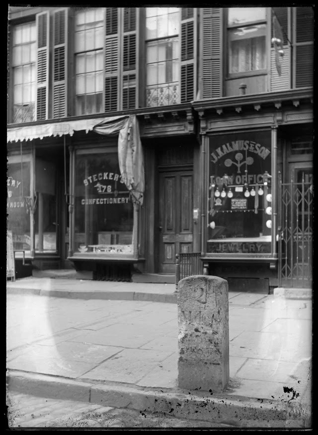
Amid modern transportation infrastructure like traffic lights, lampposts, and street signs stood a faded granite slab embedded in the sidewalk on Third Avenue near 17th Street.
What was this tombstone-like relic? New Yorkers of the era would have known it as one of Manhattan’s last milestones.
Milestones, or mile markers, helped travelers keep track of how many miles they were from City Hall as they traversed the primitive, unlit, often dangerous roads of a sparsely populated city.
Until the urbanization of the bulk of Manhattan Island in the late 19th century, milestones were often the only directionals a horseman or stagecoach driver had as they journeyed up or down one of Manhattan’s few north-south roads.
Taverns popped up around them; owners knew that weary travelers might need a hearty meal and a place to sleep before continuing in or out of the city. These “heirlooms of the past,” as one article called the milestones, were so critical, laws punished those who defaced them.
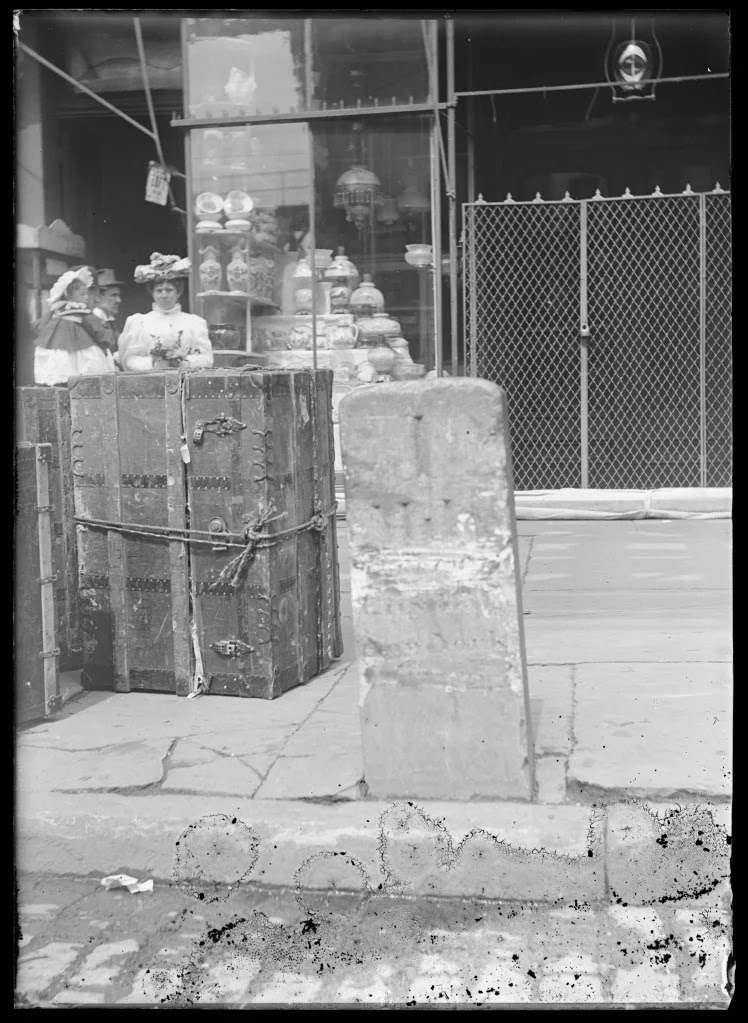
Mile marker 2, seen in the first three photos in this post, was one of 12 embedded along the Boston Post Road—a former Native American trail that ran from the Battery along the East Side and into the Bronx. Eventually subsumed by the conformity of avenues outlined in the Commissioner’s Plan of 1811, Boston Post Road roughly aligns with today’s Third Avenue.
Milestones also existed on the Bloomingdale Road, the colonial thoroughfare that began at 23rd Street and followed a path through today’s Upper West Side. Unlike the Boston Post Road mile markers, none of the Bloomingdale Road’s markers appear to have survived into the 20th century.
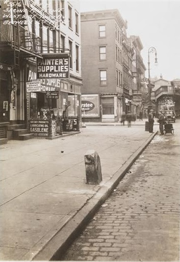
When mile marker 2 was removed from its longtime location on Third Avenue isn’t clear. The first photo, from 1900, reveals a chunk of granite that’s not in bad shape. The second image, from 1931, shows a closeup of a more battered milestone.
By the time the third photo was taken in 1936, it almost looks like trash on the curb waiting to be carted away. Which may have actually happened; the circumstances of its demise isn’t known.
But the fact that it managed to survive into the 1930s is astonishing. I’d attribute it to a combination of the sentimentality some New Yorkers had for ye olde days of Gotham, as well a benign neglect. After outliving its usefulness, most New Yorkers just ignored it.
The two-mile marker’s century-plus lifespan makes me wonder: What happened to the other 11 milestones that dotted Manhattan in today’s Midtown, Yorkville, and Inwood?
According to the City History Club, which in the early 1900s gained guardianship over the remaining mile markers, “some of the milestones have disappeared, while others have had a varied experience.” This includes destruction, theft, removal to a safe private yard, and getting wiped from the cityscape in the interest of “public improvement.”
Tracing the fate of these relics hasn’t been easy. But records and archives give us some information to go on.
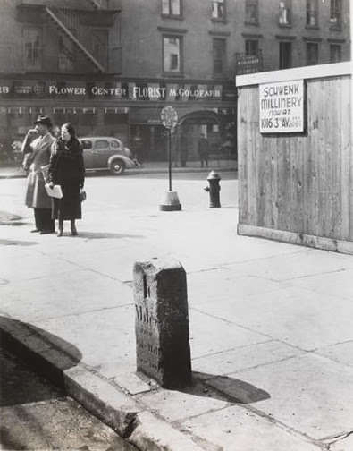
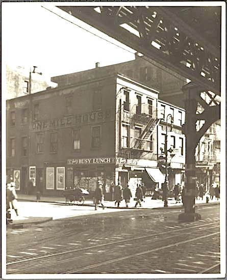
In 1904, just three of the original milestones still existed, according to a New York Times article from that year. These included mile marker 2 as well as mile marker 1, which stood in front of 213 Bowery near Rivington Street (fourth photo, from 1897).
Incredibly, the one-mile marker existed at its original Bowery location until 1926, when a truck destroyed it, according to Kevin Walsh writing in Splice Today in 2024. Keeping its memory alive was a 20th century tavern at this location called the One Mile House (see the lettering on the side of the building), visible in the photo below from 1932.
The other mile marker survivor per the Times was at Third Avenue just above 57th Street (possibly in the fifth photo). When and how that one got the boot is a mystery.
Ah, but wait! The Times article didn’t mention the two Boston Post Road mile markers that actually still exist in Manhattan to this day.
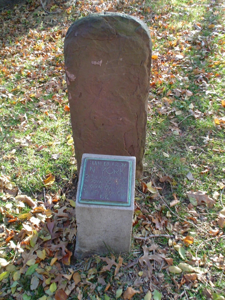
One, mile marker 11, originally stood at 189th Street. In 1912, the City History Club moved this weathered artifact to the safety of Roger Morris Park (below), which surrounds the circa-1765 Morris-Jumel Mansion on Jumel Terrace in Washington Heights.
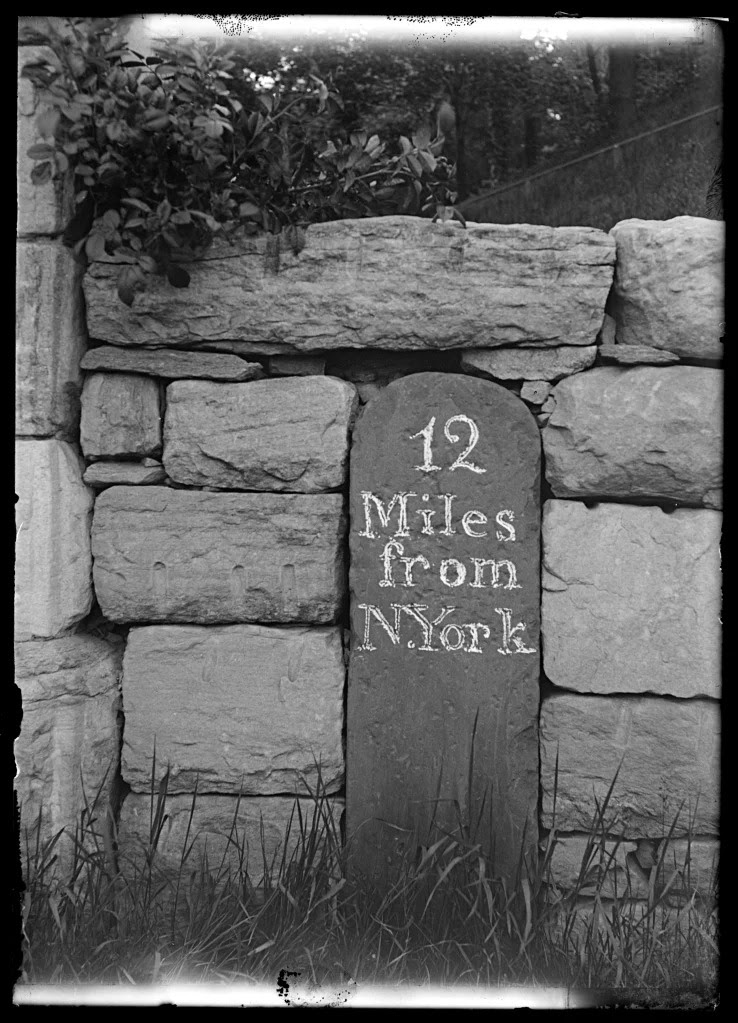
Mile marker 12 is the only milestone still visible on a city street. Its original location was at Hawthorne Street (now 204th Street) near Broadway. Workers building a mansion for wealthy merchant William Isham wanted to trash this relic, but Isham had it preserved as part of a stone gate at the entrance to his estate.
In 1911, Isham’s daughter donated to the city the land her father’s mansion once occupied, intending it to become a public park. That 12th mile marker is still built into the stone entrance that now marks Isham Park in Inwood.
Brooklyn and Queens had mile markers as well. One in Brooklyn remains (or remained? I haven’t seen it lately) on Avenue P and Ocean Parkway. In Bensonhurst, Milestone Park contains a replica of an 18th century milestone that once marked the distance to the ferries to Manhattan and Staten Island.
BEFORE THE FDR FOUR FREEDOMS STATE PARK,
THE SOUTHPOINT
WITH THE DELACORTE GEYSER IN THE 1980’S
Credits
EPHEMERAL NEW YORK
[Top photo: New York Historical; second photo: MCNY, X2010.11.10060; third photo: MCNY, X2010.11.10059; fourth photo: New York Historical; fifth photo: MCNY, X2010.11.10061; sixth photo: MCNY, 33.173.55; seventh photo: NYC Parks; eighth photo: New York Historical]
Tags: Colonial NYC Mile Markers, End of the Mile Markers in New York City, Granite Milestones in Manhattan, Mile Markers of New York City, Milestones Boston Post Road NYC, Milestones of New York City, Only Milestone on Street today in NYC, What Happened to the MIlestones of New York City
Posted in Random signage, Transit
JUDITH BERDY
All image are copyrighted (c) Roosevelt Island Historical Society unless otherwise indicated
THIS PUBLICATION FUNDED BY DISCRETIONARY FUNDS FROM CITY COUNCIL MEMBER JULIE MENIN & ROOSEVELT ISLAND OPERATING CORPORATION PUBLIC PURPOSE FUNDS.

Copyright © 2025 Roosevelt Island Historical Society, All rights reserved.Our mailing address is:
rooseveltislandhistory@gmail.com
Leave a comment