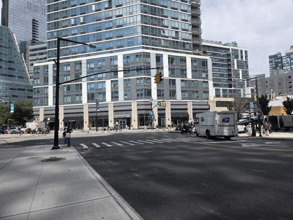
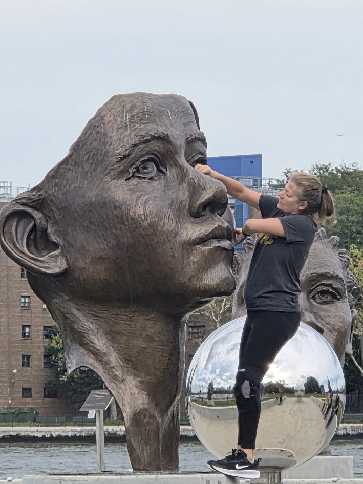
I was off to test the new Q102 route from the Island to Court Square. On weekends there are just 2 buses an hour leaving the subway station at 15 and 45 minutes past the hour. The bus stops at the 546 Main Street stop. The 12:45 bus arrived with just one other passenger on it.
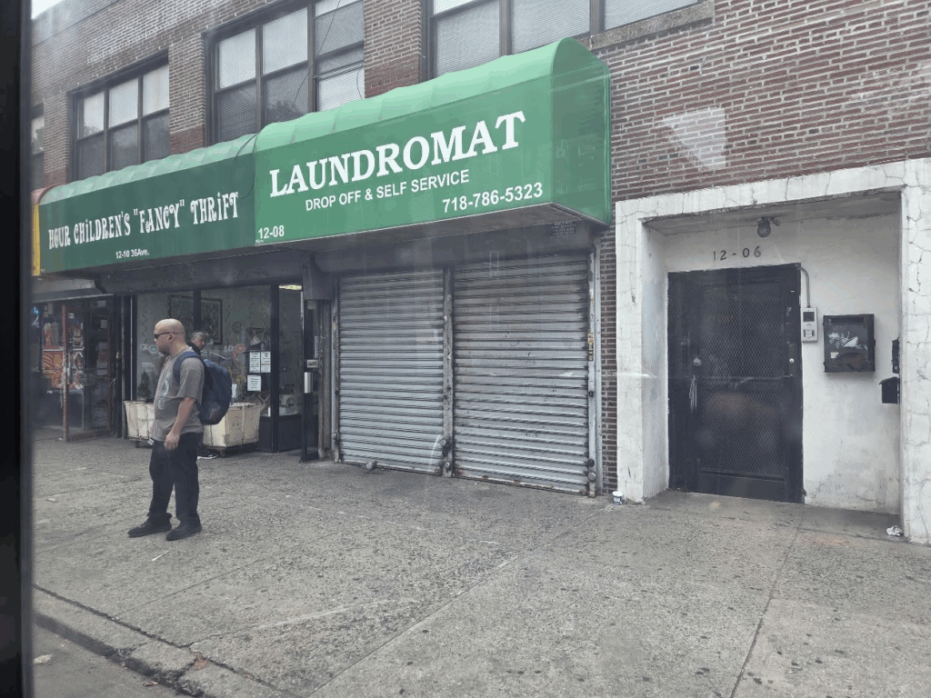
Proceeding east on 36th Avenue, the second stop is at 12th Street. This is a great location to get off and make a donation to the Hour Children Thrift Shop.
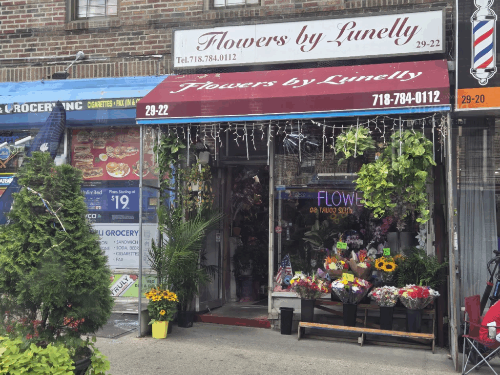
Being a holiday most shops were closed. Just before turning onto 31st Street, we passed Flowers by Lunelly, a great florist that has supplied wonderful and creative arrangements for many island events.
Being a holiday, the intersection between Northern Blvd, Queens Plaza and the bridge entry was quick. This intersection will be a challenge weekdays.
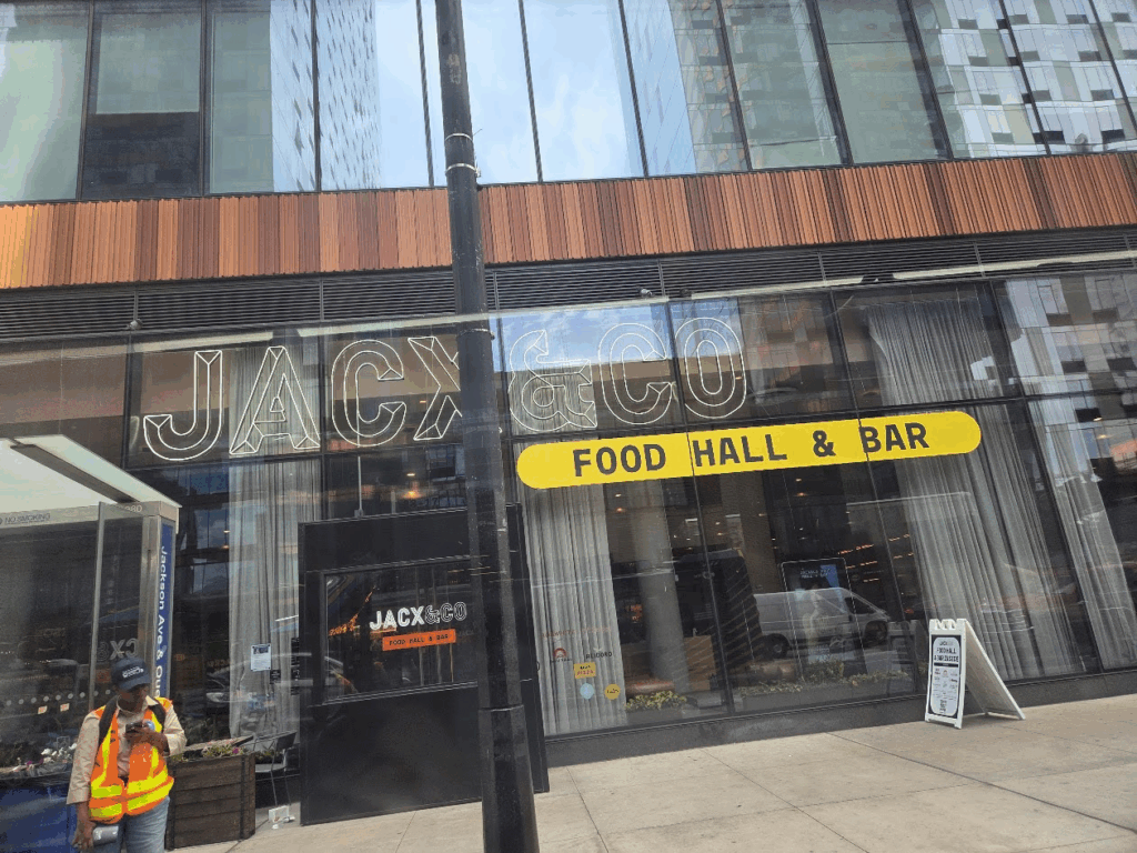
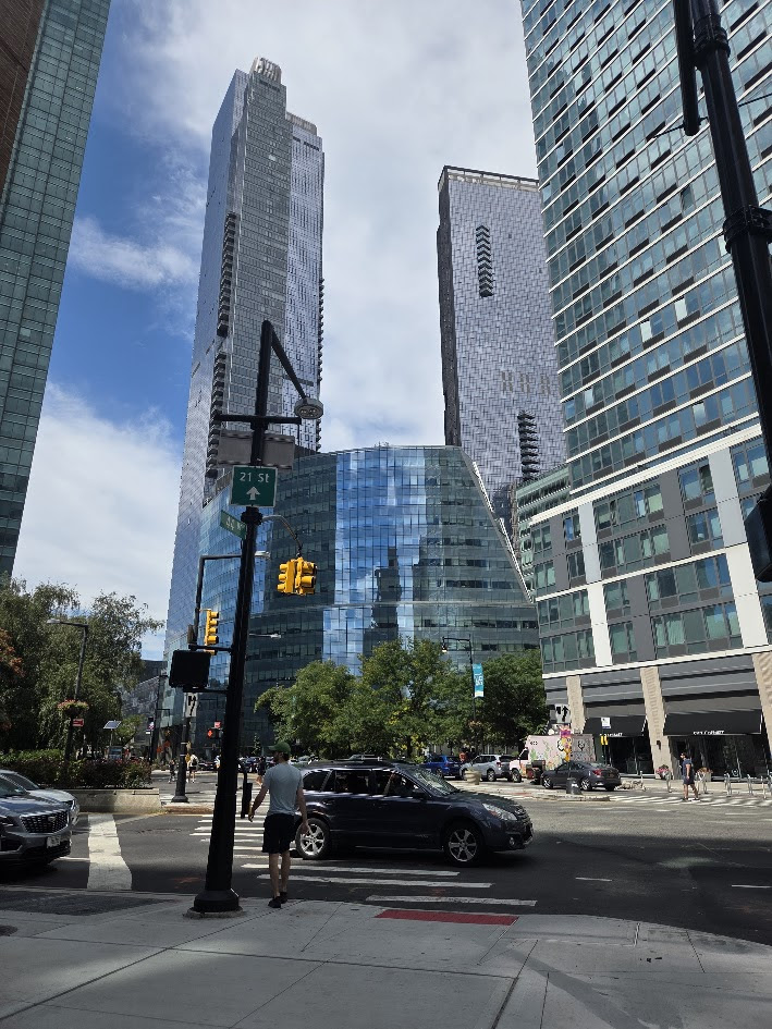
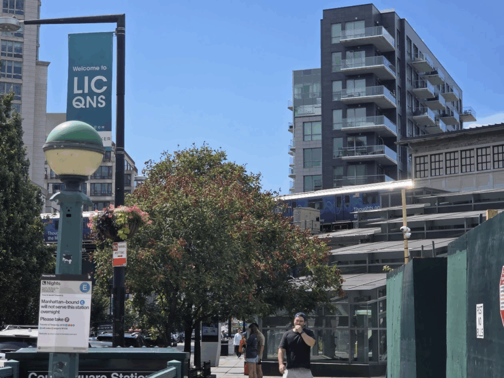
The 7 train is a few block walk from the N & R train at Queens PlazaOnce on Jackson Avenue, we were in the new skyscraper world of Long Island City. Jacx & Co, a giant food hall is the first dining spot on the avenue. Accross the street is al Murray’s Cheese, Serafina and a Chipolte. No longer an industrial area there are multiple dining spots may Asian.
The bus route ends at 44th Drive and Jackson Avenue. (The return starts at 43rd Avenue and Jackson Avenue)
It takes time to adjust to the neighborhood. Until recently the only hi-rise was Citi-Corp, now it is surrounded by other buildings. There is still a park in front of the building. There is a Target store on the other side of the building.
The grand courthouse is accross the street partially hidden by construction on the plaza outside the building.
On the next block is Teso-Life, (from Google)Teso is a Japanese lifestyle store owned by a Chinese entrepreneur, as reflected in the presence of Chinese characters throughout the store. They carry a wide selection of Korean and Japanese skincare, haircare, makeup, and food.
The E train station is on the corner.
One of the few vacant areas has a sign posted that another monster hi-rise will soon appear. (Is there any planning or zoning in Queens?)
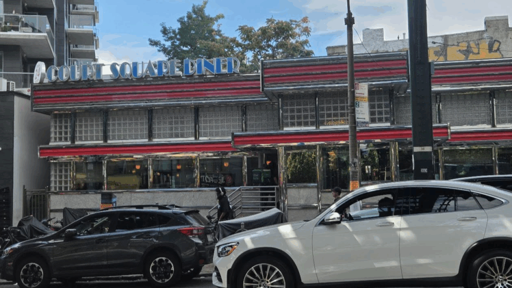
One remnant of old LIC remains on the corner 23rd Street.
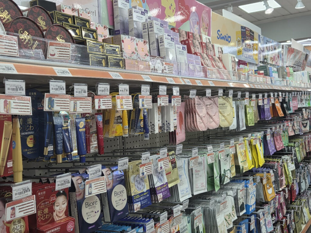
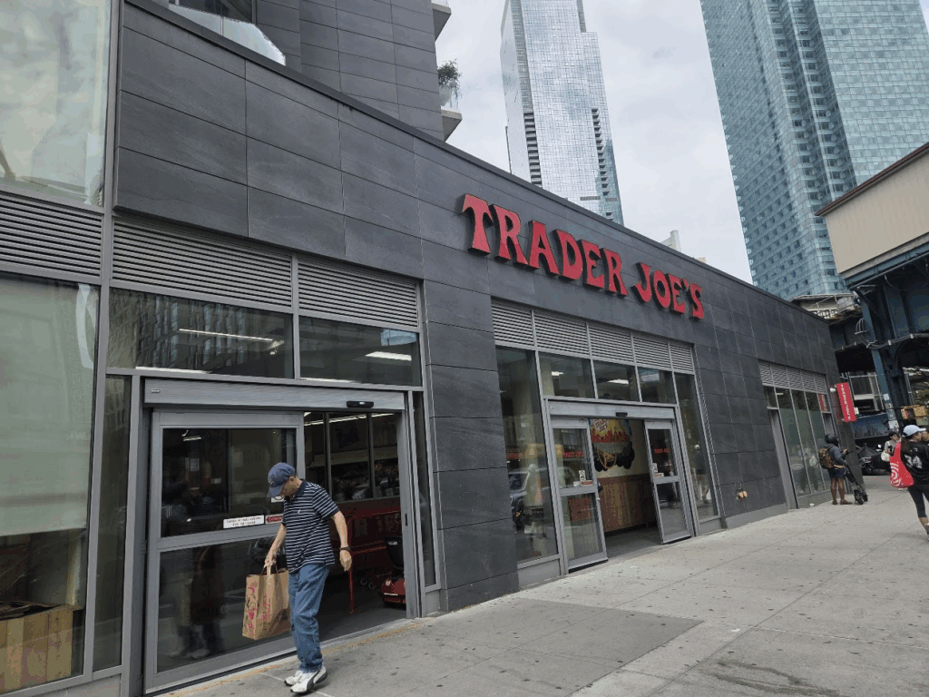
Next to the G train station and my destination was reached after a 10 minute walk from the bus stop. The store was crowded, but still easy to be in and out in less than an hour. An Uber ride seemed the best idea to bring my purchases home.
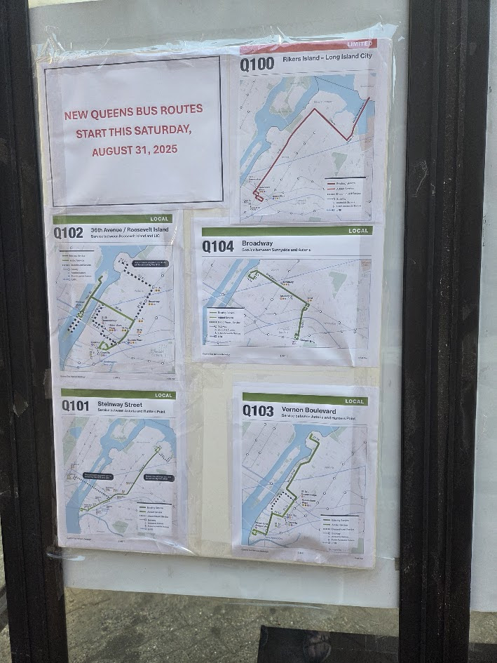
OUR QUEENS BUS ROUTES WE HAVE POSTED THE NEW ROUTE MAPS ON THE BACK OF THE CHAPEL BUS SHELTER
Saturday was escape day to Atlantic City with a group from our CBN Center. Trip was sponsored by RIDA. A day of fun in the sun!!
Credits
Judith Berdy
All image are copyrighted (c) Roosevelt Island Historical Society unless otherwise indicated THIS PUBLICATION FUNDED BY DISCRETIONARY FUNDS FROM CITY COUNCIL MEMBER JULIE MENIN & ROOSEVELT ISLAND OPERATING CORPORATION PUBLIC PURPOSE FUNDS.
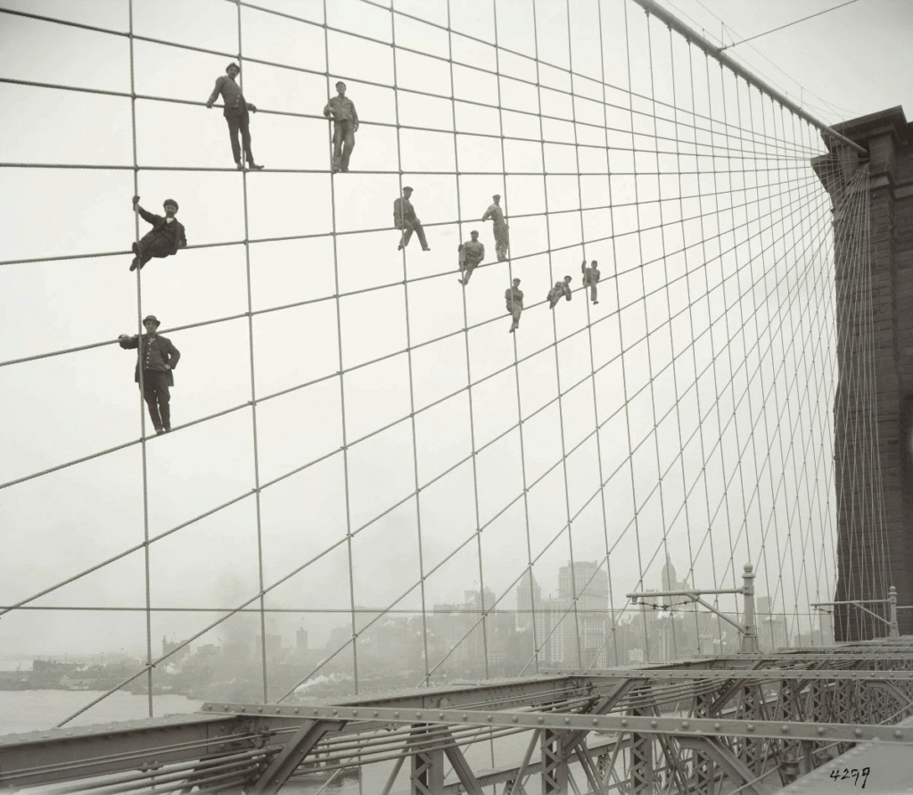
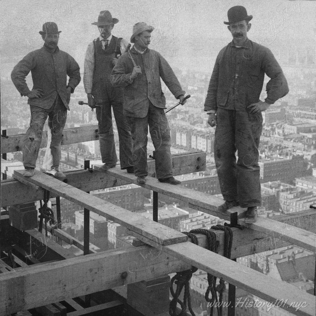
Brooklyn Bridge, showing painters on suspenders, October 7, 1914. Photo by Eugene de Salignac, Department of Bridges/Plant & Structures Collection. NYC Municipal Archives.
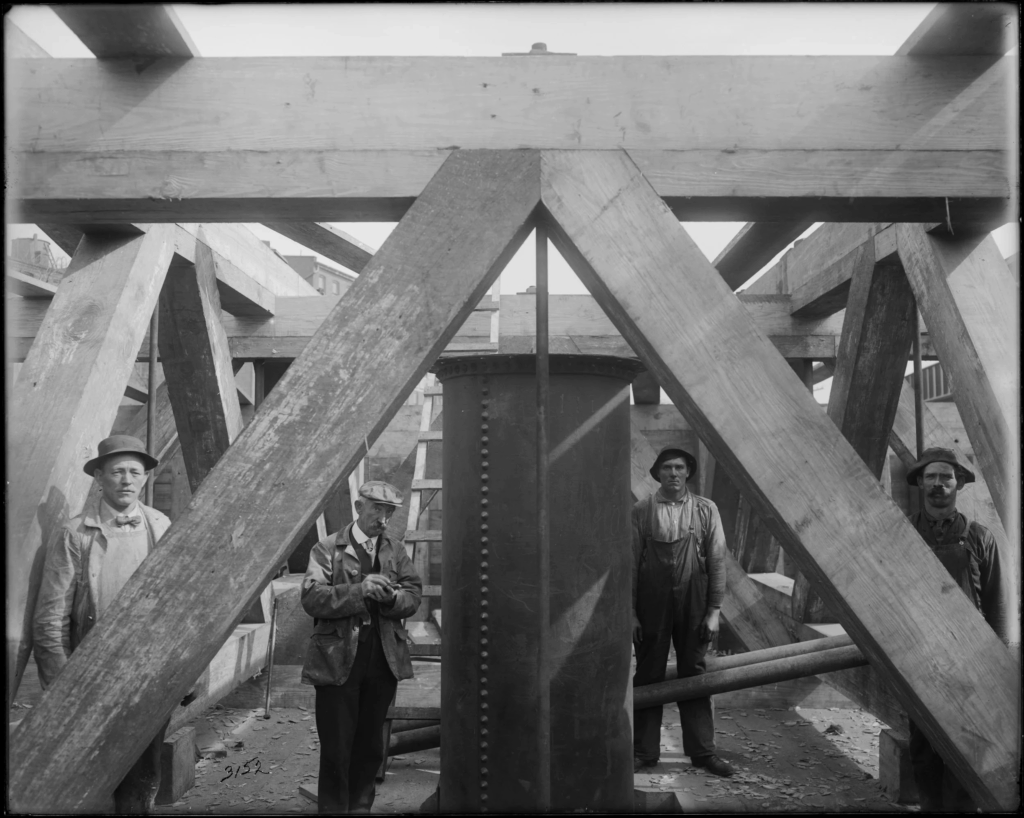
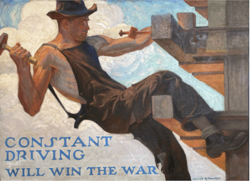
For Labor Day, we thought For the Record would look back on Eugene de Salignac’s photographs of workers. His most famous photograph is, of course, of workers on the Brooklyn Bridge, but many of his photographs emphasize labor. Some of de Salignac’s most intriguing photographs are his portraits, limited in number, but often stunning. Most are of City workers engaged in (or just pausing from) their daily tasks, be that welding, chiseling stone, giving radio broadcasts or filing paperwork. There is often an ease to his subjects that suggests de Salignac’s rapport with them. He frequently caught them in unguarded moments, often in the distinctive settings of their work sites and with the tools that epitomize their labor. Some, like the portrait of the worker in the subway cut, transcend time to become iconic American types. This was the great age of industrialized labor and de Salignac would have known that the City’s transformation would not be possible without the sweat of the City’s vast and varied workforce.
De Salignac himself was also a City worker, who from 1906 to 1934 was the sole photographer for the Department of Bridges/Plant & Structures. Some of the images reproduced here are from his rarely seen photo albums, which were organized around specific projects or themes.
Queensboro Bridge, motor room, Penn Steel Plant, Blackwell’s Island, April 22, 1907. Photo by Eugene de Salignac, Department of Bridges/Plant & Structures Collection. NYC Municipal Archives.
Queensboro Bridge, pin in place, upper deck, northeast, May 2, 1907. Photo by Eugene de Salignac, Department of Bridges/Plant & Structures Collection. NYC Municipal Archives.
Williamsburg Bridge, Caisson #2, general view of workers, October 14, 1911. Photo by Eugene de Salignac, Department of Bridges/Plant & Structures Collection. NYC Municipal Archives.
Williamsburg Bridge, Caisson #2, interior view at airlock, October 14, 1911. Photo by Eugene de Salignac, Department of Bridges/Plant & Structures Collection. NYC Municipal Archives.
Williamsburg Bridge, burning nut at base of column, September 10, 1915. Photo by Eugene de Salignac, Department of Bridges/Plant & Structures Collection. NYC Municipal Archives.
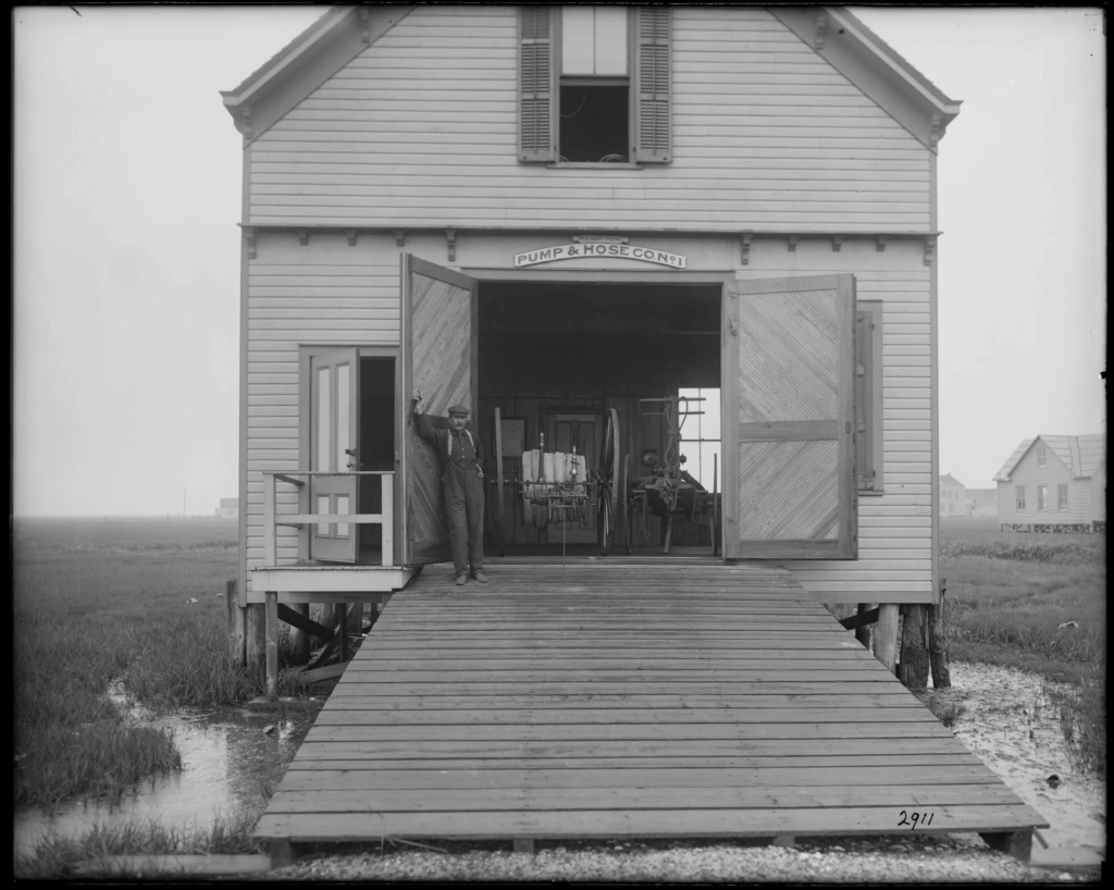
Pump and Hose Company, Jamaica, Queens, June 26, 1911. Photo by Eugene de Salignac, Department of Bridges/Plant & Structures Collection. NYC Municipal Archives.
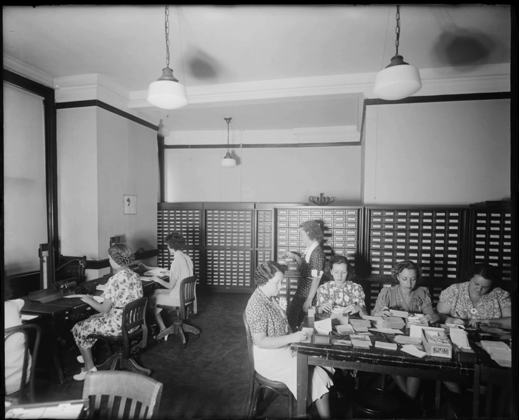
Comptrollers Office sales tax division, August 19, 1938. Photo by Eugene de Salignac, Department of Bridges/Plant & Structures Collection. NYC Municipal Archives.
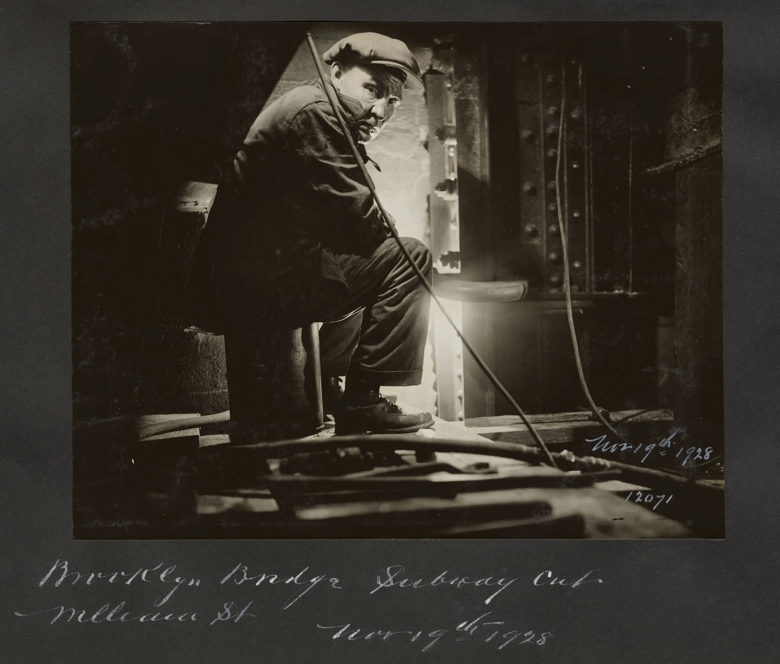
Riveter, Brooklyn Bridge, new William Street Subway cut, November 19,1928. Photo by Eugene de Salignac, Department of Bridges/Plant & Structures Collection. NYC Municipal Archives.
OUR QUEENS BUS ROUTES ARE CHANGING THIS SUNDAY, AUGUST 31ST
WE HAVE POSTED THE NEW ROUTE MAPS ON THE BACK OF THE CHAPEL BUS SHELTER
All image are copyrighted (c) Roosevelt Island Historical Society unless otherwise indicated THIS PUBLICATION FUNDED BY DISCRETIONARY FUNDS FROM CITY COUNCIL MEMBER JULIE MENIN & ROOSEVELT ISLAND OPERATING CORPORATION PUBLIC PURPOSE FUNDS.
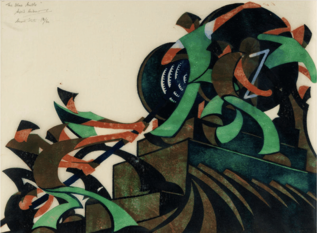
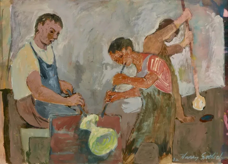
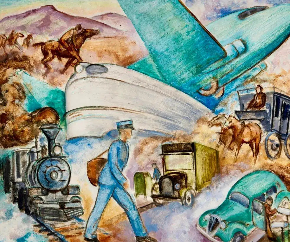
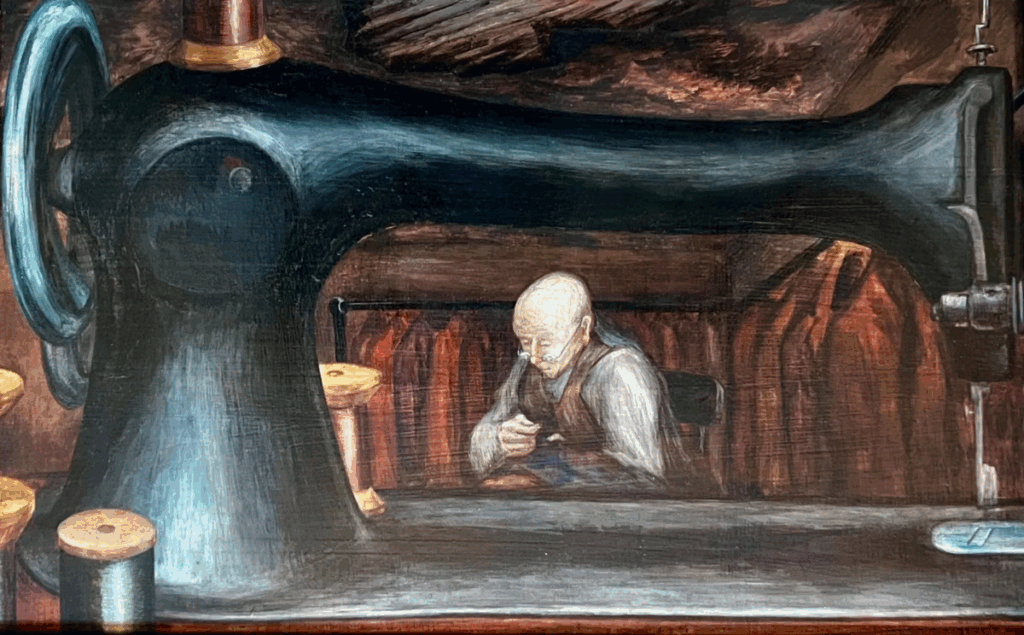
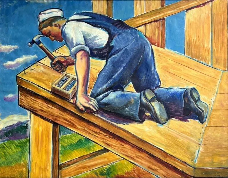
As we head into the Labor Day Weekend we have labor on our minds. People at work. Labor has long been at the heart of modern art, nowhere more so than in the powerful WPA era, when artists set out to honor the dignity, strength, and resilience of working people.
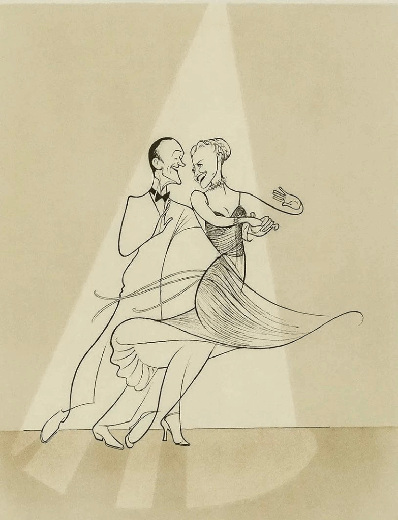
And because labor comes in many forms, our final featured piece today shifts from the job site to the stage: Fred Astaire and Ginger Rogers, captured in an iconic drawing by Al Hirschfeld. With a few elegant lines, Hirschfeld shows us a different kind of work – the art of performance, the labor of grace.
This lithograph offers a glimpse into our next exhibition: HIRSCHFELD: STROKES OF GENIUS. We can’t wait to share the exciting details next week.
This Labor Day, we celebrate the art of work — in every form. Scroll down to see how artists have captured its power and beauty across time.
All image are copyrighted (c) Roosevelt Island Historical Society unless otherwise indicated THIS PUBLICATION FUNDED BY DISCRETIONARY FUNDS FROM CITY COUNCIL MEMBER JULIE MENIN & ROOSEVELT ISLAND OPERATING CORPORATION PUBLIC PURPOSE FUNDS.
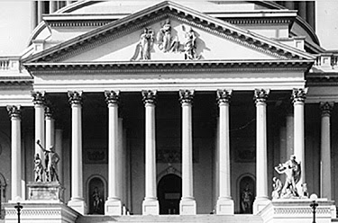
The placement and eventual removal of two statues in front of the U.S. Capitol building in Washington, D.C. is an oft-forgotten piece of American history, pertinent to our observance of Native American Heritage Month. The Rescue and The Discovery of America both included harmful stereotypes of indigenous people next to white figures in positions of power. For nearly a century, members of Congress walked past these statues to enter the Capitol. But due to the criticism of advocacy organizations like the National Congress of American Indians and individual activists like Leta Myers Smart, these statues were both taken down—a powerful example of indigenous activism in the mid-20th century.
In 1836, future president James Buchanan (then a Senator from Pennsylvania) headed a movement to commission two statues to flank the entrance to the Capitol building. Selected was Luigi Persico, an Italian-born sculptor who already created several statues for the exterior of the Capitol. Some members of Congress expressed dissent at the prospect of a non-American artist creating such important work; thus American-born Horatio Greenough was selected to sculpt the companion piece. In the following months, a proposal worked its way through Congress and to then President Martin Van Buren, who authorized Persico and Greenough to create the statues.
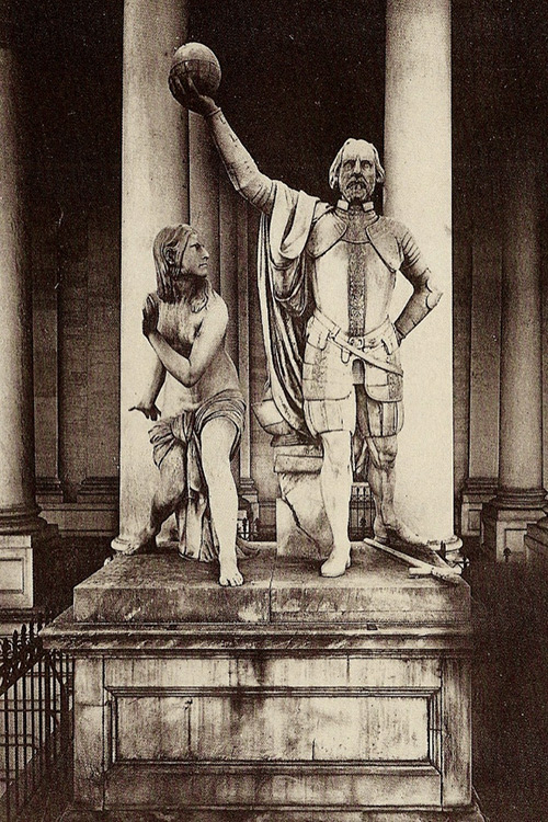
Persico’s Discovery of America was finished and installed in front of the Capitol by 1844. It depicted a triumphant Christopher Columbus holding up a globe next to a cowering American Indian woman. Symbolically, Columbus was shown confidently taking a step forward, while the Indian woman appeared intimidated and rooted in place, in a defensive stance.
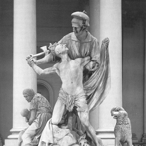
On the other side of the staircase, Greenough’s The Rescue featured a more explicitly violent altercation between indigenous people and white settlers. The centerpiece of the statue depicted a calm, strong frontiersman towering over an American Indian warrior with a tomahawk. Behind them, a frightened woman clasped a small child, and nearby, a dog looked on in horror. The implication is that the Indian threatened the lives of this small pioneer family, and the patriarch stepped up to protect them. The emotion on the Indian’s face revealed fear, while the frontiersman is in complete control. Greenough himself wrote that the statue was meant “to convey the idea of triumph of the whites over the savage tribes.”
The central theme of these sculptures ultimately promoted the idea of Manifest Destiny; that Americans were destined to take control and civilize the lands that became the United States. These false and offensive depictions of white men as more powerful and capable than indigenous people reflected and reinforced the belief that violence in the name of westward expansion was justified. At least one member of Congress was conscious of the connection between these statues and their promotion of manifest destiny. James Belser, a representative from Alabama, said, “Let gentlemen look on the two figures which have so recently been erected on the eastern portico of the Capitol and learn an instructive lesson…The artist, when he made Columbus the superior of the Indian princess in every respect, knew what he was doing.” Whether consciously or
subconsciously, this idea no doubt permeated through some members of Congress as they discussed the annexation of Texas, Oregon, and California in order to spread American influence across the West.
For their part, American Indian groups always opposed the creation and installation of these statues. Their dissent became even more vocal in the 1950s under the leadership of Smart, a member of the Omaha Tribe of Nebraska. She became active in Native political organizations (such as the National Congress of American Indians) after her negative experiences with the Office of Indian Affairs, which participated in the forceful assimilation of Native children in boarding schools. During this period, she began a campaign that called for the removal of The Rescue and The Discovery of America by writing open letters to magazines and organizations like the National Sculpture Society. Her criticisms drew attention to the physical and sexual violence depicted in the statues, as well as the cultural violence they promoted. She knew that only a legislative act could remove the sculptures and, therefore, submitted petitions to Congress that stated that the statues were “misleading to the general public in that they fail to portray the true character of the American Indian.”
everal indigenous activist groups and individual members of Congress supported Smart’s petitions. Many thought, however, it was impossible to persuade Congress to pass legislation to remove the sculptures. But in 1958, the Capitol building underwent an extensive renovation project, which provided the necessary vehicle to achieve that end.
The decision on whether to retain the statues was taken away from the larger Congress and given to the five-man ‘Commission for the Extension of the United States Capitol,’ made up of the Vice President, the Speaker of the House, the minority leaders of both chambers, and the Architect of the Capitol. This small group made the determination that year to remove the statues in accommodation with the extension of the building. The campaign to remove the statues was the most important factor. But the statues had also deteriorated significantly after being exposed to the elements during their century-long display along the steps of the Capitol. Restoration would be very expensive. So, while the dog from The Discovery of America is on display in the Middlebury College Museum of Art, the rest of the statues remain in storage.
The success of Smart and her allies speaks to the determination of American Indians to ensure a place of dignity for themselves in our nation’s capital. Indigenous people always lived in the land that is now Washington, D.C. The cultural narrative authored by colonialism attempted to rewrite their role into weak, submissive, incapable bystanders, as depicted in the two statues discussed. The removal of these statues was a meaningful step that put indigenous stories back under the control of indigenous people.
Queens Surface offered little reliable schedules and was replaced by the MTA in200-5, a vast improvement over the privately operated system.
WHERE IS THE MTA? OUR QUEENS BUS ROUTES ARE CHANGING THIS SUNDAY, AUGUST 31ST
MTA AND RIOC HAVE NOT POSTED ANY SIGNAGE INFORMING THE PUBLIC
WE HAVE POSTED THE NEW ROUTE MAPS ON THE BACK OF THE CHAPEL BUS SHELTER
STOP BY OUR VISITOR CENTER FOR YOUR NEW RTIHS TEE SHIRT (ADULT SIZES)
Credits
Written by guest contributor Kate Ashman, a senior at Brigham Young University majoring in American Studies. Edited by U.S. Capitol Historical Society staff.
All image are copyrighted (c) Roosevelt Island Historical Society unless otherwise indicated THIS PUBLICATION FUNDED BY DISCRETIONARY FUNDS FROM CITY COUNCIL MEMBER JULIE MENIN & ROOSEVELT ISLAND OPERATING CORPORATION PUBLIC PURPOSE FUNDS.
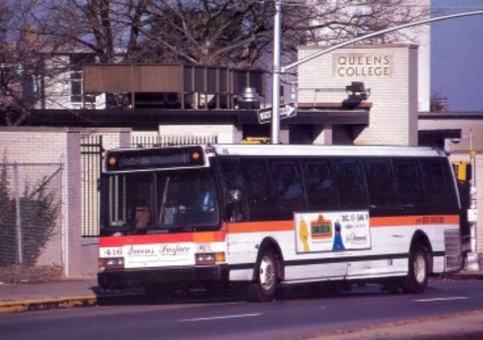
Orion VII OG HEV Orion VII NG HEV New Flyer Xcelsior XD40
Start
Roosevelt Island, Manhattan – Coler-Goldwater Hospital
Via
Northern Boulevard, Steinway Street, 20th Avenue, Roosevelt Island Bridge
End
Astoria – 27th Avenue and 2nd Street
Length
TBA
The Q102 consitutes a bus route in Queens, New York running primarily on Northern Boulevard, Steinway Street, 20th Avenue, between Roosevelt Island, Manhattan and Astoria, Queens. Formerly a streetcar route, it was operated by Steinway Transit until 1988 and then Queens Surface Corporation until MTA takeover in 2005.
The Q102 begins at 27th Avenue and 2nd Street, and goes on the avenue until it turns to 8th Street and then 30th Avenue. It then continues on 30th Avenue until it turns to 31st Street. It then then goes on the street until it heads to Jackson Avenue, while eastbound buses use 28th Street, 42nd Road, and Jackson Avenue to access Northern Boulevard. It then continues on Queens Plaza until it turns to 21st Street, 41st Avenue, and then Vernon Boulevard. It then continues on the boulevard until it turns right to 36th Street and accesses the Roosevelt Island Bridge, and after the bridge, it turns right onto Main Street. It then goes on until it uses the Bird S Coler Hospital Roadway, and loops around to head to the loop road, and continues on Main Street until it uses the East, South, and West Loop Road, where it ends there. For buses heading to Queens, they use the West Loop Road to go on Main Street and then the Roosevelt Island Bridge.
History
Streetcar service
On 1869, a horscar service opened from the 34th to 92nd Street Ferries. It was known as the Dutch Kills or 31st Street Line. It was the first horsecar line in Queens, and was operated by the Astoria and Hunter’s Point Railroad. On November 27, 1877 a person named Patrick Gleason leased the Astoria and Hunter’s Point Railroad, operating the 31st Street line for an annual rental of $4,000.
On 1901, a line was authorized in 31st Street along its whole length. Part of this was used in 1910 after the New York and Queens County Railway gave up the crooked Jane Street to Academy Street to Lockwood Street routing of the old 31st Street Line that had existed since 1865, and operated the cars in a direct line along 31st Street from Jackson Avenue to 35th Avenue.
The opening of the Queensboro Bridge caused a change in the 31st Street Line. The old route through Jane Street and 29th Street and the private right of way, still one track with turnouts, was outdated and cut directly across the new bridge plaza. Therefore, on December 4th, 1908, the New York and Queens County Railway secured a franchise to operate straight down 31st St. from 35th Ave. to Jackson Avenue, and on July 2nd, 1909 the Public Service Commission approved the abandonment of the old route. The new 31st Street Line opened on December 4th, 1909.
Bus service
Beginning in the 1920s, many streetcar lines in Queens and in the rest of the city were replaced by buses, particularly after the unification of the city’s three primary transit companies in June 1940. The bus service started on September 29, 1939 to replace the 31st Street streetcar route. The bus route was initially operated by Steinway Transit.
The bus company would become Queens-Steinway Transit Corporation in 1986, and Queens Surface Corporation in 1988.
MTA takeover
On February 27, 2005, the MTA Bus Company took over the operations of the Queens Surface routes, part of the city’s takeover of all the remaining privately operated bus routes.
Starting on April 18, 2010, all service began traveling through Roosevelt Island in the same direction and some closely spaced bus stops on the island were discontinued.
Newtown Avenue, Crescent Street, and Astoria Boulevard segment was discontinued in favor of operating via 30th Avenue on June 29, 2014.
In December 2019, the MTA released a draft redesign of the Queens bus network. As part of the redesign, the Q102 bus would have been replaced with the QT78, a “neighborhood” route that would run between Roosevelt Island and Middle Village, and the QT79, also a “neighborhood” route that would have run between Rikers Island and Hunter’s Point. The redesign was delayed due to the COVID-19 pandemic in New York City in 2020, and the original draft plan was dropped due to negative feedback.
The trolley operated over the Queensboro Bridge until the RI Bridge opened in 1957, bringing direct bus service to the island.
Queens Surface offered litte reliable schedules and was replaced by the MTA in200-5, a vast improvement over the privately operated system.
WHERE IS THE MTA? OUR QUEENS BUS ROUTES ARE CHANGING THIS SUNDAY, AUGUST 31ST
MTA AND RIOC HAVE NOT POSTED ANY SIGNAGE INFORMING THE PUBLIC
WE HAVE POSTED THE NEW ROUTE MAPS ON THE BACK OF THE CHAPEL BUS SHELTER
STOP BY OUR VISITOR CENTER FOR YOUR NEW RTIHS TEE SHIRT (ADULT SIZES)
CREDIT TO
Fandom
All image are copyrighted (c) Roosevelt Island Historical Society unless otherwise indicated THIS PUBLICATION FUNDED BY DISCRETIONARY FUNDS FROM CITY COUNCIL MEMBER JULIE MENIN & ROOSEVELT ISLAND OPERATING CORPORATION PUBLIC PURPOSE FUNDS.
STOP BY OUR VISITOR CENTER FOR YOUR NEW RTIHS TEE SHIRT (ADULT SIZES)
CREDIT TO
NEW YORK HISTORICAL
All image are copyrighted (c) Roosevelt Island Historical Society unless otherwise indicated THIS PUBLICATION FUNDED BY DISCRETIONARY FUNDS FROM CITY COUNCIL MEMBER JULIE MENIN & ROOSEVELT ISLAND OPERATING CORPORATION PUBLIC PURPOSE FUNDS.
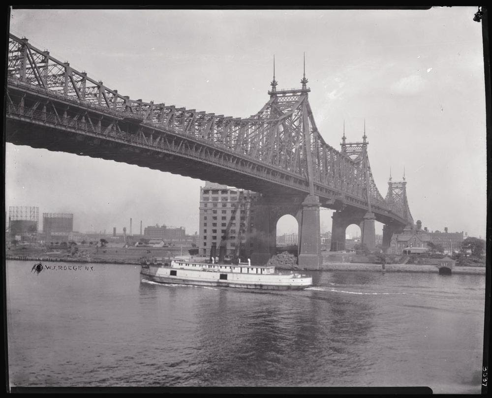
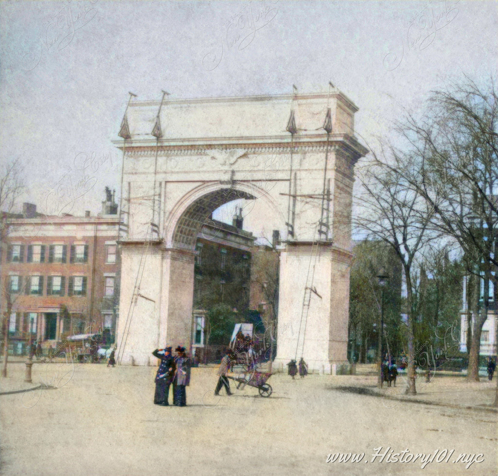
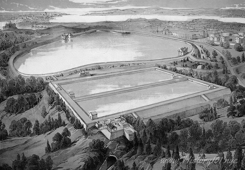
The 1870s marked a pivotal decade of transformation for New York City during the Gilded Age, initiating its evolution toward modern urbanization. This period was defined by groundbreaking infrastructural developments, most notably the commencement of the Brooklyn Bridge construction. This engineering marvel symbolized innovation and showcased the city’s progressive vision, setting the stage for New York City’s future as a global metropolis. The Gilded Age also laid the foundation for the cityscape we recognize today, with the emergence of new architectural styles and the expansion of the city’s geographical boundaries.
Culturally, New York City thrived with enriched diversity, driven by a surge in immigration during the 1870s. The city became a vibrant mosaic of cultures, languages, and traditions, significantly enhancing its social fabric. This influx of new inhabitants brought a wealth of cultural influences, reshaping New York City’s societal and cultural landscape.
During this time, New York City also faced challenges linked to rapid urban expansion, including housing shortages, sanitation issues, and the growing need for efficient public transportation. These challenges spurred extensive urban planning and public works projects, laying the groundwork for the modern New York City we recognize today.
In summary, the 1870s were a crucial period for New York City, characterized by remarkable infrastructural advancements and significant cultural transformation. The developments of this decade were instrumental in shaping the city’s future in terms of both architecture and society. The legacy of this period remains a pivotal chapter in New York City’s history, offering valuable insights into its evolution into a renowned global metropolis.
Timeline of New York City’s History in the 1870s Discover surprising historical facts about The City That Never Sleeps—explore fun, educational insights into its history, population, iconic landmarks, and more, perfect for students, history enthusiasts, and anyone curious about NYC’s rich heritage.
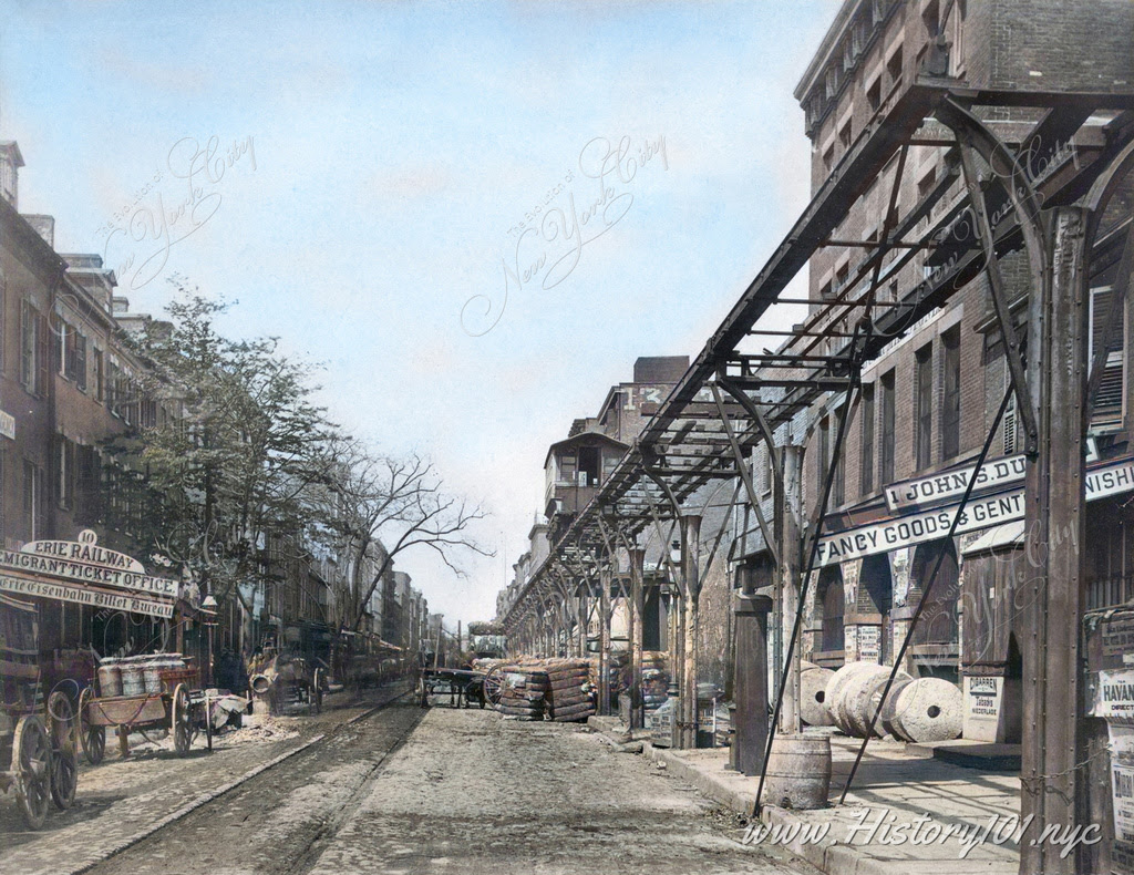
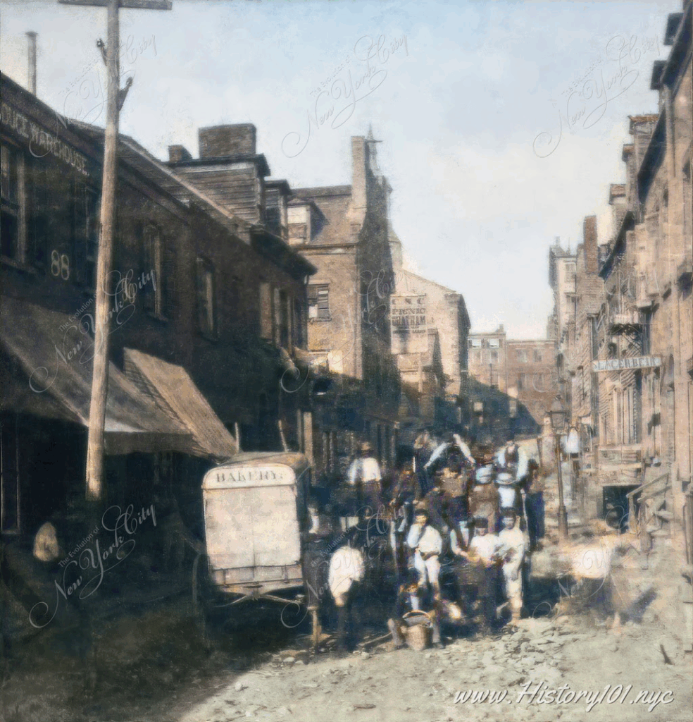
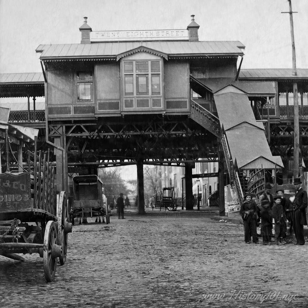
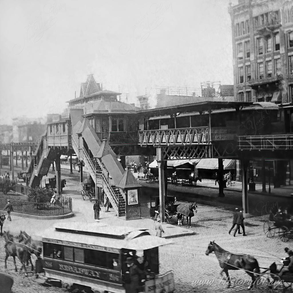
In the 1870s, Greenwich Street in New York City was a bustling hub of activity, with the Erie Railway Migrant Ticket Office and the elevated rail line adding to the vibrant atmosphere.
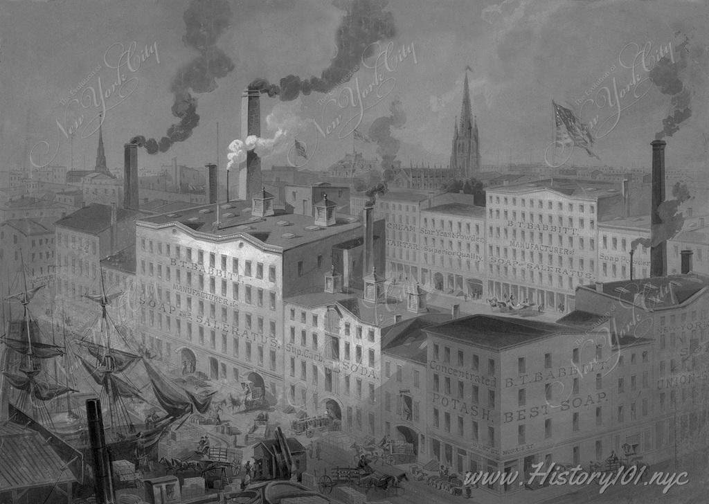
Drawing by James A. Shearman featuring a soap factory in lower Manhattan, from West St. looking northeast, with the Equitable Building in the background.
All image are copyrighted (c) Roosevelt Island Historical Society unless otherwise indicated THIS PUBLICATION FUNDED BY DISCRETIONARY FUNDS FROM CITY COUNCIL MEMBER JULIE MENIN & ROOSEVELT ISLAND OPERATING CORPORATION PUBLIC PURPOSE FUNDS.
The Architectural and Cultural Flourishing of New York City
Weekend August 23-24, 2025
History101.nyc
Issue # 1517
To see these photos in a larger format, go to history101.nyc
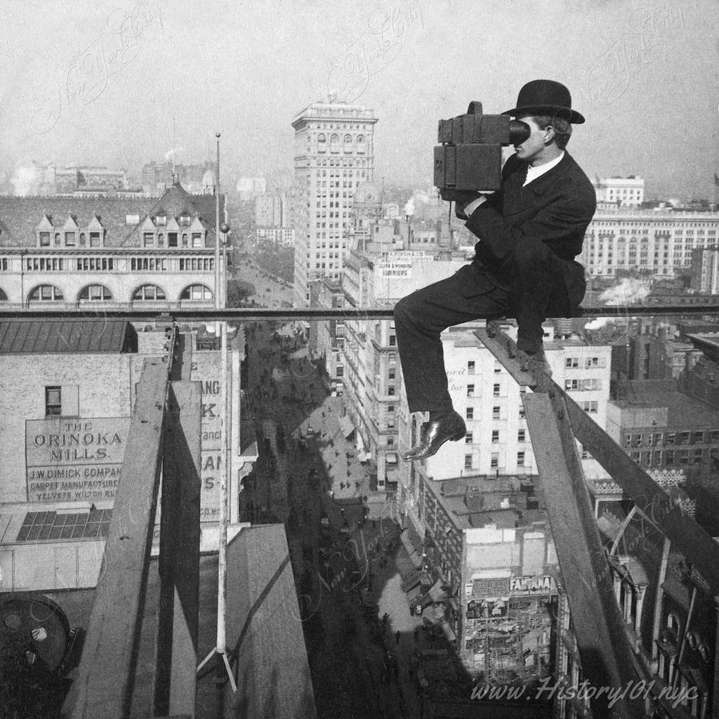
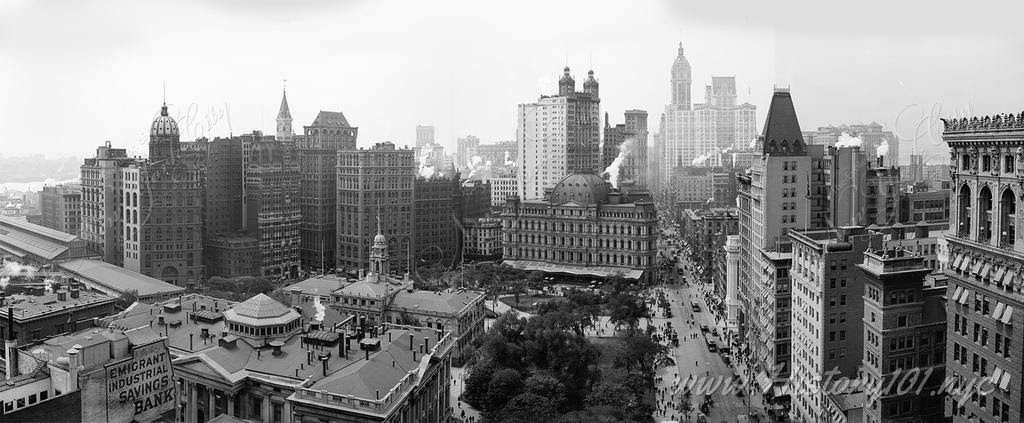
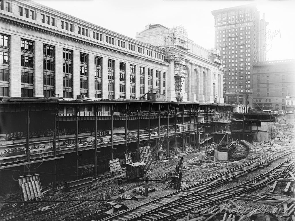
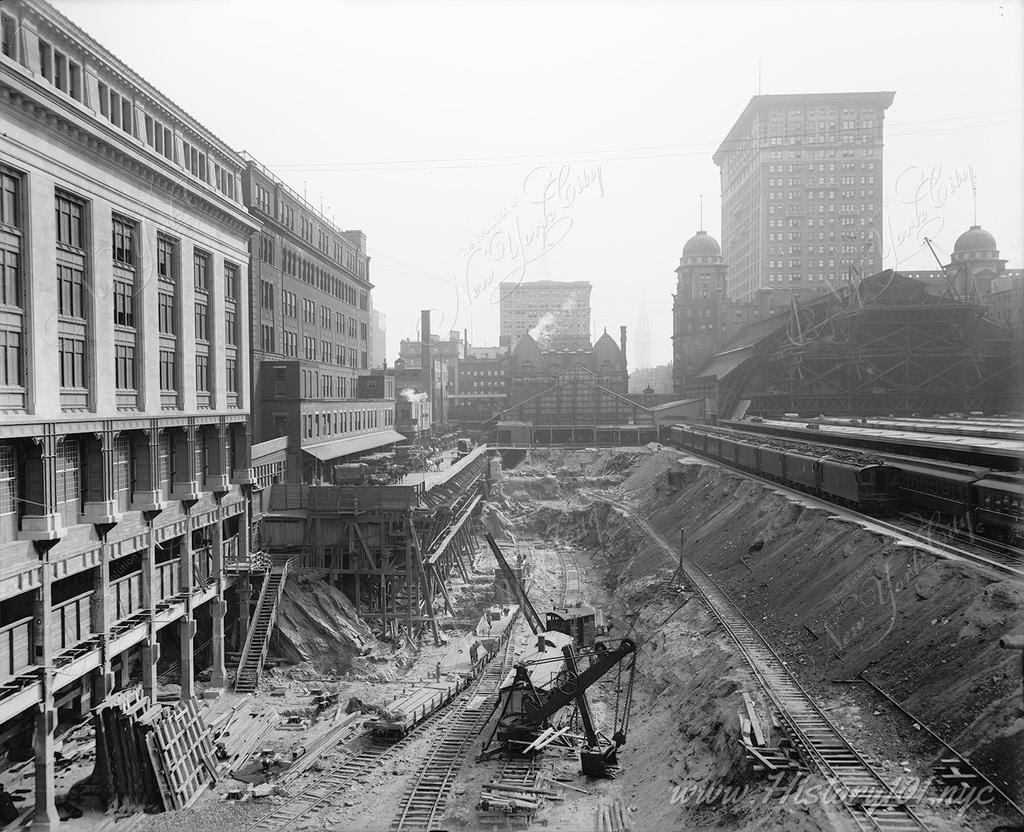
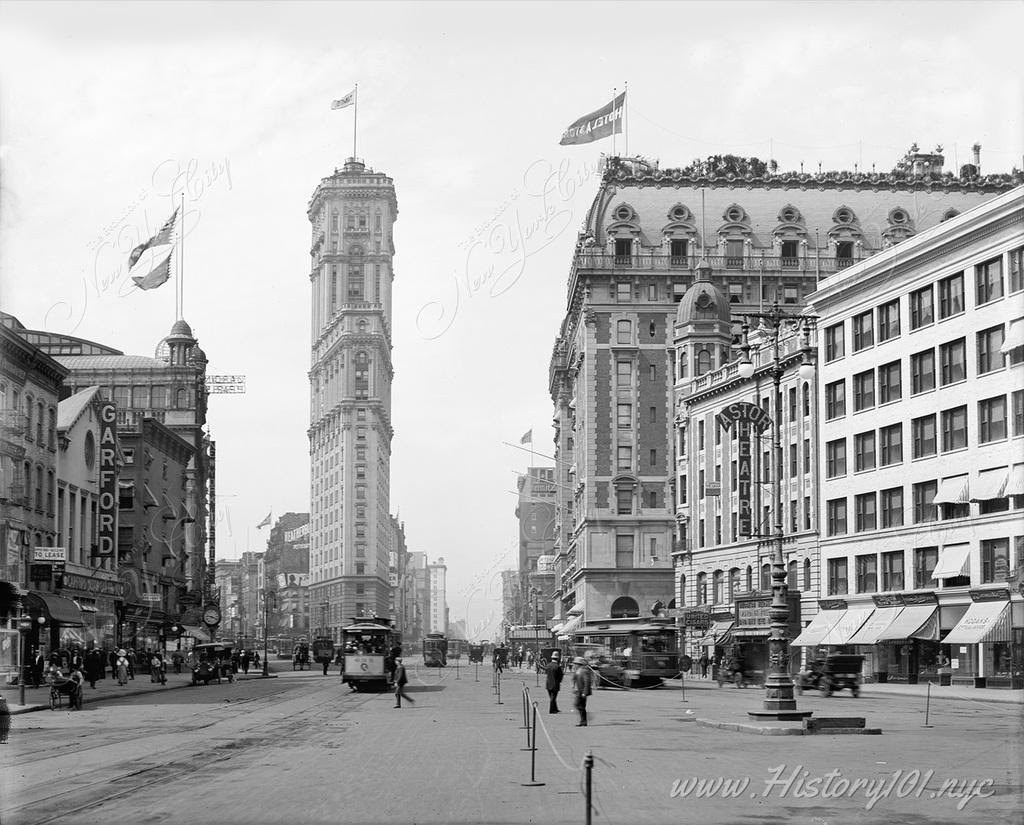
The early 20th century, specifically between 1905 and 1910, marked a pivotal shift in New York City’s architectural landscape. This period witnessed the rise of iconic structures that redefined the city’s skyline. The Singer Building, completed in 1905, soared to 47 stories, claiming the title of the world’s tallest building at the time. This architectural achievement was soon followed by the Metropolitan Life Insurance Company Tower, completed in 1909. It held the title of the tallest building until 1913, further solidifying New York City’s status as a burgeoning metropolis.
Concurrently, New York City’s subway system, inaugurated in 1904, underwent rapid expansion. The opening of the IRT Lexington Avenue Line in 1905 was instrumental in connecting the city’s diverse neighborhoods, facilitating both residential and commercial development across the boroughs. This expansion significantly transformed the city’s physical and socio-economic landscapes.
This era was marked by a significant cultural renaissance. The New York Public Library’s main branch, a standout Beaux-Arts building, began construction in 1902 and opened in 1911, symbolizing the city’s dedication to cultural enrichment. Moreover, the evolution of Broadway’s theater district, with the openings of the Hudson and New Amsterdam Theaters in 1903, mirrored the city’s expanding artistic landscape.
During this period, New York City underwent profound economic changes. Following the Panic of 1907, Wall Street emerged more robust, prompting critical banking reforms that contributed to the establishment of the Federal Reserve System in 1913. Simultaneously, the city’s population growth, fueled by immigration and urbanization, led to diverse social challenges. These included the need for new approaches to housing and public services, reflecting the city’s evolving demographics.
Timeline of New York City’s History 1905-1910 Discover surprising historical facts about The City That Never Sleeps—explore fun, educational insights into its history, population, iconic landmarks, and more, perfect for students, history enthusiasts, and anyone curious about NYC’s rich heritage.
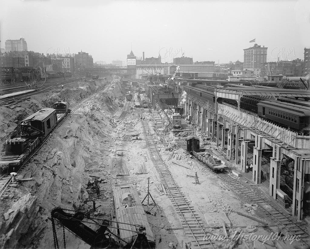
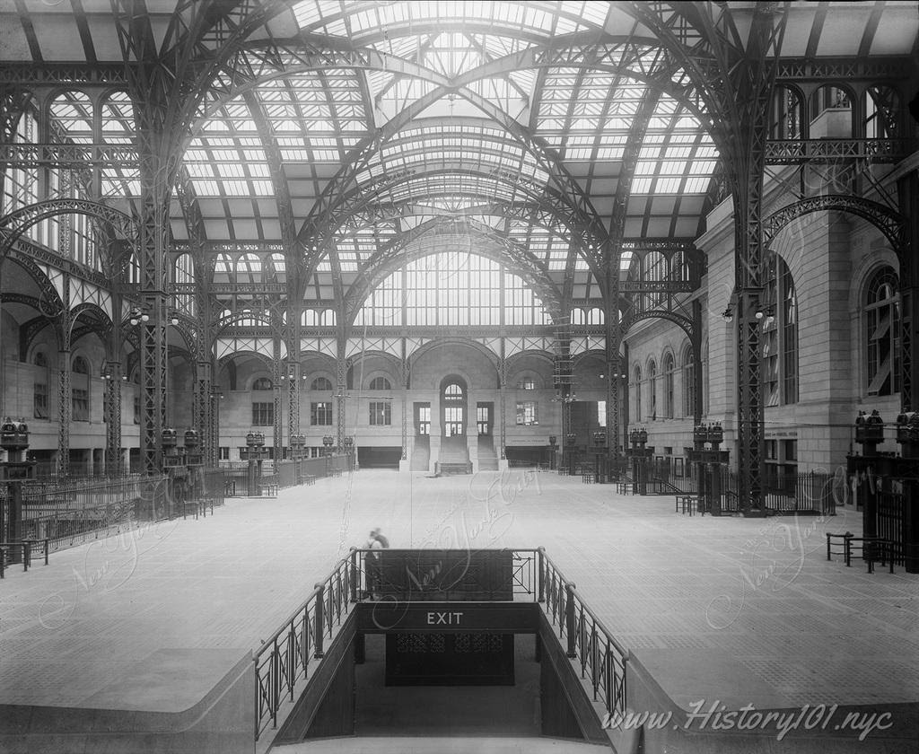
A straight perspective following the direction of the newly laid train tracks which would help to service thousands, and eventually millions of commuters a day.
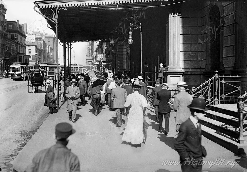
A photograph which illustrates the great style, symmetry and lighting of Penn Station’s Main Concourse.
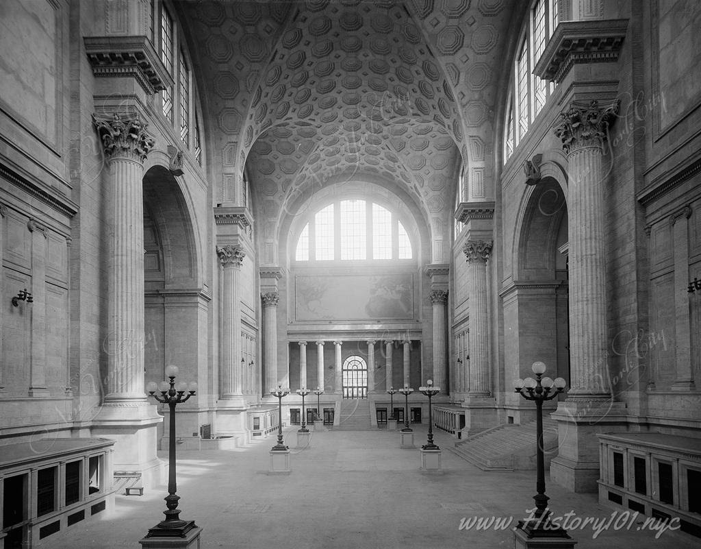
Interior view of Penn Station’s famously opulent waiting room, with its high vaulted ceilings and turn-of-the-century stonework. Image Credit: Unknown. Reprinted with permission. Restoration Credit: This image has been digitally repaired by Fine Print Design Studio.
PHOTO OF THE DAY
STOP BY OUR TABLE AT THE FLEA MARKET THIS SATURDAY TO PURCHASE YOUR NEW RTIHS TEE SHIRT (ADULT SIZES)
All image are copyrighted (c) Roosevelt Island Historical Society unless otherwise indicated THIS PUBLICATION FUNDED BY DISCRETIONARY FUNDS FROM CITY COUNCIL MEMBER JULIE MENIN & ROOSEVELT ISLAND OPERATING CORPORATION PUBLIC PURPOSE FUNDS.
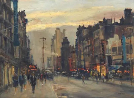
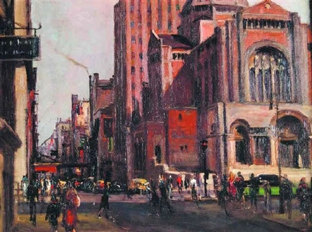
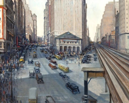
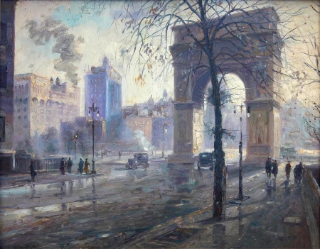
New York right now feels like it’s at a crossroads. People are fearful of walking the streets with the threat of a virus literally in the air. Subway problems, homelessness…the city doesn’t always seem to be working.
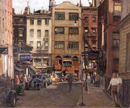
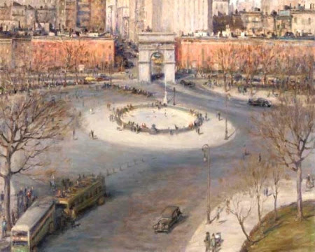
To restore your faith in Gotham, take a look at these paintings by Alfred S. Mira, whose vivid street scenes of the 1930s and 1940s city capture the life, passion, and activity inherent in New York’s soul.
Mira wasn’t a native New Yorker. Born in Italy in 1900, he came to New York as a boy with an “insatiable desire to draw,” as he put it.
Despite his parents’ misgivings, he embarked on a long career as an artist, painting cityscapes (many of his own neighborhood, Greenwich Village) depicting the day-to-day street life New Yorkers relate to and thrive on.
His style is sometimes Impressionist, but his vision of New York was one of realism. He painted the city “the way busy people see it…None of those breathtaking shots cameramen contrive of towers and infinity, which no New Yorker sees in actuality,” he said.
Mira’s paintings capture something real and remarkable about city life—the stunning palette of colors from buildings and roads, the hidden views from el trains and windows, the ordinary exchanges New Yorkers have on sidewalks with one another.
“The lure of the outdoors always attracted me, especially the city streets with their movements, color and depth—they were the things that inspired me and which I painted as they looked and as I felt them,” he said.
This site has featured Mira’s work before, and it’s the right time to present him again. Let his work remind you of what makes New York great and why you don’t ever want to leave.
PHOTO OF THE DAY
STOP BY OUR TABLE AT THE FLEA MARKET THIS SATURDAY TO PURCHASE YOUR NEW RTIHS TEE SHIRT (ADULT SIZES)
CREDIT TO
Ephemeral New York
All image are copyrighted (c) Roosevelt Island Historical Society unless otherwise indicated THIS PUBLICATION FUNDED BY DISCRETIONARY FUNDS FROM CITY COUNCIL MEMBER JULIE MENIN & ROOSEVELT ISLAND OPERATING CORPORATION PUBLIC PURPOSE FUNDS.
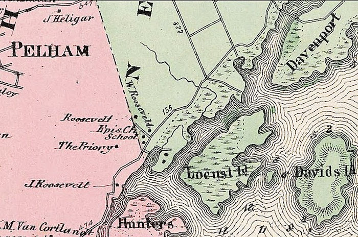
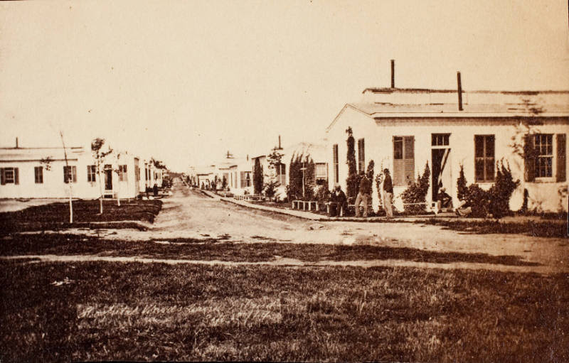
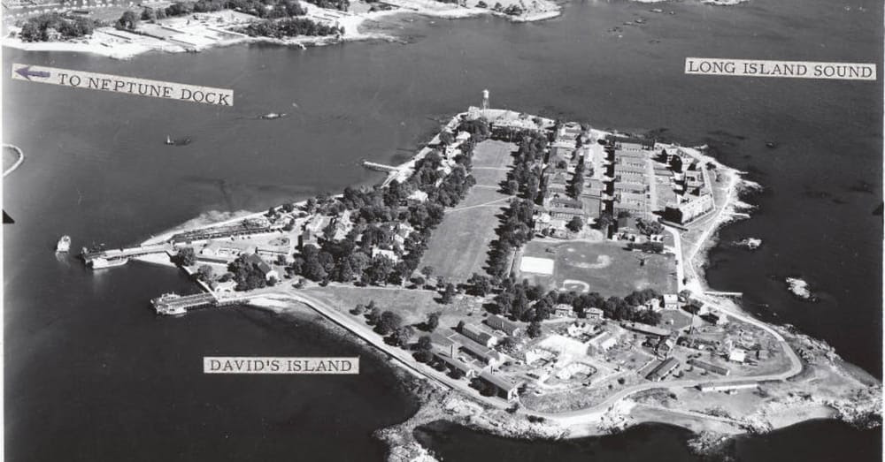
The other day I was looking thru the NYC Municipal Archives website. In a section there was a category of Transit Records. It appears that any body of a deceased person traveling thru Manhattan had to be cataloged in the large log books. During the Civil War years, I noticed that many of the persons died on David’s Island. David’s Island was also called Fort Slocum and was the home of a large hospital for Union Civil War Soldiers.
Until as late as 1803, the island was inhabited by members of the Siwanoy and the Algonquin nation. From Colonial times to the second half of the 19th century, the island was used for farming and pasturing and had various owners.
In 1856 Thaddeus Davids Sr., a New Rochelle ink manufacturer, bought the island from Newberry Davenport Jr., and it still bears his name. During the decade before the Civil War the island was a popular spot for excursion boats from New York City and elsewhere. Maps from the period show that it had a concert room, a saloon ( a genteel refreshment room) and several other buildings, perhaps a hotel.
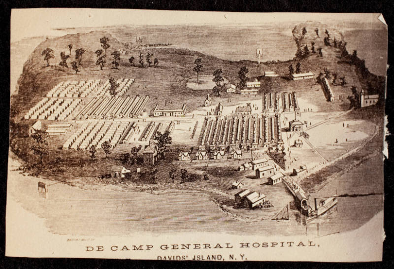
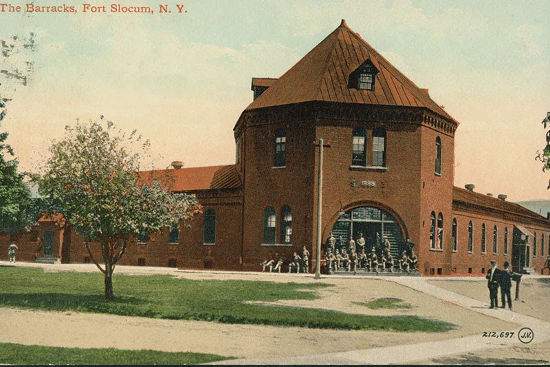
By 1861 the first soldiers arrived on the Island, and the U.S. Army established the De Camp Hospital for the wounded. After the hospital’s closing, the Army purchased the island in 1867 and called the post Davids Island until July of 1896, when the Army formally named it Fort Slocum after Major General Henry Warner Slocum of Civil War fame.
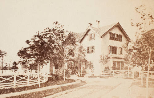
Through the Army years the island served as a prison, hospital, mustering camp, recruiting depot, coast artillery fortification, transit station, training camp, Air Force base, and missile battery.[2] Thousand of soldiers from all over the country served at Ft. Slocum and thousands of Westchester residents worked and visited there. The fort’s busiest time was during World War I when the base processed thousands of men on their way to war.
At the height of World War I, the fort had difficulty keeping up with the inflow of newly arriving troops. In December of 1917, the Department of War issued regulations that would stop voluntary enlistment in favor of a draft. In the week of December 10th, 800 men arrived each day at the New Rochelle train station and were ferried from the Neptune Park Dock to the Island. By the end of the week Fort Slocum was full, and the City of New Rochelle united to aid in the feeding, clothing, and housing thousands of men stranded during one of the coldest winters in recent history.[3] The rapid influx of new troops to the island triggered a massive construction boom, the first since the 1880s. 56 one-story buildings were erected including a recruit examination building and a post office.
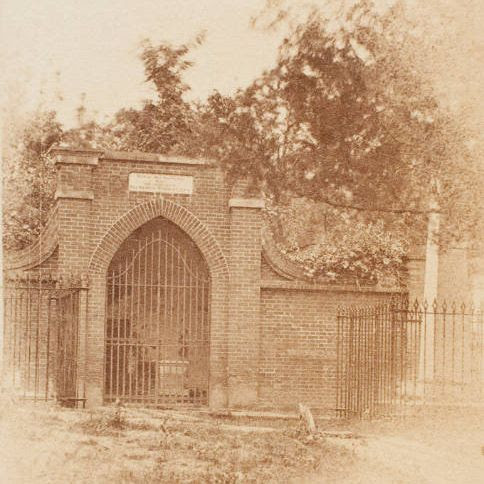
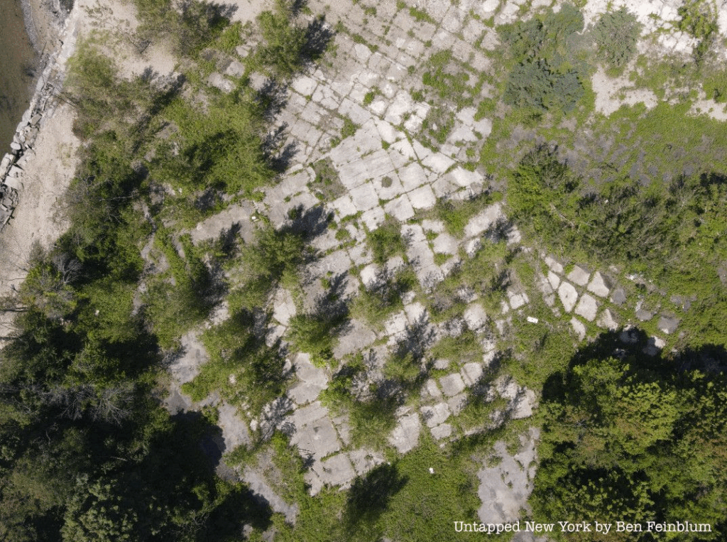
In November of 1965, Fort Slocum was abandoned by the Army and bought by the City of New Rochelle. While there have been many potential buyers such as Donald Trump, Con Edison, and Xanadu Properties, the island is still owned by the city. The ruins of Fort Slocum continued to occupy the island until 2008 when Congress approved funds to remove the remaining structures on the island including the iconic water tower. The island is currently inaccessible to the public, but a new future hopefully awaits.
Hospital treated Union and later Confederate Troops during the Civil War.
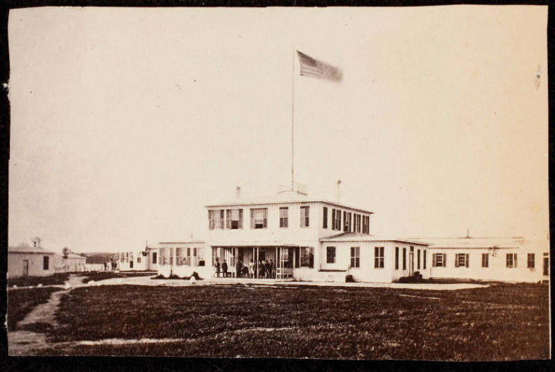
This is a carte de visite. The David L. Hack Civil War Photography Collection. A photograph of a building with people standing on the front porch, several windows and dark shutters. On the roof stands a high flag pole with the American flag flying at the top. This is from _Gardner’s Photographic Sketchbook of the War_ (Hack Collection No. 2].
FORT SLOCUM
IN USE UNTIL CLOSED IN THE 1960’S
Fort Slocum before all structures were demolished in 2008.
All that remains of the island since multiple plans for development have fallen thru.
PHOTO OF THE DAY
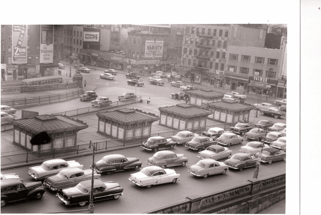
Second Avenue before Congestion Pricing
CREDIT TO
Wikipedia
All image are copyrighted (c) Roosevelt Island Historical Society unless otherwise indicated THIS PUBLICATION FUNDED BY DISCRETIONARY FUNDS FROM CITY COUNCIL MEMBER JULIE MENIN & ROOSEVELT ISLAND OPERATING CORPORATION PUBLIC PURPOSE FUNDS.