Monday, February 9, 2026 Ephemeral New York ISSUE #1624
Though its roots stretch all the way back to the Roman era, Valentine’s Day as a cultural holiday celebrating romantic love was firmly established by the 19th century.
New Yorkers at the time could honor the day by exchanging love letters, mailing cards decorated with hearts and cupids, or buying small gifts as tokens of affection. (Chocolate didn’t become a Valentine Day’s staple until 1861, when British chocolatier and marketing genius Richard Cadbury invented the heart-shaped box.)
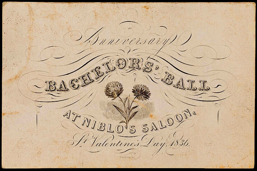
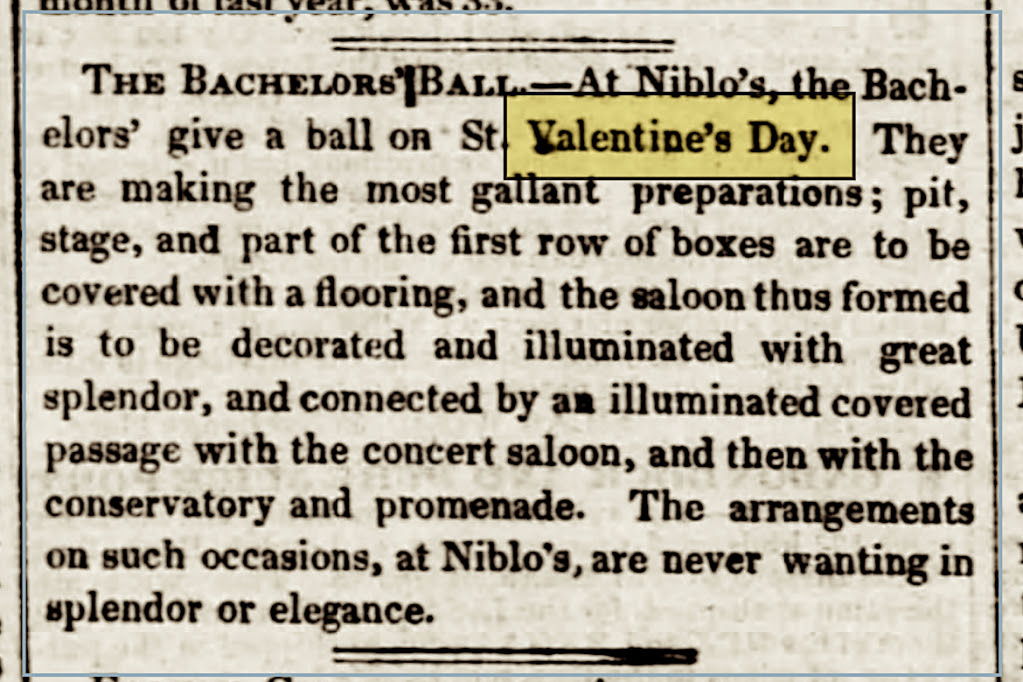
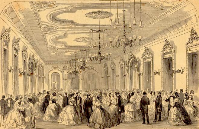
Another way to honor the day was to attend Gotham’s annual Bachelors’ Ball.
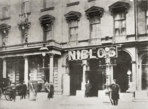
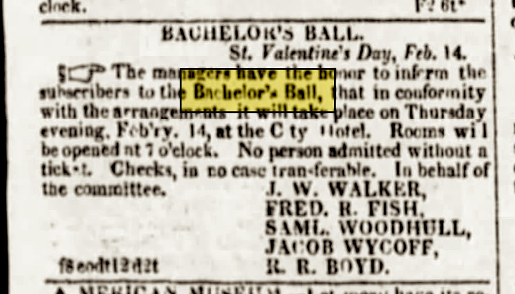
This swanky event was held every February 13th or 14th, first at the posh City Hotel beginning in the 1820s and then a decade later at Niblo’s Saloon—a theater that was part of the popular Niblo’s Garden pleasure ground at today’s Broadway and Prince Street.
The purpose of these invitation-only events—put on by one or more clubs made up of actual bachelors—seems to be for elite unmarried men to meet and potentially match with eligible women of high social class.
Holding the balls on Valentine’s Day really underlines the ultimate goal of turning single men into husbands. In an article about the Bachelors’ Ball of 1842, the New-York Mirror weirdly summed up the yearly event this way:
The balls were not “to confirm bachelors in single wretchedness, but to lead them into the silken chains of matrimony gradually—imperceptibly—sweetly—like a midsummer’s night dream—only to awaken to the realities of a sober, happy, married life.”
“These are the results of the Bachelors’ Ball; therefore, sweet ladies, prepare your brightest smiles for St. Valentine’s Eve, and be determined, on this jocund and interesting occasion, to select, cautiously but firmly, the men worthy of your hearts and hands, for, on that night, many are the contracts made, which last for life, for weal or woe.”
There may have been interruptions that prevented the Bachelors’ Ball from being held every year. But they seemed to have lasted into the early 20th century, subsumed into the Gilded Age social world with an invite list of Vanderbilts and other young eligibles.
Is there a modern equivalent of the Bachelors’ Balls? With so many people unhappy with dating apps, maybe it’s time to put them back on the calendar and open them up to every love-seeking New Yorker.
CREDITS
[Top image: MCNY, 49.268.1; second image: Wikipedia; third image: The Evening Post, 1828; fourth image: The Evening Post, 1842; fifth image: NYPL Digital Collections]
All image are copyrighted (c) Roosevelt Island Historical Society unless otherwise indicated THIS PUBLICATION FUNDED BY DISCRETIONARY FUNDS FROM CITY COUNCIL MEMBER JULIE MENIN & ROOSEVELT ISLAND OPERATING CORPORATION PUBLIC PURPOSE FUNDS.
Weekend, February 7-8, 2026 Judith Berdy ISSUE #1623
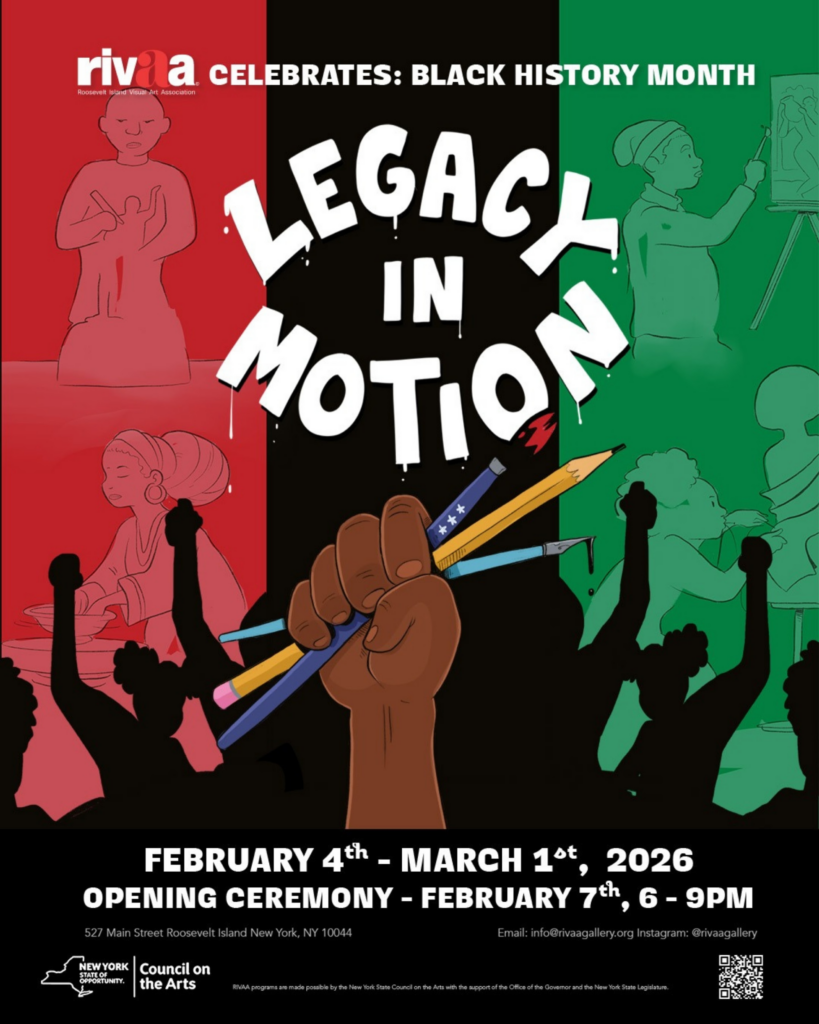
Legacy in Motion
Presented in celebration of Black History Month
Exhibition on view: February 4 – March 1, 2026
Opening Reception: Saturday, February 7, 6–9 PM
Location: RIVAA Gallery, 527 Main Street, Roosevelt Island, NY 10044
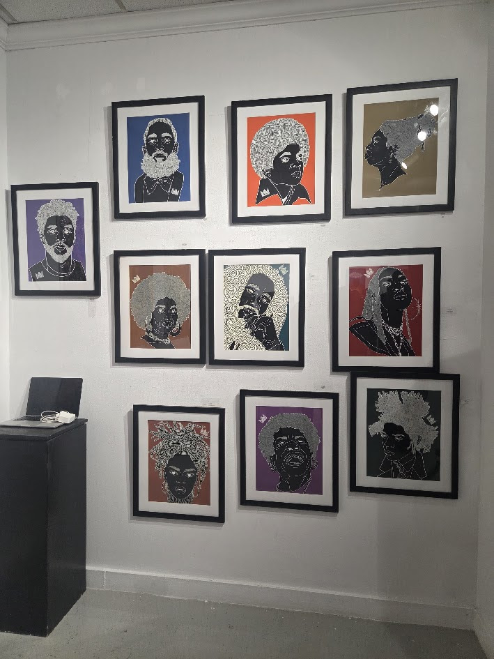
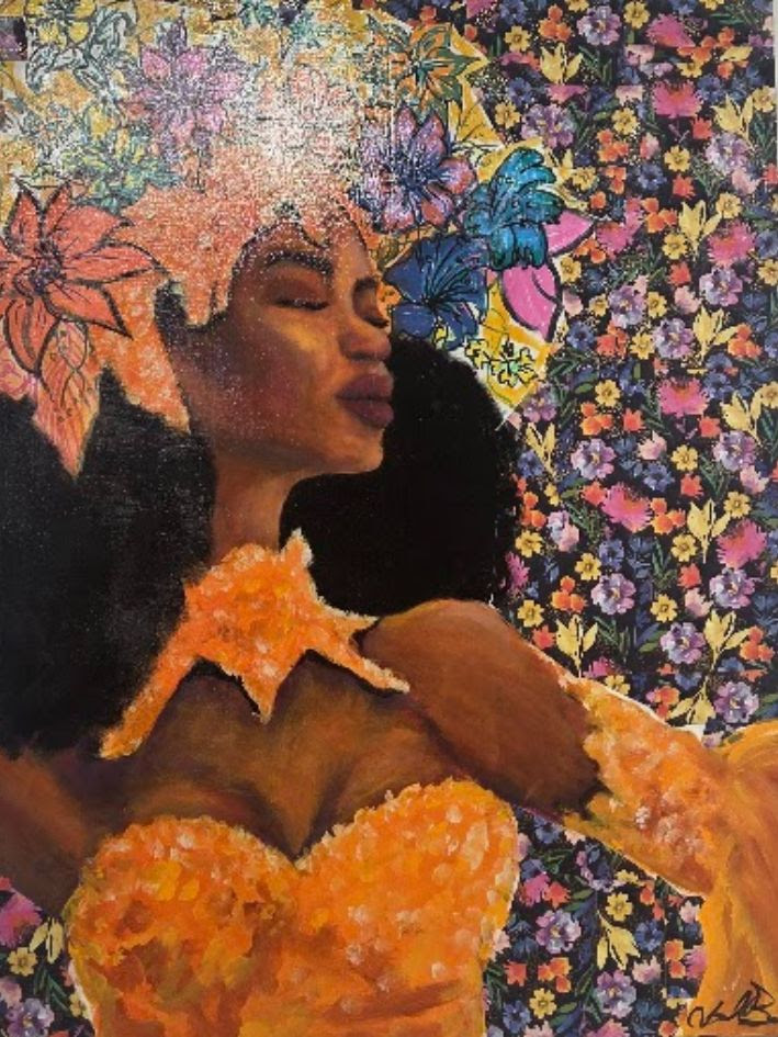
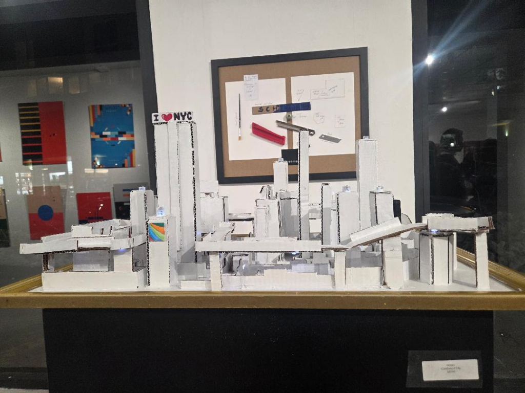
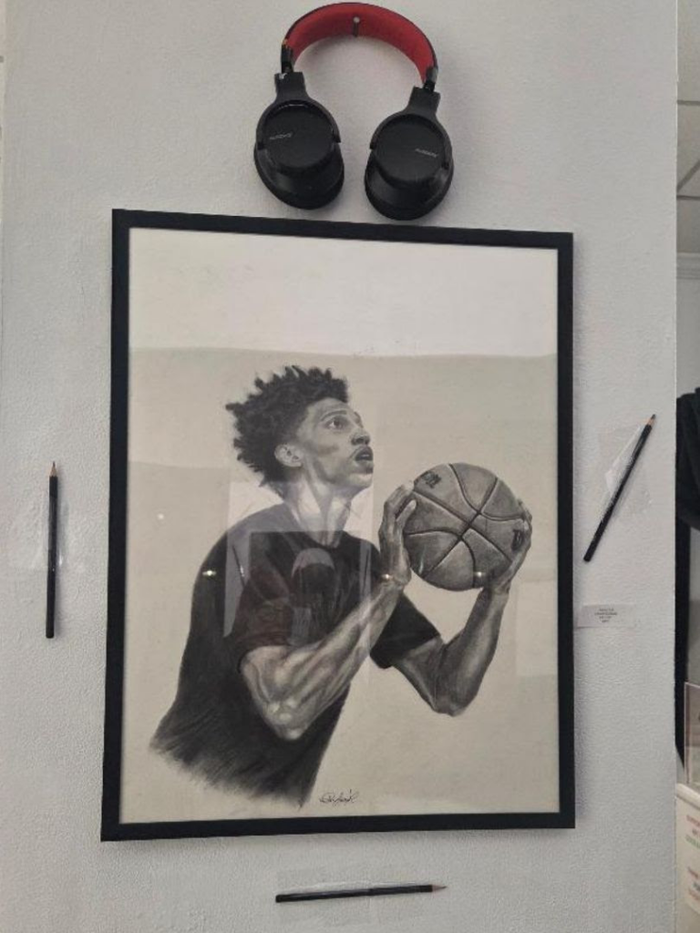
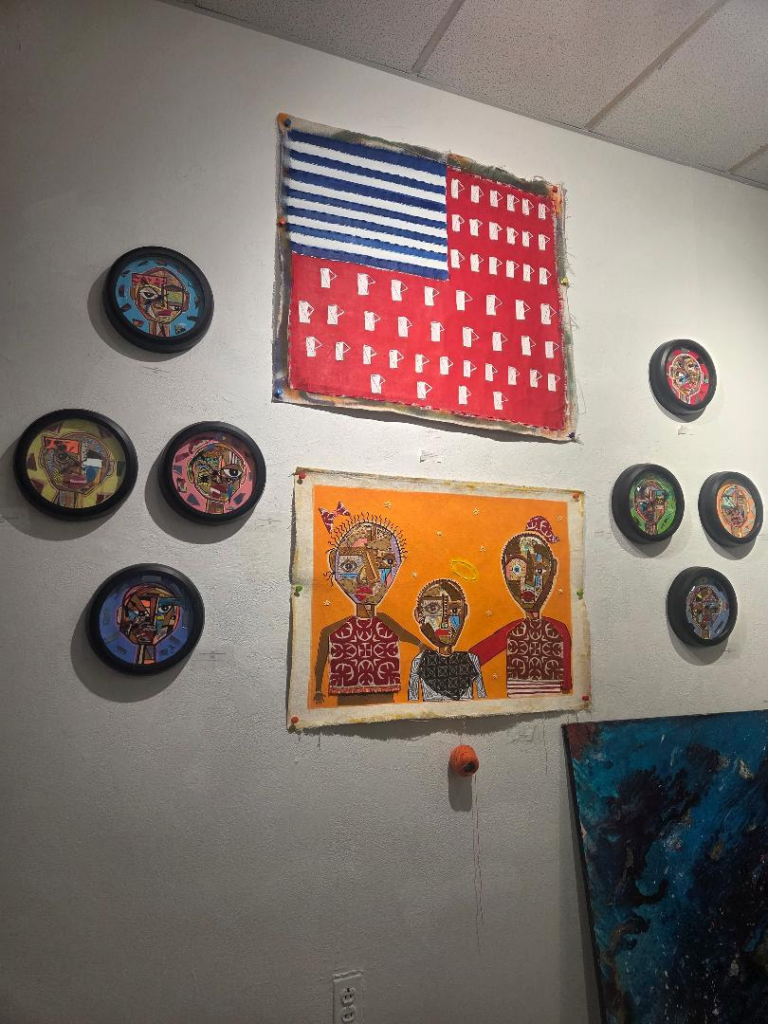
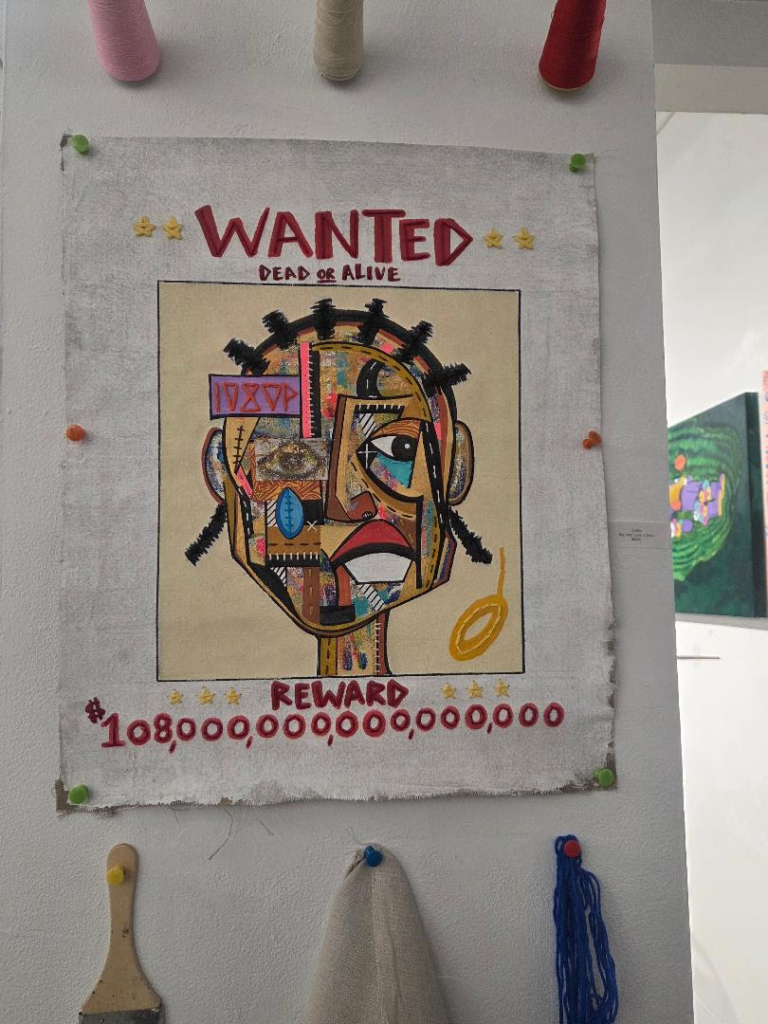
Legacy in Motion offers a glimpse into the work, process, and innovation behind the craft, seen through the lens of Black creators and artists. This exhibition highlights the tools shaped by Black hands, the techniques refined through lived experience, and the creative labor that has often gone unseen. While masterpieces born from Black artistry are too often overlooked, the recognition of the tools, methods, and makers behind those works is acknowledged even less.
This exhibition brings that history forward, honoring both the creations and the creators, and illuminating the foundational contributions that have given rise to so many of the artistic mediums we celebrate today.
RIVAA’s programs are made possible by the New York State Council on the Arts with the support of the Office of the Governor and the New York State Legislature.
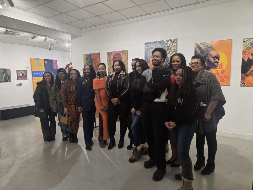
The artists gather to celebrate the exhibit opening featuring a Performance Artwork and Panel Dicussion.
K_N-_IFE Camp Sesame Street
NOLAN Cardboard City
Mercy K. Edwards
1080p
1080p Big Perp
CREDITS
JUDITH BERDY
PHOTO OF THE DAY
THINK 10 WEEKS FROM NOW
All image are copyrighted (c) Roosevelt Island Historical Society unless otherwise indicated THIS PUBLICATION FUNDED BY DISCRETIONARY FUNDS FROM CITY COUNCIL MEMBER JULIE MENIN & ROOSEVELT ISLAND OPERATING CORPORATION PUBLIC PURPOSE FUNDS.
I decided to try something new for lunch today, since the cold weather has been wearing on ability to get to the City safely.
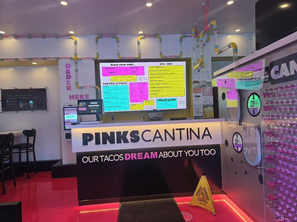
I chose the new restaurant, PINKS CANTINA. Located in back of Starbucks the shop is brightl, cheerful and Alex the proprietor is most welcoming.
The restaurant is bright, cheerful and seats about 12 persons comfortably, The menu above the counter is clear and easy to understand, It is easy to use tbe monitor to choose your items and pay for your dinner.
The Menu Board closeup
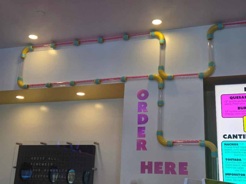
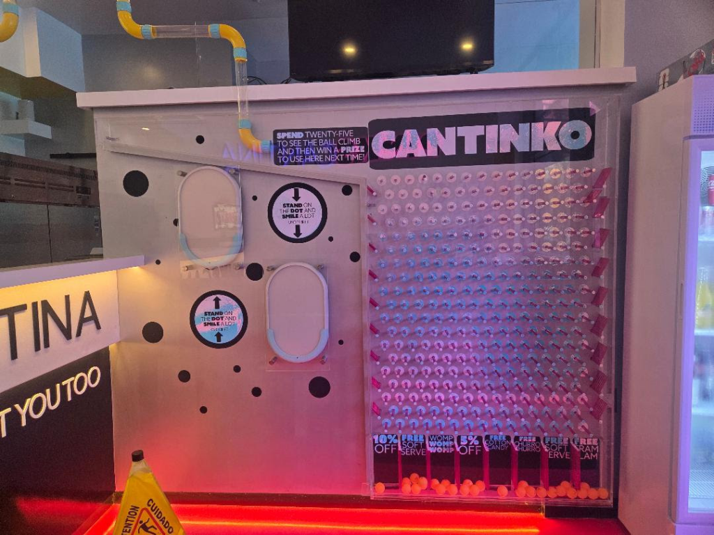
After you place your order the server puts a ping pong type ball in a tube and it proceeds thru a tube around the walls and ends up on a Cantinko board (sort of Pancinko board) where it lands on different gifts, you get at your next visit. This reminds me of pneumatic tubes of the olden days and the modern AVAC tubes.
Stop by for a delicious meal and enjoy the fun atmospher for kids and adults.
CREDITS
JUDITH BERDY
PHOTO OF THE DAY
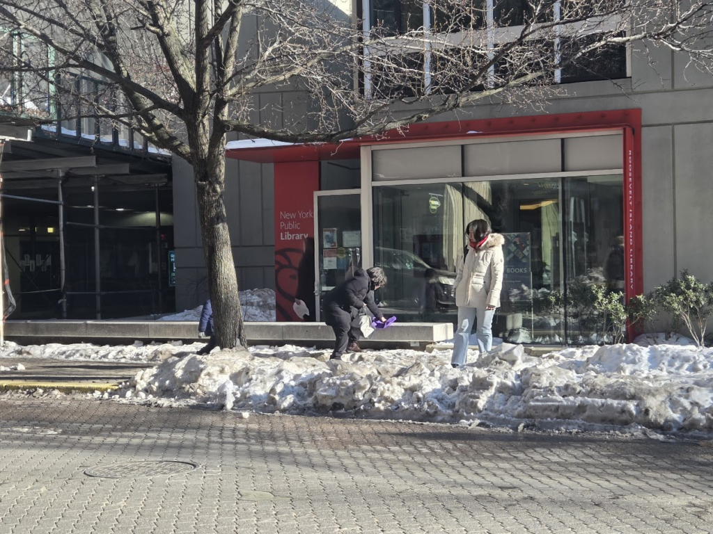
TIME TO CLEAR ALL THE BUS STOPS SO IT IS SAFE TO ENTER AND EXIT THRU THE REAR DOORS.
All image are copyrighted (c) Roosevelt Island Historical Society unless otherwise indicated THIS PUBLICATION FUNDED BY DISCRETIONARY FUNDS FROM CITY COUNCIL MEMBER JULIE MENIN & ROOSEVELT ISLAND OPERATING CORPORATION PUBLIC PURPOSE FUNDS.
On December 24, 1920, the young fireman and future fire chief Richard Norris, who had recently returned from World War One, was nearly permanently injured trying to extinguish the last broom factory fire recorded in the history of Plattsburgh, NY.
Broom making was introduced to the Mohawk Valley in the 1830s, and a broom factory existed in Plattsburgh in Clinton County in the 1840s. Brooms were just another necessary consumer item that area entrepreneurs provided to the regional market.
Broom corn was used in making these brooms. It’s not actually corn, but a variety of sorghum used primarily to make brooms. Although Benjamin Franklin has often been given credit for introducing broom corn to America, recent research suggest the seed arrived with a ship of enslaved people from Africa.
In the 1820s many Clinton County farmers produced broom corn. In 1821 Robert Platt of the town of Peru, Nathaniel Nichols of Champlain and Benona Ladd of Chazy were recognized at the Clinton County Fair for their broom corn harvest. That year Levi Marshall from Beekmantown had the best broom corn acreage.
To win this award one only had to produce 10 rods of a high quality product. Awards for other crops were for .5 or 1 full acre. In 1845, New York State Agricultural Society was still offering recognition for the best broom corn acreage but crops appear to have been more substantial in southern and mid-western states.
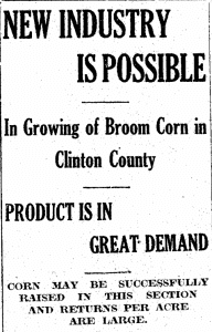
Interest in raising broom corn appeared again in 1916. In March, the County Fair management, through the Clinton County Agricultural Society’s office of their President E. F. Botsford, offered free broom corn seeds to those interested in growing what was suggested to be not only a lucrative crop, but a crop with a local market.
The local market was notably the Plattsburgh Broom Company, which offered 1st and 2nd prizes at the fair for the top bundles. They promoted a US Department of Agriculture booklet on how to grow broom corn and provided seeds for 150 farmers.
That April, an article in the Plattsburgh Sentinel promoted the planting of broom corn with the Clinton County Agricultural Society distributing seeds to anyone interested. In the fall, at the fair, only the Valley Grange of Ellenburg offered a showing of broom corn. There is no record about a prize.
The traditional broom was constructed from a bundle of twigs tied to a stout pole. In the 19th century larger corn broom operations were operated by broom makers, as Henry Rozier, a black Canadian prisoner in Dannemora Prison, was identified in the 1880 census. He was the only broom maker in the prison.
The 1920 census pointed out that Plattsburgh had many broom makers with 15 families connected to the broom manufacturing industry. Some worked on the handles and some on the machines. Nineteen-year-old Harvey Bullis was a corn sorter.
Frank and Louis Fifield were identified as owners of a broom factory in 1920, but this is difficult to confirm elsewhere. Frank Fifield was involved in a tragic accident at the Caroline Street broom factory in August of 1920 when an elevator he was taking down from the 3rd floor badly crushed a man who mistakenly was retrieving broom corn seed for his chickens from the elevator shaft. Alvin Martin died from his injuries in December and is buried in Plattsburgh’s Riverside Cemetery.
The Plattsburgh Broom Company of the 1840s on Oak Street burned in 1915 and then moved to Caroline Street. When they reopened they boasted having improved machinery, making a higher level of broom and employing from 30 to 50 people.
Francis Sargent had a broom factory on Bridge Street in November of 1867. He purchased his broom corn from the south. In 1868 his factory offered “worked up” broom corn for sale.
In May of 1868, Mr. P. Girard, advertised that he had formerly worked with Francis Sargent, and that he and L. Chauvin had opened a broom and brush factory in Walkers & Co Planing Mill, also on Bridge Street called the “Union Broom Factory.” Girard appears to have had access to local supplies of broom corn which could be made up quickly into brooms and at a reasonable cost.
The last broom factory in Plattsburgh was on Peru Street – it burned in December of 1920 and was owned by the Stower Brothers.
There was certainly a market for brooms in Plattsburgh. In November 1827, Edwards & Campbell sold corn brooms, “large and small,” along with a myriad of other products such as fabrics, artist supplies and groceries. In 1849, Nichols & Lynde advertised a stock of 50 dozen brooms and a stock of 100 dozen in 1854. And like any market, prices depended on availability.
It was reported in 1875 that the price of broom corn fluctuated more than any other crop, and in 1910 the cost of broom corn was making brooms very expensive. In May 1920 there was an article in the Plattsburgh Daily Republican about how “club girls” (members of local women’s clubs) could make money making brooms from the broom corn which grew so well in the southern states.
This program, under the supervision of the United States Department of Agriculture, suggested that communities would buy machines for the young women to use. After they paid for the use of the machines, they could profit from their work.
Broom factory fires seemed to be as common as starch factory fires. Elizabethtown lost their broom factory in 1879. The Plattsburgh factory first burned in 1915 and burned again in 1920.
Local investors encouraged them to continue, but the December 1920 fire ended large scale broom making in Plattsburgh. In 1933, broom corn was promoted as a decorative plan with a tropical air, or in a broom, sturdy with a lacquered handle on sale for $1.
It was still grown elsewhere and a new high price for a ton was set in California. Our local newspapers stopped referencing broom corn brooms in the early 1990s.
CREDITS
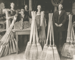
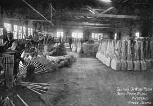
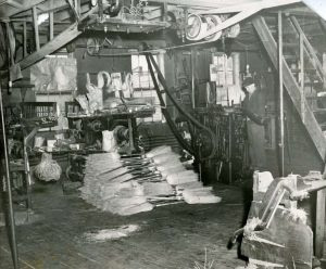
New York Almanack Photos, from above: Workers pose with brooms they made at the Range Broom Factory in Minnesota in the 1930s (courtesy Minnesota Museum of Mining); A broom corn revival article in the Plattsburgh Sentinel, April 21, 1916; The Acme Broom Works on Margin Street in Westerly, Rhode Island, which operated in the early 20th century; and inside the Whitmyer Broom Factory in Schenectady, 1947. Harvey Whitmyer was the sole operator of the factory (Grems-Doolittle Library, Union College).
PHOTO OF THE DAY
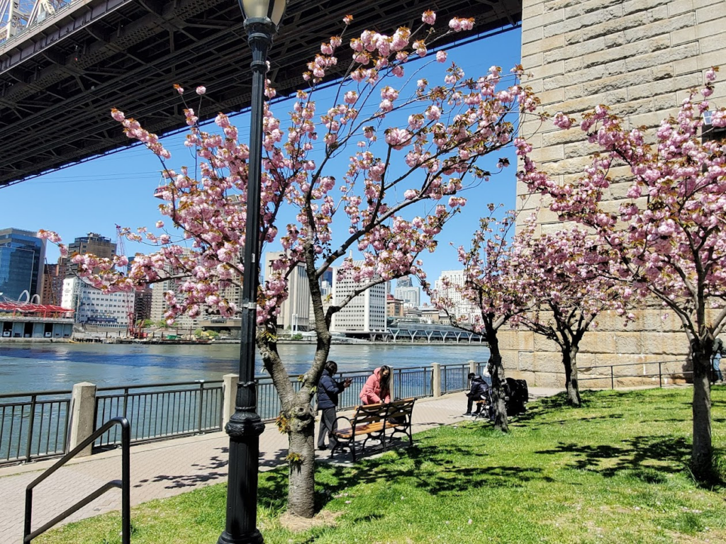
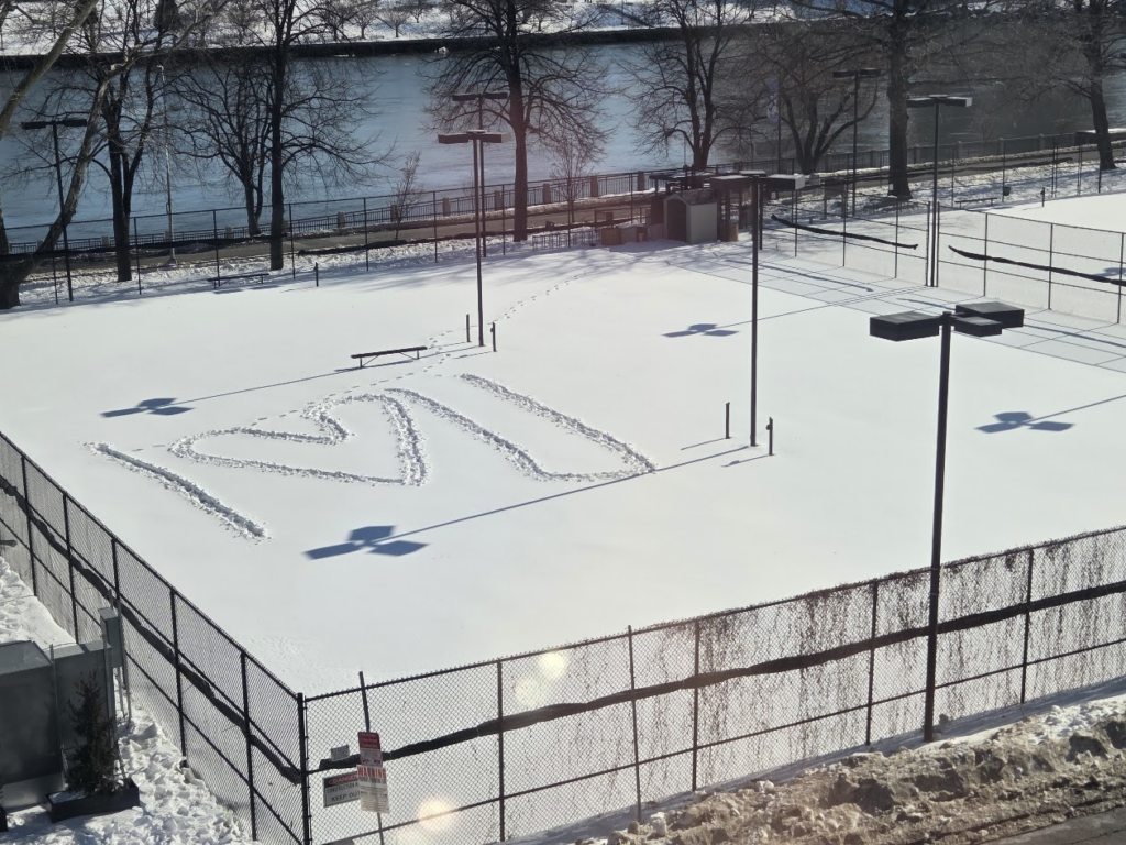
Spotted from the Octagon Love from the Tennis Court
All image are copyrighted (c) Roosevelt Island Historical Society unless otherwise indicated THIS PUBLICATION FUNDED BY DISCRETIONARY FUNDS FROM CITY COUNCIL MEMBER JULIE MENIN & ROOSEVELT ISLAND OPERATING CORPORATION PUBLIC PURPOSE FUNDS.
Sugar Hill raised historical figures including Babe Ruth and Duke Ellington, with some of the best-preserved architecture in Manhattan.
Wednesday February 4, 2026 Untapped New York ISSUE #1620
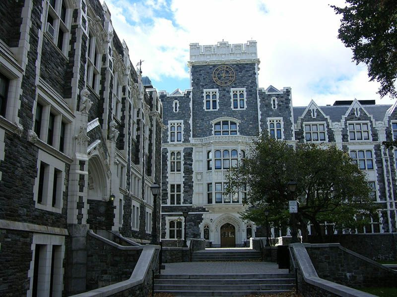
City College of New York‘s stunning Late Gothic structures rise above the surrounding residential neighborhood at the southwest edge of Sugar Hill. Built in the first decade of the 1900s, the university’s Shepherd Hall building —flanking the campus’ quadrangle courtyard — stands complete with architectural flourishes such as grotesques and gargoyles. The stone and terracotta building, built by legendary architect George Browne Post, has received a Lucy G. Moses Preservation Award from the New York Landmarks Conservancy. The entire span of the City College of New York campus spreads between St. Nicholas Park and Amsterdam Avenue.
City College holds particular significance for New York City’s Jewish community as several pivotal figures graduated from the institution including esteemed Jewish theologian Louis Finkelstein. This “Harvard-on-the-Hudson” also produced renowned American politicians such as the New York Senator and labor reformer Robert Wagner, and even the late Secretary of State Colin Powell. Additionally, two time capsules, along with a slightly more arcane “century box,” are buried at prominent positions across the grounds. For time capsule enthusiasts, set your calendars to 2047 and 2050 when the two proper time capsules will be opened. As for the retrieval of the century box, only the gargoyles and grotesques perched across the college’s historic buildings know the secret.
Trish Mayo, Courtesy of Morris-Jumel Mansion
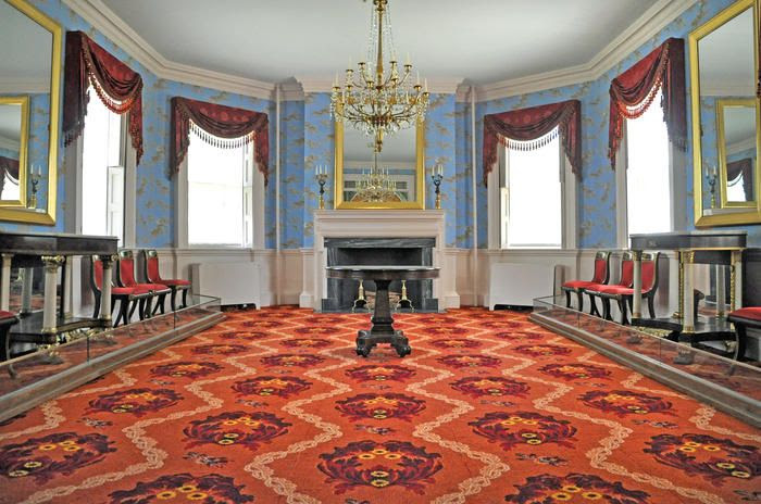
For many New York history buffs, the Morris-Jumel mansion needs no introduction. The oldest extant residence in Manhattan, the structure dates back to 1765 and played a significant role in early New York City. The property served as a summer home for British Colonel Roger Morris and his wife Mary Philipse. A significantly sized property at the time, the entire property stretched 135 acres across what is now known as Mount Morris. The mansion stands just north of Sugar Hill, rising above the Jumel Terrace Historic District west of the mansion. The mansion was also a key site during the nearby Battle of Harlem Heights.
Many may not know that a special colonial milestone resides on the property. Hearkening back to early wayfinding along the colonial-era Albany Post Road, this mile marker records “Mile 11” on the historic trail and is one of only five remaining in New York City. The home is reportedly haunted, with multiple television personalities and paranormal programs such as “Ghost Adventures” and the “Holzer Files” trying to uncover the mysteries of the mansion’s historic phantoms. One such haunt is wealthy former resident Eliza Jumel, a 19th-century real estate impresario who made the stately residence her home with her first husband Stephen Jumel before his death, after which she lived here with her second husband of one year Aaron Burr.
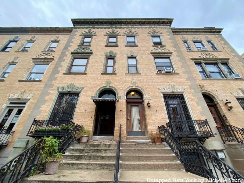
The rich cultural heritage and legacy of Strivers Row along Sugar Hill’s Eastern edge have captivated architecture fans and New York history buffs for decades. The pride of the district, this line of row houses became a major stepping stone in American culture when it was home to several renowned Black American music legends of the 20th century. Residents of Strivers Row have included W.C. Handy, Will Marion Cook, Noble Sissle, and many more.
Part of the designated St. Nicholas Historic District, Strivers Row was originally known as the King Model Houses. It serves as a cultural and architectural touchstone for those seeking to learn more about how this area of Harlem served as a key player in the birth of American pop music. From blues musicians to jazz legends, iconic cultural legacies form the foundation of Strivers Row’s impact and enduring significance to this day.
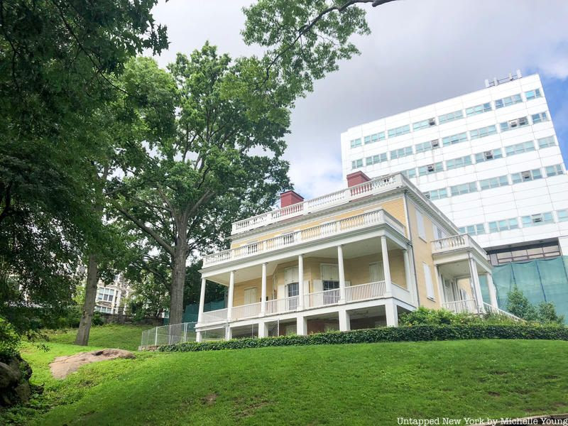
The historic Hamilton Grange National Memorial, the site of Alexander Hamilton‘s only residence that heowned, is currently located at the northern tip of St. Nicholas Park. While the location seems abrupt for the historic home — it was moved to its current location near a corner of St. Nicholas Avenue just below the City College of New York campus — the home itself dates back to 1802. Hamilton prized it as his residence, honoring the Hamilton family home in Scotland. He commissioned it just north of the city as a residence for himself and his family while he conducted political business for New York.
While Hamilton took great pride in his home, he resided there for only two years before his death in his infamous duel with Aaron Burr. Many of the home’s original features remain intact, including some surprising colonial-era artifacts such as a cooler gifted to him by George Washington. Without the intervention of nearby St. Luke’s Episcopal Church, the home would have likely been bulldozed in the 19th century. Through dedication and perseverance, the church gave Hamilton Grange a lift — literally. The entire residence had to be lifted over the church in order to make it to safety and eventually become the revered national memorial it is today. Today, there are 13 sweetgum trees on the property to represent the 13 colonies. The National Park Service offices are now in the home’s private chambers.
The famous Tenenbaum house in Sugar Hill, Harlem.
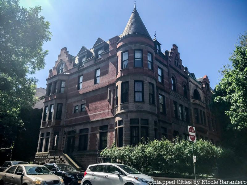
A few short blocks north of City College on Convent Avenue stands a magnificent red brick building. Imposing and glamorous, the Flemish Revival mansion might look vaguely familiar. The impressive structure, which is over 6,000 square feet with more than 50 windows throughout, is known to fans of Wes Anderson, who recognize the stately townhouse as the home of the surviving Tenenbaum family members from the much-loved film “The Royal Tenenbaums.”
Developed by Jacob D. Butler and designed by Adolph Hoak, the townhouse served as home to U.S. Attorney Charles H. Tuttle, who lived here in the early 20th century. Several prestigious lawmakers and government officials have visited the home, including Fiorello LaGuardia, during Tuttle’s time in residence. Passersby can get a glimpse of the home on the Southeast corner of 144th Street and Convent Avenue.
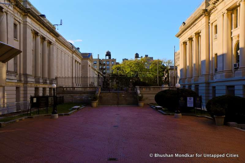
Audubon Terrace, named for John James Audubon.
On the far western edge of Sugar Hill toward Washington Heights lies the historic Trinity Cemetery and the Church of the Intercession. Dating from the 19th century, the church and graveyard are situated on land that belonged to the venerated artist and naturalist John James Audubon. Not only did Audubon previously own the land which was converted into this churchyard, but he is also buried on the property. Dedicated historians and nature lovers can find their way to his gravesite by wandering onto the grounds at 155th Street and Broadway.
Another little-known fact? This Trinity Cemetery is related to the historic Trinity Church in Lower Manhattan, which counted among its members a certain George Washington. By the early 1800s, the popular churchyard at its downtown location was too crowded, so church leaders sought a location farther uptown to offer as a burial ground. Architect James Renwick Jr. was hired to complete the task, and the rest is history.
CREDITS
Untapped New York
PHOTO OF THE DAY
FOUR STUDENTS FROM KOREAN UNIVERSITY VISIT THE CBN OLDER ADULT CENTER’ THE TEAM IS DOING RESEARCH ON CLOTHING THAT IS DESIRED BY SENIORS AND PERSONS WITH DISABILITIES
All image are copyrighted (c) Roosevelt Island Historical Society unless otherwise indicated THIS PUBLICATION FUNDED BY DISCRETIONARY FUNDS FROM CITY COUNCIL MEMBER JULIE MENIN & ROOSEVELT ISLAND OPERATING CORPORATION PUBLIC PURPOSE FUNDS.
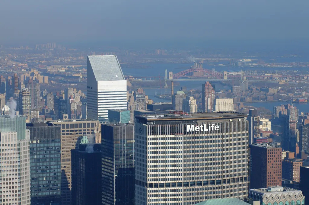
In October 1977, the 59-story Citicorp Center (now known as the Citigroup Center) made its debut on a shabby stretch of East Midtown marked by aging apartment houses, massage parlors, and hair salons.
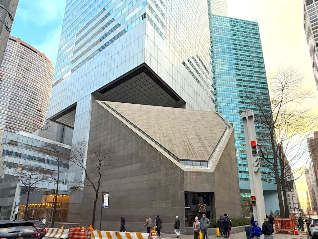
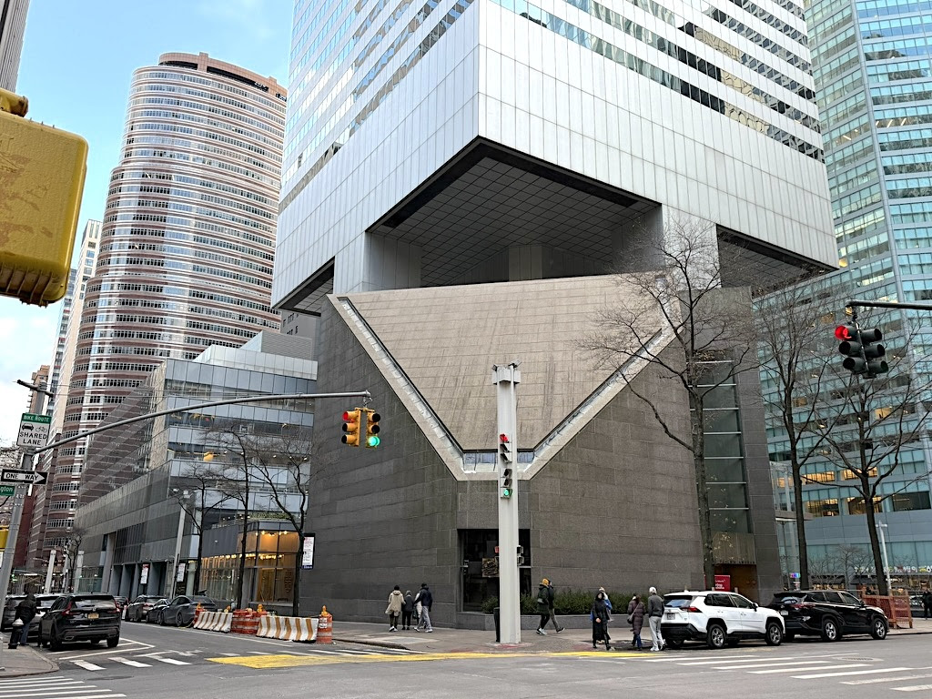
Hugh Stubbins’ cantilevered design spanned Lexington Avenue between East 53rd and East 54th Streets. It included a sunken plaza, new subway station access, retail shops, and an iconoclastic triangular roof that sloped at a 45 degree angle (below photo).
The bold design, plus the four raised columns located in the center of the building’s base rather than the corners, awed many architectural critics.
“The building starts nine stories above ground, raised on four colossal square columns and a central core in one of the most impressive—if somewhat disquieting—architectural acrobatic acts in the world,” wrote Ada Louise Huxtable in the New York Times, four months before the tower officially opened.
“I am not ever going to ask what Citicorp’s steel cost,” continued Huxtable. “But all that brute strength is now encased in the thinnest, flattest, sleekest panels of softly glistening, silvery aluminum, alternating with horizontal bands of glass. It is steel muscle in a silken glove.”
Not everyone loved the design. But at a time when the city almost went bankrupt and few skyscrapers were being built to reshape the skyline, Citicorp Center could be viewed in hindsight as a sign that New York City was not down for the count.
Yet the Citicorp Center wasn’t all about the new. Nestled amid all this steel and glass is a remnant of the New York of old.
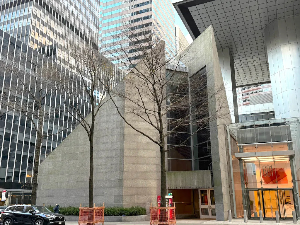
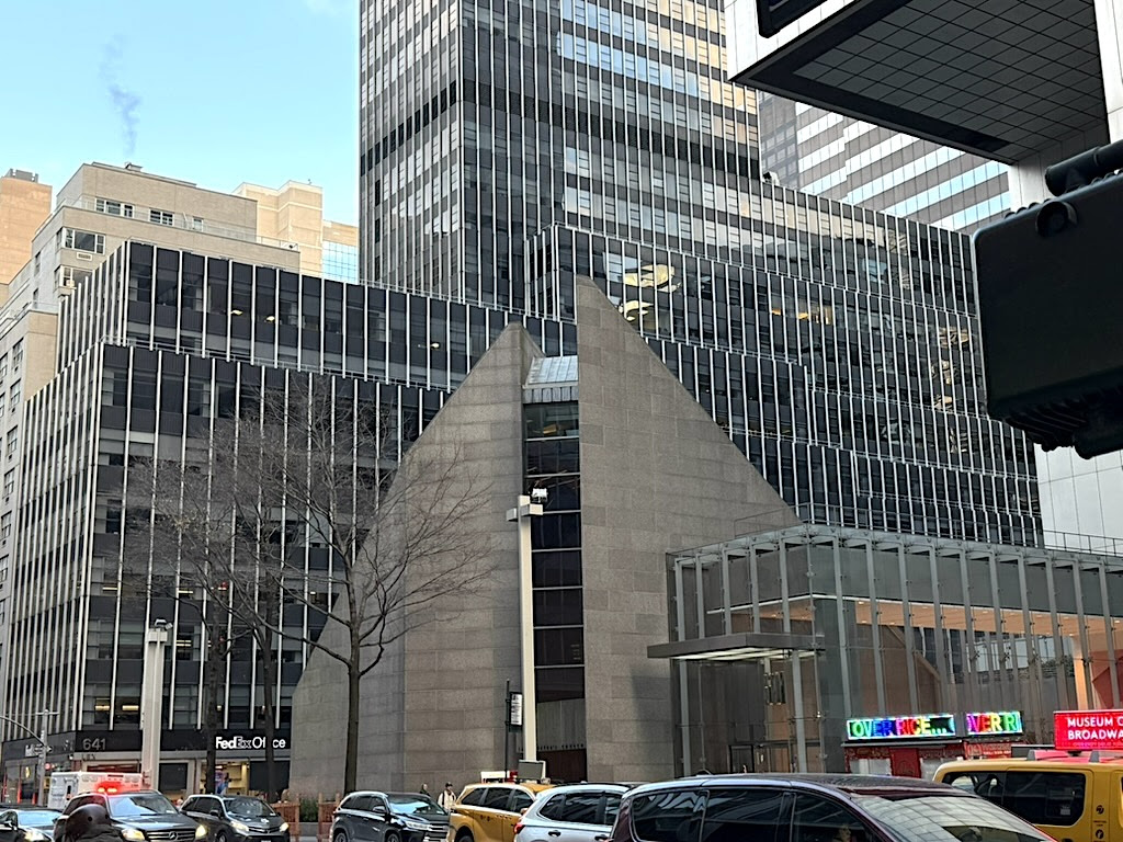
Beneath the mid-wall columns that hold up the tower sits St. Peter’s Church. Clad in granite at the corner of East 54th Street, it’s an unorthodox surprise in the sleek skyscraper canyon that Lexington Avenue has become.
The story of how this Modernist church ended up here has to do with a 19th century German congregation, the value of land in postwar East Midtown, and an unusual agreement that resulted in part of a skyscraper overhanging a brand-new church sanctuary.
Dial back to 1862 with the founding of St. Peter’s German Lutheran Church five blocks to the south. “Worship services in the German language began in a loft above a feed and grocery store at the corner of 49th Street and Lexington Avenue,” states nycago.org.
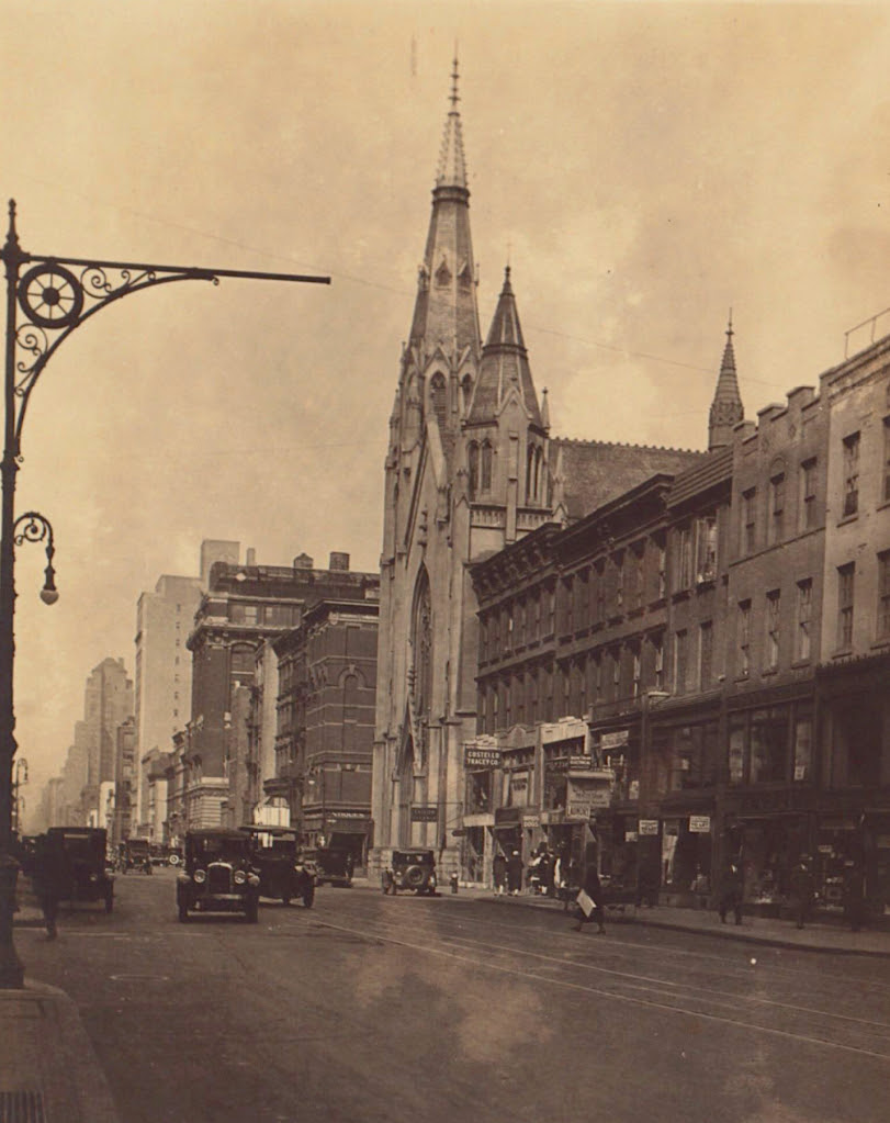
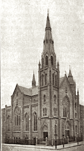
The congregation moved to a vacated church building on Lexington Avenue and 49th Street in the 1890s. That church was soon purchased by the New York Central Railroad and marked for demolition to make way for Grand Central Terminal. The congregation then built a new Gothic-style church on Lexington Avenue and 54th Street (above, in 1928), which opened in 1905.
Over the decades, the church evolved, adding English-language sermons. More than a thousand people belonged to St. Peter’s earlier in the 20th century, but in the postwar years the congregation faced a more commercial Lexington Avenue and a dwindling number of parishioners.
Then in 1969, church leaders were approached by a real estate broker who was buying up nearby parcels of land along Lexington Avenue to offer as a whole for development.
St. Peter’s, now a church that welcomed a more artistic group of parishioners—including the jazz musicians at the clubs along 52nd Street—struck a deal. The congregation would vacate the Gothic building, which would be demolished. In exchange, a new church would be built beside any new development, of which the congregation would be given partial ownership.
The congregation approved the sale in 1971, and ground broke on Citicorp Center in 1974. “St. Peter’s was promised that ‘at least 63 percent of the perimeter’ of the church would be ‘freestanding—that is, with nothing built above it,’” states the Landmarks Preservation Commission (LPC) report.
“This was accomplished by raising the office tower above the ground and by placing it far from the corner, where the [new] church was built,” continued the LPC report.
The new St. Peter’s opened in December 1977, two months after the opening of Citicorp Center, which hangs over the church on the northwest corner.
During the dedication ceremony, Stubbins, who was the architect of the church as well, compared the steel-framed structure to “hands held up in prayer,” according to the LPC report. New York Times architecture critic Paul Goldberger called it a “great granite tent sitting beneath the Citicorp tower.”
The stone and geometric exterior belies the warmth of St. Peter’s Modernist sanctuary. While it looks like a gray jewel box from 54th Street, the space rises to two triangular points joined by a walls of windows on Lexington Avenue.
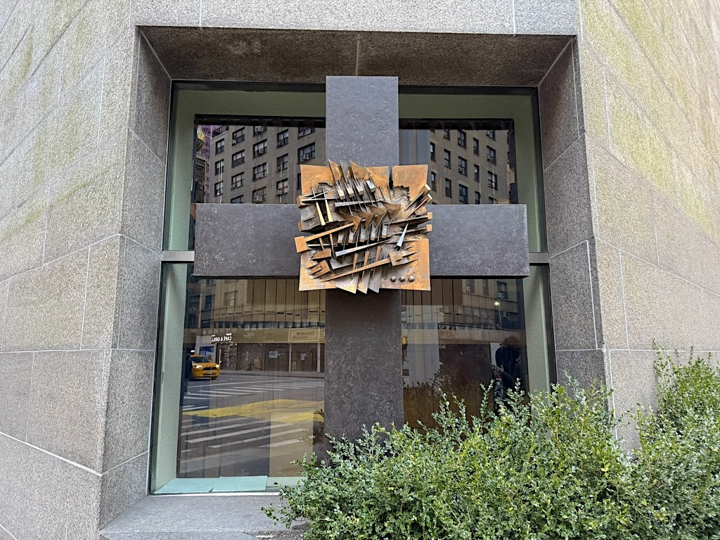
The unique Chapel of the Good Shepherd was designed by Louise Nevelson, who created a peaceful “sculptural environment” within St. Peter’s. And the exterior of the church is marked by the untraditional Cross of the Resurrection (above), by Italian sculptor Arnaldo Pomodoro.
In the past half-century, Citicorp Center has undergone transformations. Less than a year after it opened, a design flaw was discovered that put the tower at risk of toppling over due to high winds, which set off a panicked effort to stabilize the tower before hurricane season without alarming tenants.
The switch to a new name, Citigroup Center, and then landmark designation followed in the new century. In 2021, a fashionable food hall—er, “culinary collective”—and event space debuted on the lower level of the tower.
It’s appropriately named The Hugh, after the architect of both the tower and the sacred space that sits beneath it.
CREDITS
The switch to a new name, Citigroup Center, and then landmark designation followed in the new century. In 2021, a fashionable food hall—er, “culinary collective”—and event space debuted on the lower level of the tower.
It’s appropriately named The Hugh, after the architect of both the tower and the sacred space that sits beneath it.
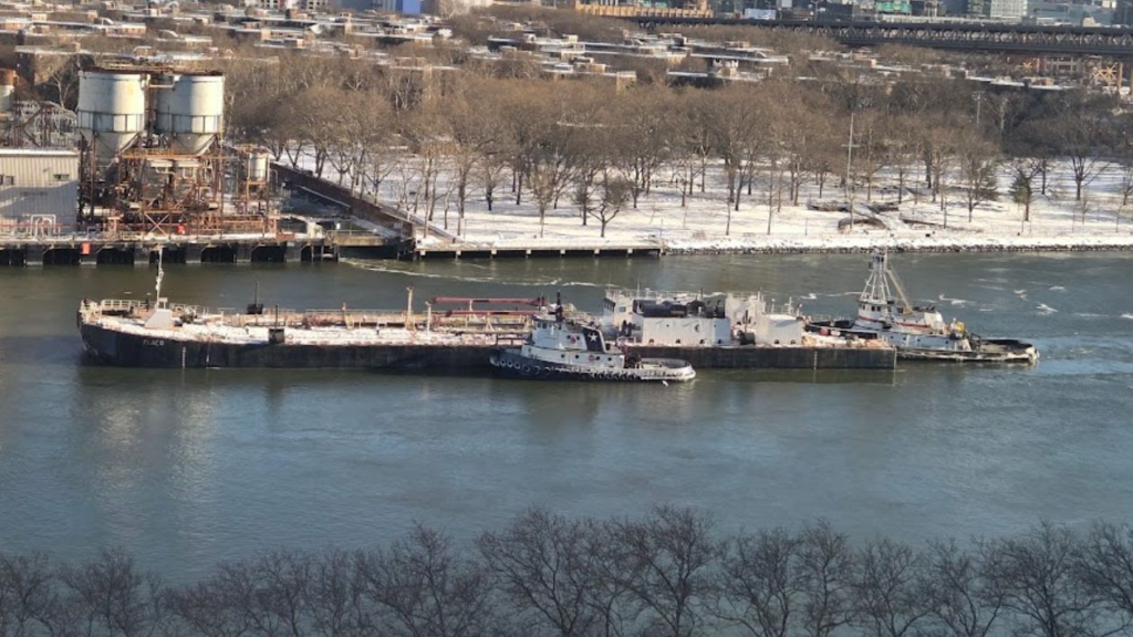
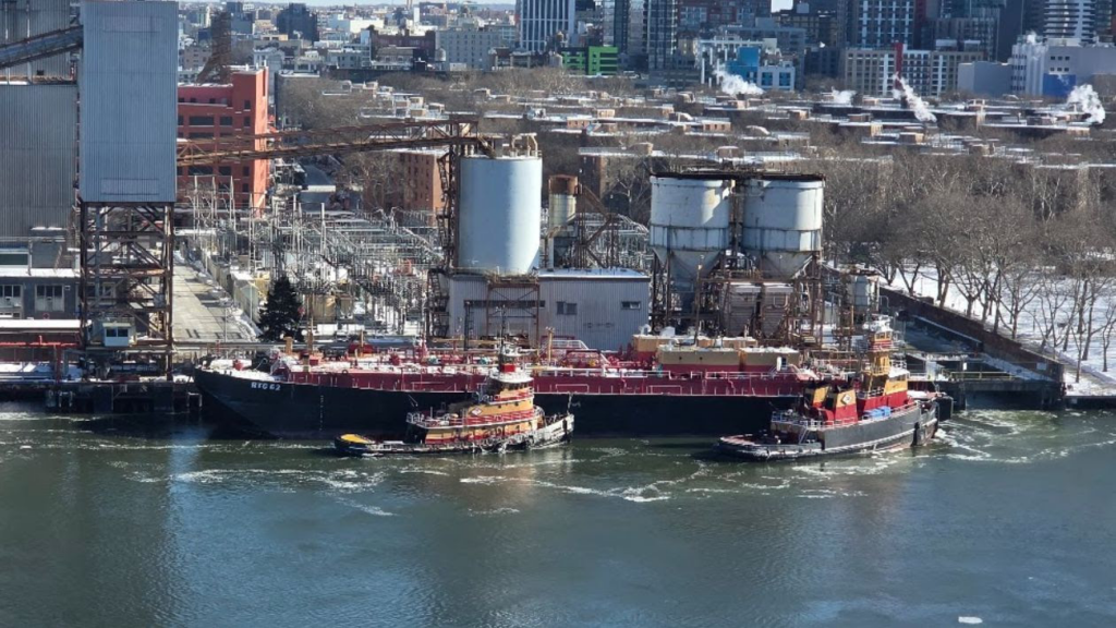
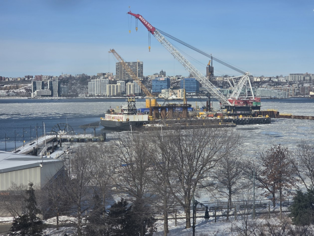
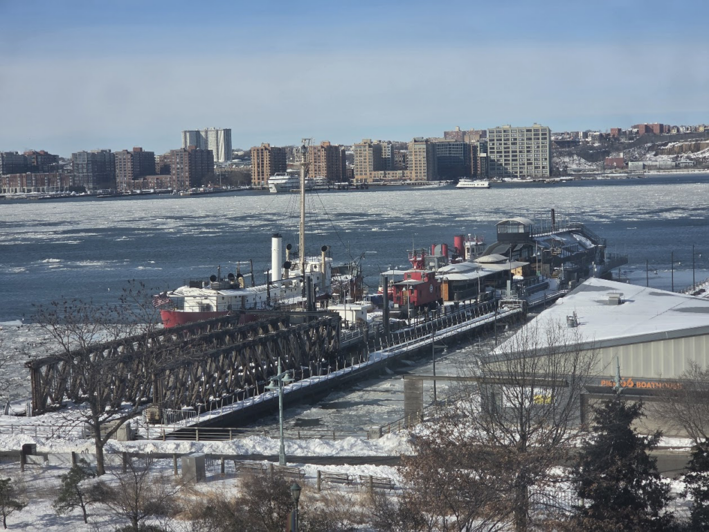
THE VIEW FROM 12th AVENUE OF THE FROZEN HUDSON RIVER. THE CONSTRUCTION IS THE TUNNEL FOR AMTRAK AND OTHER RAIL TRAFFIC
All image are copyrighted (c) Roosevelt Island Historical Society unless otherwise indicated THIS PUBLICATION FUNDED BY DISCRETIONARY FUNDS FROM CITY COUNCIL MEMBER JULIE MENIN & ROOSEVELT ISLAND OPERATING CORPORATION PUBLIC PURPOSE FUNDS.
Text by Judith Berdy Thanks to Bobbie Slonevsky for her dedication to Blackwell’s Almanac and the RIHS Thanks to Deborah Dorff for maintaining our website Edited by Deborah Dorff All image are copyrighted (c) Roosevelt Island Historical Society unless otherwise indicated
Google Images (c)
ALL IMAGES ARE SUBJECT TO COPYRIGHT (C)
FUNDING PROVIDED BY ROOSEVELT ISLAND OPERATING CORPORATION PUBLIC PURPOSE GRANTS CITY COUNCIL REPRESENTATIVE JULIE MENIN DISCRETIONARY FUNDING THRU DYCD
Weekend, January 31 to February 2, 2026 ISSUE #1618
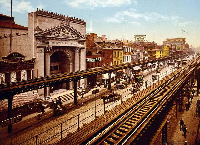
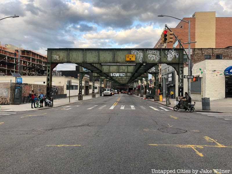
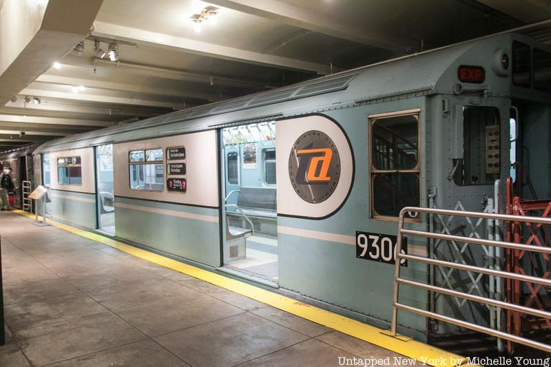
As New York City evolved and changed into the cosmopolitan city it is today, so did the transit lines connecting the city to the boroughs and Long Island. Here are 12 subway and rail lines that have been built, abandoned, then destroyed in New York City since the late 19th century some because of the construction of parallel underground lines, others because of changes in service patterns. With the triumphant return of the W line in the (supposedly) November 2016, we’re remembering some lines of the past.
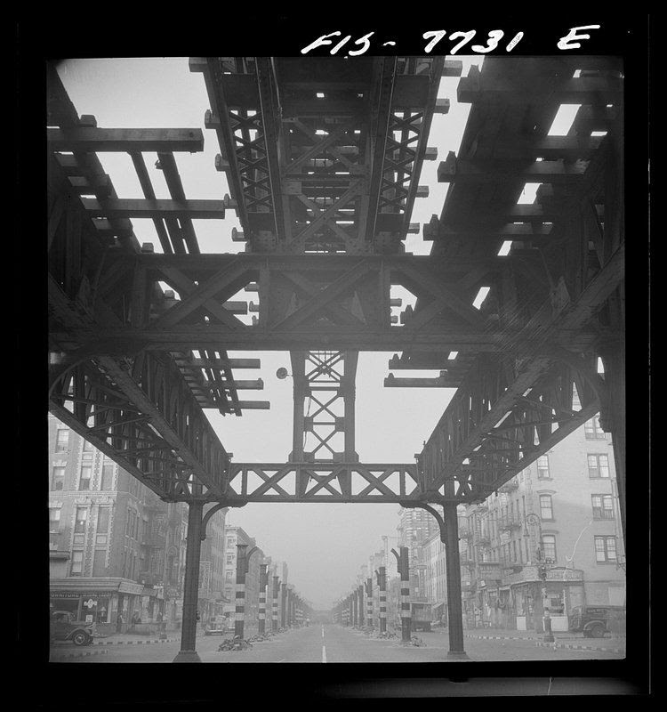
12. Second Avenue El
Looking south at 7 a.m. from 13th Street on Second Avenue, showing the elevated railway in midst of demolition. Photo by Marjory Collins from Library of Congress.
The Second Ave Elevated Line ran from 1880 until 1942. Construction began in 1879 by the Metropolitan Elevated Rail Company. Originally, there was thought to be enough room for a third rail, but when the first round of construction was done, only two rails were put down. On August 16, 1880, the line’s structures and tracks were ready to operate, running from South Ferry all the way up to 127th Street, the northern most limit at the time. Work on a third rail for the 2nd Ave el was completed in 1916 allowing for express services.
The last full length run of the train was on June 11, 1940. The line south of 60th Street continued to operate for about two more years. The New York Times reported on June 14th, 1942 one day after the 2nd Ave el was fully discontinued, that there were 200 passengers on the 6-car train as it pulled into South Ferry on its last run.
Construction for a Second Avenue Subway has been on-going, with a first section anticipated to open in December 2016 (though transit watchers are doubtful).
Constructed between 1875 and 1878, the 3rd Ave el ran from City Hall in Manhattan to the Harlem River. Through service between Manhattan and the Bronx began in 1896. This elevated line was the last elevated line to run in Manhattan with service to South Ferry ending in 1950 and City Hall in 1953. Northward, the 3rd Ave line had service from Chatham Square until 1955. However, service in the Bronx continued for a few years after operation ended in Manhattan. It ran between 149th Street and Gun Hill Road from 1955 to 1973. The line in the Bronx was completely demolished in 1977.
Originally known as the Brooklyn Union Elevated Railroad, the Fifth Avenue Bay Ridge Line opened in 1889 running from Park Row in Manahttan down Flatbush Avenue onto the 5th Avenue, ending at 65th Street by Stedman Plaza. This line stopped running in 1940. On June 25, 1923, there was a major train derailment that caused the death of eight passengers while injuring many others.
A 5th Ave el train derailed at the corner of 5th and Flathbush Avenues in Brooklyn where two cars fell of the elevated track, causing them to hang between the track and the street. Apparently, this wasn’t the first time an accident happened in this area. On January 24, 1900, not too far from the 1923 accident site, a train caught fire. Although no one was injured, it caused a lot of commotion.
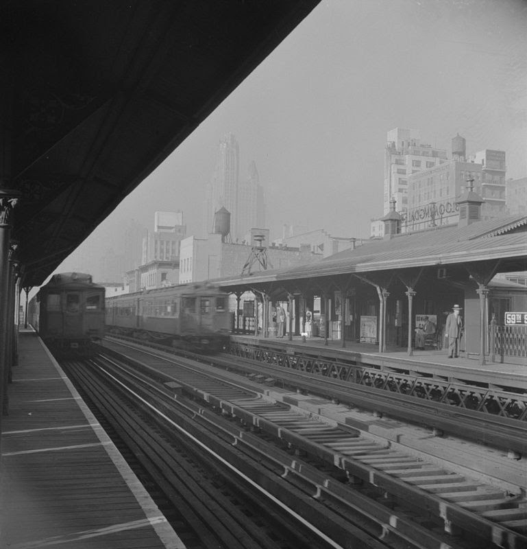
Operation of the 6th Ave el, or Metropolitan Elevated Railway began June 5, 1878 with service from Church Street up to 58th Street with all stops on 6th Avenue. The cars on this line were painted a pea green color and cost 10 cents to ride in one of the finer cars at the time. This train ran until 1938 with demolition starting as early as August 11, 1924, with the IND line moving underground. The Fulton Elevated Line at the time was also in use, and in order to keep that particular line running and expedite the construction of the IND, the 6th Ave el needed to go.
There is some controversy surrounding where the metal of the demolished 6th Ave el went. There was speculation that the metal was being sold to Japan (remember some of the demolition occurred during World War II). The New York Times reported in 1938 that 20,000 tons of steel could “ultimately take the form of explosive shells raining down from Japanese bombers on a Chinese city.” But the Chairman of the Board of Transportation at the time, John H. Delaney, and former Borough President Stanley M. Isaacs both denied the shipping of the steel to Japan.
The 9th Ave el was the first elevated railway in New York City opening on April 20, 1871. It was originally powered by steam locomotives, but in 1885, the Manhattan Railway Company added an electrified third rail making the 9th Ave el the city’s first electrified railway. At the height of its operation, the line spanned from Manhattan’s South Ferry all the way up to Kingsbridge Road in the Bronx.
As the first elevated railway in the city, there were many other “firsts” associated with it, such as the first line to have three tracks which in turn allowed it to be the first train with express service. In 1918 that meant that express services would go directly from 125th street to 155th street.
Service on the 9th Ave el ended in 1940 in Manhattan since the new A/C/E train on 8th Ave began running in 1932. Operation in the Bronx continued to run as the “Polo Grounds Shuttle” to Yankee Stadium, but shut down in 1958 when the New York Giants (baseball team) moved to San Francisco.
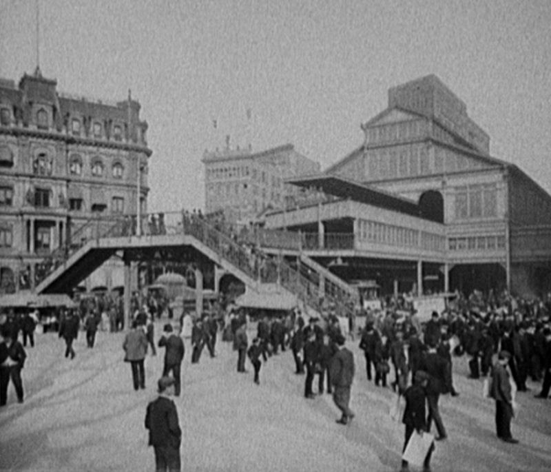
The Fulton Street el began running on April 24, 1888 originally from Fulton Ferry to Nostrand Avenue in Brooklyn. Over the next few years the line would extend until December 28, 1893 when it finally reached the Brooklyn city limit at Grand Avenue. On June 1, 1940, New York City acquired all the properties of the BMT (Brooklyn-Manhattan Transit Corporation) and the IRT (Interborough Rapid Transit Company) and abandoned all services from Fulton Ferry and Park Row to Rockaway Avenue.
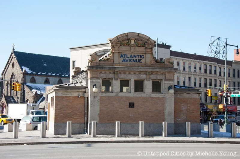
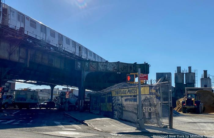
The remains of the Fulton Street connection south of Atlantic Avenue were completely demolished in 2004. Even though the elevated line has been demolished, the IND Fulton Street subway runs pretty much on the same line since 1936, it’s just been duplicated underground.
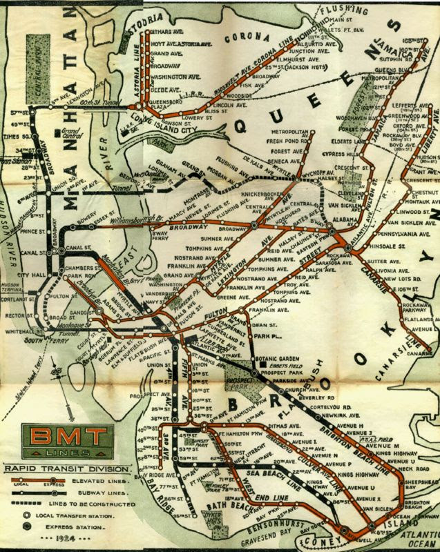
This line, not to be confused with the IRT Lexington Avenue line, was the first standard elevated rail line in Brooklyn, which began running on May 13, 1885 from Washington and York Streets to Gates Avenue. This line was short lived because on April 27, 1889, the Lexington el began using the Myrtle Avenue Elevated line.
Service on the Lexington Line was not completely abandoned until October 1950. From 1904 to 1950, the Lexington Line basically ran on the elevated Broadway line. In the 1950s, ridership decreased because of the Myrtle Ave el and and underground line running under Lafayette Avenue, so the Lexington el was dismantled.
5. Long Island Rail Road at Chambers Street
The Long Island Rail Road (LIRR)used to run south into Brooklyn past Atlantic Avenue and into Manhattan by Chambers Street. The LIRR would come up from underground at Atlantic Ave and ride on today’s J line at Fulton Street. In 1916, LIRR service to Chambers Street ended, deemed an unsuccessful experiment.
The LIRR ran from 1898 to 1917 from the lost Williamsburg Terminal to Far Rockaway during the summer. When the Williamsburg Terminal was demolished, the J train handled the service of LIRR to Far Rockaway from August 4, 1913 to 1916.
4. Culver Line
On June 19, 1875, the PP&CI railroad (Prospect Park & Coney Island) ran from Prospect Park to Gravesend Avenue and Neck Road. Until 1912, the line would go through multiple stages of ownership from the LIRR, the BRT, and then finally the South Brooklyn Railway.
On March 16, 1919, the Culver Elevated line was constructed from 9th Avenue to King’s Highway. Service eventually reached Coney Island on May 1, 1920. In 1954, new construction of the 6th Avenue IND connected it to the Culver el causing the elevated line between 9th Avenue and Ditmas Avenue to become practically unused. So, the MTA made the Culver a shuttle from 9th to Ditmas with stops at Fort Hamilton Parkway and 13th Avenue but eventually closed the shuttle in 1975. The structure was completely demolished in 1985.
3. Myrtle Avenue Line
Today there is a Myrtle Ave line that runs through Brooklyn, but it is not the same one the past. What is used today follows the remnants of the old Myrtle Avenue Line which ran from Jay Street to Metropolitan Ave until it was abandoned on October 4, 1969. This particular line was the last one in the entire city to use the wooden cars typically operated on the elevated lines.
The Myrtle Ave Line opened in April 1888 running between Adams Street station in downtown Brooklyn and Grand Avenue in Clinton Hill. Through the next few years it would slowly branch out further until 1906 when it was finally extended to Metropolitan Ave. Today, the eastern most part of the line between Wyckoff and Metropolitan Avenues is still being used by the M subway line.
2. World’s Fair Subway Line
This line was created specifically for the World’s Fair in 1939 in Queens. The line started near the Forest Hills-71st Street stop along today’s M/R lines, by what the Queens Boulevard line of the IND, ran through Jamaica Yard, turned north at the east side of Flushing Meadows-Corona Park and rolled into the World’s Fair Terminal Station. The two-mile long track cost a total of about $1.7 million to build, operate, and maintain.
On January 15, 1941, demolition of this line began following expense issues and political pressure. There was some movement back then to keep the line working, but there wasn’t much need after the fair ended as Citi Field and the US Tennis Association hadn’t been established yet. Moreover, the line didn’t meet construction standards for permanent lines at the time which required them to be underground.
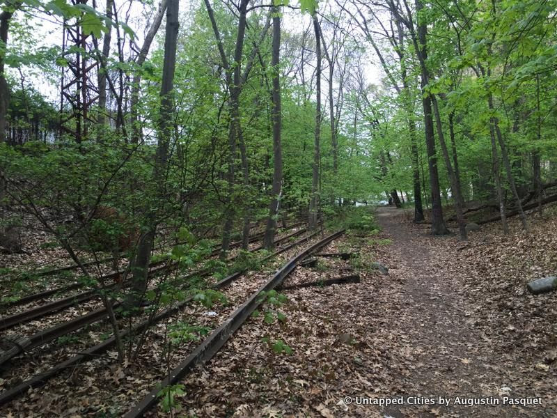
This defunct LIRR line is a 3.5-mile long stretch of rail that starts in Rego Park and ends at Rockaway Peninsula. Constructed in 1908-09, this branch was created to connect the LIRR to Rockaway Peninsula. Before the Depression in the 1930s, there was a plan to connect this line with the IND subway line, but the economic downturn ultimately shelved those plans. So the line remained a part of the LIRR until 1950, but fires on the wooden tracks led the LIRR to sell it to New York City who rebuilt the tracks and converted it into a subway line with service to the Rockaways in 1956.
The line was also connected to the LIRR Montauk Branch via the Glendale Junction which stopped operating in 1946. The north end of the Rockaway Line above Liberty Avenue maintained its services until June 8, 1962. In the end, decreased patronage caused the line to close down.
Today, there is an effort being made to convert the abandoned rail line into a park, or high line like on Manhattan. The project, dubbed the QueensWay, was started by The Friends of QueensWay (FQW) which aims to turn the railline into a park “enjoyed by bikers, walkers, joggers, visitors, tourists, workers and residents in Queens and the rest of the world.”
Stirring the Melting Pot: Photographs from The New York Historical Collections is on view at The New York Historical through March 29.
PHOTO OF THE DAY
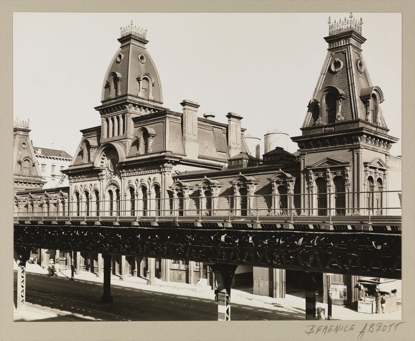
THIRD AVENUE CAR BARN AT 65-66 STREETS BERENICE ABBOTT-PHOTOGRAPHER 1936 Museum of the City of New York
All image are copyrighted (c) Roosevelt Island Historical Society unless otherwise indicated THIS PUBLICATION FUNDED BY DISCRETIONARY FUNDS FROM CITY COUNCIL MEMBER JULIE MENIN & ROOSEVELT ISLAND OPERATING CORPORATION PUBLIC PURPOSE FUNDS.
NYC’s Never-Built Pneumatic Tube Railway, from the Gotham Center Archives
Thursday, January 29, 2026
ISSUE #1616
Untapped New York is excited to announce a new editorial collaboration with the Gotham Center for New York City History. In this series, we’ll share fascinating stories from the Gotham Center archives. These scholarly articles will explore New York City history through a variety of lenses and cover topics that range from Dutch colonialism to modern art!This post on Gilbert’s pneumatic train is the first in a series of posts on the Gotham Center blog drawn from the authors’ work Never Built New York, published courtesy of Metropolis Books.
Rufus Henry Gilbert was among the most influential, and tragic, inventors to promote a mid-nineteenth-century transit scheme. Born in 1832 in Guilford, New York, Gilbert possessed an itinerant and brilliant mind. As a young man, he taught himself classical literature, mechanics, and mathematics; he apprenticed at a manufacturing firm but switched to studying medicine at the College of Physicians and Surgeons, becoming a distinguished surgeon and doctor. At the outbreak of the Civil War, he signed up as a Union surgeon and was decorated for performing the first operation ever done under fire. By war’s end, he had risen to become medical director and superintendent of all U.S. Army hospitals, chiefly training other doctors––who became known as sawbones––in the terrible art of amputation. This was hardly the road to rapid transit.
Chronic stomach ailments, which he had contracted during the war, forced Gilbert to resign his commission and abandon his medical practice. Prior to the war, grieving over the loss of his wife, he had sailed to Europe, where abysmal tenements convinced him that overcrowded slums were the chief cause of disease and early death among the poor. Gilbert’s answer to the cholera, typhus, and diphtheria rampaging among the downtrodden classes was, elliptically, rapid transit. He reasoned that fast and cheap public conveyances would allow the poor to flee their teeming, disease-infested neighborhoods, and live in the hinterlands, where they could enjoy clean air and water, and plentiful sunshine. The pathways to good health were the tracks to suburbia.
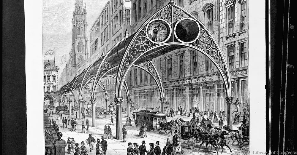
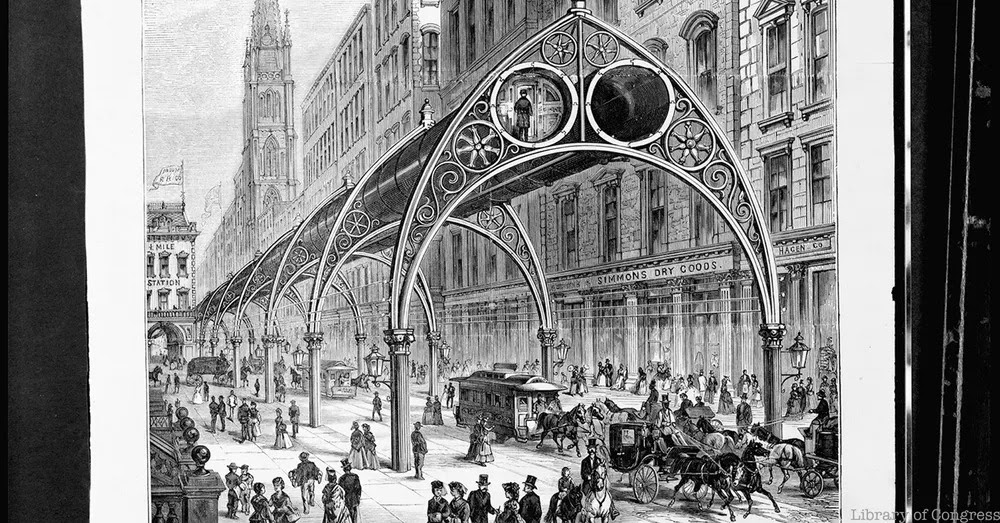
After a stint working as an assistant superintendent for the New Jersey Central Railroad, Gilbert at last devoted himself to perfecting rapid transit in New York City. Several iterations on, he came up with his Elevated Railway, for which he was granted a patent in 1870. Gilbert’s design was a hybrid––a combination of Alfred Beach’s air-powered underground and Charles T. Harvey’s cable-powered elevated––which had begun a brief experimental run on Greenwich Street in July 1868. Passengers would waft around town propelled by compressed air, moving through a double row of what Gilbert called “atmospheric tubes.” The elevated tubes, which he envisioned as eight or nine feet in diameter, were suspended from 24-foot-high, wrought-iron Gothic arches, held aloft on slender, fluted, Corinthian columns.
The arches, which were reinforced by trusses elaborately adorned with French curves and spoked rosettes, were a huge hit. The New York Times predicted the elevated would become “the pride and boast of the people living along the line” and lauded its “lightness and beauty of architectural design.”
Gilbert put his stations about one mile apart and provided them with pneumatic elevators, “thus obviating the necessity of going up and down stairs for transit,” said Scientific American. He also planned a telegraph triggered by the passing cars, which would automatically signal arrivals and departures from all points along the line.
In 1872, the state legislature gave Gilbert a charter to build his elevated pneumatic train. He was allowed three years to span nearly the length of Manhattan, from West Broadway and Reade Street in present-day Tribeca, along Sixth to the Harlem River.
Then Wall Street collapsed in the Panic of 1873. No one would invest in Gilbert’s fanciful and untested scheme.
Gilbert was not one to give up. He obtained at least two other patents for his “improved elevated railway,” which by 1874 had morphed from the exotic pneumatic train into a more conventional steam-powered train––still running on an elevated track, now held aloft on a less-graceful Gothic arch adorned in trefoils.
The great virtue of Gilbert’s plan, according to his civil engineer Richard P. Morgan, Jr., was prefabrication. “As all the parts will be prepared and fitted to each other before they are brought to their places, the structure can be quickly put up, and during the process of erection will occupy no more of the street than is now used by the erection of new buildings.”
In 1875, the state legislature freed the city’s mayor to appoint a Board of Rapid Transit Commissioners, which, in turn, authorized Gilbert to build his line on Second and Sixth avenues. Now he found backers, and on April 19, 1876, construction began at the corner of Sixth Avenue and 42nd Street.
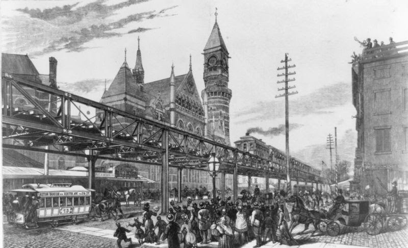
The first train on the Gilbert elevated railroad passing through Sixth Avenue, Image via Library of Congress
Two years later, on June 5, 1878, the Sixth Avenue El opened, and 30,000 riders overwhelmed the steam cars. Ten cents bought a ride from Rector Street to Central Park, via Church, West Broadway, and Sixth Avenue. The following day, Gilbert was stripped of his seat as a company director and, later, forced out altogether. His former partners, who were tied to “Boss” Tweed, swindled him out of his holdings and erased him from the company name, which became the Metropolitan Elevated Company.
The shady stock swap left the inventor impoverished and broken. He spent the last years of his life pursuing his victimizers in court. Gilbert was last seen on the streets of New York, hobbled, leaning on a pair of sticks as he walked to the elevated station at 72nd Street and Ninth Avenue. He died of his debilitating stomach ailments on July 10, 1885, at just 53 years old.
CREDITS
Sam Lubell is a Staff Writer at Wired and a Contributing Editor at the Architect’s Newspaper. He has written seven books about architecture, published widely, and curated Never Built Los Angeles and Shelter: Rethinking How We Live in Los Angeles at the A+D Architecture and Design Museum. Greg Goldin was the architecture critic at Los Angeles Magazine from 1999 to 2011, and co-curator, and co-author, of Never Built Los Angeles. His writing has appeared in The Los Angeles Times, Architectural Record, The Architect’s Newspaper, and Zocalo, among many others.
PHOTO OF THE DAY
FIRST AVENUE, MANHATTAN
All image are copyrighted (c) Roosevelt Island Historical Society unless otherwise indicated THIS PUBLICATION FUNDED BY DISCRETIONARY FUNDS FROM CITY COUNCIL MEMBER JULIE MENIN & ROOSEVELT ISLAND OPERATING CORPORATION PUBLIC PURPOSE FUNDS.
New York City’s borough of Staten Island has a long history of quarantines and public reactions to them. Just over five miles from Manhattan, Staten Island has faced numerous disease outbreaks, with quarantine measures playing a central role in containment efforts. In the nineteenth century, mass immigration and the spread of infectious diseases overwhelmed the city, leading to stricter quarantine enforcement. At the time, immigrant health regulations were managed by municipal authorities and the State Health Office, which operated a quarantine station on Staten Island. The island became a focal point for disease containment, housing sick immigrants upon their arrival in New York. Throughout its history, Staten Island has also witnessed strong public opposition to quarantine measures, sometimes leading to violent protests—including during the most recent COVID-19 pandemic. [1]
In November 2020, as COVID-19 cases surged, the state ordered bars and restaurants to close by 10 PM. One Staten Island bar defied the mandate, resulting in the revocation of its liquor license. Some Staten Islanders saw this as government overreach, viewing the restrictions as an infringement on private businesses. As the most Republican-leaning borough in an overwhelmingly Democratic city, many Staten Island residents have long been skeptical of government intervention. Residents also feel neglected by the rest of New York City, fueling resentment toward state officials and policies imposed without their input. Tensions escalated when the bar’s manager continued to sell alcohol without a license and, in an attempt to evade arrest, struck a deputy sheriff with his SUV. [2]
This 2020 event reflects a broader pattern. From yellow fever in the 1700s to the HIV epidemic of the 1980s, disease outbreaks have shaped New York City’s history. Staten Island has a unique relationship with these epidemics. Since the early to mid-nineteenth century, Staten Islanders have expressed strong, sometimes violent, opposition to quarantine measures.
Throughout its history, Staten Island has maintained a tumultuous relationship with city, state, and federal governments, which often prioritized the interests of merchants and other elites over the concerns of the island’s residents. This tension is exemplified by the quarantine facilities established on Staten Island during the 1800s and 1900s.
Yellow Fever and Staten Island Quarantine
In 1799, yellow fever arrived in New York City through its bustling ports, which were already among the world’s busiest. Fearing a halt in commerce, government officials proposed quarantining ships and passengers to prevent the spread of disease. To contain the outbreak, commissioners from the state legislature sought to establish a quarantine facility away from Manhattan’s ports, choosing Staten Island, which consisted of independent towns before becoming a borough of New York City in 1898. [3]
When the commissioners acquired a site for a quarantine hospital on Staten Island in 1799, local landowners resisted. However, the government exercised eminent domain to seize the land, and soon hospitals and other buildings were erected to treat yellow fever and other contagious diseases. This facility became known as the New York Marine Hospital, or simply “The Quarantine.” [4]
Despite the prevalence of yellow fever in the late 1840s, calls to abolish the quarantine hospital persisted. A committee formed in 1849 to consider Staten Island’s concerns ultimately recommended relocating The Quarantine, although shipping merchants—concerned about potential disruptions to their interests—opposed this change. The merchants, wielding significant influence due to their economic contributions, successfully thwarted efforts to relocate the facility and kept The Quarantine in operation for a few more years. [5]
In 1856, another yellow fever outbreak reignited calls to remove The Quarantine, but once again, the proposal was blocked by merchants and immigration officials. The Quarantine suffered from poor mismanagement. Employees who worked at the hospital freely returned to their communities, becoming vectors for spreading disease. Compounding this issue, the prevailing miasma theory of the time held that diseases spread through “bad air,” creating further alarm. [6] Most of the hospital’s patients were immigrants, viewed by many as carriers of disease. The rapid increase in immigration during the 1840s and 1850s fueled anti-immigrant sentiments, adding tension to the already volatile situation. Mismanagement, xenophobia, and merchant interests culminated in what became known as the Staten Island Quarantine War.
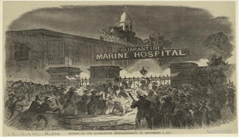
On September 1-2, 1858, a mob, organized by local landowners and fueled by years of neglect and anti-immigrant sentiment, attacked the Quarantine, setting it ablaze. No deaths were reported, but the hospital was completely destroyed. The federal government responded by establishing Swinburne and Hoffman Islands in 1860 to house immigrants arriving through New York’s ports, relocating quarantine facilities away from Staten Island. [7]
Completed in 1870, Swinburne Island—named after Civil War veteran and surgeon Dr. John S. Swinburne—became known as “Lower Quarantine,” where sick individuals were hospitalized. Hoffman Island, finished in 1872 and named after former New York Governor and New York City Mayor John T. Hoffman, was referred to as “Upper Quarantine,” where asymptomatic individuals were held. Though these islands were intended to replace quarantine efforts on Staten Island, the borough’s involvement with disease containment was far from over. [8]
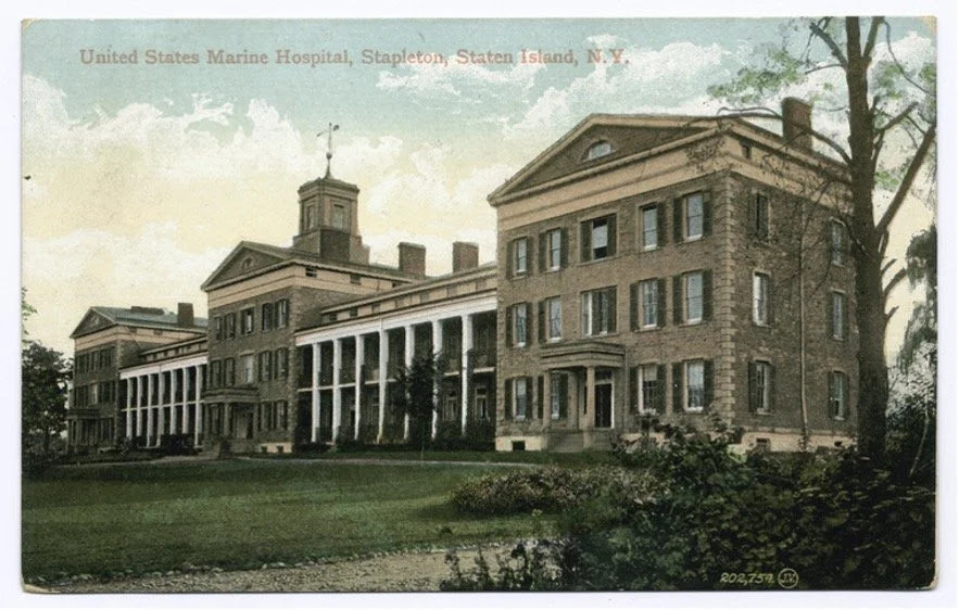
In 1878, another yellow fever outbreak prompted the passage of the National Quarantine Act, which shifted quarantine authority from state to federal control. This legislation reignited discussions about establishing a new quarantine hospital on Staten Island. The planned facility was to be known as the U.S. Marine Hospital. The following year, The New York Times referred to the Quarantine Act as “an experiment,” noting that the federal government had yet to exercise its authority over quarantine matters. While some raised concerns about the impact of quarantine regulations on commerce, the article emphasized that the measure was primarily a public health necessity, justified by the ongoing yellow fever epidemic. [9]
For Staten Island, the proposed U.S. Marine Hospital had little to do with yellow fever and more to do with federal authority. On Christmas Eve, the New York Times reported on local opposition to converting Staten Island’s Seaman’s Retreat into the new U.S. Marine Hospital due to concerns about spreading infectious diseases. [10]
Despite local resistance, the Seaman’s Retreat was sold to the federal government. A follow-up article in the New York Times reported that commercial bodies in New York City had petitioned Congress to acquire the property for a government hospital, dismissing fears about disease spread as “absurd.” Ultimately, the federal government proceeded with its plan, disregarding Staten Island’s past experiences and residents’ concerns. [11]
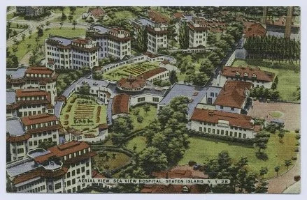
After Staten Island became a New York City borough in 1898, the island was once again chosen for a quarantine facility, this time for tuberculosis (TB). In 1905, New York City selected a site on Staten Island’s second-highest point to build a sanatorium. At the time, TB was treated with fresh air, sunlight, and a good diet, and sanatoriums provided a place for patients to receive such care. [12]
The resulting Sea View Hospital, completed in 1913, was not easily accessible to the poor, for whom treatment was often financially out of reach. Many working-class residents could not afford sanatorium care or take time off work, rendering the sanatorium a privilege unavailable to most.
Local landowners also opposed the sanatorium. In a letter to the New York Times, one Staten Island resident argued that the presence of “thousands of consumptives” would degrade property values and force long-time residents to sell their homes. Despite such protests, Sea View Hospital opened, providing TB treatment to those who could afford it. [13]
Modern Parallels: Staten Island and COVID-19
Staten Island’s longstanding tensions with New York City, state, and federal governments over quarantine matters were largely dormant until recent years, thanks to advances in vaccines and public health. However, the COVID-19 pandemic revived these debates.
In November 2019, the first confirmed COVID-19 case heralded a new era of pandemic response. Staten Island again found itself embroiled in quarantine-related conflict. The November 2020 incident involving a bar manager who struck a deputy sheriff with his SUV reflects a deep-seated resistance to state-imposed public health measures, echoing the Staten Island Quarantine War of 1858. While the 2020 conflict did not involve literal flames, it kindled a spirit of defiance that legislation alone cannot extinguish.
CREDITS
Carlos A. Santiago is the Programs Associate and Archivist at CitizensNYC, a grantmaking nonprofit that has provided microgrants to grassroots community projects across New York City since 1975. He holds a BA and MA in History from SUNY Buffalo and Brooklyn College, where he studied the history of tourism and urbanization in Puerto Rico. While managing digital collections at a genealogy nonprofit from 2019 to 2022, he uncovered stories about New York City that deepened his interest in researching the city where he was born and raised.
[1] Brendan P. O’Malley, Protecting the Stranger: The Origins of US Immigration Regulation in Nineteenth-Century New York (PhD diss., CUNY Graduate Center, 2015), 20-23.
[3] Richard M. Bayles, History of Richmond County (Staten Island), New York: From its Discovery to the Present Time (New York: L.E. Preston, 1887), 267.
[4] Bayles, History of Richmond County, 268.
[5] Bayles, History of Richmond County, 269.
[6] Bayles, History of Richmond County, 269-270.
[7] The Miriam and Ira D. Wallach Division of Art, Prints and Photographs: Picture Collection, The New York Public Library. “Attack On The Quarantine Establishment, On September 1, 1858.” New York Public Library Digital Collections. https://digitalcollections.nypl.org/items/510d47e1-281b-a3d9-e040-e00a18064a99.
All image are copyrighted (c) Roosevelt Island Historical Society unless otherwise indicated THIS PUBLICATION FUNDED BY DISCRETIONARY FUNDS FROM CITY COUNCIL MEMBER JULIE MENIN & ROOSEVELT ISLAND OPERATING CORPORATION PUBLIC PURPOSE FUNDS.