WE CAN EASILY ADD YOUR FRIENDS AND FAMILY TO RECEIVE THEIR OWN ISSUES DIRECTLY FROM US 6 DAYS A WEEK. SEND US THEIR NAMES AND E-MAILS. THEY WILL SOON BE ENJOYING THEIR OWN COPY AS EARY AS 6:15 IN THE MORNING!
With National Mall Debut of 120 Statues Celebrating Women in STEM
Smithsonian Partners With IF/THEN
To Display the Largest Collection of Statues of Women
Ever Assembled
Credit: Courtesy of IF/THEN COLLECTION Joyonna Gamble-George stands next to her statue in the #IfThenSheCan — The Exhibit. Gamble-George is an American neuroscientist, innovator, and entrepreneur.
The Smithsonian will shake up Women’s History Month in March with a new Women’s Futures Month, a forward-looking celebration of the power of women and girls in STEM (science, technology, engineering, mathematics) to shape a better world. To kick off the month, the Smithsonian will present “#IfThenSheCan – The Exhibit,” a collection of 120 statues of women in STEM. On display in Smithsonian gardens and in and around select Smithsonian museums March 5–27, the exhibit is the largest collection of statues of women ever assembled together.
The 120 life-size 3D-printed statues are of a diverse coalition of contemporary women STEM innovators and role models leading a variety of fields, from protecting wildlife, discovering galaxies, building YouTube’s platform, to trying to cure cancer. From Jessica Esquivel, one of only 150 Black women with a doctorate in physics in the country, to Karina Popovich, a college student who produced over 82,000 pieces of 3D-printed PPE for health-care workers in the early days of the pandemic, visitors will come face to face with entrepreneurs, educators, scientists and conservationists who are building the future. Each statue will feature a unique QR code so visitors can learn about these inspiring personal stories.
“These striking 3D-printed figures of remarkable women in STEM careers help us celebrate the incredible impact women continue to make on vital scientific endeavors,” said Lonnie Bunch, Secretary of the Smithsonian. “This exhibition highlights how a more diverse, more inclusive workforce will strengthen our shared future.”
“‘#IfThenSheCan – The Exhibit’ provides the perfect opportunity for us to show that women have successfully thrived in STEM for decades, while also illustrating the innumerable role models young women can find in every field,” said Ellen Stofan, the Smithsonian’s Under Secretary for Science and Research. “Through this exciting collaboration with Lyda Hill Philanthropies, the Smithsonian is furthering our commitment to fostering an environment where all girls know they can make an indelible mark on our future.”
“We are excited to highlight the work of these game-changing STEM innovators and help expand the narrative about who is leading in these fields,“ said Rachel Goslins, director of the Arts and Industries Building. “These women are changing the world and providing inspiration for the generation that will follow them.”
IF/THEN is an initiative designed by Lyda Hill Philanthropies to activate a culture shift among young girls to open their eyes to STEM careers. From tagging sharks, searching for extraterrestrial life, fighting superbugs, to choreographing robots, these STEM innovators were selected through a rigorous process that identified them as leaders in their fields with a commitment to inspire the next generation. All were chosen by the American Association for the Advancement of Science (AAAS) and Lyda Hill Philanthropies to serve as AAAS IF/THENAmbassadors: high-profile role models for middle school girls.
“#IfThenSheCan – The Exhibit” will be unveiled to the public March 5, kicking off the month-long Women’s Futures Month festival with a weekend of exciting programs at the Arts and Industries Building. Programming for the month will invite visitors of all ages and gender expressions to dream big and see themselves as scientists-in-the-making. They will be given the unique opportunity to meet the women scientists and inventors changing the world during a free “Work It! FUTURES Career Day” March 5, and they can enjoy inspiring activities for future-makers of all ages during a “Spark the FUTURES: Science Family Day ” March 6.
During opening weekend, visitors will be able to explore all 120 statues placed in the Arts and Industries Building, the Smithsonian Castle and the adjacent Enid A. Haupt Garden. Starting March 7, select statues will spread out to the Smithsonian’s National Museum of Natural History and other locations along the National Mall through the end of the month.
This program is made possible by the support of Lyda Hill Philanthropies and the IF/THEN initiative.
“What inspires someone to dream big, reach further, leap higher?” asked Lyda Hill, entrepreneur and founder of Lyda Hill Philanthropies. “‘#IfThenSheCan – The Exhibit’ was a big idea that we created with the intention to reach young girls to spark their dreams and support their interest in science. We are deeply grateful to the Smithsonian to make these statues accessible to so many in our nation’s capital.”
Really enjoyed meeting Dr. Lataisia Jones, a neuroscientist with @NIH. She brought so much infectious enthusiasm, humility, and expertise with her!
Credit: Courtesy of IFTHEN Collection #IfThenSheCan—The Exhibit,2021
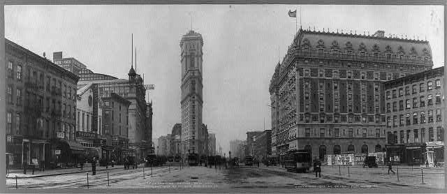
Times Square around 1904. The NY Times building, then brand new, is in the center. On right is the old Astor Hotel, since razed. Believe it was still Longacre Square at the time of the photo. HARA REISER AND ANDY SPARBERG got it right
Funding Provided by: Roosevelt Island Corporation Public Purpose Funds Council Member Ben Kallos City Council Discretionary Funds thru DYCD Text by Judith Berdy
Edited by Deborah Dorff ALL PHOTOS COPYRIGHT RIHS. 2022 (C) PHOTOS IN THIS ISSUE (C) JUDITH BERDY RIHS
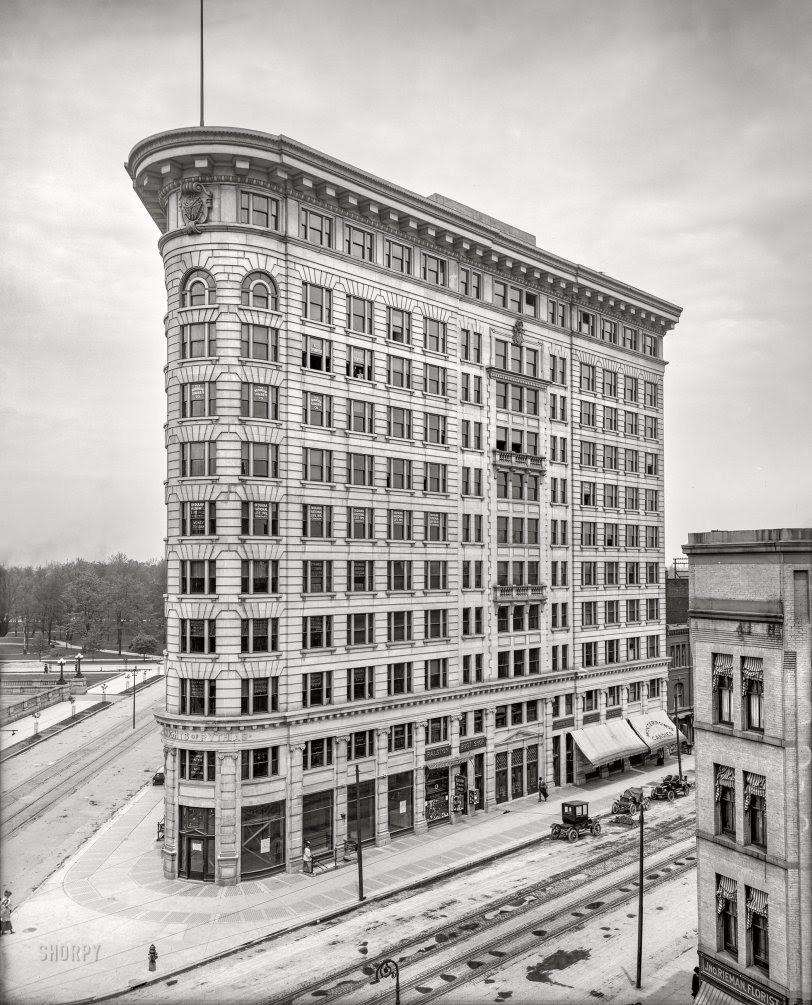
Indianapolis circa 1905. “Knights of Pythias Building.” Last glimpsed here, 10 years ago! 8×10 inch dry plate glass negative, Detroit Publishing Company.
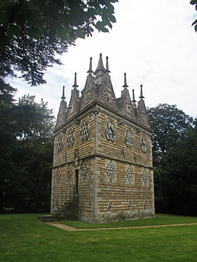
This amazing triangular building was designed by Sir Thomas Tresham (father of one of the Gunpowder Plotters) and constructed between 1593 and 1597. It is a testament to Tresham’s Roman Catholicism: the number three, symbolising the Holy Trinity, is apparent everywhere. There are three floors, trefoil windows and three triangular gables on each side.On the entrance front is the inscription ‘Tres Testimonium Dant’ (‘there are three that give witness’), a Biblical quotation from St John’s Gospel referring to the Trinity. It is also a pun on Tresham’s name; his wife called him ‘Good Tres’ in her letters
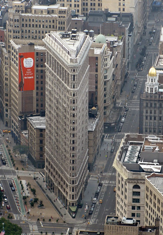
New York Flatiron triangular building – panoramio.jpg
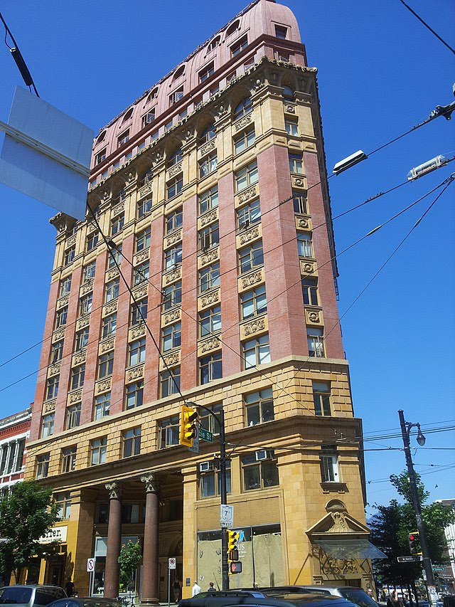
Gastown Buildings on Cambie Street – panoramio.jpg
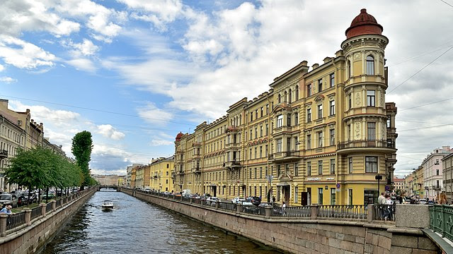
Saint-Petersburg. Apartment house of V. A. Ratkov-Rozhnov. Embankment of the Griboyedov Canal, 71.jpg
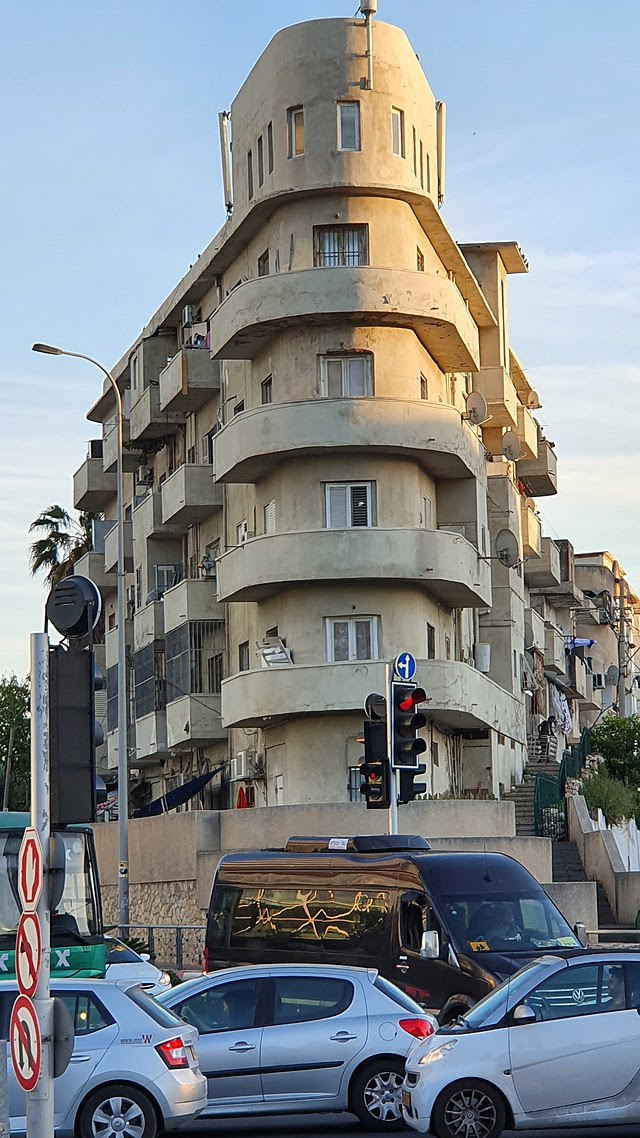
Boat hause-Shimon Levi house-Tel Aviv.jpg
Shimeon Levi house, 56 Levanda St, Tel Aviv Built 1934-1935 commonly known as “Ship building” Architects: Shimon Hamadi Levi, Arieh Cohen. Bauhaus.
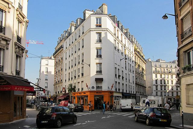
Rue Breguet & Rue Boulle, Paris October 2012.jpg Rue Breguet & Rue Boulle, Paris October 2012.
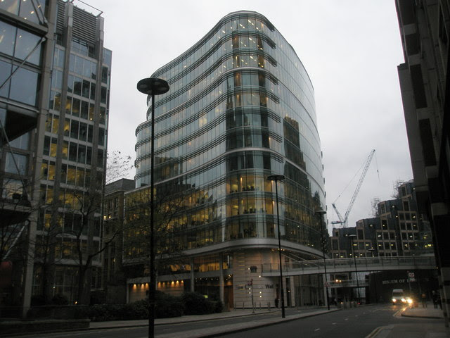
Triangular office block at London Wall – geograph.org.uk – 643161.jpg
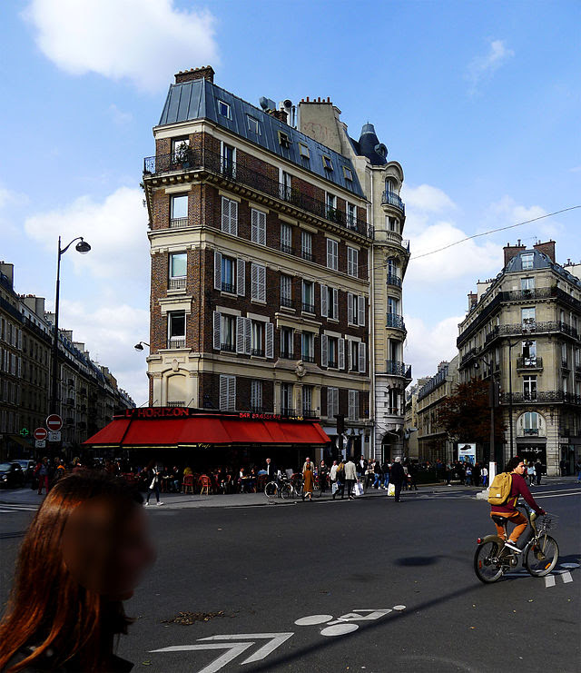
http://P1330656 Paris VI rue de Rennes rwk.jpg
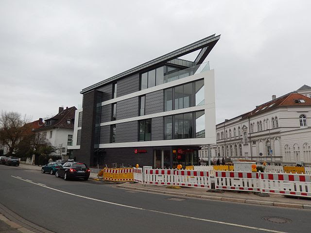
Gebäude Ecke Appelstraße – Herrenhäuser Kirchweg.jpg
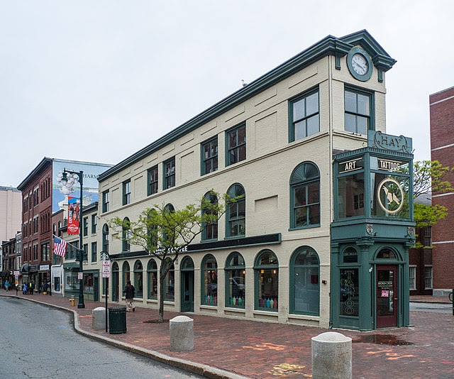
Hay Building, Portland, Maine.jpg
Hay Building, also known as the Charles Q. Clapp Building, is a historic commercial building on Congress Square in downtown Portland, Maine. It occupies a prominent triangular site at the junction of Congress, High and Free Streets. Built in 1826.
All image are copyrighted (c) Roosevelt Island Historical Society unless otherwise indicated
WIKIPEDIA COMMONS
RIHS (C) FUNDING PROVIDED BY ROOSEVELT ISLAND OPERATING CORPORATION PUBLIC PURPOSE GRANTS CITY COUNCIL REPRESENTATIVE BEN KALLOS DISCRETIONARY FUNDING THRU DYCD
Admittedly a bit of a trick. Anyone who travels knows about JFK, and LGA is known, too, not least for Joe Biden’s comment a “third world airport”. But did “Wrong Way Corrigan” fly out of JFK? How many world flight records were shattered at LGA? There’s only one answer: Floyd Bennett Field. Never heard of it. Stay glued. This is a good tale, and it ends with a mystery.
First, FBF is in Marine Park, Brooklyn, along the shore of Jamaica Bay. It was created by connecting Barren Island and several smaller islands to the rest of Brooklyn with sand pumped from the Bay.
Why? One reason was that Charles Lindbergh did not take off from New York City on his historic solo flight to Paris. The City missed the reflected glow of Lindbergh’s triumph. Unlike other cities such as Atlantic City and Cincinnati, New York didn’t have a municipal airport. New York did have many private airfields, and, in the earliest days of few regularly scheduled commercial airflights, no one thought we needed a municipal field as well.
Several official bodies did recommend that NYC build its own airport, but this was ignored until the construction of Newark Municipal Airport. As the best equipped airport in the area, US Postal Service designated Newark as the airmail terminal for the New York City area. Recall that airline traffic was funded mainly by Washington’s airmail business rather than by passengers. So, we lost twice – the prestige of a new airport and postal funds to support airlines. (This is why the DC-3 was revolutionary, because it carried enough passengers to support a profit-making business.)
In mid-1927, a Washington committee identified six met area locations where an airport might be built. Debate followed, and Congressman (and future mayor) Fiorello La Guardia pushed for a commercial airport on Governors Island, as it was closer to Manhattan and located in the middle of the Harbor. He introduced a resolution in Congress to do this, but it was voted down.
Finally, Barren Island was chosen. Few people lived there, and it was owned by the City which had already spent $100 million between 1900 and 1927 to construct a seaport in Jamaica Bay – the project was abandoned, but land had already been dredged land for shipping channels. No obstructions existed nearby and being on Jamaica Bay would allow seaplanes to use the airport – and seaplanes were the leaders in commercial aviation at this time. Hopefully, the airport would spur development of Jamaica Bay, since the seaport had been dropped.
FBF would be a big deal, top of the line airport, accommodating airplanes and seaplanes. Planners wanted a best rating from the Department of Commerce. In order to secure an “A1A” rating, FBF had the country’s longest concrete runway, an 8-inch-thick layer of reinforced concrete, gravel drainage strips, 200-foot-wide, twice the minimum runway width mandated by the Department of Commerce. Its runways, at a time when most airports still had dirt runways and no night landings, made the airport among the most advanced of its day, as did its comfortable terminal facilities with numerous amenities. These amenities included an underground tunnel for passengers to make their way to the runway without getting wet or windblown
The airport was named after Floyd Bennett, a noted aviator who piloted the first plane to fly over the North Pole and had visualized an airport at Barren Island before dying in 1928. Bennett Field construction started the same year. The airport was dedicated on June 26, 1930, and officially opened to commercial flights on May 23, 1931.
As a commercial airport, FBF never got off the ground. Bennett Field suffered from its poor location in outer Brooklyn. There were no limited-access roads between Manhattan and the airport, and the only direct route from Manhattan to Bennett Field was Flatbush Avenue, a congested street with local traffic throughout its length. This was exacerbated by the fact that the bus-to-subway connection did not occur until 1940.
And airmail. LaGuardia pushed for Floyd Bennett Field to replace Newark Airport as the city’s main air terminal but failed. Since commercial passenger traffic followed airmail, no regularly scheduled commercial passenger airlines were based at FBF. So, in 1933, while Newark carried 120,000 airline passengers, 1.5 million pounds of mail, and 425,000 pounds of express mail, Bennett carried 52 airline passengers, 98 bags of mail, and 100 pounds of express.
But FBF was heavily used by civil aircraft. In 1932, it had become “the most desirable American Field as an ocean hop terminal”. At least four transatlantic flights had occurred there that year, and at least four more flights were scheduled for 1933. By 1933, Floyd Bennett Field accommodated more flights than Newark Airport: 51,828 arrivals and departures, compared to 19,232 at Newark. By number of flights, Bennett Field was the second-busiest US airport that year, behind only Oakland International Airport in California.
Floyd Bennett Field was a perfect spot for aviation pioneers and daredevils to launch their flights, and many trans-continental, trans-Atlantic and round the world flight records were set and broken here. Famous aviators flew here – Roscoe Turner, Wiley Post (the first solo flight around the world, took off and landed here in front of crowds of 50,000 fans), Howard Hughes broke the world record for flying around the world departing from FBF on his Lockheed Super Electra.
Howard Hughes arrives at Floyd Bennett Field. (Photo: Bettmann/Getty Images)
FBF was the finishing line for the Bendix Trophy Race a key transcontinental competition. Women were active aviators here and in the 1936 Bendix Race, women won three of the top five places. Beryl Markham, the Kenyan novelist, and Jacqueline Cochran were prominent women aviators who set records at Bennett field.
Contestants before the 1933 Annette Gipson all woman’s race
Amelia Earhart and Charles Lindbergh took part in FBF events but perhaps the best remembered flight from FBF was Douglas Corrigan’s “mistaken” flight to Ireland on July 17, 1938. Long story, but Corrigan claimed that his planned non-stop cross-country flight in a $325 used plane went awry, and he found himself en route across the Atlantic rather than the continent. Forever, Floyd Bennett Field would be identified with “Wrong way Corrigan”.
In 1938, the Navy, which already occupied part of Bennett Field, began to expand its facilities there. As the Navy operation grew, all private airlines were ordered to leave, and all remaining residents on Barren Island would be evicted. On May 26, 1941, the airport was closed to all commercial and general aviation uses, and a week later, the Navy opened Naval Air Station New York with an air show that attracted 30,000 to 50,000 attendees. During the war, the miliary used FBF extensively.
NAS New York functioned as a support and training base for Naval and Marine units throughout the postwar period. With the Vietnam War over, the military said it would vacate the airport. Mayor Lindsay wanted to convert it to a commercial airport and Governor Rockefeller wanted to make it into a mall, industrial park and housing development. Long story short, Bennett Field became part of the Gateway National Recreation Area’s Jamaica Bay Unit and is managed by the National Park Service.
Now some mysteries. The City’s Department of Docks was responsible for construction. We don’t know who the architect was, but we are told that the admin building (now Ryan Visitors Center) was a masterpiece. The outside of the main building (ae the top) has some Art Deco elements, but on a colonial revival or Neo-Georgian base. The inside design was influenced by Art Deco and Egyptian art, which was an influence on art deco. But I could find no photo record.
The WPA was involved in construction. The City seems to have made some sharp deals. In 1936, the federal government contributed $4.7 million toward Bennett Field’s expansion, while the city spent only slightly more than $339,000.
The WPA was also central in the most interesting mystery. Four large murals with the theme “The History of Flight” were commissioned from the WPA’s Federal Art Project.
The murals were not delivered until May 1940, after the Navy had taken control of the airport. Civic and patriotic groups immediately attacked them as Communist propaganda. They argued, for example, that the murals show the Wright brothers at Kitty Hawk in Russian peasant costumes, a likeness of Stalin, that people in another panel seem “strangely un-American in expression and garb” and that they “stand with upraised fists, the Communist salute”. Several reports say that one mural was created by Diego Rivera and that Arshile Gorky was working on another. These seem both highly unlikely.
Another report says that Colonel Brehon Somerveil, WPA Administrator, ordered them taken down and burned for being “socialist propaganda.” (Given Somerveil’s hard anti-communist views, this would not be surprising.) The Times says that Somerveil dismissed one artist on the project (Thomas Corwin) “for preparing Communist propaganda” and dismissed his supervisor for “incompetence” in submitting Corwin’s work.
Alas, we don’t know what the murals actually looked like. Several images can be found, but it’s not clear if these are the Bennett field murals. Both from Wikipedia.
NEW YORK CHAMBER OF COMMERCE YESHIVA UNIVERSITY, WASHINGTON HEIGHTS LAURA HUSSEY GOT IT RIGHT!!!
Text by Judith Berdy Thanks to Bobbie Slonevsky for her dedication to Blackwell’s Almanac and the RIHS Thanks to Deborah Dorff for maintaining our website Edited by Deborah Dorff All image are copyrighted (c)
Sources STEPHEN BLANK
All image are copyrighted (c) Roosevelt Island Historical Society unless otherwise indicated
FUNDING PROVIDED BY ROOSEVELT ISLAND OPERATING CORPORATION PUBLIC PURPOSE GRANTS CITY COUNCIL REPRESENTATIVE BEN KALLOS DISCRETIONARY FUNDING THRU DYCD
The Technologist, September 1870. Public domain To correct the record, the designers should be identified as Craven, Dearborn, and their colleagues. Given the Water Tower’s distinctive architectural character, it is possible that some uncredited architect also played a role.
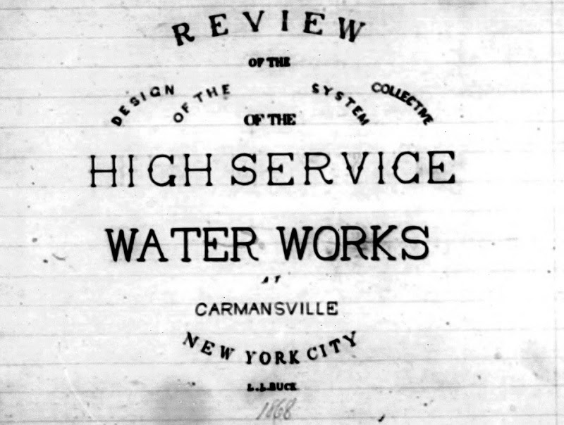
“Review of the Design of the Collective System of the High Service Water Works at Carmansville, New York City,” by L.L. Buck, 1868 (Collection of the author.)
Although construction on the Water Tower did not begin until the summer of 1869, its design was completed by the spring of 1868.
We know this thanks to a thesis written at that time by Rensselaer Polytechnic Institute student L.L. Buck. It provides dimensions that are consistent with those in Dearborn’s early 1870s plans and its narrative descriptions and calculations are much more detailed than those in news articles or official reports. Who said schoolwork isn’t important?
Among other things, the paper tells us that in the Tower’s interior there “will be a brick lining 8 inches thick and with an air space, between it and the stones of the wall, of 4 inches” and the stairs “are to be of iron, cast treads and wrought frame work in each story to wind from one side around to the opposite side, or occupying 8 sides, the landing on each floor to be vertically over that of the preceding.”
Incidentally, the student, whose full name was Leffert Lefferts Buck, went on to an accomplished career including serving as Chief Engineer on the Williamsburg Bridge.
It Not Only Resembles a Medieval Tower, It Is Built Like One Too
Although built for a functional purpose, the Highbridge Water Tower is an ornamental building often likened to medieval minarets and campaniles (Italian bell towers) and the comparisons have considerable merit, both stylistically and structurally. The architectural connections are obvious, but the physical similarity is not as readily apparent until one ventures inside or looks at architectural drawings.
Built more than a decade before the first steel frame skyscrapers of the 1880s, the Water Tower has load bearing walls designed to support the weight of the building above, including a full water tank. Much like a historic church, it has thick walls at the bottom and thinner ones at upper levels.
Transition from shaft to tank room (now observation level)
Both Buck’s paper and Dearborn’s plans show that at the base the octagonal structure has an outer diameter of 29 feet and walls 5.5 feet thick, leaving only 18 feet inside. Above the base, the main shaft tapers slightly so that the walls are 4 feet thick but the interior space remains 18 feet across. The few windows in the base and shaft are narrow and vertical to maintain the structural integrity.
Exterior of the tank room, now observation level
In contrast, the walls of the tank room, which is now the observation level, only support the weight of the cupola above. They are a much slimmer 1 feet, 4 inches thick and have expansive windows, two on each of the eight sides. As a result, this part of the tower has a more spacious, light-filled interior of 25 feet, 8 inches in diameter.
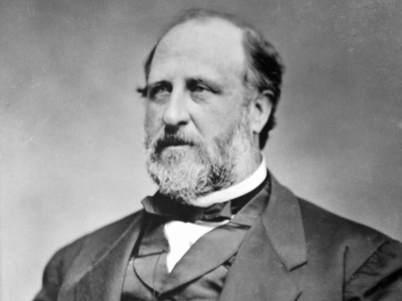
A silver-plated model of the Highbridge Water Tower, now owned by the New-York Historical Society, bears a lengthy inscription stating that it was presented to John L. Brown, the building contractor, “by the Employees on the Tower Works, as a Souvenir of the pleasant times passed in his employ.” It also lists various City officials, among them William M. Tweed, Commissioner of Public Works. In fact the linkage between the two was more than incidental.
Brown, who the New York Times once referred to as “the Tammany street-cleaner and contractor,” told an investigatory commission in 1872 “I had no connection with Mr. Tweed.” However, “Boss” Tweed acknowledged in 1877 what many long suspected; he held a secret interest in Brown’s street cleaning company and ensured that it received city contracts and payment for work it did not perform. In jail by then, he made confessions like this in an unsuccessful effort to be paroled. As for Brown, he was off the hook, having died a rich man two years earlier.
As for the Water Tower, Brown received that contract in 1867 from the Croton Aqueduct Board, which had autonomy from Tweed and other politicians. However, Tweed, who was infamous for inflating costs on innumerable public works projects to benefit himself and his cronies, most notoriously with the “Tweed Courthouse,” gained control of Croton Aqueduct operations in April 1870 while the Tower was under construction. There is some evidence that similar corrupt practices occurred on a modest scale with the Tower. As for that silver model, it seems more likely a gift from Tweed, known for his affection for luxuries, than from workers paid modest wages.
The Tower’s water system operations ended on December 15, 1949 when it was made obsolete by a new electric powered pumping station at 179th Street and Amsterdam Avenue. The City’s Department of Water Supply, Gas, and Electricity planned to raze the old structure, which had become a target of vandals.
In stepped Robert Moses to the rescue. Yes, really. As the New York Herald Tribune reported in 1951, “the Parks Department said it was the intention of Commissioner Robert Moses to save the 170-foot structure as a historical landmark.” The City formally transferred the Tower to the Parks Department in 1955, along with the High Bridge, also removed from water service in 1949, and a section of the Old Croton Aqueduct.
After the Highbridge Water Tower was placed under Parks jurisdiction, the agency teamed up with the Benjamin Altman Foundation to install an electric carillon. This was a device imitating the sound of bells, allowing a building often compared to a medieval campanile to function like one. It debuted on Memorial Day 1958 with a 15-minute performance broadcast on WNYC radio.
The Altman Memorial Carillon, as it was called officially, chimed thrice daily on weekdays and twice a day on weekends for several minutes from speakers mounted in the old tank room. As Gay Talese of the New York Times observed in 1961, it “has served as a combination concert hall and alarm clock with such fidelity that many residents have let it run their lives.”
How long the five-octave carillon continued to operate is unclear. Periodically there has been talk of replacing it, but when members of the Parks and Cultural Affairs Committee of Manhattan Community Board 12 voted on capital project priorities in 2019, there was no support for this.
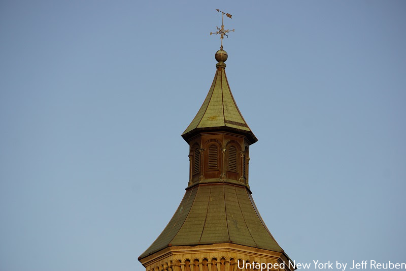
Undoubtedly the saddest day in the Highbridge Water Tower’s history is June 11, 1984, when a man broke in, set a fire in the tank room, and jumped to his death. This badly burned the cupola, which had wooden framework, destroyed the carillon, and caused other damage.
FromThe water-supply of the city of New York. 1658-1895. Published 1896.Public domain
In the late 1980s and early 1990s the Parks Department carried out a restoration, which included a new cupola. Although it looks generally similar to the original, there are aesthetic differences, including louvers in the middle section instead of windows. Also, the replacement weather vane has an arrow, whereas old drawings and photographs show something resembling a mythical aquatic creature.
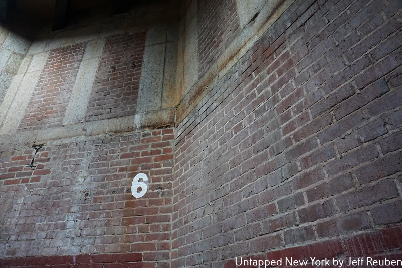
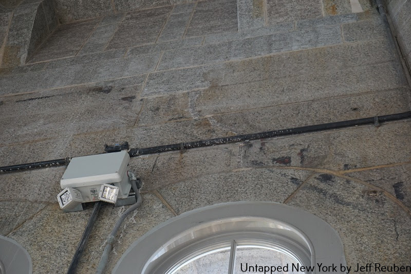
Today, the cupola is reached via a spiral staircase in the center of the tank room though it is off-limits to the public. On the other hand, the original cupola contained a scenic lookout. A vestige of this are markings on the walls indicating the outline of the stairs that extended above the water tank (photo above).
Find out more about these and other facts and stories at our upcoming virtual talk about the Highbridge Water Tower on March 24th at 12 p.m. The event is free for Untapped New York Insiders. If you’re not a member, join now (new members get their first month free with code JOINUS).
A CONNECTION
Looking back on my family history it has much of a connection with today’s events. My maternal grandmother- Esther Silerrglate was born in St. Petersburg, Russia in 1888. My maternal grandfather-Charles Katz was born in Mogilev, Belarus in 1880, while my paternal grandfather-Philip Beridchawsky was born in Balta prefecture of Ukraine in1880. They all emigrated to the US in about 1900-1905 and settled in Philadelphia and Brooklyn.
I have visited the beautiful cities of St. Petersburg and Kiev to splendidly beautiful cities.
Words cannot express my sadness and praise for the people of this country.
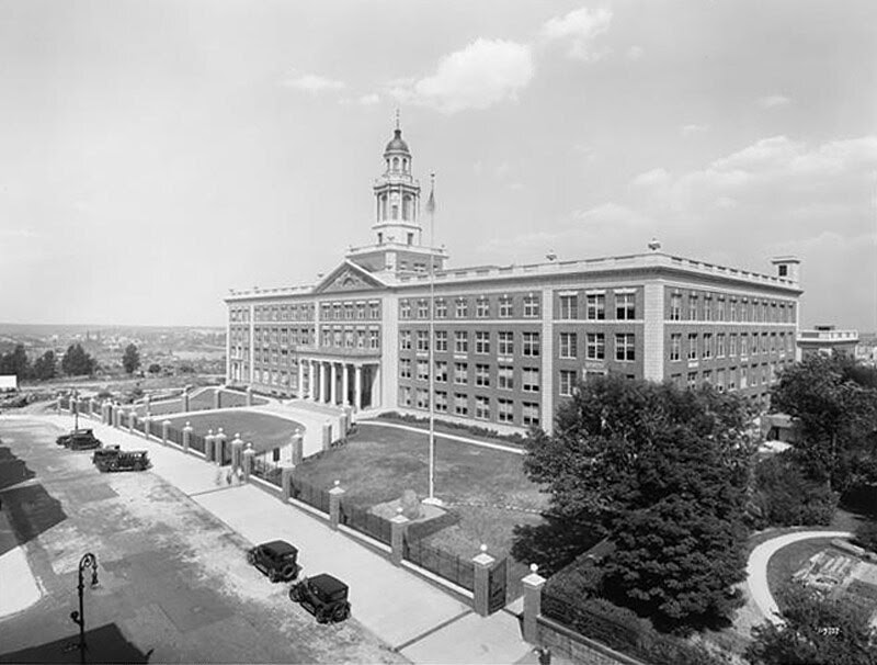
GEORGE WASHINGTON HIGH SCHOOL ON AUDUBON AVENUE ANDY SPARBERG, HARA REISER, CLARA BELLA GOT IT RIGHT!
Text by Judith Berdy Thanks to Bobbie Slonevsky for her dedication to Blackwell’s Almanac and the RIHS Thanks to Deborah Dorff for maintaining our website Edited by Melanie Colter and Deborah Dorff
All image are copyrighted (c) Roosevelt Island Historical Society unless otherwise indicated
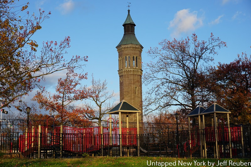
UNTAPPED NEW YORK JEFF REUBEN
RIHS (C) FUNDING PROVIDED BY ROOSEVELT ISLAND OPERATING CORPORATION PUBLIC PURPOSE GRANTS CITY COUNCIL REPRESENTATIVE BEN KALLOS DISCRETIONARY FUNDING THRU DYCD
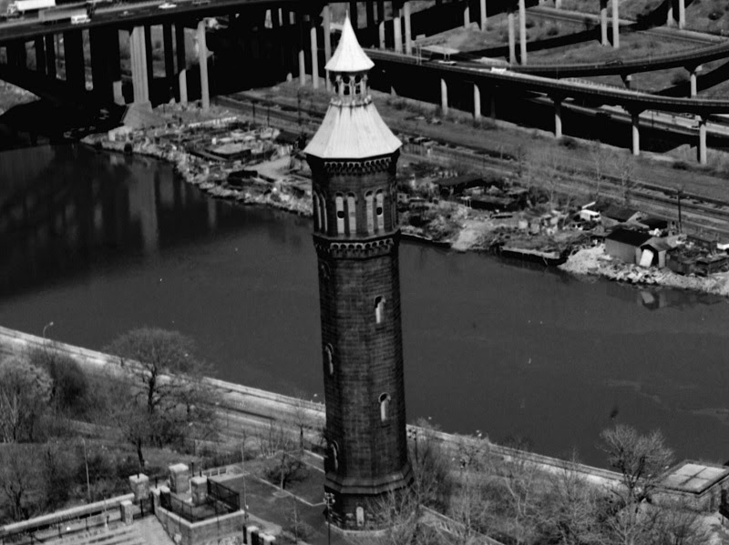
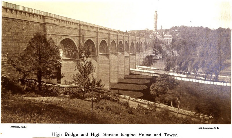
The 200-foot tall Highbridge Water Tower in Washington Heights stands on a bluff above the High Bridge and Harlem River, sharing a park landscape with a swimming pool, baseball field, playground, terrace, and lawns. It is a familiar, if somewhat mysterious landmark for local residents, MetroNorth Hudson Line commuters, and motorists on the Harlem River Drive and other nearby roadways and bridges.
However, when it was completed 150 years ago, its setting and function were quite different. Constructed as an addition to the Croton water system in a then thinly populated area, it was a major catalyst in the transformation of Upper Manhattan into bustling urban neighborhoods.
For many today, its origins and historic role are unknown, but it is time to rediscover this enigmatic icon, which is not only celebrating its sesquicentennial in 2022, but was also recently reopened for tours following a $5 million restoration. In celebration of its return to the spotlight, we present ten secrets of this distinctive structure.
NYC Department of Public Works, Annual Report, 1872. Public domain
When the Croton Aqueduct opened in 1842, providing Manhattan with an abundant source of clean drinking water, the system relied on gravity for water pressure. As a result, northern Manhattan was not served by the system given that much of it is at elevations higher than the reservoirs in Central Park and at 42nd Street. A bit ironic considering that the High Bridge, which carried the aqueduct over the Harlem River., became a defining feature of the area and a popular destination for visitors following its completion in 1848.
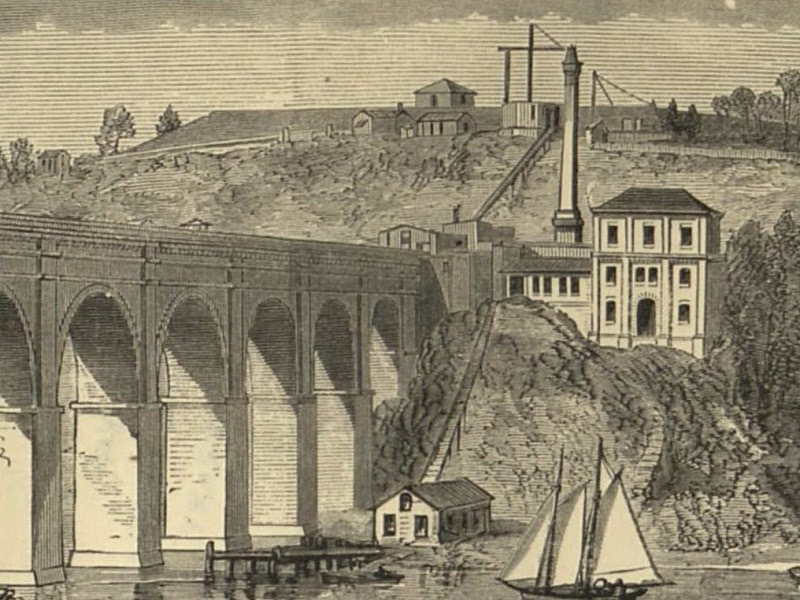
The Technologist, Aug. 1870. “High Service Water Works.” (Tower under construction)Public domain
In an era when individual buildings did not have their own water pumps and tanks, a systemic solution was needed. So, the City’s Croton Aqueduct Department added the High Service Water Works to “cure the evil of limited supply to those whose ambition brought them above the level of the reservoir” as the New York Times elegantly phrased it in 1866. The site selected for these facilities was high ground near the Manhattan end of the High Bridge.
The Water Tower was just one part of this. As shown in the historic images above, next to it was a reservoir, opened in 1870, with a storage capacity of nearly 11 million gallons. It was high enough that it provided water pressure to serve 90 percent of the High Service Area; water pressure for the other 10 percent was provided by a 47,000-gallon water tank located inside the Tower.
Next to the High Bridge, there was also a pumping station with a steam engine, boiler, and smokestack to force water up from the aqueduct, a coal dock and shed along the waterfront, and an inclined plane to lift coal up the steep river bank to the pumping station. All except the Tower no longer exist, nor does another pumping station added in the mid 1890s about 1,000 feet to the north.
Morris-Jumel Mansion
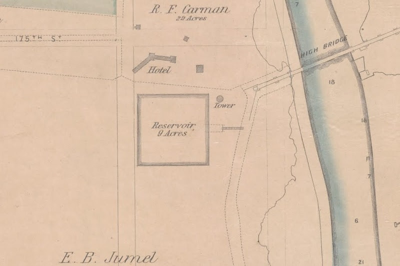
Describing the High Service Water Works plans, the New York Herald reported in 1864 that “this is to be done by means of a tower erected on Madame Jumel’s property, at High Bridge.”
This is a reference to Eliza B. Jumel, the American-born widow of French merchant Étienne (anglicized to Stephen) Jumel and ex-wife of Aaron Burr. Residing nearby in the Morris-Jumel Mansion, now a museum, she owned extensive real estate holdings including about seven acres where the City wanted to locate the High Service Water Works.
She offered this land for about $79,000, “to avoid the expenses which the City would necessarily have to incur to ascertain the value of the property.” The City rejected this and pursued an eminent domain taking, resulting in a Court approved compensation of $45,000. This substantial price reduction was a moot point for Madame Jumel; the process was completed in December 1865, six months after she passed away at age 90.
The map above from 1867 shows where the Water Tower and reservoir were to be placed and also indicates property boundaries (dashed lines) prior to the taking, including Jumel’s lands and the City’s aqueduct corridor extending south from the High Bridge.
WHO DESIGNED IT?
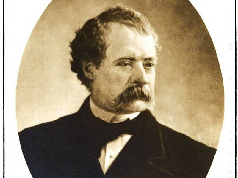
Identifying who designed the Highbridge Water Tower is a matter worthy of attention, not least because many sources have credited it to the wrong person.
Contemporary accounts state that the High Service Water Works, including the Tower, were designed under the direction of Alfred W. Craven, who served as the Croton Aqueduct Chief Engineer from 1849 to 1868. Some sources also mention William L. Dearborn, who served as Engineer in Charge from 1862 to 1872. For what it is worth, Dearborn also signed plans for the Water Tower from the early 1870s. “
These extensive works have all been designed under the general direction of A.W. Craven, esq., engineer in chief of the Croton Department, by Wm. L. Dearborn, esq., Engineer in charge.”
New York Tribune, January 14, 1868. “Croton Department: New High-service Reservoir and Water Works at Washington Hights”
However, a century later in 1967 the City’s one-page Landmark Designation report states the Tower is “attributed to John B. Jervis.” One of the giants of American civil engineering history who was Croton Aqueduct Chief Engineer from 1836 to 1848, Jervis oversaw design and completion of the aqueduct and the High Bridge. However, after 1848 he went on to other endeavors and there is no evidence he designed the High Service Water Works. It appears that Jervis’ work on the High Bridge was conflated with the later Tower.
Alfred W. Craven, from Early Columbia engineers, an appreciation. Public domain
In an adult version of the children’s classic “telephone game,” many subsequent sources also state that Jervis designed the Tower, but dropping the “attributed to” qualification. It has become canon.
The Blue Dragon Sculptre by Swedish artists Gustav and Ulla Kraitz located on Roosevelt Island near the entrance to Southpoint Park.
LAURA HUSSEY,GLORIA HERMAN , ALEXIS VILLAFANE AND VICKI FEINMEL GOT IT EARLY!!!
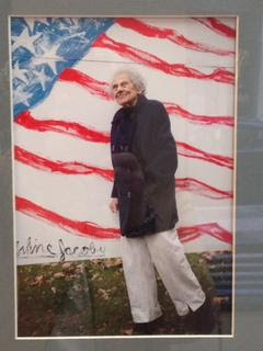
from readers: Not sure if this is a statue made by an amused grandchild of me swimming in the East River, or the wonderful whale statue at the entrance to the South Point Park en route to the FDR Memorial. So sorry to learn of Arline’s death. One of the very wonderful people who have been part of the Rivercross world for many, many years. Do you think that is because of the influence, however subtle, of Nellie Bly? Regards, Jay Jacobson
Below images are from Arline Jacoby
Hi Judy, Thank you so much for remembering me and sending me the information about Arlene. As I was reading the reflections on her, it brought joyful images to mind of when I was involved with RIVAA> She had so much joy and energy when it came to art. A truly beautiful soul. I can still hear her voice and feel her passion. She will certainly be missed. I will attend the memorial tomorrow. Thanks again and sending hugs and warm wishes for a healthy, joyful year ahead for you. Best, Ron Becker, Former Director of Therapeutic Recreation at Coler-Goldwater
Text by Judith Berdy Thanks to Bobbie Slonevsky for her dedication to Blackwell’s Almanac and the RIHS Thanks to Deborah Dorff for maintaining our website Edited by Melanie Colter and Deborah Dorff
All image are copyrighted (c) Roosevelt Island Historical Society unless otherwise indicated
Sources
UNTAPPED NEW YORK
FUNDING PROVIDED BY ROOSEVELT ISLAND OPERATING CORPORATION PUBLIC PURPOSE GRANTS CITY COUNCIL REPRESENTATIVE BEN KALLOS DISCRETIONARY FUNDING THRU DYCD


