A postcard reveals a portion of the Italian Garden and the breathtaking views.
Twenty-three year old Charles V. Paterno earned his medical degree from Cornell University in 1899. He would not use it for long. The son of real estate dealer John Paterno, he was born in Castelmezzano, Italy and immigrated with his family in the 1880s. Charles and his brother Joseph took over the real estate business when their father died. Although he would never practice medicine again, Charles retained the title Doctor for the rest of his professional life. At the turn of the century the Upper West Side was developing quickly and the Paterno brothers were leaders in erecting modern apartment houses for urban pioneering families. Their Paterno Construction Company gained a reputation for producing luxurious, architecturally conservative apartment buildings. Within a few years the brothers had amassed large personal fortunes. In 1905 Dr. Paterno purchased seven and a half acres in the Inwood section of Manhattan with breathtaking views of the Hudson River and the New Jersey Palisades on the opposite bank. He commissioned architect John C. Watson to design his new home—one that would be quite unlike any of the other turn-of-the-century mansions that were rising along Riverside Drive and upper Fifth Avenue. Taking advantage of the scenic setting 125 feet above the Hudson, Paterno envisioned a romantic Rhineland-like castle. According to The Sun years later, “It is said that he saw a place in the country of his forefathers that made a deep impression on him. It was in surroundings similar to the Fort Washington section. When he decided to build himself a home on the Drive he remembered this castle and had his home built accordingly.”
Castle Paterno perched above the Hudson like a romantic Rhineland relic.
And he got what he paid for. Costing $500,000, about $10 million by today’s standards, the four-story castle was ready for occupancy in 1909 (although still not completed). While Paterno could have gotten away with durable (and perhaps more expected) granite for his castle, he chose white marble. The mansion sat at approximately 185th Street on what was then called Boulevard Lafayette (an extension of Riverside Drive) and Northern Boulevard (later to be renamed Cabrini Boulevard). Building Age called it “a residence of unique construction.” The castle was accessed through an underground passage that ran under the front of the building. Fifteen steps lead from the Boulevard to a terrace with a fountain. Stairs on either side led to another landing where the tunnel opened into the side of the hill.
The New York Times depicted the unique entrance on June 7, 1908 (copyright expired)
Guests may have felt some trepidation as they followed the underground passage 75 feet, slowly ascending, to the basement of the mansion—rather like feudal knights stealing into a fortress.
The New York Times June 7, 1908 (copyright expired)
The New York Times described the first room in which the visitor would emerge within the subbasement of the house. “One finds a room probably without a counterpart in any New York home. This is not a dungeon into which may be thrown those who incur the displeasure of the owner, nor is it a secret compartment for the safekeeping of the family jewels.” It was a “mushroom vault” which Building Age explained was “for propagating the succulent fungi.” The Times said that here with “just the right conditions of temperature and moisture, [Dr. Paterno] can have mushrooms sprouting every day in time for dinner.” Here, too, was the wine cellar. The basement proper held the Turkish bath with dressing room, two hot rooms of different temperatures, massage rooms and a swimming pool fed by pumps from the Hudson River below. There were also a grill room and “lounging room” at this level. Finally, at 80 feet above the street level, was the main reception hall, 20 feet square. Opening off the hall were the parlor, library, music room and Paterno’s den. Although the architecture was inarguably medieval, the interior decoration was eclectic. Each room of the house reflected a different period or style. The parlor was furnished in Louis XV style; the dining room was “Colonial;” and the library was outfitted in an Asian motif. Drawing on Andrew Carnegie’s practice of being awakened by organ music, Paterno had a clever and unique antique clock installed in the entrance hall that automatically operated the $7000 organ on the second floor gallery at certain times of the day. The large clock also operated the set of chimes in the castle tower, announcing the hour and half hour. The bedrooms were located on the second floor; the master bedroom measuring 18 by 20 feet. A nursery and sewing room were also on this level. While the house was still under construction, Building Age noticed that “an unusual feature in connection with the sleeping rooms will be that none of them will be reached directly from the hall, but through a vestibule.” The entertainment areas were located on the third floor. Here were the immense banquet hall and ballroom covering about 50 square feet with ceilings 20 feet high. Balconies sprouted off the ballroom, affording guests nighttime views of the Hudson that, perhaps, made the climb to this level worthwhile. The large billiard room was also situated on the third floor. The roof over about one-half of the building was dedicated to a garden. “But it will be no ordinary roof garden,” promised Building Age. The outdoor space included an aviary, solarium and large conservatory where Mrs. Paterno’s friends enjoyed polite conversation over tea while taking in the view. A foot and a half of soil covered the roof to accommodate a natural garden. Below, an extensive Italian garden was laid out with colonnades, pergolas and fountains. Below it a service tunnel ran directly from Northern Boulevard to the kitchen and servants’ quarters, eliminating the possibility of deliverymen running into family members. By 1913 Paterno Castle was still not completed. On February 16 The Sun noted that “Along the Drive under the house there is a pile of marble that is waiting to be put in place.” But the newspaper was impressed by the remarkable mansion nonetheless. “A castle of medieval times could not offer a more formidable appearance. “ Paterno Castle took full advantage of the location in its outside spaces. “Along the 139 feet on [Northern Avenue] is a railing ten feet high of marble and iron. It is a massive affair and harmonizes with the architecture of the castle.” The house, said the article, “is built as far out on the cliff as it was possible to build it. This gives a lawn of nearly 200 feet between it and the iron and marble railing along Northern Avenue. Over the roadway at the entrance to the house is a marble porch with battlement on top, as in the feudal castle of old.”
The fence, called by The Sun “a railing…of marble and iron,” mirrored the crenelated towers.
Three years later the house was officially completed. The New York Tribune, on November 5, 1916, jibed “This might be the poet’s ‘castled crag of Drachenfels’ frowning o’er the wide and winding Rhine’ were it not the Hudson River bluffs at 185th Street, with the 35-room residence of Dr. Charles V. Paterno playing the part of the castle.”
A shady pergola wrapped along the edge of the cliff — NYPL Collection
The castle was superbly designed for entertaining and the Paternos took full advantage. On the afternoon of April 12, 1917 they hosted a reception for the Reverend Billy Sunday along with cooperative ministers and executive committee members of the Y.W.C.A. and Y.M.C.A. For years society page reports would tell of tea being served in the solarium and programs of organ music being enjoyed. The Paterno family was just finishing dinner on the evening of July 24, 1919 when a ruckus occurred. Anna Bailey, also known as Anna Creegan, was found climbing over the garden wall. When arrested, she had under her blouse Mrs. Paterno’s silver sugar bowl and two silver platters. Dr. Paterno told police that how the woman got into the house was a mystery. Despite the silver items being found on her person, the woman denied having taken them. The Evening World remarked on the defendant’s appearance at court. “Miss Baily, or Mrs. Creegan, was the object of considerable attention in the court room. Although she is a trifle shy of forty, her hair is bobbed. She wore a purple skirt, a blue waist and a red tie and carried a buff-colored sweater.” The newspaper apparently felt her sense of style was as offensive as her theft. Partly due to his own development, land along the Hudson at the far northern end of Manhattan increased in value. In 1935 Fort Tryon Park, a gift to the city from John D. Rockefeller, Jr., was completed and in 1938 The Cloisters Museum was opened. Dr. Charles Paterno smelled money. He told The New York Times in August, 1938, that “the many improvements in that part of the city…had led to a strong residential movement in that area with a definite demand for the finer type of garden type apartments.” And there was no more advantageous spot for “the finer type of garden type apartments” than the site of his castle. Charles Paterno announced plans “to demolish his fortress-like residence
A section of the cast iron fencing lays on its side as workmen begin demolition in 1938 — NYPL Collection
Paterno commissioned George Fred Pelham, Jr. to design the $6 million project to be called “Castle Village.” By the end of 1938 Paterno Castle was gone. But today relics of the medieval-style fortress remain. The white marble garage and servants’ quarters were converted to housing, and marble entrance columns remain as do sections of the Italian Gardens. The guesthouse, sitting at the northernmost edge of the former estate, survived. It sits precariously above the Hudson and retains a small garden. Remnants of what was undeniably one of the most picturesque and romantic structures in Manhattan still exist; but the bulk of Dr. Charles Paterno’s remarkable estate was a victim of his own financial interests.
THIS IS FROM ED LITCHER: Pan American’s first Clipper flight from the Marine Air Terminal at Laguardia Airport in New York City departed on March 31, 1940. The photo shows the terminal with a Boeing Model B-314 ‘Yankee Clipper’ at its dock. This terminal is the oldest active airport terminal from the first generation of passenger air travel? The Art Deco terminal is a New York City Landmark and thus safe from destruction, unlike other more ill-fated terminals at JFK Airport.
Text by Judith Berdy Thanks to Bobbie Slonevsky for her dedication to Blackwell’s Almanac and the RIHS Thanks to Deborah Dorff for maintaining our website Edited by Melanie Colter and Deborah Dorff
All image are copyrighted (c) Roosevelt Island Historical Society unless otherwise indicated
Sources
DAYTONIAN IN MANHATTAN WIKIMEDIA COMMONS
FROM THE ARCHIVES IS FUNDED BY DISCRETIONARY FUNDS FROM NYCITY COUNCIL MEMEBR JULIE MENIN AND RIOC PUBLIC PURPOSES FUNDS.
The Gilded Age ushered in opulent mansions, ostentatious balls, and very conspicuous consumption. But this era synonymous with wealth also brought us the breadline—where impoverished New Yorkers stood in the shadows night after night, waiting their turn to obtain a free meal.
“Fleischmann’s Bread Line,” by Everett Shinn, about 1900
Breadlines (many of which distributed more than bread) proliferated by the turn of the century at Gotham’s missions and benevolent societies created to serve the poor. But the first breadline, where the term originates, started at a fashionable bakery on Broadway and 10th Street in 1876.
Louis Fleischmann, a prosperous Austrian immigrant, owned the Vienna Model Bakery next door to Grace Church on the edge of the Ladies Mile shopping district. One December night, Fleischmann saw a group of men huddled in front of a steam grate beside the store. He brought the men—or “hungry tramps,” as one newspaper described them—some unsold bread left in the bakery. They accepted it eagerly.
Fleischmann’s Vienna Model Bakery during the daytime, 1898
More men showed up the next night, forming a quiet line at the back door. Touched by their plight, Fleischmann decided that anyone who queued up by midnight would be given half a loaf of leftover bread, no questions asked. For the next four decades, Fleischmann distributed bread (as well as hot coffee) to sometimes hundreds of men per night on his “breadline,” as it became known.
City newspapers covered Fleischmann’s breadline heavily, some with sympathy and others with a hint of disdain. “Here are men whose lives are not running well—400 small worlds gone to shipwreck,” reported the New York Press in 1902. The New-York Tribune wrote in 1904, “The picturesque and pitiful line of men in the early hours of every morning has become one of the features of the city’s life.”
At the head of Fleischmann’s breadline, 1904, photographer unknown
While New Yorkers debated whether the breadline helped the hungry or instead contributed to “pauperism” and encouraged men to accept handouts, painters, illustrators, and photographers were drawn to Fleischmann’s, where they captured scenes of charity and misery.
Whether painted by social realists such as Everett Shinn and George Luks or shot by news photographers like George Bain, these images depict anonymous men in black hats and coats awaiting their half a loaf and cup of coffee. The humanity of the often faceless men is the focus; the argument as to whether such handouts were helpful or hurtful doesn’t factor in.
George Bain’s view of a snowy night on the breadline in 1908
The one curious breadline painting comes from George Luks. Like Everett Shinn, Luks was a member of the Ashcan School, and his work typically reflected a gritty early 20th century city.
In 1900, Luks painted children on a bakery breadline, even though there’s no documentation that young people ever came to Fleischmann’s or any other nighttime breadline. The kids in Luks’ painting have baskets to fill with stale bread, which they may be bringing home to hungry family members.
“Breadline,” by George Luks, 1900
Or perhaps putting kids on his breadline was Luks’ way of drawing attention to the thousands of homeless children who lived on the streets or in lodging houses, working in legitimate jobs or joining criminal gangs. Access to a breadline could have kept these “street arabs,” as they were dubbed, from going to bed hungry.
PLANS FOR ART EXHIBIT IN MOTORGATE ATRIUM.THAT TOOK PLACE IN LATE 1980’S
Text by Judith Berdy Thanks to Bobbie Slonevsky for her dedication to Blackwell’s Almanac and the RIHS Thanks to Deborah Dorff for maintaining our website Edited by Melanie Colter and Deborah Dorff
Sources EPHEMERAL NEW YORK
[Top image: Wikipedia; second image: MCNY 93.1.1.18243; third image: National Gallery of Art; fourth image: Alamy; fifth image: George Bain Collection/LOC]
FUNDING PROVIDED BY ROOSEVELT ISLAND OPERATING CORPORATION PUBLIC PURPOSE GRANTS CITY COUNCIL REPRESENTATIVE BEN KALLOS DISCRETIONARY FUNDING THRU DYCD
The collection consists of architectural plans for most buildings on the 958 blocks of Manhattan below 34th Street. They date from establishment of the Department of Buildings (DOB) in 1866 through 1978. The plans had been submitted to the DOB by builders, architects, plumbers, electricians, etc., as part of the process to receive a permit to build or alter any structure.
Regulations concerning buildings pre-date the DOB. In 1625, the Dutch West India Company imposed rules for the locations and types of houses that could be built in the colony. Among the edicts were prohibitions on roofs made of reeds, and wooden or plaster chimneys. Throughout the next 200 years, city leaders enacted an array of building regulations, mostly related to sanitation and public safety, particularly from the hazard of fire. There was good reason for this. Fires devastated the city in 1776, 1835, and 1845. The 1845 fire destroyed 345 buildings in the financial district and killed 40 people. In 1816, the city banned new construction of wood-frame structures below Canal Street and in 1849 the ban was extended to 32nd Street. By 1882, no wood-frame buildings were allowed below 155th Street.
Evolution of a tenement, from single-to-multiple-family structures, an illustration from the Tenement House Commission Report of 1895. NYC Municipal Library.
In addition to fire, the exponential growth of the city necessitated additional building regulations. The city’s population increased from 60,000 people in 1800, to 800,000 in 1860. To accommodate this expansion, single-family homes were sub-divided, additional floors were added, and extensions were built into their already small yards, leaving little open space for light or ventilation. By 1865, more than 15,000 tenement-style houses had already been built.
During the 18th and 19th century the city experienced cholera, yellow fever, and typhoid epidemics. Overcrowding and close quarters with little ventilation and unsanitary conditions contributed to the spread of disease.
Caption: The introduction of new technologies such as the elevator and steel-frame construction allowed ever-larger and taller buildings to rise in Lower Manhattan. The collection includes an elaborate fire-escape for the building on Washington Place where the Triangle Shirtwaist Factory fire occurred. DOB Collection. NYC Municipal Archives.
In 1860 the New York State Legislature passed “An Act to provide against unsafe buildings in the City of New York…,” calling for the appointment of a Superintendent of Buildings and a staff of inspectors. Over the next 40 years, the city and state enacted new regulations, including establishment of the Bureau of Fire Escapes and Iron Work in 1874, and the Bureaus of Plumbing, Light, and Heat in 1892.
Other laws passed in 1867 and 1879 mandated fire escapes but failed to adequately address issues of light and ventilation. This resulted in the Tenement Act of 1901, which imposed many more regulations, such as requiring new buildings to have outward-facing windows, indoor bathrooms, proper ventilation, and increased fire safeguards. Population growth also meant that the City’s economy grew and became more complex, creating the need for larger and more versatile spaces.
Advances in the water supply system, sanitary engineering, access to gas and electricity for illumination and cooking, and central heating systems added to the complexity of building construction and to the variety of types of plans that needed to be filed. New lighting fixtures in the District Attorney’s office on Centre Street. DOB Collection. NYC Municipal Archives.
Of the thousands of plumbing drawings, one of our favorites is a very artistic sink and toilet drawing for the Manhattan House of Detention. DOB Collection. NYC Municipal Archives.
Permit and application correspondence in block and lot folders, DOB Collection. NYC Municipal Archives.
Permit applications and filed plans are arranged according to the Block and Lot number, a system that provides every city parcel of land with a unique identifying number. Insurance atlases are a helpful tool in identifying historical block and lot numbers. 1897 Bromley Atlas. New York Public Library online resource.
Increasingly, trained architects and engineers, rather than tradespeople and builders, were needed to navigate the complexities of the system and to submit plans and application forms. The DOB retained the bulk of these materials until the early 1970s when it initiated a pilot project to save space by microfilming the building plans that had accumulated over the previous century. They employed an outside vendor for the microfilming, intending to dispose of the original materials after filming. The idea of disposing of the original material raised alarms among the city’s community of historians, architects, and preservationists, including the Landmarks Preservation Commission. They monitored the quality of the microfilm and it was determined that the film did not meet accepted standards. The project was discontinued after filming the surviving plans for all buildings on the 958 blocks of Lower Manhattan below 34th Street. At that point they transferred the plans to Municipal Archives.
Roll plans from the DOB in storage. NYC Municipal Archives.
In 1979, an initial group of 1,000 rolls of blueprints and plans were transferred to the Municipal Archives, and more kept coming. By 1984, the archives conducted an inventory of the accumulated rolled plans and concluded that they had acquired a total of 5,738 rolls of plans. Until 2018, these plans were in storage in the same state they arrived in, occasionally being pulled by archives staff for use by researchers if they knew they existed.
In 2018, the Municipal Archives received support from the New York State Library Conservation/Preservation Discretionary Grant Program to process and re-house a subset of the Manhattan Building plans that pertained to the neighborhoods of Tribeca and Soho. This allowed staff to be hired to begin to process the plans. After the approximately 140 blocks encompassing those two neighborhoods were completed in the fall of 2019, the archivists started working on the lowest blocks in Manhattan.
Poor storage conditions and improper handling during the microfilming process resulted in damage to the plans. DOB Collection. NYC Municipal Archives.
Less than ideal storage conditions have led to some daunting issues in processing the collection. The microfilm vendor haphazardly and messily rewrapped the plans in acidic wrapping paper tightly tied with damaging twine and labelled the “bundle” with minimal, and often insufficient, information.
It’s a big task for our rolled plans processing team to process and rehouse these plans to reestablish intellectual control over the material and to create more optimal retrieval and storage conditions. Here is a look at some of the tasks we perform on each roll.
The re-rolled plans are stored in archival containers. DOB Collection. NYC Municipal Archives.
First, the dusty bundles are un-rolled and the plans are identified, sorted, flattened, repaired if damaged, counted and cataloged, and carefully and neatly re-rolled onto acid-free tubes, wrapped with protective Mylar, and stored in acid-free boxes. The method for organizing the plans is according to the building’s block and lot number; all the plans for all the buildings or structures built on a particular city lot, and all the changes and alterations made to an already existing building on that lot, are stored together. When sorting the plans, we verify the block and lot information and record it in a spreadsheet, as well as addresses, quantity of plans, dates, and notes on architects, important features, and major condition concerns that are passed on to our conservation department.
A block can contain up to 70 or 80 lots, sometimes all rolled together. Over time, when buildings are expanded or torn down, and new larger buildings are built, or buildings are combined, the lot number can change. The lot numbers written on these plans (often written very boldly in horrifying black magic marker!!!!) are essentially only accurate for the location identification as it was in the 1970s. This mean that we do not know the contents of a bundle until it is unrolled.
When we identify the plans, we record the block and lot number from when the plan was filed as well as the current identifying information listed in the DOB BIS (Building Information System). Our concern is that researchers might request materials based on numbers from the DOB BIS, or from insurance atlases, or old block and lot maps, which may not match up with 1970s labeling. Our goal is to provide multiple entry points.
After unrolling, plans are under boards and light weights. DOB Collection. NYC Municipal Archives.
The drawings span more than 100 years and many print types created by many different processes are represented in the collection. During processing they are sorted according to print type and separated by sheets of Mylar to avoid chemical migration between the different types of plans.
Plan types. Blueprint. DOB Collection. NYC Municipal Archives.
Plan types: Aniline print. DOB Collection. NYC Municipal Archives.
Plan types. Drawing on drafting linen. DOB Collection. NYC Municipal Archives.
After processing, the containers and re-shelved. DOB Collection. NYC Municipal Archives.
We have processed almost 30,000 drawings but there’s a lot more work to be done! Clearly, it is a really big, multi-year project, but it’s very worth it. Now, when we receive inquiries about plans from researchers, we can tell immediately whether we do or do not hold plans for a particular address or block and lot number, and can supply quantity and date information simply by checking the spreadsheet. Retrieval of the actual plans once they are processed takes minutes instead of hours and almost everything that has been processed is in a state that is now ready for scanning because the flattening and repair has already been performed. As of now we are scanning on demand for researchers as well as digitizing particularly interesting or beautiful plans so they can be part of our online gallery.
It’s also worth doing the work because the collection has so much to offer that is now becoming more accessible to the public.
THE ROOSEVELT ISLAND CONNECTION
When Goldwater Hospital closed, the RIHS acquired all the plans for the building dating back to 1936. Cornell Tech acquired the building with the plans that were abandoned in the basement there. Cornell gave us permission to take the plans.
After spending weeks sorting thru hundreds of plans, we removed about 180 sets to the RIHS archives in the Octagon.
Having such a large amount of paper was cumbersome and we did spend a summer sorting and cataloging them courtesy of our intern Sean McKee.
When we relocated our office and the building was being renovated, the plans went into cartons in storage. We finally decided that the RIHS could not preserve all these architectural treasures. We contacted the NYS Archives which would be a very complicated transfer, since the plans were NYC property. (The NYS Archives in Albany acquired the RIOC collection dating from the Welfare Island 1969 days to further development. RIOC could not maintain the archives and were happy to ship them off to Albany for conservation and preservation.)
We contacted the NYC Municipal Archives who agreed to acquire the Goldwater collection. Being City property it would be an easy transfer. The Archives facility was being relocated and we had to wait for construction to be complete and then thru the pandemic.
Last spring the plans were finally relocated to Brooklyn Industry City location where they are being preserved and protected from deterioration.
Good news is that both sets of archival materials are in new home and being conserved and cataloged for public use.
Cart of Goldwater plans before sorting. Plans is in RIHS office prior to storage and move to NYC Municipal Archives.
RIHS AND GOOD SHEPHERD TEAM UP TO MEET COMMUNITY ON SATURDAY.
Barbara Spiegel, Judith Berdy, Rev. Geraldo Ramirez share a table on Saturday.
That’s Tom Otterness’ Life Underground in the subway at 14th St and 8th Ave. Part of the MTA Arts for Transit program, and very cute! From Aron Eisenpreiss
Ed Litcher, Gloria Herman and Hara Reiser also got it right.
Text by Judith Berdy Thanks to Bobbie Slonevsky for her dedication to Blackwell’s Almanac and the RIHS Thanks to Deborah Dorff for maintaining our website Edited by Deborah Dorff All image are copyrighted (c)
NYC MUNICIPAL ARCHIVES
CITY COUNCIL REPRESENTATIVE JULE MENIN DISCRETIONARY FUNDING THRU DYCD
Among the trio of turn-of-the-century New York State Arts and Crafts communities, Elverhoj is the least-well-known. The recent publication of Elverhoj: The Arts and Crafts Colony at Milton-on-Hudson (Black Dome Press, 2022; distributed by RIT Press), written by William B. Rhoads and Leslie Melvin, resolves the oversight.
Roycroft, in East Aurora (Erie County), and Byrdcliffe, in Woodstock, both began earlier than Elverhoj. Previously, each was the subject of a definitive scholarly text.
Elverhoj was established by Anders Andersen and Johannes Morton on the picturesque west shore of the Hudson River in 1912. Its Danish name loosely translates to “hill of the fairies.” Persisting until the 1930s, well outside of the Arts and Crafts period, it fell victim to the Depression eventually filing for bankruptcy like so many enterprises.
In between, and for a quarter century, Elverhoj (pronounced “El-ver-hoy”) enjoyed enthusiastic, positive public reception and critical distinction: at exhibitions in Chicago, New York, and Boston; winning a gold medal at the 1915 Pacific Exposition in San Francisco; and being featured in an article published in The Craftsman, a monthly magazine published by Gustav Stickley and a key organ for the American Arts and Crafts Movement.
Today, Elverhoj’s metalware and jewelry are arguably best known, though scarce. In addition to these (relatively speaking) better known forms, work produced in silver, copper and wrought iron, etchings and paintings round-out the Elverhoj craft oeuvre.
Some Elverhoj products doubtless escape contemporary notice as they are unmarked by either the artist who created them or the place where they were created. Whether modesty or communitarianism accounts for this is unknown.
Thankfully, the book offers archival photographs and, more significantly, artist drawings for many Elverhoj products. They include unusual (and probably never before seen) metal sconces, table and hanging lighting. The illustrations provide readers with examples from which attributions can now have a reference source.
The book’s authors take readers on a deep dive into Elverhoj. Rhoads and Melvin are masters at ferreting out fugitive information—from archives and newspapers to advertising clippings and printed brochures. Meticulously documented, the text as much satisfies readers with heretofore unreported information as it acts as a springboard and inspiration for ambitious researchers to dive deeper into original, primary texts associated with their own investigations.
The thirteen-chapter narrative is organized chronologically. Thematic chapters identify subjects of particular appeal and significance: how work produced at the Colony brought it a national reputation, the (legitimizing) presence of important visitors to the Elverhoj colony, and a lengthy chapter about the craftswomen of Elverhoj.
As interest in Arts and Crafts tapered off by the late-teens, finally dissipating in the 20s, Elverhoj turned to theatrical productions with performances covered by the New York Times beginning in 1926. Famed film actress Dorothy Gish, for instance, performed at the colony in 1932.
Distinctively, and unlike Roycroft and Byrdcliffe that never established formal ties to any educational institution, Elverhoj connected with nearby Vassar College. Summer classes at Elverhoj dovetailed with Vassar’s curricular interests. Even commerce between the two organizations ensued: Elverhoj made Vassar’s 1922 class ring.
A 20-page timeline of the Elverhoj Colony (constructed by Melvin), an appendix of personalities (with thumbnail biographies) with looser connections to the Colony, and a second appendix focused on retail shops hosting Elverhoj’s output concludes the work.
Since its 1972 revival, research on the American Arts and Crafts Movement (1900-1920) has unsurprisingly moved from the initial broad strokes to more particular, finely detailed narratives. Elverhoj is William Rhoads and Leslie Melvin’s valuable report on the modest-sized craft colony that made an over-sized contribution to the movement.
While early, waterfront approaches to the decorative arts style importantly helped situate and contextualize (and in some cases, glamorize) the Movement, subsequent investigations more specific in nature deepen understanding of the Movement, its products, and personalities.
Rhoads and Melvin’s Elverhoj compares favorably with the exhaustive texts on the state’s two other arts and crafts colonies (Via and Searl’s 1994 Head, Heart and Hand on Roycroft and Green’s 2015 book, Byrdcliffe). As such, Elverhoj belongs on the bookshelves of all serious Arts and Crafts scholars as well as those studying decorative art and the history of craft in the United States.
Readable and impeccably documented, the book is profusely illustrated. Copies can be ordered from RIT Press.
William Rhoads is professor emeritus of Art History, SUNY at New Paltz, and author of numerous books and scholarly articles, including many on the Colonial Revival and Franklin Roosevelt’s interests in architecture and art. Leslie Melvin is an academic technologist at Bard College and joined the Elverhoj research group while a board member of the Ulster County Historical Society.
Photos, from above: Elverhoj Summer School cover; and Elverhoj table lamp provided.
Plaque celebrating 100th anniversary of Queensboro Bridge
Thanks to Bobbie Slonevsky for her dedication to Blackwell’s Almanac and the RIHS Thanks to Deborah Dorff for maintaining our website Edited by Deborah Dorff All image are copyrighted (c)
SOURCES
Walter Barrett, The Old Merchants of New York City, Second Series 1883
NEW YORK ALMANACK
GRANTS CITY COUNCIL REPRESENTATIVE JULIE MENIN DISCRETIONARY FUNDING THRU DYCD, ROOSEVELT ISLAND OPERATING CORPORATION PUBLIC PURPOSE FUNDS
Many times I spot a wonderful and unique book I would love to own. Many of them were published by Phaidon. Enjoy the story of this unique publishing enterprise.
PHAIDON: HOME OF THE VISUAL ARTS Phaidon is the premier global publisher of the creative arts. We work with the world’s most influential authors to produce innovative books on art, photography, design, architecture, fashion, food, and travel, and illustrated books for children. Phaidon has a long and distinguished history as an art-book publisher with over 1,500 titles in print.
EARLY DAYS The company was founded in Vienna in 1923 by Dr Béla Horovitz and Ludwig Goldscheider. Horovitz named the company Phaidon (‘ai’ pronounced ‘i’ as in ‘wise’ – International Phonetic Alphabet) in reference to Phaedo, a Greek philosopher and pupil of Socrates, to acknowledge his love of classical culture. Horovitz created quality books at an affordable price while Goldscheider contributed elegant layouts and handsome production.
The classic, now familiar, archetypal Phaidon book was introduced in 1937 with large-format publications on Van Gogh, Botticelli, and the French Impressionists. Horovitz was a pioneer of the international co-edition.
MOVE TO ENGLAND The arrival of the Nazis in Vienna forced Horovitz to move the company to England. For the next fourteen years, Phaidon books were distributed through George Allen and Unwin Ltd. Horovitz and Goldscheider expanded the large-format series to include books on Donatello, Bellini, and Michelangelo, many edited by Goldscheider himself.After the war, the company launched an innovative programme of scholarly and popular art publishing. This included the monumental critical catalogue of drawings in The Royal Collection at Windsor Castle, begun in 1942, and an elegant ‘pocket’ series of art-history texts.One of Phaidon’s best-known and biggest-selling titles, The Story of Art, first published in 1950, was the result of a chance meeting between Horovitz and Ernst H. Gombrich on the top deck of a London bus. A fellow pre-war refugee from Vienna, Gombrich was a research fellow teaching at the Warburg Institute. Horovitz persuaded him to write a one-volume survey of the history of art, and to encourage the reluctant author to persevere — Horovitz refused to take back the advance on royalties that Gombrich had been paid when he wavered. The book has gone on to sell 8 million copies and has been translated into thirty languages.
HOROVITZ DIES
When Béla Horovitz died suddenly in New York in 1955, Phaidon continued under the direction of his son-in-law, Harvey Miller, who upheld the traditions of scholarship and high quality, producing fine monographs and catalogues, expanding the Colour Plate (now Colour Library) series and many of Gombrich’s more scholarly titles. In 1967 Phaidon was sold to Frederick Praeger Inc, a subsidiary of Encyclopaedia Britannica. Praeger found the venture unprofitable and in 1974 he sold the company to Elsevier.
The 1970s saw a great expansion in the number of staff employed by Phaidon and the number of titles it published. Like many other publishers at the time, Phaidon diversified into a range of subject areas and began to buy-in titles from publishers abroad. Elsevier found art books unprofitable and, in 1981, 4 directors led a management buyout under the name Musterlin.
THE REVIVAL Entrepreneur Richard Schlagman acquired Phaidon Press in 1990 with the objective of re-establishing it as the leading publisher of books on the visual arts. The company’s headquarters returned to London in May 1991, with an energetic publishing program of new books, the revitalising of older standard texts, and the establishment of a global sales and distribution operation.
The company’s fortunes were revived, in part, via a return to Phaidon’s traditional values of excellent design and affordable prices. The books became recognised worldwide as being of the highest quality in terms of content, design, and production.
The 2005 English publication of The Silver Spoon and the 2006 launch of the Wallpaper* City Guides, a major series of travel guides aimed at Phaidon’s core audience, successfully extended the publishing list beyond the company’s traditional subject areas.
A NEW ERA In October 2012, Phaidon came under new ownership and its new senior management team began the task of growing the company for the long term as the world’s leading publisher of books in the visual arts, food, and children’s markets.
Publishing successes in subsequent years expanded the growing art program to include books made in collaboration with the global superstar Rihanna, NIKE, photographer Annie Leibovitz, fashion designer Sir Paul Smith, the streetwear brand Supreme, and Cecily Brown, one of many cutting-edge artists in the company’s iconic Contemporary Artists Series. More recently, Phaidon has successfully added interior design to its core publishing categories.
In August 2014 Phaidon acquired the online art-sales business Artspace, and in January 2020 Phaidon acquired the esteemed publishing house The Monacelli Press from its founder, Gianfranco Monacelli.
With Headquarters in London and New York, and offices in Paris and Berlin, Phaidon now operates a global sales and distribution network, selling in over 100 countries and publishing books in English, Chinese, French, Spanish, Japanese, and German, and with an increasing number of publishing partners in further languages.
Phaidon’s beautiful illustrated books are treasured worldwide for their outstanding content and award-winning production, and feature the finest creative work from leading innovators in all areas of the arts, architecture, design, photography, interior design, travel, and food.
‘ABSTRACTION” BY ARTIST ILYA BOLOTOSKY ON WALL AT GOLDWATER HOSPIAL, 1940, NOW ON VIEW AT CORNELL TECH BLOOMBERG CENTER.
ED LITCHER GOT IT RIGHT!!!
Text by Judith Berdy Thanks to Bobbie Slonevsky for her dedication to Blackwell’s Almanac and the RIHS Thanks to Deborah Dorff for maintaining our website Edited by Melanie Colter and Deborah Dorff
All image are copyrighted (c) Roosevelt Island Historical Society unless otherwise indicated
PHAIDON
THIS PUBLICATION FUNDED BY DISCRETIONARY FUNDS FROM CITY COUNCIL MEMBER JULIE MENIN & ROOSEVELT ISLAND OPERATING CORPORATION PUBLIC PURPOSE FUNDS.
Although Hopper aspired to recognition as a painter, his first successes came in print, through his illustrations and etchings. Having trained in commercial art in his student years, he found work as an illustrator after leaving school in 1906. By this time, New York had established itself as the advertising and publishing center of the United States, and in the 1910s and 1920s Hopper received a steady flow of assignments, which helped him earn a living and supported his fine art practice. His illustrations often featured urban motifs inspired by New York—theaters, restaurants, offices, and city dwellers—that would become foundational to his art.
Intrigued by the creative possibilities of printmaking, Hopper spent much of his free time between 1915 and the early 1920s refining his etching techniques. He acquired a press for his studio in 1916 and began to exhibit and sell his prints, many of which also took inspiration from city subjects. For Hopper, the print medium offered a critical opportunity to sharpen his compositional skills and to experiment with light and shadow in black and white.
The Window
2
Hopper spent hours strolling New York’s sidewalks, riding its elevated trains, patronizing its eating establishments, and attending the theater, always on the lookout for new subjects. He was particularly drawn to the fluid boundaries between public and private space in a city where all aspects of everyday life—from goods in a storefront display to unguarded moments in a café—are equally exposed. The window became one of Hopper’s most enduring symbols, and he exploited its potential to depict the exterior and interior of a building simultaneously, a viewing experience he described as a “common visual sensation.”
Hopper’s interiors suggest the vulnerability of private life in the densely populated metropolis. In Night Windows (1928) and Room in New York (1932), for example, he captures the experience of the city after nightfall as illuminated spaces became a sort of urban theater for passersby. For Hopper, New York’s windowed facades served as dynamic structuring devices that he employed in compositions throughout his career.
The Horizontal City
3
Five paintings made between 1928 and 1935—Manhattan Bridge Loop; Blackwell’s Island; Macomb’s Dam Bridge; Apartment Houses, East River; and Early Sunday Morning—share nearly identical dimensions and the same panoramic format. Collectively, these paintings provide invaluable insight into Hopper’s contrarian vision of a horizontal city; as Alfred H. Barr observed of Hopper’s work in 1933: “His indifference to skyscrapers is remarkable in a painter of New York architecture.”
Describing his aims in Manhattan Bridge Loop, Hopper explained that the painting’s horizontal composition was an attempt to give “a sensation of great lateral extent” and bring attention to the cityscape beyond the frame; “I just never cared for the vertical,” he later quipped. His depictions of the wide spans of the city’s bridges, its industrial landscapes, and its low-slung buildings elevate the quotidian and prosaic over the iconic, offering a powerful counterpoint to the awe-inspiring views of the New York skyline celebrated in the news and in works by many of his contemporaries.
Washington Square
4
Hopper moved to a modest top-floor residence at 3 Washington Square North in Greenwich Village in 1913, and was joined there by the artist Josephine (Jo) Verstille Nivison Hopper upon their marriage in 1924. When the Hoppers moved across the hall in 1932 to a larger apartment overlooking Washington Square Park, they devoted more space to artmaking than to their domestic accommodations. Even as she pursued her own work, Jo played a crucial supportive role in Edward’s practice as his long-standing model and chief record- keeper. The intersections between work and home life were fluid and the dynamics between the two artists challenging at times, but Edward and Jo remained in that apartment until their deaths in 1967 and 1968, respectively.
In his first years on Washington Square, Edward took great interest in the cityscape visible from his windows and his rooftop. Jo, for her part, often selected interior subjects, from the pot- bellied stove to the stairwell that led the seventy-four steps up to the apartment. Through their front windows, the Hoppers witnessed the incessant cycles of demolition and construction as nineteenth- century buildings like their own were torn down to make way for new structures. During their many decades in Greenwich Village they advocated for the preservation of the neighborhood as a haven for artists and as one of the city’s cultural landmarks.
Theater
5
Hopper was passionate about the theater, and his work underscores the critical role it played as an active mode of spectatorship and a wellspring of visual inspiration. He and Jo frequented local establishments like the Sheridan Theatre, a nearby movie house, as well as the theaters clustered in Times Square’s growing entertainment district, as documented by the numerous ticket stubs they methodically annotated and kept. Hopper set several compositions within theater interiors, focusing not on the action on stage or screen but instead on transitional moments and private interludes—an usher lost in thought, a lone theatergoer at the back of a cinema. Hopper’s experiences in these venues, in which real and fictive worlds are divided only by a proscenium, surely contributed to many of his stagelike compositions.
Back in the studio, Hopper’s painting process often called for its own form of theater. With a background in acting as a member of the Washington Square Players, Jo collaborated with Edward, helping him source props and posing as various figure types. For each painting, Edward gradually transformed Jo’s likeness into a distinct character through a succession of preparatory studies, once remarking that the final work “doesn’t look anything like her usually.”
Reality and Fantasy
6
In his personal journal “Notes on Painting” from around 1950, Hopper described his desire to create a “realistic art from which fantasy can grow.” At a time when many artists in New York had grown skeptical of figurative painting and aligned themselves with new modes of abstraction, Hopper’s depictions of cafeterias, theaters, offices, and apartment bedrooms occupied a potent middle ground, with their radically simplified geometry and uncanny, dreamlike settings.
In these ambitious late works, Hopper often incorporated solitary figures or small groups of individuals set in generic urban spaces that nonetheless capture particularities of the city’s built environment— a brownstone abutting a public park, a cafeteria overlooking another building’s facade, a neighbor’s window seen through one’s own. Through these scenes, New York served as a stage set or backdrop for Hopper’s explorations of what he described as the “vast and varied realm” of one’s inner life.
Sketching New York 7 Throughout his career, Hopper explored the city with sketchbook in hand, recording his observations through drawing. A substantial volume of sketches and preparatory studies charts Hopper’s favored locations across New York, many of which the artist returned to again and again in order to capture different impressions that he could later explore on canvas.Hopper described his on-site sketching process as working “from the fact,” an effort to collect details directly from the world around him. These sketches greatly informed his paintings, and in certain compositions based on specific sites, Hopper’s final works hew closely to his fastidious studies. More commonly, Hopper painted an imagined New York, one in which he synthesized elements from disparate locations—a revolving door, shadows on a facade—and altered them to suit his interests.
The newly restored Triboro Hospital, now the T Building Apartments in Jamaica, Queens.
THE NEWLY RESTORED ENTRANCE TO THIS LATE 1930’S BUILDING. RESTORED WITH HISTORIC TAX CREDITS, MANY ASPECTS OF THE ORIGINAL STRUCTURE ARE MAINTAINED, RESTORED AND ARE FLOURISHING. A SALUTE TO AN 8 YEAR PROJECT OF PRESERVATION.
ED LITCHER GOT IT RIGHT.
Text by Judith Berdy Thanks to Bobbie Slonevsky for her dedication to Blackwell’s Almanac and the RIHS Thanks to Deborah Dorff for maintaining our website Edited by Melanie Colter and Deborah Dorff
All image are copyrighted (c) Roosevelt Island Historical Society unless otherwise indicated
Sources
WHITNEY MUSEUM OF AMERICAN ART( C)
FUNDING PROVIDED BY ROOSEVELT ISLAND OPERATING CORPORATION PUBLIC PURPOSE GRANTS CITY COUNCIL REPRESENTATIVE BEN KALLOS DISCRETIONARY FUNDING THRU DYCD
Design in NYC and Traces 100 years of Urban Planning Grand Central at New Exhibition
6SQFT
Photos courtesy of Regional Plan Association
In celebration of its centennial, the civic group Regional Plan Association has opened a free public exhibition in Grand Central Terminal’s Vanderbilt Hall. Designed by James Sanders Studio and curated by RPA, The Constant Future: A Century of the Regional Plan explores 100 years of New York City’s development from 1922 to the present day. The two-story display will be on view through October 24.
Established in 1922, the Regional Plan Association is a non-profit group that develops ideas and recommendations to improve the quality of life in New York City and its surrounding area.The exhibition will include photomurals and a series of large display panels that present text, images, and archived videos that tell a story of NYC throughout its history. All of the photos and information come from the RPA’s extensive archive.The Constant Future covers events starting with the rise of the automobile, the social, economic, and racial tensions of the 1960s, Superstorm Sandy and climate change, and the Covid-19 pandemic, according to a press release.The Vanderbilt Hall exhibit will revolve around four landmark Regional Plans from 1929, 1968, 1996, and 2017. Visitors will learn about “cultural products of their own time” and “bold, imaginative, and influential responses to formidable challenges of metropolitan life.” This includes things like housing, public health, jobs, and transportation.
The exhibit is designed by James Sanders Studio, whose principal James Sanders co-produced with Ric Burns PBS’s award-winning series, New York: A Documentary Film.
Concluding the exhibition is a QR display that asks New Yorkers to imagine the future of New York and the region, as the area continues to recover from the pandemic. RPA will host a series of public programs this month that will explore the past, present, and future of New York.
FROM ED LITCHER: The New York Curb Market had a tradition of street trading. Its brokers had unwritten territorial rights to lampposts and other easily-recognized street structures where they could be easily picked out by their clerks. Except for the coffered roof above the brokers’ heads, Starrett & Van Vleck were to recreate the outside Curb Market.
The $1.2 million building rose rapidly and on Saturday, June 25, 1921 the Curbstone brokers held their last outdoor session. The following Monday an impressive ceremony opened the new New York Curbstone Market. Around 8:00 in the morning the Curbstone brokers assembled on Broad Street as they always had, along with their clerks. Each broker was assigned his position in the new building. In 1931, now known as the New York Curb Exchange, the group remodeled the main façade at No. 86 Trinity Place, giving it an up-to-date modernistic face. Perhaps to save money, however, the Greenwich Street façade was left as-is. Change came again to the Curb when in 1953 the name was changed to the American Stock Exchange.
Massive lettering was affixed to the Trinity Place front announcing the new name. But on Greenwich Street “NEW YORK CURB MARKET” still remained carved into the stone.
In 2008 the exchange was absorbed by NYSE Amex Equities and it abandoned its old headquarters for Wall Street. The massive building sits unused and largely ignored, the last remnant of an uncanny and quirky time in New York stock trading.
GLORIA HERMAN GOT IT TOO!!
Text by Judith Berdy Thanks to Bobbie Slonevsky for her dedication to Blackwell’s Almanac and the RIHS Thanks to Deborah Dorff for maintaining our website Edited by Melanie Colter and Deborah Dorff
All image are copyrighted (c) Roosevelt Island Historical Society unless otherwise indicated
Sources
6SQFT
FUNDING PROVIDED BY ROOSEVELT ISLAND OPERATING CORPORATION PUBLIC PURPOSE GRANTS CITY COUNCIL REPRESENTATIVE BEN KALLOS DISCRETIONARY FUNDING THRU DYCD
Jones’s Wood was a block of farmland on the island of Manhattan overlooking the East River. The site was formerly occupied by the wealthy Schermerhorn and Jones families. Today, the site of Jones’s Wood is part of Lenox Hill, in the present-day Upper East Side of New York City.
History
Tomb of David Provoost (1857)The farm of 132 acres (53 ha), known by its 19th-century owners as the “Louvre Farm”, extended from the Old Boston Post Road (approximating the course of Third Avenue) to the river and from present-day 66th Street to 75th Street.[1][2] It was purchased from the heirs of David Provoost (died 1781)[3] by the successful innkeeper and merchant John Jones, to provide himself a country seat near New York.[1][4] The Provoost house, which Jones made his seat, stood near the foot of today’s 67th Street.[5] After his death the farm was divided into lots among his children. His son James retained the house and its lot. His daughter Sarah, who had married the shipowner and merchant Peter Schermerhorn on April 5, 1804, received Division 1, nearest to the city. On that southeast portion of his father-in-law’s property, Peter Schermerhorn, soon after his marriage, had first inhabited the modest villa overlooking the river at the foot of today’s 67th
19th centuryIn 1818, Peter Schermerhorn purchased the adjoining property to the south from the heirs of John Hardenbrook’s widow Ann, and adding it to his wife’s share of the Jones property—from which it was separated by Schermerhorn Lane leading to the Hardenbrook burial vault overlooking the river at 66th Street—named his place Belmont Farm. They at once moved into the handsomer Hardenbrook house looking onto the river at the foot of East 64th Street;[7] there he remained, his wife having died on April 28, 1845. The frame house survived into the age of photography, as late as 1911.[8] It survived an 1894 fire that swept Jones’s Wood almost clear and remained while the first building of The Rockefeller Institute for Medical Research, now Rockefeller University, was erected to its south. The block of riverfront property now occupied by Rockefeller University is the largest remaining piece of Jones’s Wood. The house was razed after 1903.[8]
Bills to acquire as park
In 1850 Jones’s Wood became the subject of suggestions for setting aside a large public park, which was eventually to result in the creation of Central Park. The first choice for the park’s site was the wooded Jones/Schermerhorn estate on the East River.[9] Intermittent editorials in Horace Greeley‘s New York Tribune and William Cullen Bryant‘s Post had offered rosy images of rural Jones’s Wood. State senator James Beekman, who had a share in the grand Federal-style Beekman house between today’s 63rd and 64th Streets that abutted the modest Hardenbrook-Schermerhorn villa,[10] lobbied the city aldermen in 1850. A resolution was duly passed in 1851 to acquire the Jones’s Wood property, which, the New York Herald said, “would form a kind of Hyde Park for New York”.[11]When the Joneses and Schermerhorns proved reluctant to part with the property, Beekman introduced a bill into the state Senate to authorize the city to appropriate the land by eminent domain. Beekman’s bill passed unanimously on June 18, 1851; it passed the Assembly as well, and the governor signed it into law on July 11.[12] The proposal for paying for the improvements through a general assessment met stiff opposition, since half of the cost of Jones’s Wood would be paid for through property assessments paid by all uptown property owners, including those who lived as far away as Harlem.[13] Residents of Manhattan’s West Side also objected for a different reason: it would be too far away for them to reach, compared to a centrally located park.[14]Andrew Jackson Downing, one of the first American landscape designers and a strong advocate for Central Park stated that he would prefer a park of at least 500 acres (200 ha) at any location from 39th Street to the Harlem River.[15]: 452–453 [16] In any case, the Jones and Schemerhorn heirs subsequently brought a lawsuit and successfully obtained an injunction to block the acquisition, and the bill was later invalidated as unconstitutional.[17]The clamorous arguments fought in the newspapers over a city park then shifted to proposals for the modern day Central Park.[18] Another suggestion was to enlarge the existing Battery Park, a move endorsed by most of the public but opposed by wealthy merchants. As a compromise, New York City’s aldermen also voted to expand Battery Park to 24 acres (9.7 ha).[19][14] Even as the coalition to build Central Park grew, supporters of Jones’s Wood Park continued to advocate for the site’s acquisition, though there were still disputes even within this group. Landowner James Crumbie wanted the southern border to be set at 66th Street so that his property would directly abut the park, while the Schermerhorns wanted the southern border two blocks north at 68th Street so their land would not be taken. State senator Edwin Morgan introduced another bill to acquire Jones’s Wood in 1852, but the bill died after Morgan shifted his support to the Central Park plan.[20]As support for Central Park increased, advocates for Jones’s Wood Park, such as nearby landowner James Hogg and the then-incipient New York Times, claimed that Central Park’s supporters were motivated by property speculation.[20] Central Park had a wider coalition of support than Jones’s Wood Park did. This was partially because of the former’s central location, and partially because the site of Central Park was inhabited by a low-income community called Seneca Village, which, Central Park’s supporters claimed, needed to be redeveloped.[21] Supporters of Jones’s Wood Park continued to lobby for their site, using increasingly misleading tactics to do so. During the 1853 session of the New York State Legislature, Beekman convinced both state senators and assemblymen to reconsider the Jones’s Wood bill, and then bribed a court clerk to prevent media from reporting on the vote. Hogg held interviews with several newspapers to ensure media support for Jones’s Wood Park, though there was considerable prejudice from newspapers on both sides of the debate.[22] These papers created petitions to support each position, and the petitions each gained at least 20,000 signatures, but ten percent of these were said to have been falsified.[22][23] The general public was mostly apathetic to the dispute as long as the result was a large city park.[22]The dispute peaked in mid-1853 when Beekman and Morgan presented competing bills that respectively advocated for Jones’s Wood and Central Park. Unlike the 1851 act, Beekman’s amended bill would not take property assessments into consideration, which was seen as a move to retain support from neighboring landowners. Both bills ultimately passed, but after the passage of the Jones’s Wood bill, Beekman amended it so that the city was obligated to take the land for Jones’s Wood rather than merely creating a commission to examine the feasibility of doing so.[24] The Schermerhorns and Jones sued to stop the bill from taking effect, and New York Supreme Court judge James I. Roosevelt invalidated the second Jones’s Wood bill in January 1854, to the consternation of Beekman and other Jones’s Wood supporters.[24][25][26]
Jones’s Wood Hotel
Peter Schermerhorn died on June 23, 1852,[1] and during the next decade the Jones and Schermerhorn cousins soon discovered that though they had retained possession of their landscaped estate, the pressures of the city’s inexorable northward growth soon hemmed them on two sides. Casual pilferage of fruit from their orchards and the presence of German beer gardens along the Post Road at the gates of their shaded country lane encouraged them to lease a portion of the land for a commercial picnic ground and popular resort hotel, the Jones’s Wood Hotel; the hotel extended the old Provoost house,[27] adding a dance pavilion, shooting range and facilities for other sports. Jones’s Wood became the resort of working-class New Yorkers in the 1860s and 70s, who disembarked from excursion steamers and arrived by the horsecars and then by the Second Avenue Railroad, to enjoy beer, athletics, patriotic orations and rowdy entertainments that were banned by the prim regulations of the city’s new Central Park.[28]Valentine Mager, the proprietor, pointedly advertised in the New York Times on April 25, 1858, that his grounds (enlarged by additional leases from Joneses and Schermerhorns) were “on the whole, the only place on the Island where a person can enjoy or make himself comfortable.”[29] Here the Caledonian Society repaired for Highland games, and the daredevil Charles Blondin performed, who “sought out perilous localities, eligible for his performance, in various parts of the Republic ; and, among other famous spots, Jones’s Wood—a sort of wild and romantic Vauxhall or Cremorne, on the banks of the Hudson,” George Linnaeus Banks (Blondin: his life and performances, 1862, p. 42) had it, slightly misplacing the riverside site. Thomas Francis Meagher‘s address to the “Monster Irish Festival” at Jones’s Wood on August 29, 1861, was memorable enough for excerpts to be printed among inspiring exemplars of oratory in Beadle’s Dime Patriotic Speaker (1863, p. 55).The northern section of the Louvre Farm, as the families still termed it, from 69th to 75th Streets,[30] was divided into lots in 1855, advertised to the public as part of the “beautiful property so well known as Jones’s Wood” and sold for residential development.[31]The year 1873 marked the last of the old Wood, as trees were being felled to allow for construction.[32] Several proprietors succeeded to the leases of the amusement park, and John F. Schultheis, who had purchased some Schermerhorn lots outright, erected his “Colisseum” about 1874. It occupied the full frontage on Avenue A (now York Avenue) between 68th and 69th Streets, providing an entrance to Jones’s Wood, and extended over most of the ground towards the river. It had seating for 14,000 spectators.[33] To the north, Schultheis established a second picnic ground, which he called “Washington Park.” Below the bluff, right on the river’s edge, a single-story Greek Revival structure behind a colonnade, alleged by a New York Times journalist to have been a riverfront chapel erected by the Schermerhorns for Sunday services for their neighbors along the river, was rented as a bathing house by the Pastime Athletic Club in 1877;[34] they remained there for twenty years, while Schultheis gradually raised their annual rent from $180 to $1250,[8] then decamped for 90th Street and the East River.[35]“Jones’s Wood, the general and inclusive term for the neighborhood, was razed by fire in 1894”, Hopper Striker Mott recorded in 1917. “At break of day on May 16th the East River bluffs from 67th to 71st Street were practically swept of buildings”.[36][33] The fire covered 11 acres (4.5 ha). Fifty horses perished in the stables, and the “Silver King” fire engine was overtaken by flames and incinerated. The Jones house, occupied by John F. Schultheis, Jr, was burnt, but the Schemerhorn house, standing in the path of 67th Street, was spared. On the site now stand several institutions: Weill Cornell Medical Center and the Hospital for Special Surgery.
20th century
In 1903 John D. Rockefeller purchased the remaining block of the Schermerhorn farm, which had already been subdivided into about 110 lots, preparatory to sale, and extended from 64th Street to 67th Street, and from Avenue A to the newly plotted “Exterior Street”, for $700,000.[8] 65th Street and 66th Street had never been cut through the property and were de-mapped. The projected Exterior Street along the river was subsumed into today’s FDR Drive. This is the site today of Rockefeller University.[37]By 1911, “The Schermerhorn country place at Jones Wood, where until recently also there was a Schermerhorn residence, is now the site of model tenements. The real estate holdings of the family rank about third in the scale of those having ownership for two centuries,” stated Town & Country on May 26, 1911, exaggerating by about a century.[38] The name of Jones’s Wood was retained in Jones Wood Gardens, an ultra-exclusive private garden established in 1920 at 65th and 66th Streets between Third and Lexington Avenues. The garden only had twelve keys, and was meant for the residents of 157-167 East 65th Street and 154-166 East 66th Street, a group of thirteen row houses built by Edward Shepard Hewitt in 1920.[39]
WHILE WAITING FOR A BUS ON THIRD AVENUE, I SPOTTED THIS ROLLS ROYCE 2022 GHOST RETAILS FOR $345,000 OR THE COST OF 125,000 BUS RIDES, APPROXIMATELY.
Text by Judith Berdy Thanks to Bobbie Slonevsky for her dedication to Blackwell’s Almanac and the RIHS Thanks to Deborah Dorff for maintaining our website Edited by Melanie Colter and Deborah Dorff
Sources
WIKIPEDIA
FUNDING PROVIDED BY ROOSEVELT ISLAND OPERATING CORPORATION PUBLIC PURPOSE GRANTS CITY COUNCIL REPRESENTATIVE BEN KALLOS DISCRETIONARY FUNDING THRU DYCD
When I visit NYU physicians office on East 41st Street, there is an odd street on the corner. Not Second Avenue or Third Avenue, it is Tunnel Exit Street.
Had to find out more about this street from 34th to 41st Streets
When the Queens Midtown Tunnel was built in 1940, connecting Hunters Point, Queens, to Murray Hill, Manhattan, two streets were constructed with it. Tunnel Entrance Street (formerly Tunnel Approach) and Tunnel Exit Street are exactly what they sound like. The former leads to the tunnel’s entrance, and the latter allows exiting cars to diffuse into Second or Third Ave gradually over eight blocks. What’s interesting is that, despite the surrounding neighborhood having blossomed over the past seven decades, Tunnel Entrance and Tunnel Exit Streets have no street addresses. Perhaps this is because of the area’s unpopularity: one online reviewer called a nearby park “the saddest park in New York.” She goes on to cite noise and traffic as the vicinity’s biggest nuisances.
This Brooklyn road (or series of connected roads) is adjacent to the Floyd Bennett Field, which once was New York’s first municipal airport. Opened in 1931, it went on to be the most active US airport during World War II. The field is currently part of the Gateway National Recreation Center and commemorates aviation history. Recently, the field held the Brooklyn Tomato Battle. In addition, the aptly named Aviation Road is the only remaining entrance to the field, since the airport and WWII Navy entrances are now closed to the public.
No, there weren’t any famous New Yorkers named “Extra.” The street got its name because it was simply unclaimed, extra land. When Philip Minthorne, who owned this land as part of an 110-acre farm, passed way in the early nineteenth century, his children split up the land but left out a small piece for whatever reason. For a while, this 3-feet wide, 120-feet long piece was home to seedy establishments, like low-end speakeasies and metalworking garages. After a brief stint as the back door of punk venue CBGB, the place declined into shabbiness once more. Now, the small street is revitalized again, with restaurants, shops, and artsy events.
Queens has a Conduit Avenue, Brooklyn has Conduit Boulevard. It’s really the same road that crosses both boroughs and was named after a water conduit (aqueduct) run by the now-defunct Brooklyn Water Works that was replaced by this road. The entire length of the road stretches from Atlantic Avenue in Brooklyn to the Queens/Nassau County border.
Force Tube Avenue was also built onto the same water conduit as Conduit Avenue/Boulevard. It warranted a separate listing just because it’s name is so awesome. It’s currently separated from Conduit Boulevard by an empty grassy lot but on a map you can easily see that it’s the same right of way, cutting against the regular Queens street grid.
Division Street in Chinatown gets its name from a colonial border between two landowners, James deLancey and Henry Rutgers who, according to Forgotten NY, “between them owned most of the Lower East Side in the 18th Century.” The Second Avenue Elevated train once ran down Division Street, demonstrating just how long borders can linger, long after the people who create them are gone.
Meanwhile, Division Avenue in Brooklyn marked a former municipal boundary between Brooklyn and Bushwick (which included Williamsburg at the time).It should be noted that Queens is particularly full of functionally named streets, like Junction Boulevard, Railroad Avenue (next to Cavalry Cemetery), North Loop Lane (near Fort Totten), Traffic Avenue (in Ridgewood), and Trotting Course Lane. There’s also a “Zoo Bridge” which is just next to the World’s Fair Pavilion ruins in Flushing Meadows Corona Park
RIHS KID’S BOOK GIVEAWAY ON SATURDAY AT RIVERCROSS LAWN
FALL FOR ARTS COORDINATED BY RIVAA
FOR RIOC
GREAT ART NOW ON VIEW ON RIVERCROSS LAWN
4 NYU BIOLOGISTS ARE SOLVING ALL KINDS OF PUZZLES
THE DARK CITY IS SURROUNDED BY OUR ISLAND GREENERY
THE BEAUTY OF MANY CULTURES
THE SUPER PAINTING TEAM FROM OUR YOUTH CENTER
MARGIE SMITH, MATT KATZ AND SHERRIE HELSTEIN, LONG TIME ISLANDERS STAFFED THE PAIN DISTRIBUTION TABLE.
FROM: ED LITCHER A bank draft dated July 28, 1828 from the City of New York to James Blackwell for $13,900.00, which completed the Blackwell Island transfer of ownership from the family to the City of New York.
The next big transfer of ownership for our island will happen on 12/24/2068 when the current City/State 99-year lease will expire and the island will be returned to full City control. ALEXIS VILLAFANE ALSO GOT IT RIGHT
Text by Judith Berdy Thanks to Bobbie Slonevsky for her dedication to Blackwell’s Almanac and the RIHS Thanks to Deborah Dorff for maintaining our website Edited by Deborah Dorff All image are copyrighted (c)
UNTAPPED NEW YORK
JUDITH BERDY JAY TARTEL
CITY COUNCIL REPRESENTATIVE JULE MENIN DISCRETIONARY FUNDING THRU DYCD
We know about Blackwell’s Island and the Blackwell House, the family home on the island. But there was another Blackwell House, across the river in Queens – in what was known as Ravenswood. It was a large and important house, and one with a particular story. A door! Read on.
First, about the Blackwell family and our island. Note, some of the material in the next paragraphs is lifted from earlier RIHS materials, a truly wonderful collection.
Under Dutch rule, our island was known as Varckens Eylandt, or Hog Island. Amsterdam Governor Wouter van Twiller purchased it from two Indian chiefs in 1637. Just 2 years later, it was being farmed under land grants from the Amsterdam Chamber of the West India Company to Jan Alteras, Francois Fyn, Jonas Bronck and finally Laurens Duyts. The last in this line, Duyts, defaulted on his lease and, worse, was banished from the province for “selling his wife into immoral slavery and for gross immoralities committed by himself.”
The British took over New Amsterdam and confiscated Hog Island in 1667. In 1668, a Captain John Manning was granted a “patent” on the island by the British. Five years later, after mismanaging his command of New York’s Fort James during a Dutch attack (I believe he surrendered it to the Dutch), he was tried by court martial and publicly disgraced. (His sword broken over his head?) Manning moved to his island retreat and evidently found solace there. Reverend Charles Wolley, writing in 1701, tells us that he had often gone to Manning’s Island to visit the Captain, “whose entertainment was commonly a bowl of rum-punch.”
The ownership of our island passed to Robert Blackwell, who had come from England in 1661 and started a business in Elizabethtown, NJ. He married Robert Manning’s daughter Mary, moved to the island and renamed it Blackwell’s Island. Robert Blackwell owned a plantation on the mainland in Newtown (Ravenswood) in Queens, opposite the island.
His son, also Jacob, was born in 1717 in Ravenswood (and in 1780, died there as well). I assume, but don’t really know for sure, that this was the same property built by his grandfather. Jacob Blackwell was an enterprising businessman and active in the miliary. Prior to the French and Indian War, he held a Captaincy in the Newtown militia. When the Revolutionary War broke out, he was a member of the committee of correspondence in 1774-75, organized the Queens County militia and served in the 1st, 3rd and 4th provincial congresses. When Queens County was overrun by foreign troops, he returned to Ravenswood, trusting the British assurances but the privations and pecuniary losses which he continued to suffer from the enemy are believed to have hastened his death.
A brief sidebar about the Revolution and Blackwell’s Island. In a History of Queens County with illustrations, Portraits & Sketches of Prominent Families and Individuals, published in 1882, we learn that during the exchange of canon fire across the East River between the British in Queens and the Americans in Manhattan, the British actually invaded Blackwell’s island. But they were forced to retreat: “This cannonading continued for several days, by which the enemy were so emboldened that on Tuesday they crossed in considerable numbers to Blackwell’s Island, but the shot from our batteries proving too warm for them they soon recrossed the river.”
Jacob willed the island to his sons, James and Jacob. But it’s interesting to learn that the will also indicates that, like many New Yorkers of that time, Jacob Blackwell was a slave owner. He willed “a negro girl named Isabel to his daughter Mary” and stipulated “that a ”8-acre tract on York Island near Harleam with negroes not already devised to be sold, proceeds to payment of debts and legaices”
The brothers fought their way through financial problems after the war. Their situation seems to have improved and by 1796 the Blackwell House was built on our island. The Blackwell family owned and farmed the island until 1828 when it was sold to the City of New York. Jacob Blackwell became the owner of the Ravenswood house – again, where he and his brother had been brought up, presumably the same Blackwell house built by Robert Blackwell a century earlier.
Ravenswood and the other Blackwell House
Ravenswood runs along the East River, now part of Long Island City between Astoria and Hunter’s Point. European settlers drove away Native Americans who were there and farmed the area. A Colonel George Gibbs bought much of the land in Ravenswood in 1814. After his death in 1833, the land was divided into nine estates and by 1848 villas and mansions dotted the shore. By this time, this part of Long Island was connected by ferry to New York City, still perched at the southern tip of Manhattan island. (Astoria was also becoming a summer estate haven for wealthy New Yorkers.)
The Roach Brothers also purchased land in Ravenswood a bit later, and commissioned Alexander Jackson Davis, widely considered America’s greatest architect of the mid-nineteenth century, to draw up schemes for a planned community that would attract wealthy Manhattanites. (We recall that Davis also designed the Blackwell Island Lunatic Asylum.)
In a few years, Ravenswood became of the most exclusive neighborhoods on Long Island and even on the entire East River. New York merchants enriched with the city’s growing fortunes moved in, stimulated by the construction of the Erie Canal. Almost none of them came from old families (who had manors in other parts of the region).
A unique feature was the public promenade. While lots were granted to the edge of the East River, a public walkway was carved into the properties so that neighbors could enjoy the impressive views
Blackwell House as it was in the 1920s, 27th Avenue and 8th Street, 1923. Courtesy of the Queens Borough Public Library, Archives, Eugne L. Armbruster Photographs
Ravenswood as a Neo-Classical bucolic Arcadia had a short lifespan. An 1894 New York Times article notes, “Not more than 20 years ago famous families of that period filled these great houses with life and fashion. Black clouds of smoke now hang over these once beautiful homes, which are streaked and seamed… Manufactories and other industries gradually drove nearly all the old-time residents out of their great houses.” The wealthy moved eastwards on Long Island. Their mansions were left behind and by the late 1870s many ended up as orphanages and asylums. As the LIRR moved in along Newtown Creek, hundreds of small factories sprang up in Ravenswood which prospered along the busy East River. Finally, during the 1930s and 40s, vast tracts of public housing (and Queensbridge Park) were erected, and the recognizable shape of modern Ravenswood was formed.
The Blackwell door on exhibit at the Greater Astoria Historical Society
So, what about the Door??
After the Battle of Brooklyn (aka the battle of Long Island) in August 1776, British and Hessians swept into Queens from the south and east. Colonel Jacob Blackwell had to flee. The British hacked a mark on his front door – the “Arrow of Confiscation” – announcing that it had been appropriated by the crown.
This arrow marking still exists in the door’s exterior. The story continues:
Jacob Blackwell returned to the house and lived there through the worst of the British occupation, and died there in October 1780, still a British subject in a land not yet the independent United States.
In the 1820s, our old friend George Gibbs owned the Ravenwood Blackwell house and property. James Fenimore Cooper, the famous American novelist and a friend of Col. Gibbs, spent time at the old stone house in 1825. (Is this, “the old stone house”, the Blackwell house in Ravenwood?) Cooper worked on the outlines of his novel, “The Water Witch” or “Skimmer of the Seas” during his stay. This is significant in that Cooper wrote about dueling ships racing up the East River and through the treacherous Hell Gate.
Over time, the Blackwell House became a boys’ boarding school from 1845-46, a picnic grove/park in 1882 and was occupied until its demolition in 1901. National Grid’s Big Allis power plant now occupies its site.
Back to the Door. The door was part of the house from about 1765 to its demolition in 1901. (So presumably, it was always the same structure.) The door was rescued by the prominent Tisdale family of Astoria, who may have displayed it or stored it at their lumber yard on the Astoria peninsula from 1901 to 1951. James Tisdale donated the door to the Brooklyn Museum in 1951 which possessed the door until December 3, 2007, when the Museum donated it to the Greater Astoria Historical Society.
There’s more! More was learned about the door after its “rediscovery”. It sports two porthole-like windows, which experts say the colonists created from melted-down bottles to avoid a glass tax levied via the British Townshend Acts. “The colonists clearly were thumbing their nose at the British authorities,” said Bob Singleton, a past president of the Greater Astoria Historical Society. “For the British, it would’ve been like a pebble in their shoes.”
Finally, it was learned that the original doorknocker was among a collection of artifacts held by the Franklin Delano Roosevelt Residence in Hyde Park, NY. The historical society is hoping to acquire the doorknocker and reunite it with the door.
PORT AUTHORITY BUS TERMINAL , 1941 HARA REISER, ARON EISEPREISS, ALEXIS VILLAFANE, ED LITCHER, ANDY SPARBERG , NINA LUBLIN, GLORIA HERMAN ALL GOT IT RIGHT.
Thanks to Bobbie Slonevsky for her dedication to Blackwell’s Almanac and the RIHS Thanks to Deborah Dorff for maintaining our website Edited by Deborah Dorff All image are copyrighted (c)


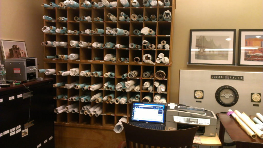


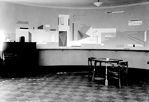


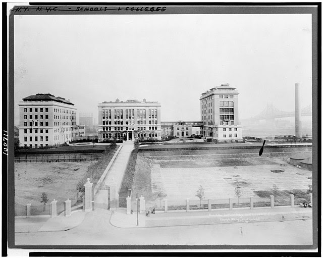
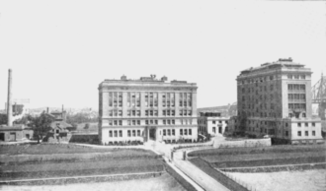


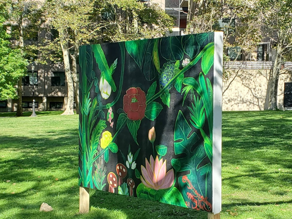
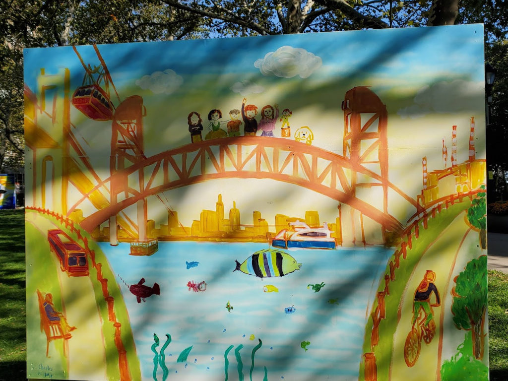
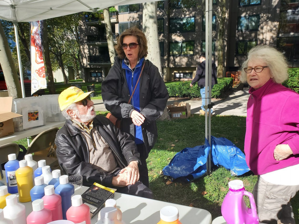


.jpg)