The Architectural and Cultural Flourishing of New York City
Weekend August 23-24, 2025
History101.nyc
Issue # 1517
To see these photos in a larger format, go to history101.nyc
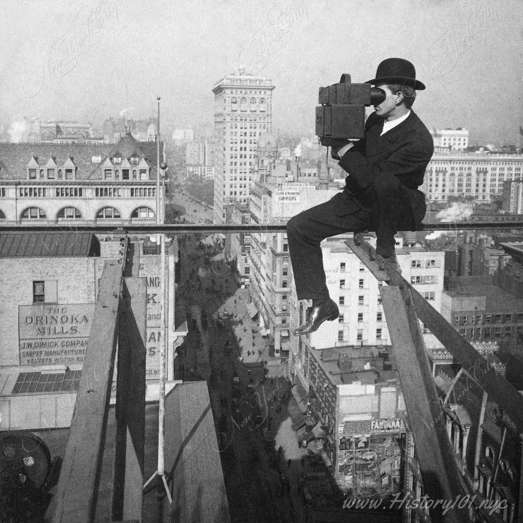
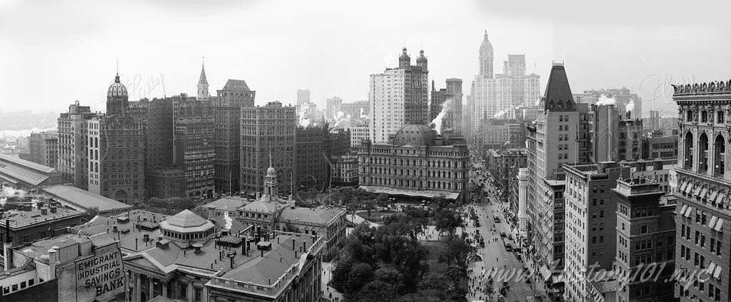
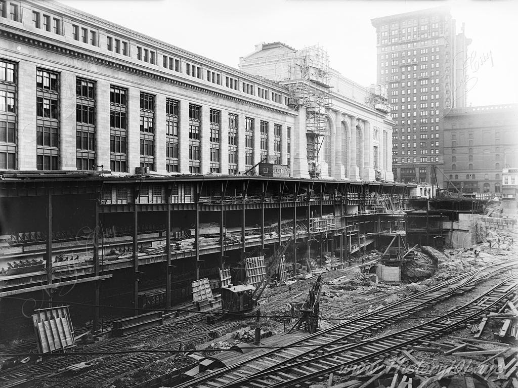
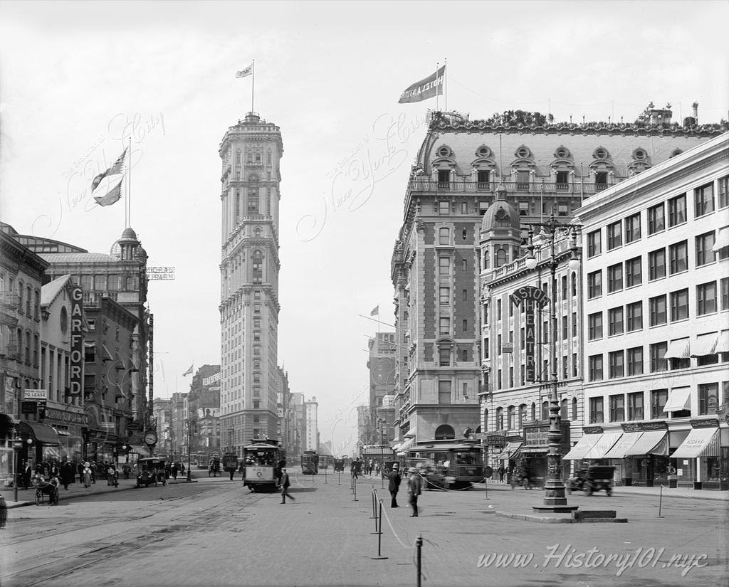
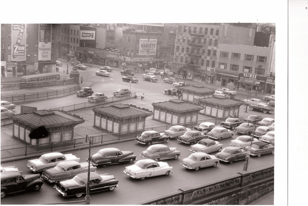
The early 20th century, specifically between 1905 and 1910, marked a pivotal shift in New York City’s architectural landscape. This period witnessed the rise of iconic structures that redefined the city’s skyline. The Singer Building, completed in 1905, soared to 47 stories, claiming the title of the world’s tallest building at the time. This architectural achievement was soon followed by the Metropolitan Life Insurance Company Tower, completed in 1909. It held the title of the tallest building until 1913, further solidifying New York City’s status as a burgeoning metropolis.
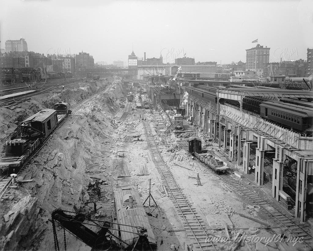
Concurrently, New York City’s subway system, inaugurated in 1904, underwent rapid expansion. The opening of the IRT Lexington Avenue Line in 1905 was instrumental in connecting the city’s diverse neighborhoods, facilitating both residential and commercial development across the boroughs. This expansion significantly transformed the city’s physical and socio-economic landscapes.
This era was marked by a significant cultural renaissance. The New York Public Library’s main branch, a standout Beaux-Arts building, began construction in 1902 and opened in 1911, symbolizing the city’s dedication to cultural enrichment. Moreover, the evolution of Broadway’s theater district, with the openings of the Hudson and New Amsterdam Theaters in 1903, mirrored the city’s expanding artistic landscape.
During this period, New York City underwent profound economic changes. Following the Panic of 1907, Wall Street emerged more robust, prompting critical banking reforms that contributed to the establishment of the Federal Reserve System in 1913. Simultaneously, the city’s population growth, fueled by immigration and urbanization, led to diverse social challenges. These included the need for new approaches to housing and public services, reflecting the city’s evolving demographics.
Timeline of New York City’s History 1905-1910 Discover surprising historical facts about The City That Never Sleeps—explore fun, educational insights into its history, population, iconic landmarks, and more, perfect for students, history enthusiasts, and anyone curious about NYC’s rich heritage.
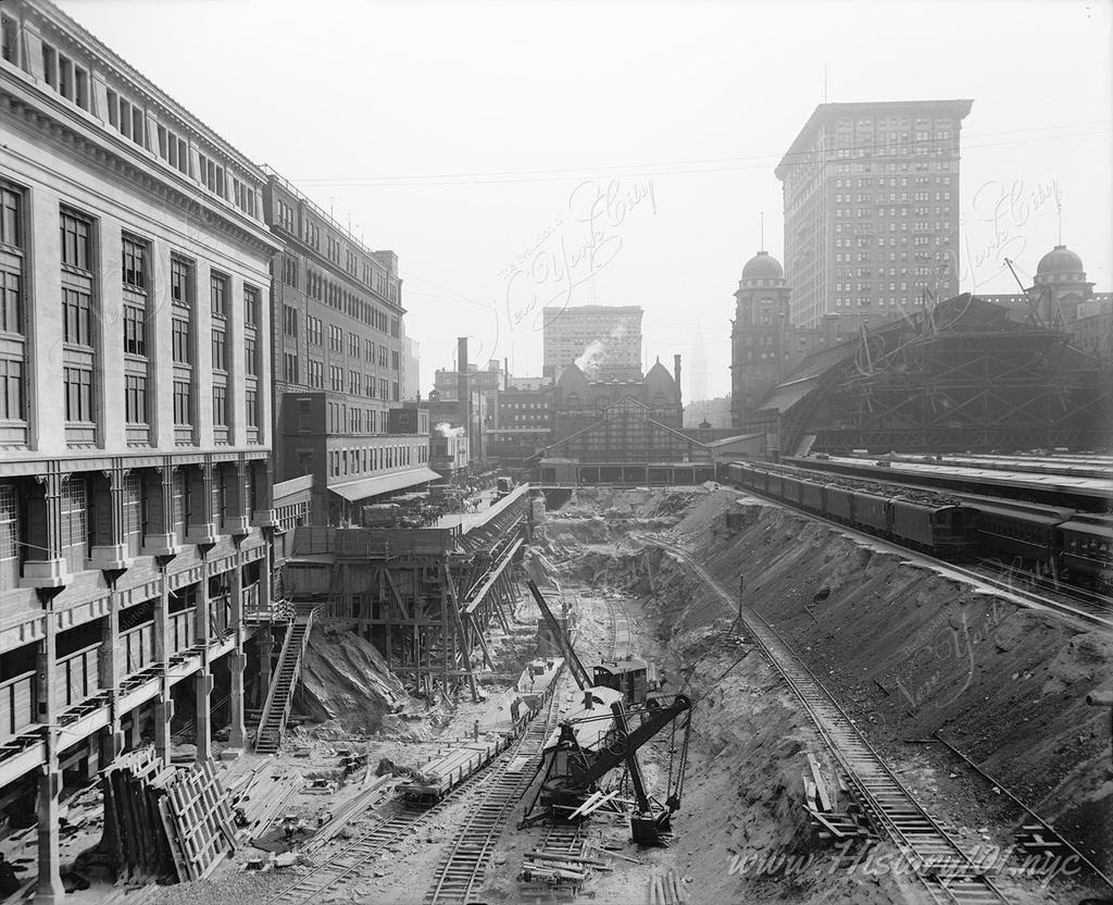
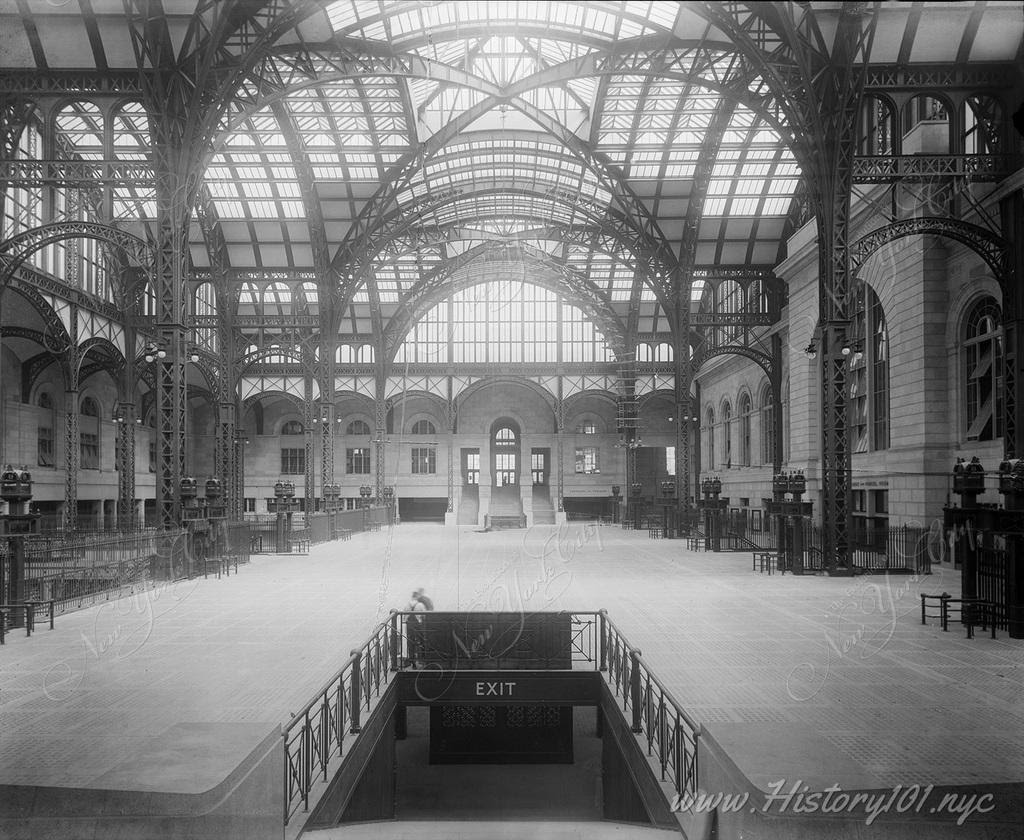
A straight perspective following the direction of the newly laid train tracks which would help to service thousands, and eventually millions of commuters a day.
A photograph which illustrates the great style, symmetry and lighting of Penn Station’s Main Concourse.
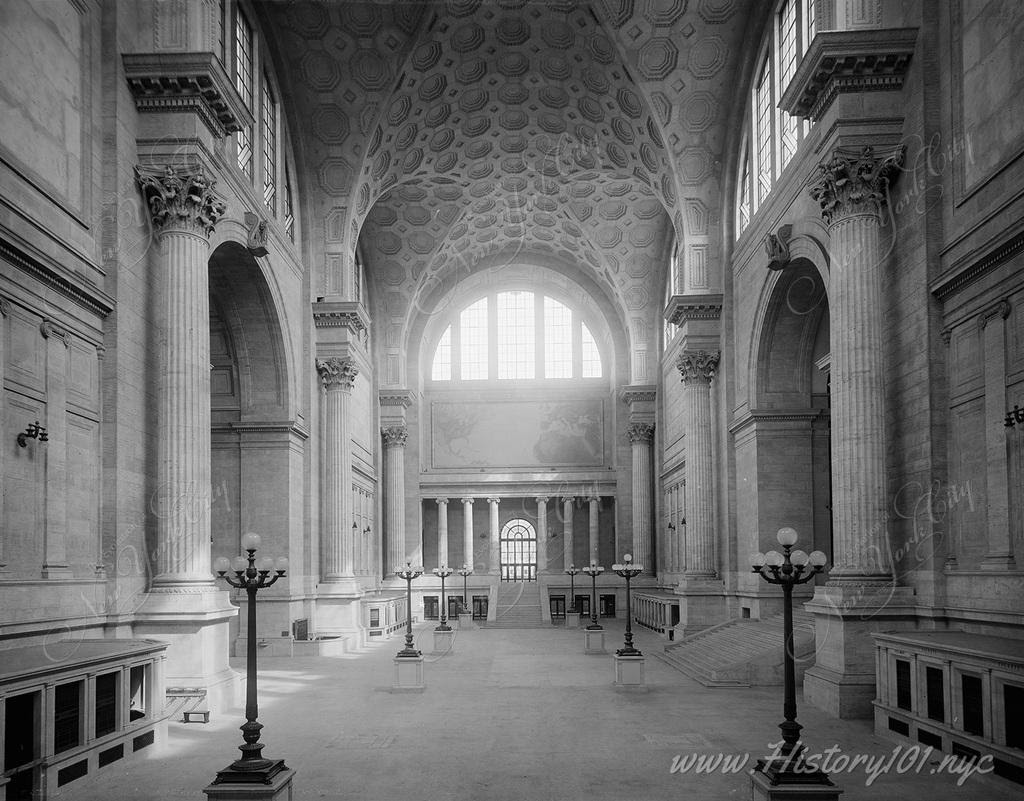
Interior view of Penn Station’s famously opulent waiting room, with its high vaulted ceilings and turn-of-the-century stonework. Image Credit: Unknown. Reprinted with permission. Restoration Credit: This image has been digitally repaired by Fine Print Design Studio.
PHOTO OF THE DAY
STOP BY OUR TABLE AT THE FLEA MARKET THIS SATURDAY TO PURCHASE YOUR NEW RTIHS TEE SHIRT (ADULT SIZES)
All image are copyrighted (c) Roosevelt Island Historical Society unless otherwise indicated THIS PUBLICATION FUNDED BY DISCRETIONARY FUNDS FROM CITY COUNCIL MEMBER JULIE MENIN & ROOSEVELT ISLAND OPERATING CORPORATION PUBLIC PURPOSE FUNDS.
New York right now feels like it’s at a crossroads. People are fearful of walking the streets with the threat of a virus literally in the air. Subway problems, homelessness…the city doesn’t always seem to be working.
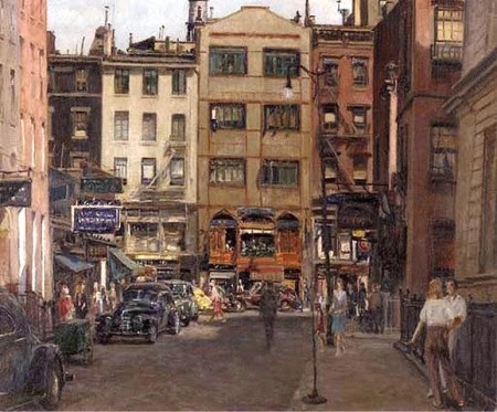
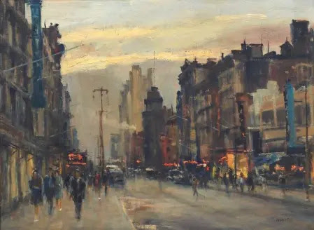
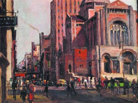
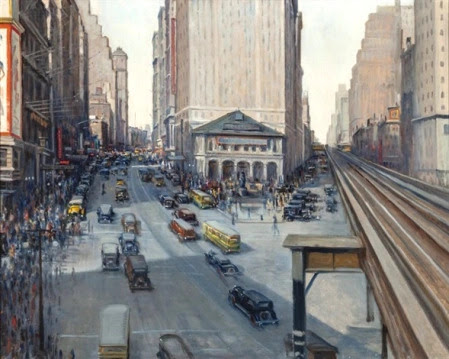
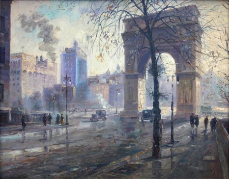
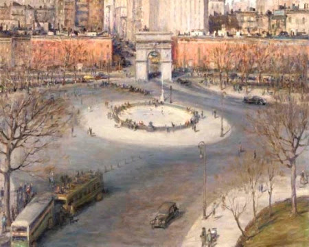
To restore your faith in Gotham, take a look at these paintings by Alfred S. Mira, whose vivid street scenes of the 1930s and 1940s city capture the life, passion, and activity inherent in New York’s soul.
Mira wasn’t a native New Yorker. Born in Italy in 1900, he came to New York as a boy with an “insatiable desire to draw,” as he put it.
Despite his parents’ misgivings, he embarked on a long career as an artist, painting cityscapes (many of his own neighborhood, Greenwich Village) depicting the day-to-day street life New Yorkers relate to and thrive on.
His style is sometimes Impressionist, but his vision of New York was one of realism. He painted the city “the way busy people see it…None of those breathtaking shots cameramen contrive of towers and infinity, which no New Yorker sees in actuality,” he said.
Mira’s paintings capture something real and remarkable about city life—the stunning palette of colors from buildings and roads, the hidden views from el trains and windows, the ordinary exchanges New Yorkers have on sidewalks with one another.
“The lure of the outdoors always attracted me, especially the city streets with their movements, color and depth—they were the things that inspired me and which I painted as they looked and as I felt them,” he said.
This site has featured Mira’s work before, and it’s the right time to present him again. Let his work remind you of what makes New York great and why you don’t ever want to leave.
PHOTO OF THE DAY
STOP BY OUR TABLE AT THE FLEA MARKET THIS SATURDAY TO PURCHASE YOUR NEW RTIHS TEE SHIRT (ADULT SIZES)
CREDIT TO
Ephemeral New York
All image are copyrighted (c) Roosevelt Island Historical Society unless otherwise indicated THIS PUBLICATION FUNDED BY DISCRETIONARY FUNDS FROM CITY COUNCIL MEMBER JULIE MENIN & ROOSEVELT ISLAND OPERATING CORPORATION PUBLIC PURPOSE FUNDS.
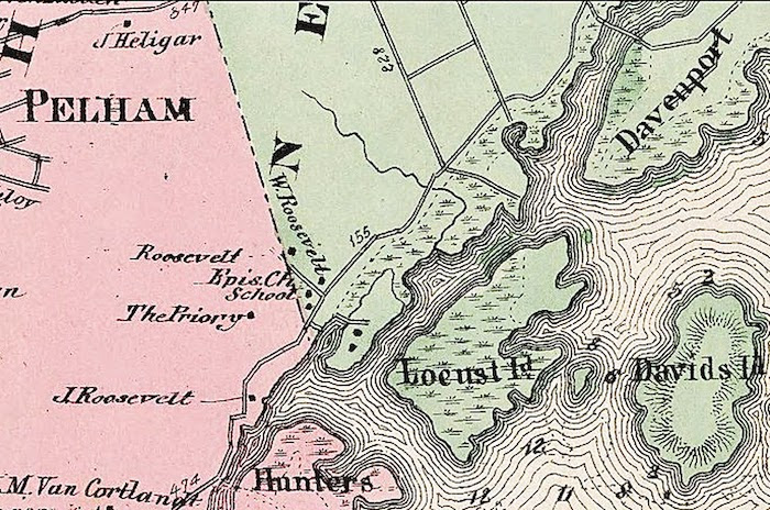
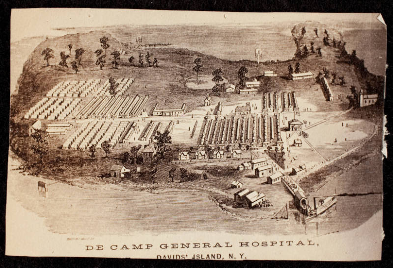
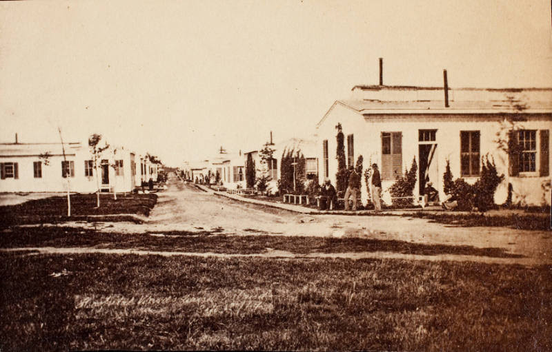
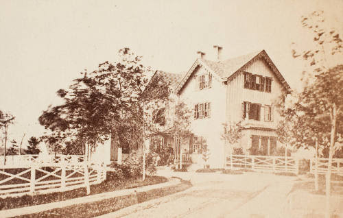
The other day I was looking thru the NYC Municipal Archives website. In a section there was a category of Transit Records. It appears that any body of a deceased person traveling thru Manhattan had to be cataloged in the large log books. During the Civil War years, I noticed that many of the persons died on David’s Island. David’s Island was also called Fort Slocum and was the home of a large hospital for Union Civil War Soldiers.
Until as late as 1803, the island was inhabited by members of the Siwanoy and the Algonquin nation. From Colonial times to the second half of the 19th century, the island was used for farming and pasturing and had various owners.
In 1856 Thaddeus Davids Sr., a New Rochelle ink manufacturer, bought the island from Newberry Davenport Jr., and it still bears his name. During the decade before the Civil War the island was a popular spot for excursion boats from New York City and elsewhere. Maps from the period show that it had a concert room, a saloon ( a genteel refreshment room) and several other buildings, perhaps a hotel.
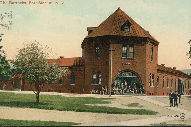
By 1861 the first soldiers arrived on the Island, and the U.S. Army established the De Camp Hospital for the wounded. After the hospital’s closing, the Army purchased the island in 1867 and called the post Davids Island until July of 1896, when the Army formally named it Fort Slocum after Major General Henry Warner Slocum of Civil War fame.
Through the Army years the island served as a prison, hospital, mustering camp, recruiting depot, coast artillery fortification, transit station, training camp, Air Force base, and missile battery.[2] Thousand of soldiers from all over the country served at Ft. Slocum and thousands of Westchester residents worked and visited there. The fort’s busiest time was during World War I when the base processed thousands of men on their way to war.
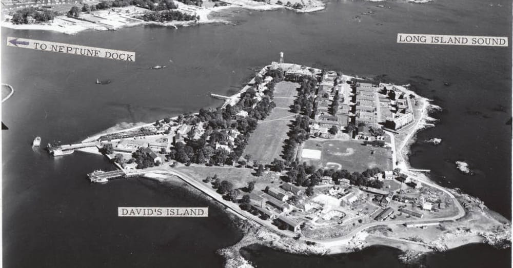
At the height of World War I, the fort had difficulty keeping up with the inflow of newly arriving troops. In December of 1917, the Department of War issued regulations that would stop voluntary enlistment in favor of a draft. In the week of December 10th, 800 men arrived each day at the New Rochelle train station and were ferried from the Neptune Park Dock to the Island. By the end of the week Fort Slocum was full, and the City of New Rochelle united to aid in the feeding, clothing, and housing thousands of men stranded during one of the coldest winters in recent history.[3] The rapid influx of new troops to the island triggered a massive construction boom, the first since the 1880s. 56 one-story buildings were erected including a recruit examination building and a post office.
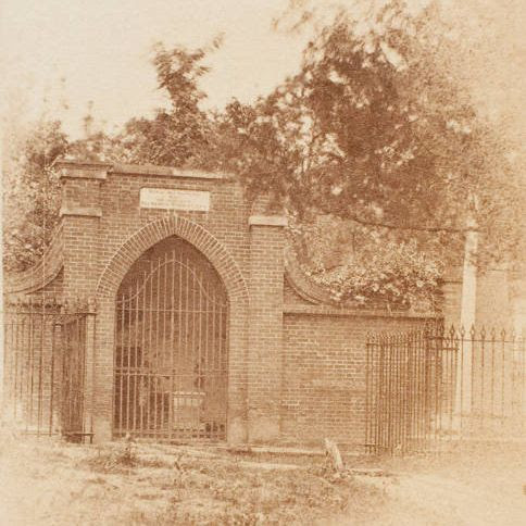
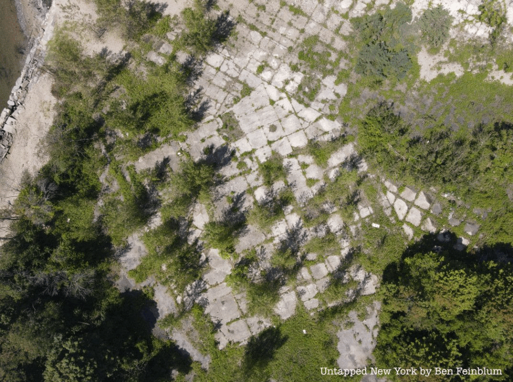
In November of 1965, Fort Slocum was abandoned by the Army and bought by the City of New Rochelle. While there have been many potential buyers such as Donald Trump, Con Edison, and Xanadu Properties, the island is still owned by the city. The ruins of Fort Slocum continued to occupy the island until 2008 when Congress approved funds to remove the remaining structures on the island including the iconic water tower. The island is currently inaccessible to the public, but a new future hopefully awaits.
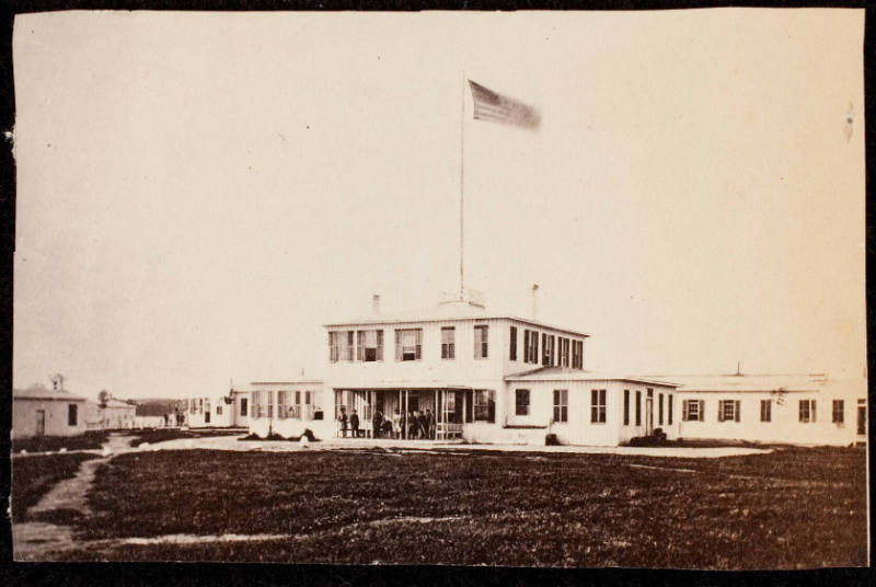
Hospital treated Union and later Confederate Troops during the Civil War.
This is a carte de visite. The David L. Hack Civil War Photography Collection. A photograph of a building with people standing on the front porch, several windows and dark shutters. On the roof stands a high flag pole with the American flag flying at the top. This is from _Gardner’s Photographic Sketchbook of the War_ (Hack Collection No. 2].
FORT SLOCUM
IN USE UNTIL CLOSED IN THE 1960’S
Fort Slocum before all structures were demolished in 2008.
All that remains of the island since multiple plans for development have fallen thru.
PHOTO OF THE DAY
Second Avenue before Congestion Pricing
CREDIT TO
Wikipedia
All image are copyrighted (c) Roosevelt Island Historical Society unless otherwise indicated THIS PUBLICATION FUNDED BY DISCRETIONARY FUNDS FROM CITY COUNCIL MEMBER JULIE MENIN & ROOSEVELT ISLAND OPERATING CORPORATION PUBLIC PURPOSE FUNDS.
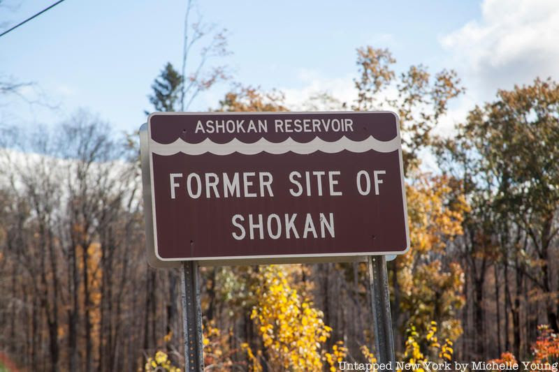
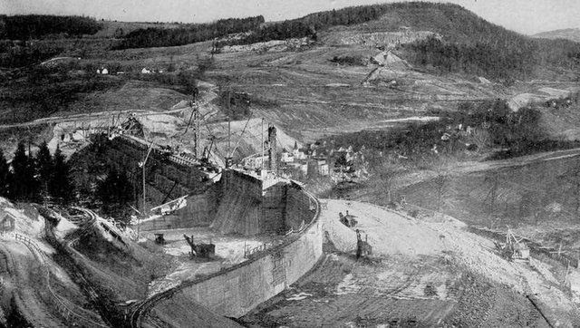
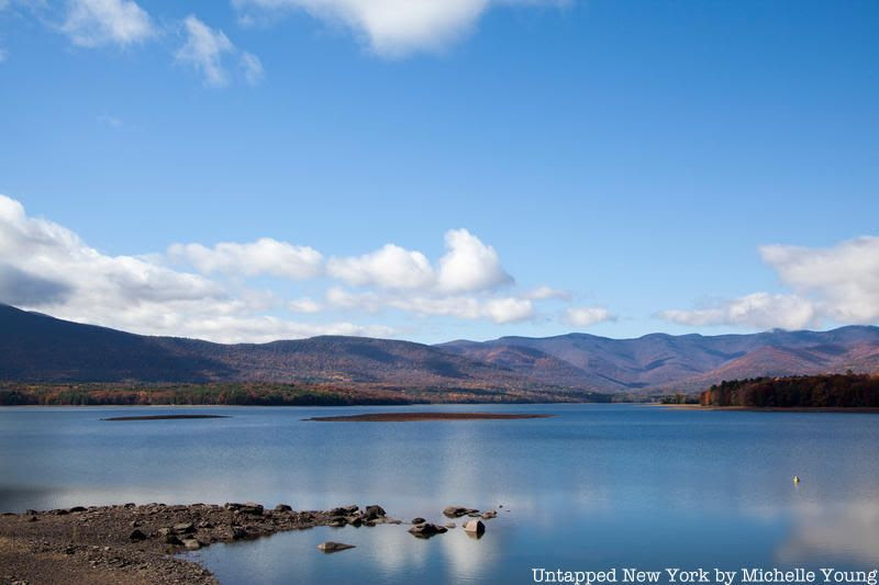
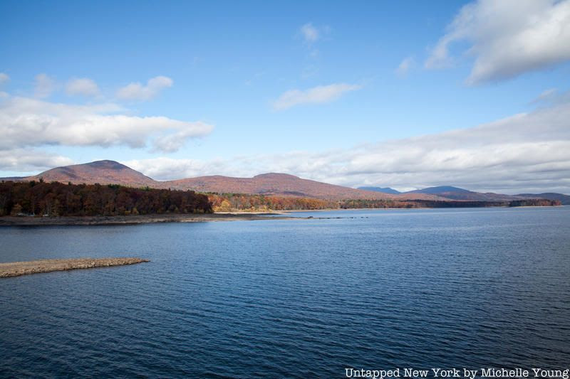
New York City has some of the best drinking water in the country, but it didn’t come without a price. Most are familiar with the Croton Aqueduct, the first to bring fresh water to the city in 1842–updated in 1890. The Catskill Aqueduct was next (a push after Brooklyn was incorporated into the City of New York), built between 1917 and 1924, bringing 40% of New York City’s water from a series of reservoirs 163 miles from upstate New York. What New Yorkers may not know is that the six reservoirs of the Catskill Aqueduct, including Ashokan Reservoir which is New York City’s largest, were formed by flooding a dozen towns.
The plan for the Catskill Aqueduct began in 1905 when the New York City Board of Water Supply was formed, allowing for the acquisition of property by eminent domain and the construction of dams, reservoirs and and aqueducts. The area in question was formerly a farming area, with logging activity as well as the quarrying of bluestone, some of which ended up on the Brooklyn Bridge.
2000 people were relocated, including a thousand New Yorkers with second homes. 32 cemeteries were unearthed and the 1,800 residents buried elsewhere, to limit water contamination. Residents were offered $15 from the city ($65 later for the Delaware Aqueduct) to disinter their relatives and rebury them elsewhere.
Some of NYC’s Water Comes from Drowned Towns in the Catskills
Construction of the Ashokan Reservoir in 1910. Image from New York City Department of Environmental Protection
Buildings and industries were relocated or burned down, trees and brush were removed from the future reservoir floor–all the work done predominantly by local laborers, African-Americans from the south and Italian immigrants. To control the fighting that arose between labor groups, a police force which became the New York City Department of Environmental Protection (NYCDEP) Police, was created.
In sum, four towns were submerged while eight were relocated to build the Ashokan Reservoir. When the dam was completed, steam whistles were blown for an hour warning residents that the water was coming. Today, remnants of foundations, walls, and more can still be seen, particularly when water levels are lower–often in the fall. Although access to the reservoirs has been limited since 9/11, you can see some of those archeological finds from bridges. You can also hike and bike along a ridge of the reservoir.
The last of the eminent domain lawsuits in the Ashkoan Reservoir area was not settled in 1940 and it was not until 2002 that New York City made any moves to acknowledge the history in the Esopus Valley. The NYCDEP installed an outdoor exhibition in Olive, New York that commemorated the lost towns and the feat of the aqueduct itself, with the intention to add exhibits at five other reservoirs (although we were not able to find that the exhibition or any others are still available). Signage now shows the sites of the former towns.
The Delaware Aqueduct is the most recent of the city’s aqueducts and its story is similar to the Catskill Aqueduct–the Pepacton Reservoir (aka the Downsville Reservoir or the Downsville Dam) was formed by not only flooding four towns, but also submerging half of the existing Delaware and Northern Railroad. This reservoir provides 25% of the city’s drinking water, and combined the Catskill and Delaware Aqueduct provides 90% of the city’s water.
All image are copyrighted (c) Roosevelt Island Historical Society unless otherwise indicated THIS PUBLICATION FUNDED BY DISCRETIONARY FUNDS FROM CITY COUNCIL MEMBER JULIE MENIN & ROOSEVELT ISLAND OPERATING CORPORATION PUBLIC PURPOSE FUNDS.
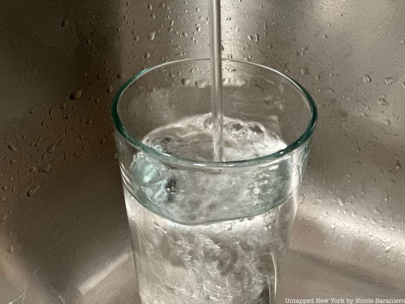
NYC tap water has been called “the champagne of drinking water.” It’s won multiple taste test awards and is credited as the reason NYC bagels and pizza are so delicious. In addition to being famously tasty, NYC tap water is also an impressive feat of engineering. Here, we explore where it comes from, what makes it taste so good, and more secrets!
1. Some of NYC’s Water Comes from Drowned Towns in the Catskills
Construction of the Ashokan Reservoir in 1910. Image from New York City Department of Environmental Protection
Fresh water first came to New York City via the Croton Aqueduct in 1842. In 1917, construction began on the Catskill Aqueduct which provided six new reservoirs that supplied water to New York City. Many of those reservoirs were built on the site of existing Catskill towns in an area used largely for farming, logging, and bluestone quarrying. To make way for the reservoirs, 2,000 people had to be relocated. In addition to living residents, 1,800 bodies from cemeteries at the sites were unearthed and re-interred elsewhere. Homes, businesses, and trees were torn down.
In total, four towns were submerged and eight were relocated to build the Ashokan Reservoir, the largest reservoir for New York City. Before the water rushed in, whistles were blown for an hour to warn any stragglers to leave. When the water levels are low today, you can see foundations, walls, and other remnants of the lost towns. Learn more about the drowned towns here!
2. Microscopic Crustaceans Were Found in NYC Tap Water
In 2010, a Reddit user uploaded images of microscopic shrimp-like organisms found in a glass of tap water. What the user captured were copepods, very tiny crustaceans that are known to eat mosquito larvae and help keep water supplies clean. The presence of this organism, though invisible and harmless, posed a problem for Orthodox Jewish people who follow a Kosher diet in New York City. A NYC Department of Environmental Protection (DEP) spokesman told Wastewater Digest back in 2004 that the copepods can easily be filtered out with a commercial filter or the water could be run through a double cloth to remove the creatures.
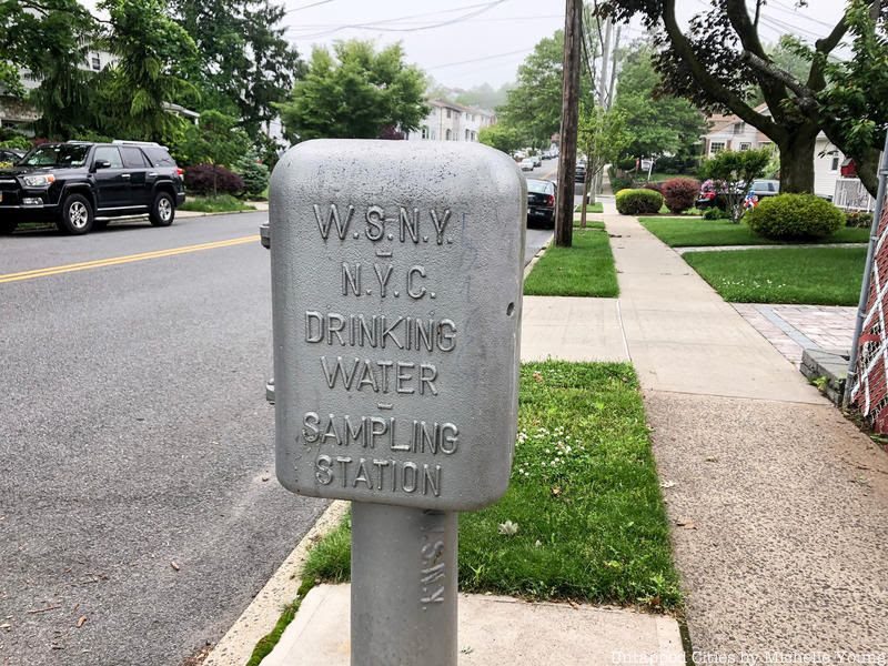
3. What’s Inside Drinking Water Sampling Stations?
There are more than 950 NYC drinking water sampling stations spread across the five boroughs. Inside these silver, cast iron boxes there is a sink. Quality scientists working for the DEP visit these sampling sites to conduct tests over 30,000 times a month. They are out in the field every day of the year making sure the water is safe to drink. A few things they test for include “bacteria, chlorine levels, pH, inorganic and organic compounds, turbidity, and odor” among other quality metrics.
4. NYC’s Water Supply System Provides One Billion Gallons of Water Per Day
New York City’s tap water comes from 19 reservoirs and three controlled lakes located in the Hudson Valley and Catskill regions. Those bodies of water are part of two primary surface water supplies, the Catskill/Delaware and Croton. In order to get clean water to all of New York City’s more than 8.8 million residents, the water supply system provides more than one billion gallons of water per day! This supply also serves one million people residing in Westchester, Putnam, Orange, and Ulster counties. That’s nearly half of the entire population of New York State. The water from our upstate watershed areas can take anywhere from 12 weeks to a year to travel through the system to the city, according to the New York Times.
5. NYC Tap Water is Unfiltered (Most of it)
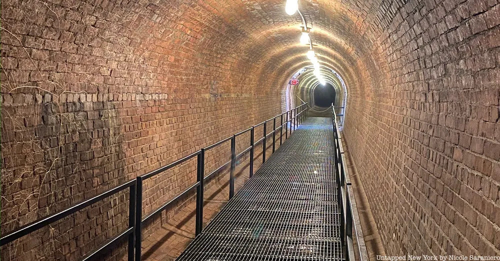
Inside a tunnel of the Old Croton Aqueduct in Ossining, NY
Due to the high quality of water from the Catskill/Delaware supply, New York City is one of only five large cities in the nation that does not use filtration as a treatment method. It is actually the largest unfiltered water system in the country. Instead of filtration, NYC tap water that comes from the Catskill/Delaware supply is treated using chlorine and ultraviolet light. Chlorine is a disinfectant that kills germs and prevents bacteria from growing on pipes. Ultraviolet light further disinfects the supply. More than 2 billion gallons of water go through this disinfection process every day at the Catskill/Delaware UV Disinfection Facility in Westchester. Water from the Croton supply is filtered at an underground facility in the Bronx called the Croton Water Filtration Plant.
6. You Can See Remnants of NYC’s Old Reservoirs
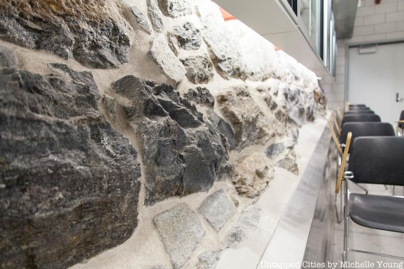
When the Old Croton Reservoir first opened, there were multiple reservoirs within the limits of New York City that it fed and there are many remnants of that system that you can see today. One of these remnants is a stone wall inside the New York Public Library which was once part of the Croton (or Murray Hill) Distributing Reservoir’s foundation. The reservoir opened in 1842 and stood where Bryant Park is today. It was a favorite walking spot of Edgar Allan Poe and other New Yorkers who could walk along the edge and take in the city views.. It was torn down in 1900.
Another reservoir once stood where the Great Lawn of Central Park is now. Remnants of this structure can be found poking out of the ground on the east side of the Great Lawn and inside the conference room at the Central Park NYPD station on the 86th Street transverse (seen above). Track down more remnants of the Croton Aqueduct here! Today, the last point of travel for most NYC tap water before it enters homes and businesses is the Hillview Reservoir in Yonkers.
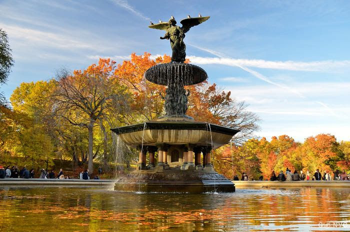
7. The Bethesda Fountain Honors NYC’s First Drinking Water Supply
Bethesda Fountain is an iconic attraction of Central Park, but few may know the story behind it. The official name of the fountain is Angel of the Waters. When Central Park was originally designed, this was the only fountain that was in the plan. The twenty-six-foot-high fountain was created by sculptor Emma Stebbins, the first woman to receive a commission for a major public work in New York City. Calvert Vaux designed the base it stands on and Jacob Wrey Mould created the ornamentation. The fountain commemorates the 1842 opening of the Corotn Aqueduct which brought fresh drinking water to the city. The angle holds a lily in one hand while blessing the waters with the other. At her feet, four cherubs represent health, purity, temperance, and peace.
8. A Formerly Abandoned Queens Reservoir is Now Part of a Park
From 1858 until 1990, parts of Brooklyn received water from the now-decommissioned Ridgewood Reservoir. This reservoir was fed by small streams on Long Island. Located on the southeastern corner of Ridgewood, Queens, the reservoir distributed over 45 million gallons of water per day. After being decommissioned in 1990, the site sat largely untouched. Management of the site was transferred to the parks department in 2004. Today, the reservoir is part of Highland Park, a designated freshwater wetland.
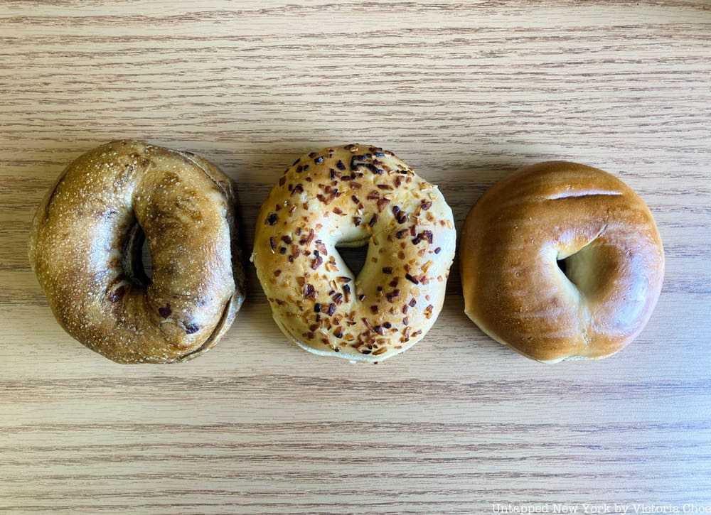
9. Does NYC Tap Water Really Make Bagels and Pizza Taste Better?
NYC tap water has been called “the champagne of drinking water” and businesses in states across America have imported or tried to replicate our water to make their bagels or pizza taste just like those made here in the city. But is water really the key to the best bagel or slice? It’s a debate that’s been hashed out in articles by NPR, Reader’s Digest, Sauce, Food & Wine, Smithsonian Magazine, and countless other publications. There are certain qualities that make NYC tap water unique, such as lower concentrations of calcium (an element that can make water have a bitter taste) and magnesium, but higher levels of sodium and other natural minerals from the water source. These attributes make NYC water “soft.” The softness or hardness of water does impact how it reacts to gluten in the dough. Hard water tends to strengthen gluten, making for a dough that’s a bit tougher, as noted by Smithsonian Magazine. While NYC tap water may give our dough the slightest edge, there are many other factors that contribute to making a good bagel or pizza pie, like how you bake it and the quality of the other ingredients you use. The water likely has little impact on the overall taste, but what do you think?
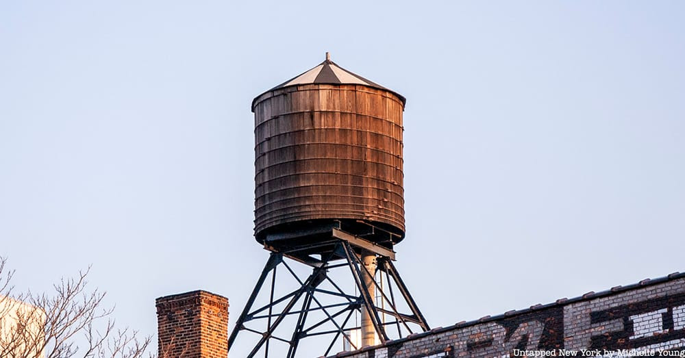
10. How Do Water Towers Work?
Water towers are a ubiquitous part of the New York City skyline, but how do they actually work? Most of New York City’s water travels to the city purely by the force of gravity, gaining enough speed and pressure to travel up to six floors high naturally (roughly 60 to 75 feet). This is impressive, but many New York City buildings are much, much taller. In order to get water to the upper floors of the tallest buildings, you need pumps and water storage. Enter the water tower. Traditionally, water towers are made of cedar wood or California redwood planks held together like a barrel with steel hoops. The wood is highly effective at insulating the water, keeping the water from freezing in the winter. Though the concept of water towers is simple and seems old-fashioned, they are still very much in use today. Check out some of the most unique water towers in NYC right here including the giant water towers at the World Trade Center!
PHOTO OF THE DAY
Grilled Chicken Sandwich at Nisi Yummy
Credits
UNTAPPED NEW YORK
All image are copyrighted (c) Roosevelt Island Historical Society unless otherwise indicated THIS PUBLICATION FUNDED BY DISCRETIONARY FUNDS FROM CITY COUNCIL MEMBER JULIE MENIN & ROOSEVELT ISLAND OPERATING CORPORATION PUBLIC PURPOSE FUNDS.
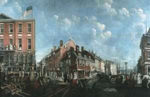
Merchant’s Coffee House at the Outbreak of the Revolution
August 15, 2025
Nesbitt Deane, the hatter, whose shop was in the old Merchants’ Coffee House building in the city of New York, advertised in 1775, to let the two or three upper stories of the house, “being noted for a Notary Public’s office these two years past,” which he further describes “as being so pleasantly situated that a person can see at once the river, shipping, Long Island and all the gentlemen resorting to the House on business from the most distant climes.”
Although the Coffee House was generally the resort of strangers as well as citizens, yet, in 1775, on account of the stagnation of business caused by the cessation of all trade with Great Britain during the American Revolution, it was almost deserted.
This is made plain by an article which appeared in the New York Journal of October 19; and as this has some interesting statements about coffee houses in general and about the Merchants’ Coffee House in particular, we have thought it well to reproduce it entirely.
“To the Inhabitants of New York:
“It gives me concern, in this time of public difficulty and danger, to find we have in this city no place of daily general meeting, where we might hear and communicate intelligence from every quarter and freely confer with one another on every matter that concerns us.
“Such a place of general meeting is of very great advantage in many respects, especially at such a time as this, besides the satisfaction it affords and the sociable disposition it has a tendency to keep up among us, which was never more wanted than at this time.
“To answer all these and many other good and useful purposes, Coffee Houses have been universally deemed the most convenient places of resort, because at a small expense of time or money, persons wanted may be found and spoke with, appointments may be made, current news heard, and whatever it most concerns us to know.
“In all cities, therefore, and large towns that I have seen in the British dominions, sufficient encouragement has been given to support one or more Coffee Houses in a genteel manner.
“How comes it then that New York, the most central, and one of the largest and most prosperous cities in British America, cannot support one Coffee House? It is a scandal to the city and its inhabitants to be destitute of such a convenience, for want of due encouragement.
“A coffee house, indeed, here is! a very good and comfortable one, extremely well tended and accommodated, but it is frequented but by an inconsiderable number of people; and I have observed with surprise, that but a small part of those who do frequent it, contribute anything at all to the expense, of it, but come in and go out without calling for or paying anything to the house.
“In all the Coffee Houses in London, it is customary for every one that comes in, to call for at least a dish of Coffee, or leave the value of one, which is but reasonable, because when the keepers of these houses have been at the expense of setting them up and providing all necessaries for the accommodation of company, every one that comes to receive the benefit of these conveniences ought to contribute something towards the expense of them.
“To each individual the expense is a trifle quite inconsiderable, but to the keeper of one of these houses it is an article of great importance, and essential to the support and continuance of it. I have, therefore, since I frequented the Coffee House in this city and observed the numbers that come in without spending anything, often wondered how the expense of the house was supported, or what inducement the person who kept it could have to continue it.
“At the same time I could not help being equally surprised at the disposition of people who acted in this manner; or their thoughtlessness in neglecting to contribute to the support of a house which their business or pleasure induced them to frequent; especially as I have met with no Coffee House in my travels better accommodated with attendance or any liquors that could be expected in a Coffee House.
“I have of late observed that the house is almost deserted, and don’t wonder that fire and candles are not lighted as usual; it is rather surprising they were continued so long. I am convinced the interest of the person who keeps it, must, without a speedy alteration, soon induce her to drop the business and shut up her house; and I cannot help feeling concern that a very useful and worthy person, who has always behaved well in her station, should not be treated with more generosity and kindness by her fellow citizens.
“I am concerned, too, for my own conveniency and for the honor of the city, to find that it will not support one Coffee House.”
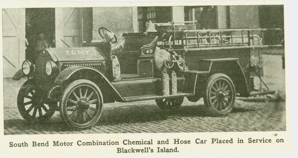
PHOTO OF THE DAY
ENGINE COMPANY 49 FIREHOUSE LOCATED ON BLACKWELL’S ISLAND UNTIL 1959 NY FIRE MUSEUM
Credits
NEW YORK ALMANACK
All image are copyrighted (c) Roosevelt Island Historical Society unless otherwise indicated THIS PUBLICATION FUNDED BY DISCRETIONARY FUNDS FROM CITY COUNCIL MEMBER JULIE MENIN & ROOSEVELT ISLAND OPERATING CORPORATION PUBLIC PURPOSE FUNDS.
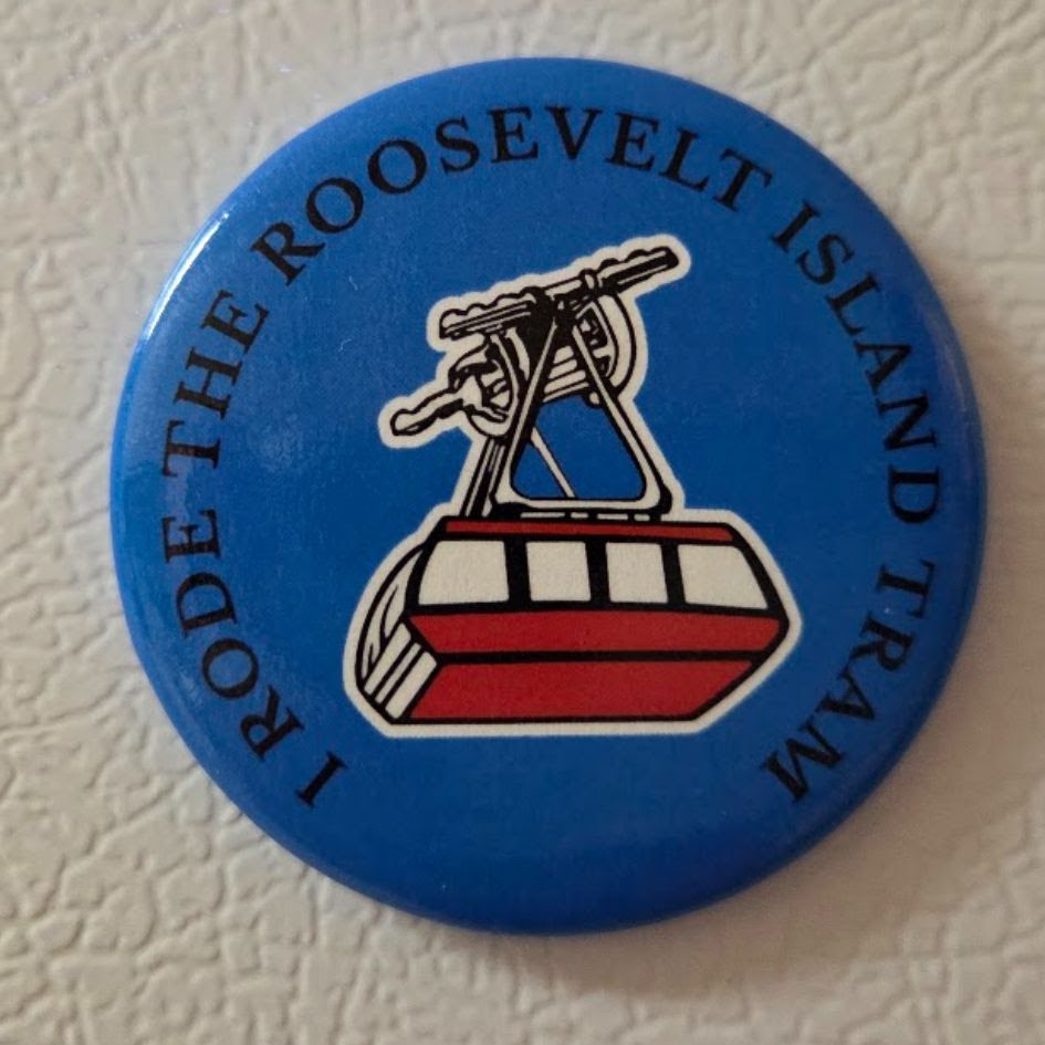
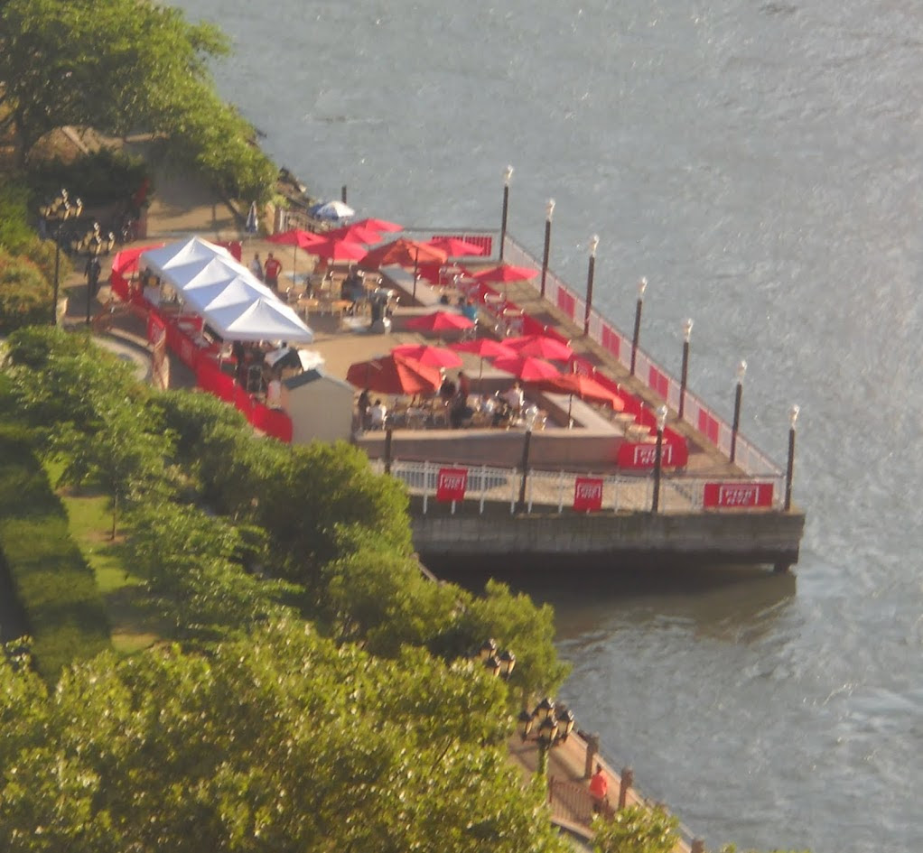
TRAM BACK ON FULL SERVICE AND A GREAT RIOC SPRUCE UP
Weekend, August 16-17, 2025
Judith Berdy
Issue # 1511
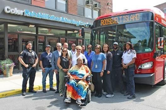
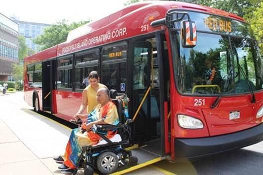
RED BUS TO SERVE COLER
The Roosevelt Island Operating Corporation (RIOC) and NYC Health + Hospitals/Coler announce a new pilot program that will extend free Red Bus service on Roosevelt Island directly to the front entrance of the skilled nursing & rehabilitation center located at 900 Main Street, during morning and afternoon rush hours, beginning Monday, August 18. As part of the pilot, Coler will serve as the northernmost stop on the island from 6:00 a.m. to 10:00 a.m. and 3:00 p.m. to 8:00 p.m. on weekdays. The initiative aims to improve public transportation access for Coler residents, staff, and visitors.
“The extension of the RIOC Red Bus service to our main entrance at NYC Health + Hospitals/Coler will have a profound impact on the quality of life of staff, residents and visitors who commute to our nursing facility from other transportation hubs on Roosevelt Island,” said NYC Health + Hospitals/Coler Interim Chief Executive Officer David Weinstein, MA, HSA, LNHA. “I am grateful to our partners at Roosevelt Island Operating Corporation for working with us to improve accessibility to this invaluable service.”
“Extending the Red Bus to Coler Hospital is something that has been requested of different RIOC administrations for years, likely since the facility first opened. Today, we are pleased to announce a new pilot program that will finally allow Coler residents, staff, and visitors to travel directly from the island’s transportation hubs to the hospital’s front door every weekday during our busiest rush hour periods,” said Mary Cunneen, Chief Operating Officer of the Roosevelt Island Operating Corporation. “I want to thank David Weinstein, interim CEO of NYC Health + Hospitals/Coler, for his partnership and commitment to making this possible, and RIOC’s Transportation Department, led by Nestor Ortiz, for moving quickly to turn this long-standing goal into a reality.”
Currently, passengers traveling to or from Coler via the Red Bus must use the Octagon stop, located south of the Coler campus. This additional distance can be challenging, especially for Coler residents, many of whom have mobility limitations. Under the pilot program, the Red Bus will instead make its final northbound stop at the same Coler stop used by the Q102 bus during weekday peak hours.
The addition of the Coler stop is not expected to affect the current Red Bus schedule. During off-peak hours and weekends, the route will continue to begin and end at the Octagon.
TRAM BACK ON FULL SCHEDULE
Our Tram operator, Leitner-Poma, has completed the communications system upgrade work on the South Tram cabin early. Both cabins will now return to their normal schedules, with 2 cabins operating starting today at 2:30pm for afternoon rush hour service.
We want to thank everyone in the community for their patience and understanding while we completed these necessary system upgrades.
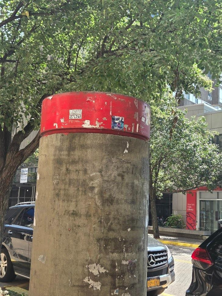
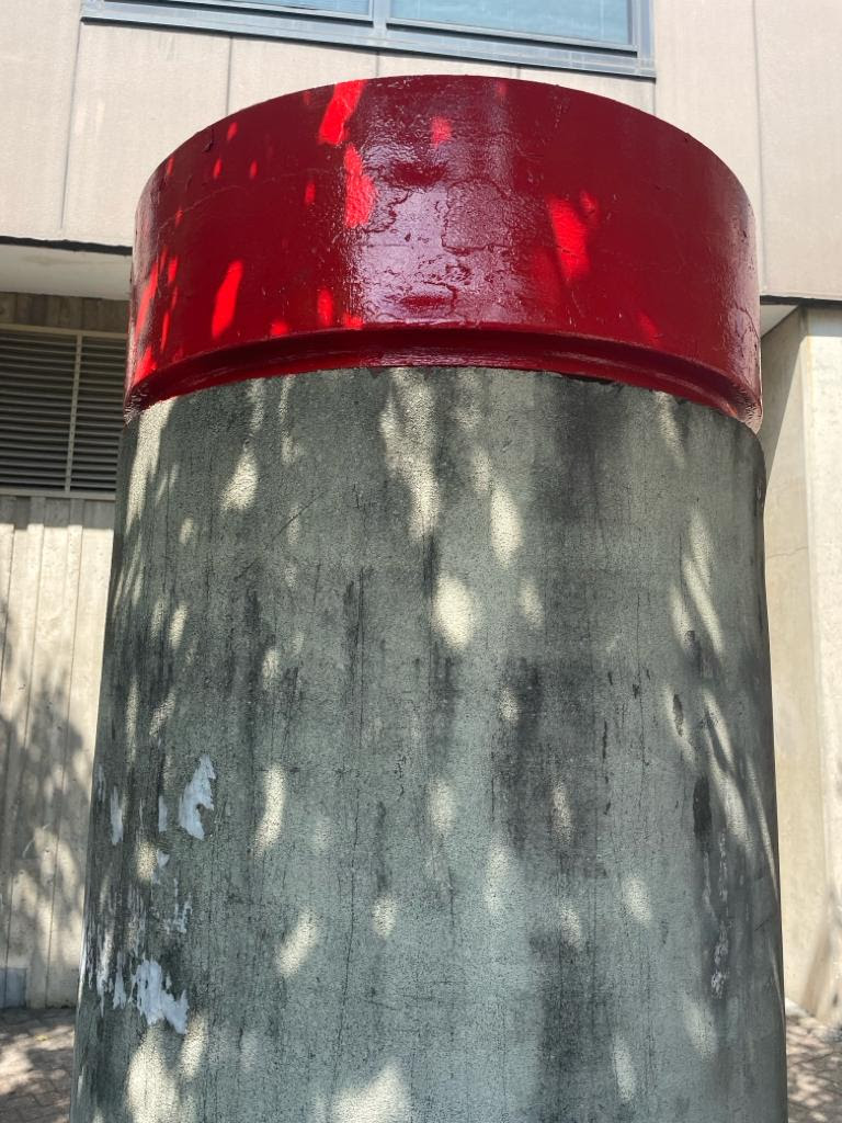
KIOSKS GET PAINT JOB AND SCRUBBING
Above left: before Above right: after
I submitted a problem on the RIOC website under the heading “Report a Problem”. All I wrote is that our 50 year old round kiosks are dirty and have not been powerwashed and the tops painted in years.
Less than a week later RIOC send me photos of the newly cleaned and painted kiosks. Looking better than in years the RIOC RED shines again.
Thanks to tthe maintenance staff members:Christopher Alexander Mehdi Omrani Alex Perez for their efforts.
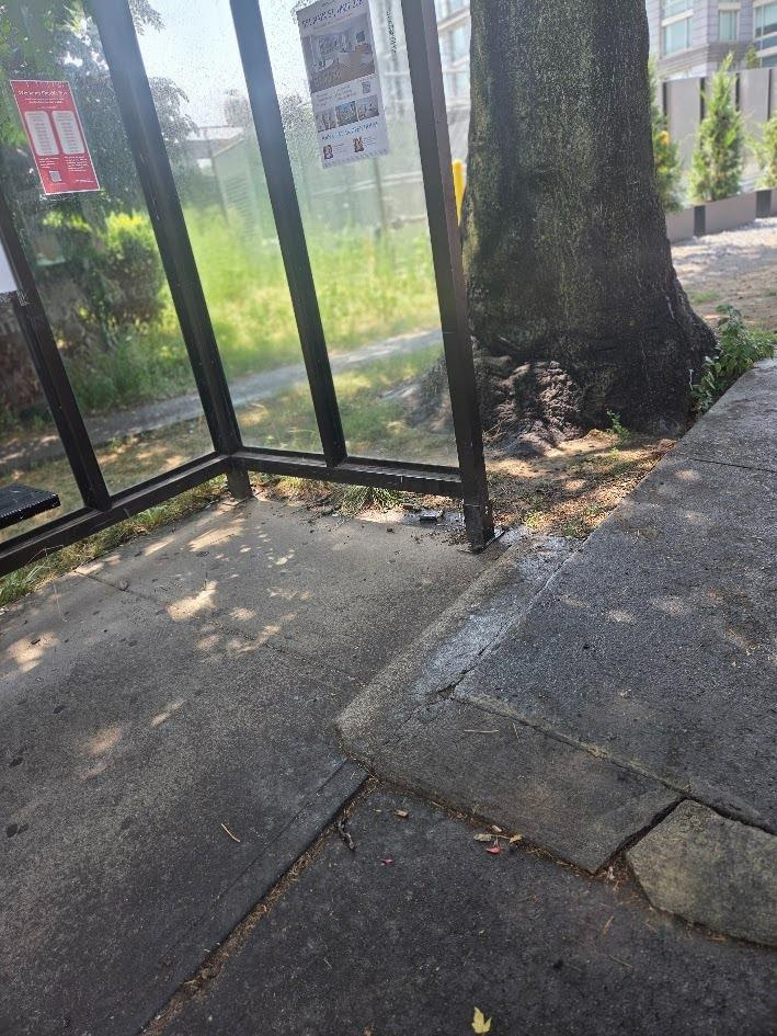
CONCRETE PATCHING AT OCTAGON BUS STOP
A part of the sidewalk at the Octagon bus stop has been cracking and was a tripping hazard. After reporting it to “Report a Problem” the area was repaired promptly. Now the tripping hazzard has been removed,
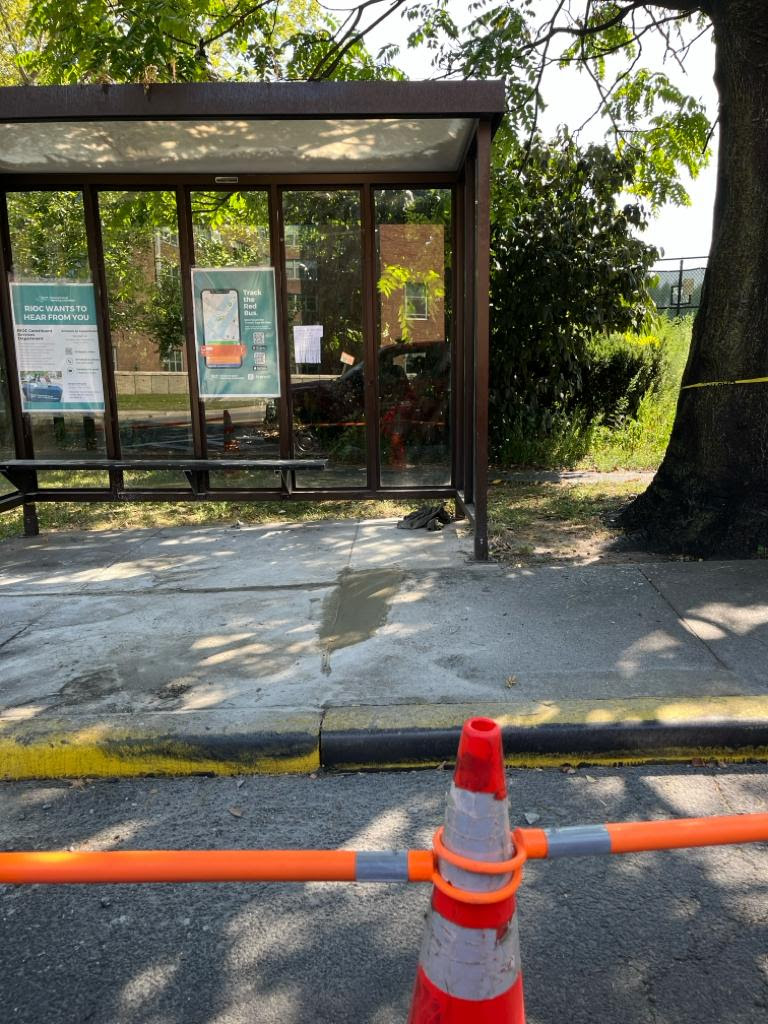
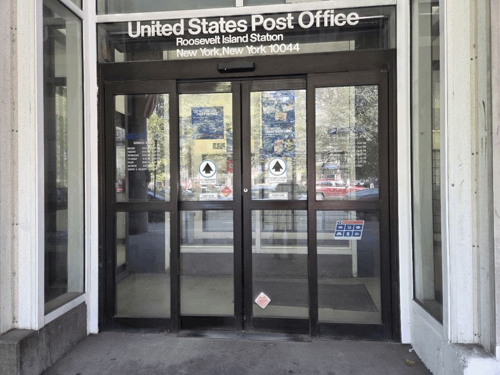
PHOTO OF THE DAY
NEGLECT AT R.I. POST OFFICE THERE SEEMS TO BE NO CLEANING GOING ON AT OUR LOCAL POST OFFICE
Credits
ROOSEVELT ISLAND OPERATING CORPORATION NYC HEALTH +HOSPITALS JUDITH BERDY
All image are copyrighted (c) Roosevelt Island Historical Society unless otherwise indicated THIS PUBLICATION FUNDED BY DISCRETIONARY FUNDS FROM CITY COUNCIL MEMBER JULIE MENIN & ROOSEVELT ISLAND OPERATING CORPORATION PUBLIC PURPOSE FUNDS.
As anyone who has ever taken a walk through a city park knows, New York is rich with beautiful bronze statues.
Typically they grace a public space, often on a decorative pedestal or base and in a setting that underscores their importance (or their importance at the time the statue was completed).
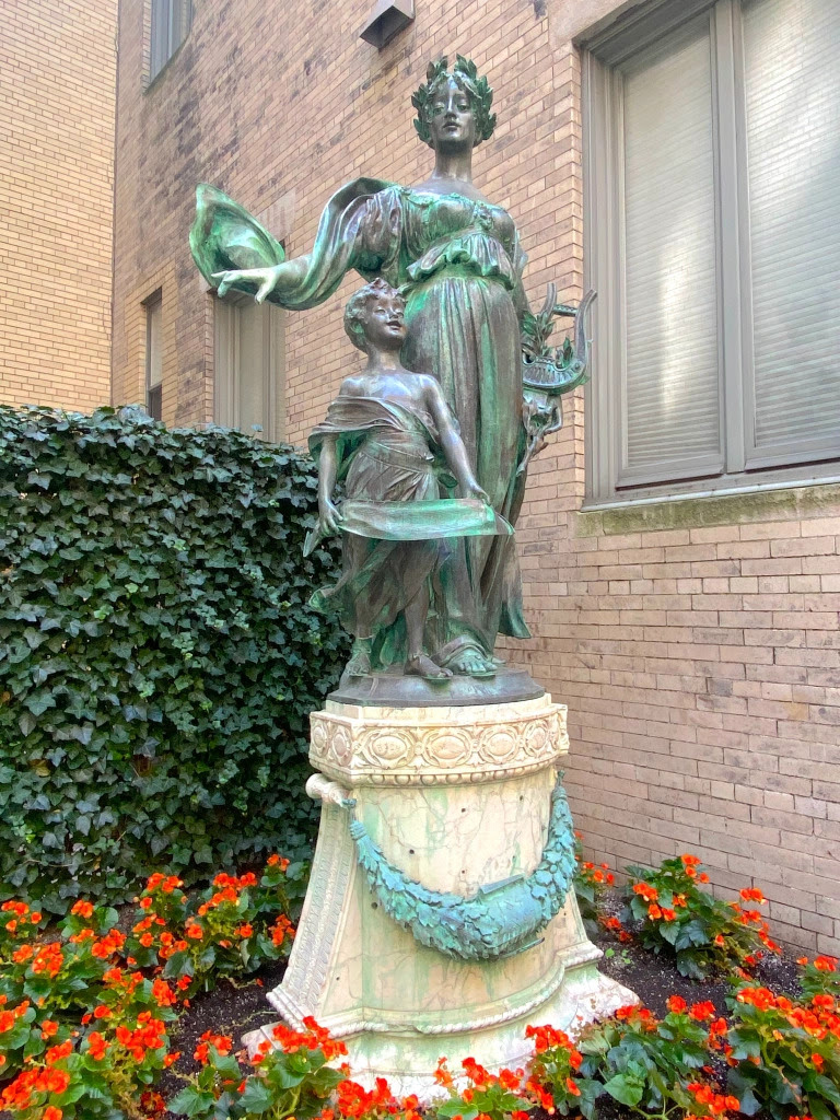
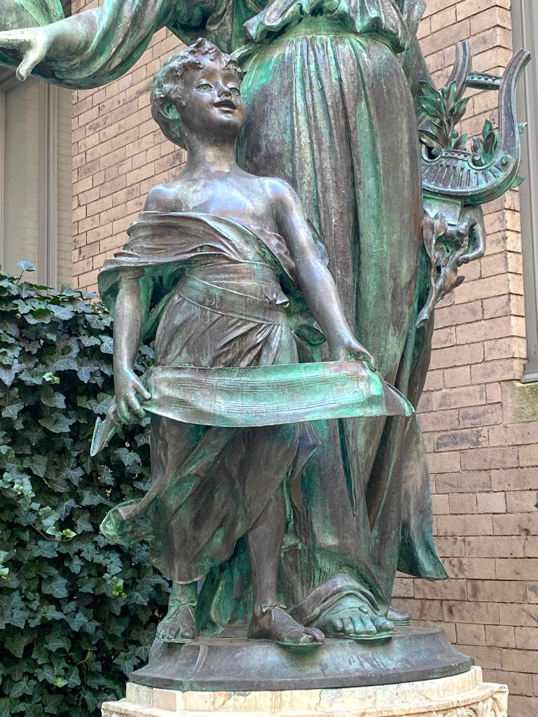
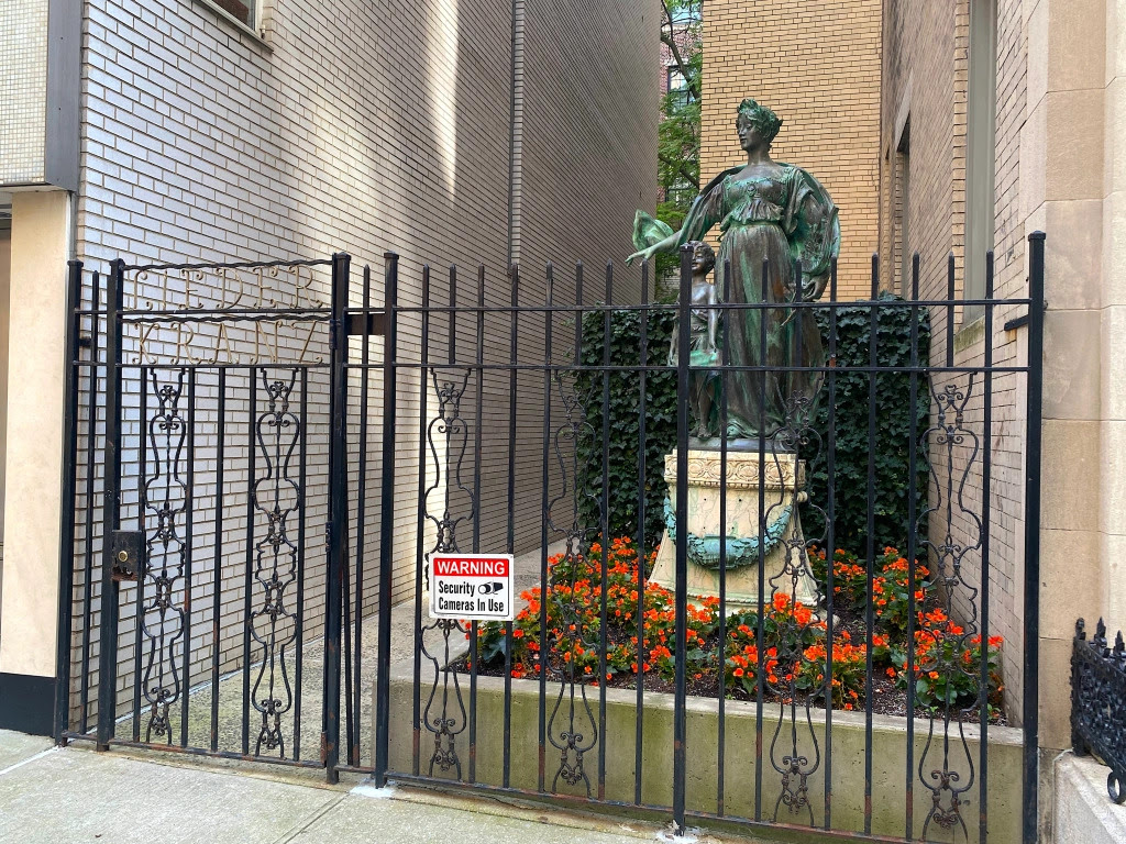
Then there are the statues you come across in an unexpected place, say an ordinary city block. That was my curious introduction to this stunning sculpture of Polyhymnia, which sits behind a fence in a courtyard on East 87th Street steps from Fifth Avenue.
Poly who? Polyhymnia is the Ancient Greek goddess of lyric poetry. One of the nine muses, she’s a daughter of Zeus and also the goddess of music, song, and dance.
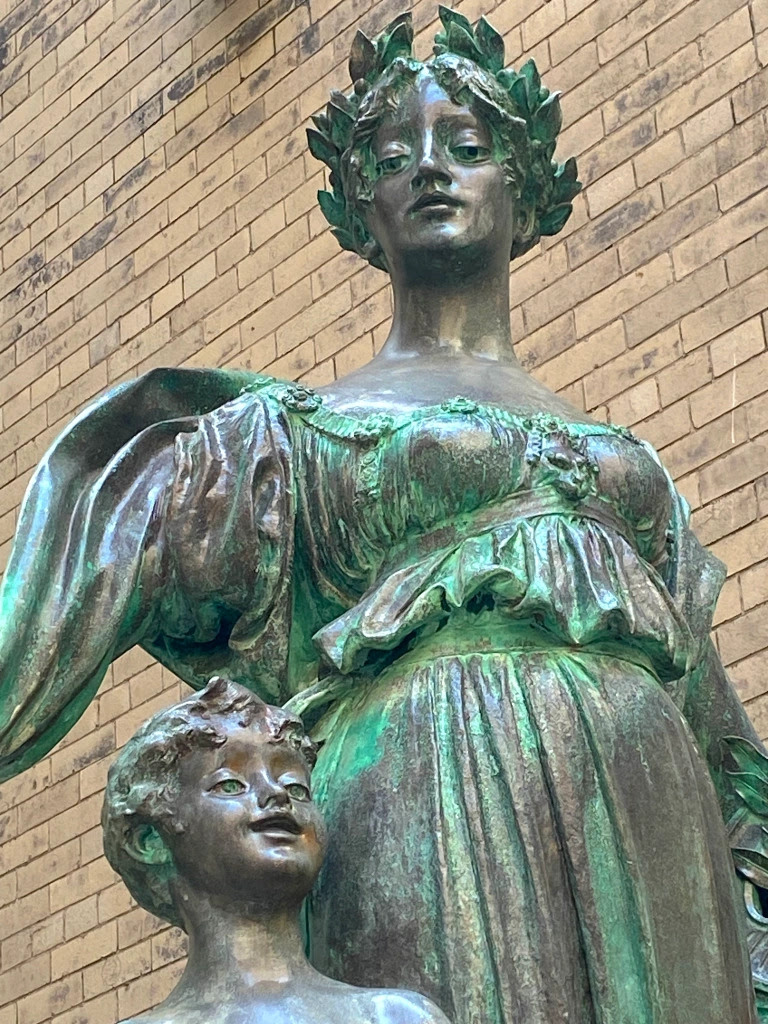
Here she stands on a marble base amid orange flowers and a wall of ivy; in front of her is a wrought-iron fence and gate. Clad in Classical garb and with a child beside her, she looks pensive, her eyes cast down toward the child. She appears to be holding a lyre.
So how did Polyhymnia end up on one of the most luxurious townhouse blocks in Manhattan? Her story begins in 1895 with the establishment of a group called Der Liederkranz Damen Verein.
The German name translates into “The Liederkranz Ladies’ Club.” This was an all-female auxiliary organization that supported the philanthropic and social activities of the Liederkranz Club—a singing society formed in New York City in 1847 for men of German descent.
In the decades before the Civil War, German immigrants came to New York by the thousands; in 1860, they comprised a quarter of the city’s population. Groups like the Liederkranz Club offered fellowship and culture for German newcomers as they navigated life in a not always welcoming metropolis.
“During the period preceding the Civil War, German American singing groups sprang up all over America, preserving German musical tradition and keeping the culture alive,” explained the website for the Liederkranz of the City of New York, the group’s current name. “Interest in the music of Germany was at its height.”
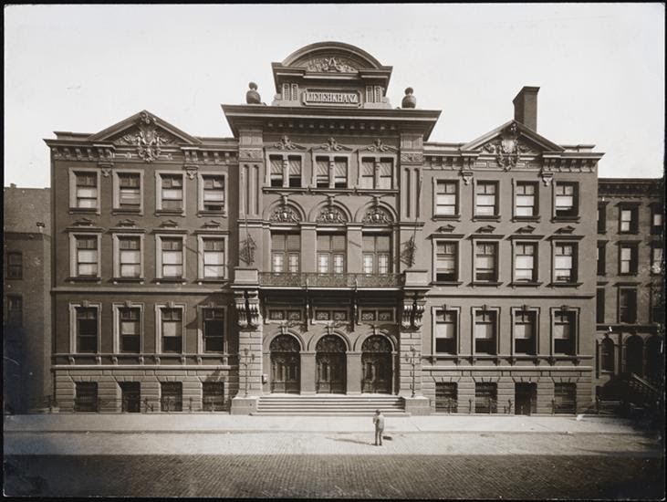
By the late 19th century, the group had hundreds of members. William Steinway, of Steinway Pianos fame, then became president of the Liederkranz. He helped guide members to raise funds for a clubhouse that was eventually built at 111-119 East 58th Street (below photo).
Two years after the Damen Verein formed, members commissioned sculptor Giuseppe Moretti to create the statue of Polyhymnia. It was presented as a gift for the clubhouse in 1897 to honor the Liederkranz Club’s 50th anniversary.
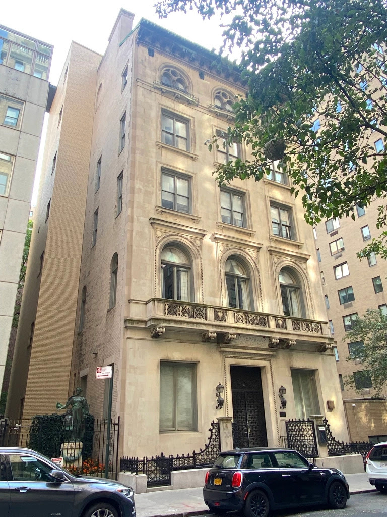
Facing a decline in membership after World War II, the Liederkranz sold the East 58th Street clubhouse. In 1949 members purchased the former Henry Phipps mansion—a 1904 granite and limestone Beaux Arts jewel built by this steel magnate turned philanthropist—at 6 East 87th Street.
When the Liederkranz moved to the Upper East Side, Polyhymnia came along, situated ever since in the small courtyard behind the wrought iron fence.
While the Liederkranz is still sponsoring music events and supporting cultural and social exchange, Damen Verein disbanded in 2009. Polyhymnia “serves as a permanent reminder of the spirit and generosity of the Damen Verein,” states the website.
And she’s a wonderful, slightly mysterious muse who will stop you in your tracks if you happen to find yourself on East 87th Street.
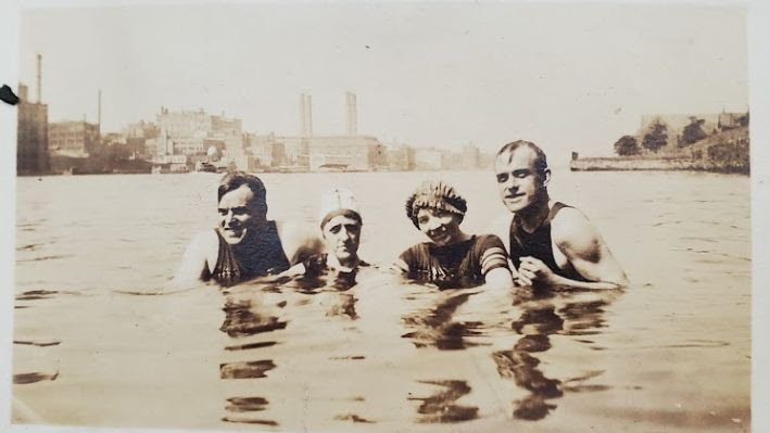
PHOTO OF THE DAY
SUMMER OF 1912
CREDITS
Fifth photo: MCNY, X2010.11.5555] Tags:German Singing Group NYC Liederkranz, Giuseppe Moretti Polyhymnia statue, Greek goddess polyhymnia 87th Street NYC, History of Liederkranz Club NYC, Liederkranz Club 58th Street NYC, Liederkranz Club NYC, Polyhymnia statue 87th Street, Polyhymnia statue Liederkranz Club Posted in Music, Uncategorized, Upper East Side | Ephemeral New York
All image are copyrighted (c) Roosevelt Island Historical Society unless otherwise indicated THIS PUBLICATION FUNDED BY DISCRETIONARY FUNDS FROM CITY COUNCIL MEMBER JULIE MENIN & ROOSEVELT ISLAND OPERATING CORPORATION PUBLIC PURPOSE FUNDS.
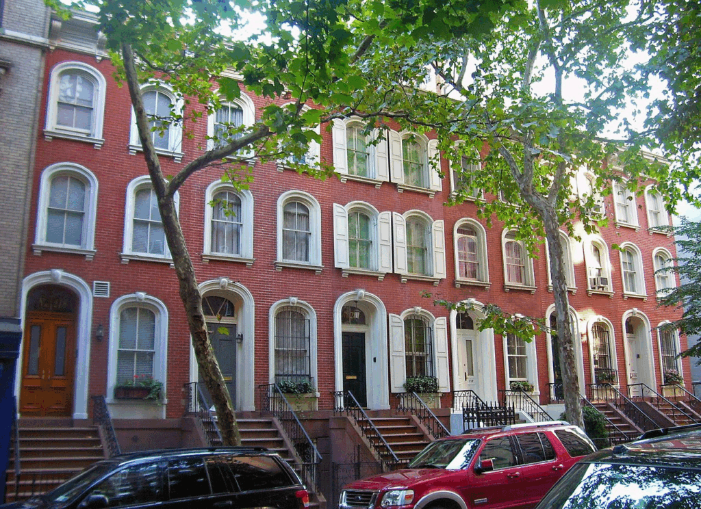
The houses at 208–218 East 78th Street in Manhattan, New York, United States, are a group of six attached brick rowhouses built during the early 1860s, on the south side of the street between Second and Third Avenues. They are the remnant of 15 built along that street as affordable housing when the Upper East Side was just beginning to be developed.
They are distinctive for the round-arched windows and door openings on their north (front) facades, an unusual trim for houses otherwise firmly in the Italianatearchitectural style common for urban buildings of that era.[2] They are the second oldest group of buildings on the Upper East Side after the East 78th Street Houses a block to the east, but unlike that row they retain more of their original appearance. In 1978 they were designated New York City landmarks,[2] and in 1983 they were listed on the National Register of Historic Places.
The row is on the south side of East 78th, between Second and Third avenues. The block is residential, with many similar, taller rowhouses on both sides of the tree-lined street. The neighborhood is just outside the Upper East Side Historic District, close to the southern edge of Yorkville.
Each house is three stories high and two bays, only 13 feet 4 inches (4.06 m) wide on a raised basement. All are trimmed with carved stone elliptical arched surrounds. The entryways and the adjacent first-story windows have an additional keystone molding. The upper windows also have corbeled sills. The flat rooflines have projecting cornices with vertical brackets. Stoops with iron railings lead to the sidewalk from the entryways, all located on the east bay of the front facades.[1]
There are a few deviations from these standards. The house at 214 has had shutters added, and it and 216 have had some of their original ironwork replaced. At 218, the original brownstone stoop has been replaced with a modern concrete one.[1]
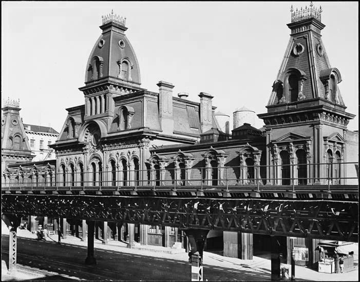
Third Avenue Car Barn at 65th Street
History
The construction of the Third Avenue Railway in 1852 allowed residents of what was then the village of Yorkville to commute to jobs in what is today Midtown and Lower Manhattan. The present area of East 78th Street was still an undeveloped section of Yorkville nine years later, in 1861, when Howard Martin bought 200 feet (61 m) of frontage along the block to build speculative housing.[1]
In accordance with a New York Supreme Court decision a year earlier, Martin paid $128 ($3,410 in 2023[3]) to the city for the opening of 78th Street. He had subdivided it into 15 lots, numbered 206–234 East 78th, and had begun building when he sold the properties to William Brower in 1862. Brower retained the builders, Warren and Ransom Beman and John Buckley, a likely reason for the uniformity of the resulting buildings.[1]
Construction was delayed somewhat by the difficulty of getting materials during the Civil War, but Brower had sold all the houses by the time construction was finished in 1865. Since then, number 206 on the west end of the row and 220–234 on the east have been demolished to build the neighboring, taller apartment buildings.[1]
Other than the alterations noted above, they are as they were when originally built. All five have remained private residences. In 2010 a real estate listing for 208 East 78th gave its rent as $15,775 a month.[4]
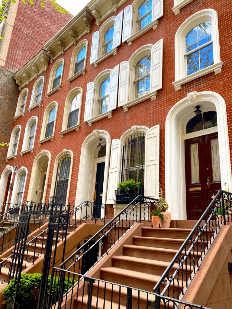
PHOTO OF THE DAY
SUMMER OF 2012
CREDITS
WIKIPEDIA
All image are copyrighted (c) Roosevelt Island Historical Society unless otherwise indicated THIS PUBLICATION FUNDED BY DISCRETIONARY FUNDS FROM CITY COUNCIL MEMBER JULIE MENIN & ROOSEVELT ISLAND OPERATING CORPORATION PUBLIC PURPOSE FUNDS.
City Landmarks Five Garment District Buildings Ahead of MajorChanges in Midtown
Wednesday, August 13, 2025
6sqft Devon Gannon
Issue # 1508
The Furcraft Building on West 30th Street. All photos courtesy of the NYC Landmarks Preservation Commission.
Midtown South could look a lot different in the coming years, with a neighborhood rezoning imminent, but at least five buildings will remain protected. The Landmarks Preservation Commission (LPC) on Tuesday voted to designate five buildings that not only are unique architecturally, but also reflect the development of the Garment District and the importance of the fashion industry to New York City. The designation comes as the City Council prepares to vote on the Midtown South Mixed-Use plan this week.
“Designed by many of the city’s leading architects of the time, the buildings designated today are some of the Garment District’s most impressive examples of early 20th-century commercial architecture, which tell the full story of the Garment District’s historic development, the people who worked here, the labor history that grew here and spread nationally, and the industry that has been one of New York City’s most important economic and cultural engines,” LPC Chair Sarah Carroll said.
LPC started surveying the area, roughly 23rd to 42nd Street, and Fifth to Ninth Avenues, focusing on the blocks set to be rezoned. The research staff then developed a framework to illustrate the development of the Garment District, which had largely been left out of the previous designations in the neighborhood.
The five buildings “stand out architecturally and historically, and together tell the story of a time of great change for Midtown Manhattan,” a press release reads.
The Barbey Building at 15 West 38th Street.
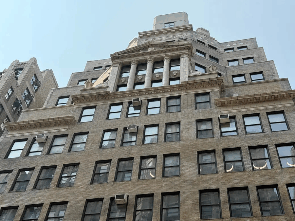
The new individual landmarks include 15 West 38th Street, known as the Barbey Building. The oldest of the five, the 12-story tower was designed in 1908 by Delano & Aldrich and features a Renaissance Revival style, with a facade of red brick, terra cotta, and gridded windows. From 1985 to 2019, the building served as the corporate headquarters for Lord & Taylor.
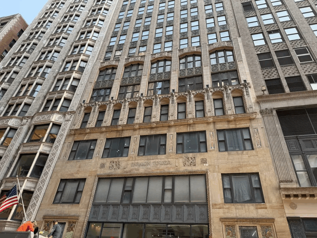
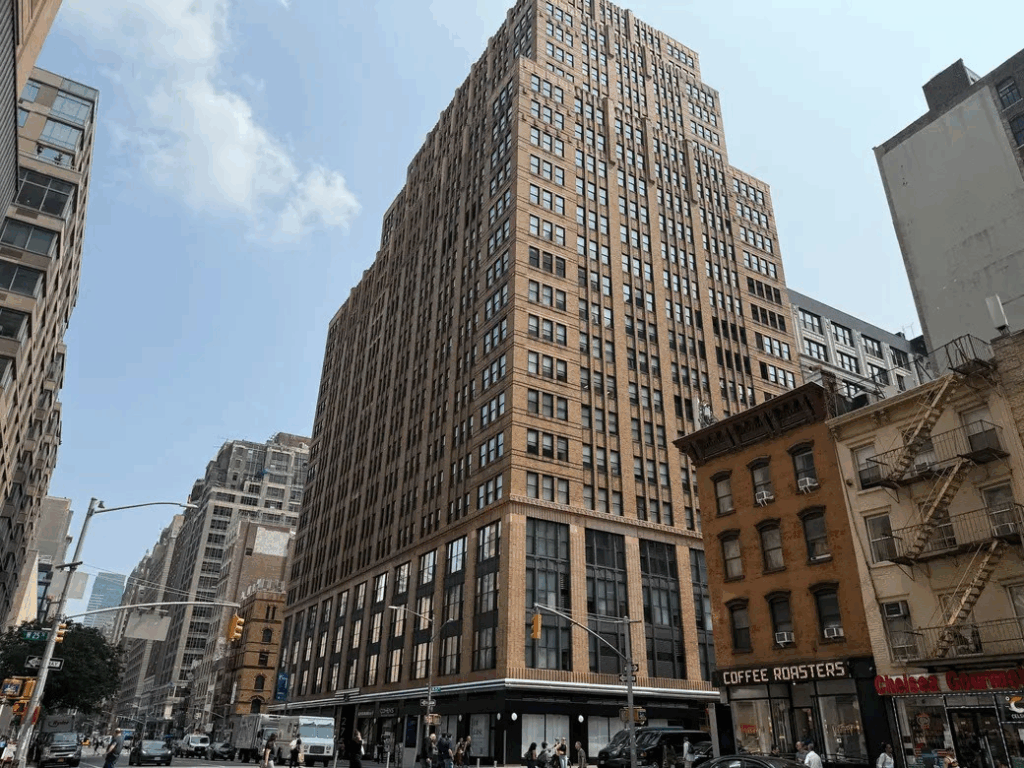
The Fashion Tower
The Fashion Tower, located at 135 West 36th Street, is a 20-story tower designed by prolific architect Emery Roth in 1925. The building features a distinctive blend of Medieval, Renaissance Revival, and Art Deco styles, with colorful peacocks at the lobby and freight entrances and winged angels holding cutting shears and brushes.
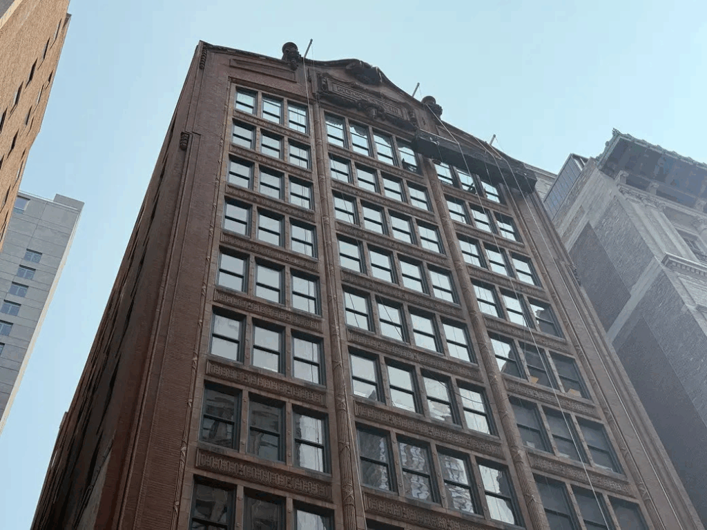
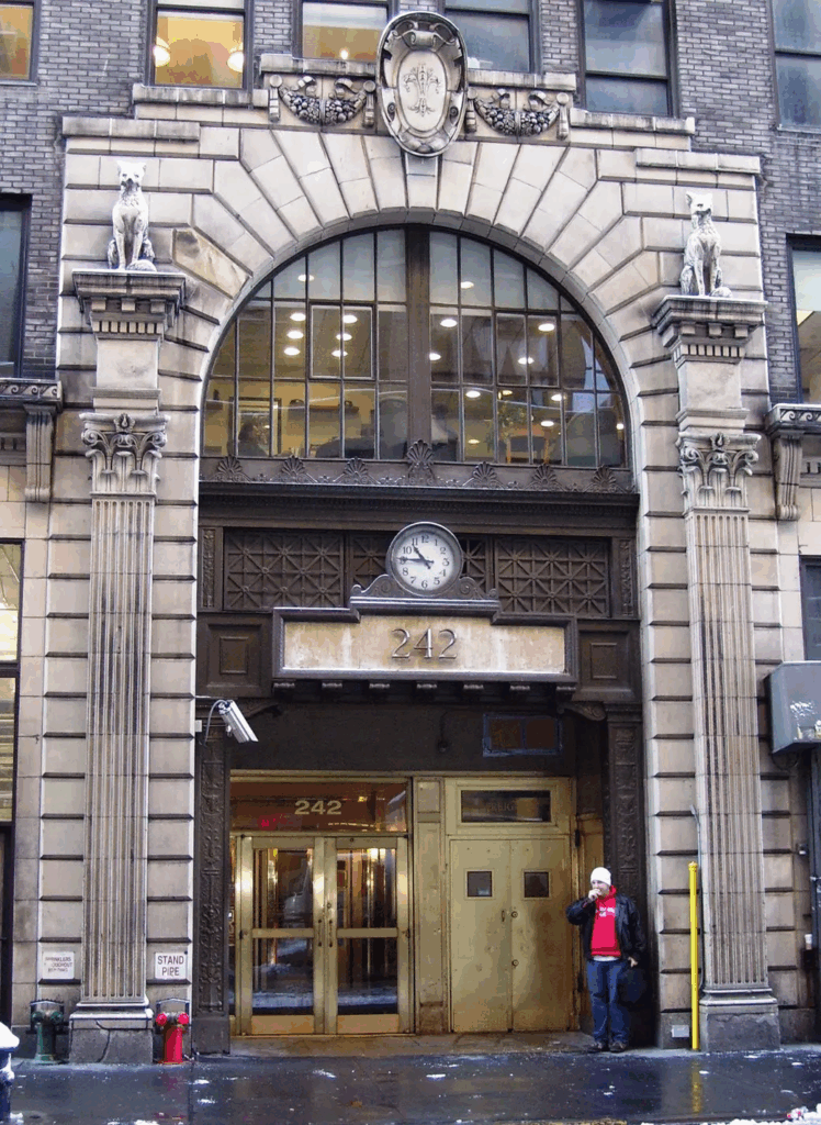
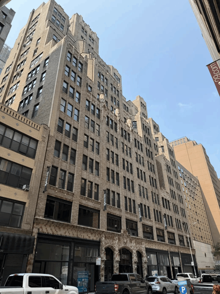
At 242-246 West 30th Street, the Furcraft Building rises 14 stories. Designed by Henry I. Oser in 1926, the building is on what was known as “Furriers’ Street,” the heart of the city’s thriving fur industry. According to the commission, more than 85 percent of the nation’s furs were produced in New York City from the early 20th century through the 1970s.
The entrance to the limestone building is flanked by two fox sculptures. The facade of a Greek temple sits at the top, which was likely visible from Penn Station during its early years, as 6sqft previously reported.
The 29th Street Towers.
Also designed by Henry Oser, the 29th Street Towers include two buildings built for fur manufacturing, made evident at the entrance of the building, which features grotesques of beavers. As the LPC noted, the towers’ intact facade and terra cotta decoration represent a “standout example” of manufacturing buildings built to house the fur industry in the Garment District.
The Lefcourt Clothing Center.
The 27-story brick building at 275 Seventh Avenue, known as the Lefcourt Clothing Center, was also landmarked on Tuesday. The Art Deco building, designed by architect Ely Jacques Kahn, has setbacks starting on the 18th floor, textured brickwork, decorative metal window enframents at the second through fourth stories, which originally held showrooms. In the 1930s, one floor of the building was leased by the International Ladies Garment Workers Union to be used as a health care facility for workers.
This week, the full City Council will vote on the Midtown South rezoning, which is expected to be approved. The plan updates zoning rules for 42 blocks of the neighborhood to allow for roughly 9,500 new homes, 2,800 of which would be affordable. As part of the deal reached with City Hall and the Council, $120 million will be set aside to help protect and support the Garment industry.
As 6sqft reported, the city will connect local businesses with new resources via Midtown Made, create a local production fund to encourage designers to work with local manufacturers, and allocate $50 million to help find below-market space for the garment industry.
“Smart planning and preservation go hand-in-hand, and we’re utilizing all the tools at the City’s disposal to help Midtown South adapt and grow while protecting the neighborhood’s vibrant history,” DCP Director Dan Garodnick said.
“These architectural gems won’t just enliven the neighborhood for current and future residents, they also serve as a reminder of the continuous adaptation across historical eras in Midtown Manhattan.”
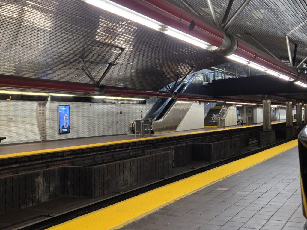
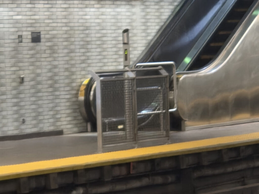
PHOTO OF THE DAY
NEW SAFETY BARRIERS AT OUR SUBWAY STATION
CREDIT TO
6SQFT
DEVON GANNON
All image are copyrighted (c) Roosevelt Island Historical Society unless otherwise indicated THIS PUBLICATION FUNDED BY DISCRETIONARY FUNDS FROM CITY COUNCIL MEMBER JULIE MENIN & ROOSEVELT ISLAND OPERATING CORPORATION PUBLIC PURPOSE FUNDS.